Lee to Kyle Canyon | Foxtail Canyon Route | Mt Charleston Wilderness | Spring Mountains, Nevada
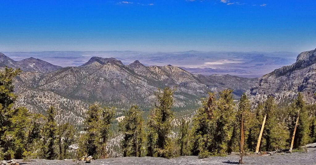
This beautiful route ascends through the Foxtail Canyon picnic area and an abandoned Girl Scout camp and then gradually weaves around passing just right (south) of the beautiful Foxtail Canyon Springs before ascending to the upper rim of Kyle Canyon. A left (North) turn there will take you along the summit of Kyle Canyon’s upper rim to Mummy Mountain’s main summit area. However, in this adventure we turn right to traverse the high Lee/Kyle Canyons ridge top before connecting with the Mt. Charleston upper North Loop Trail then descending back to the Foxtail Picnic Area via Lee Canyon’s gradual mid-ridge making this a circuit adventure. Route details: 15 mi RT/ Approx. 8,000 > 11,000ft; **Brief Initial Road, Then Wilderness** Click image or title above for more…
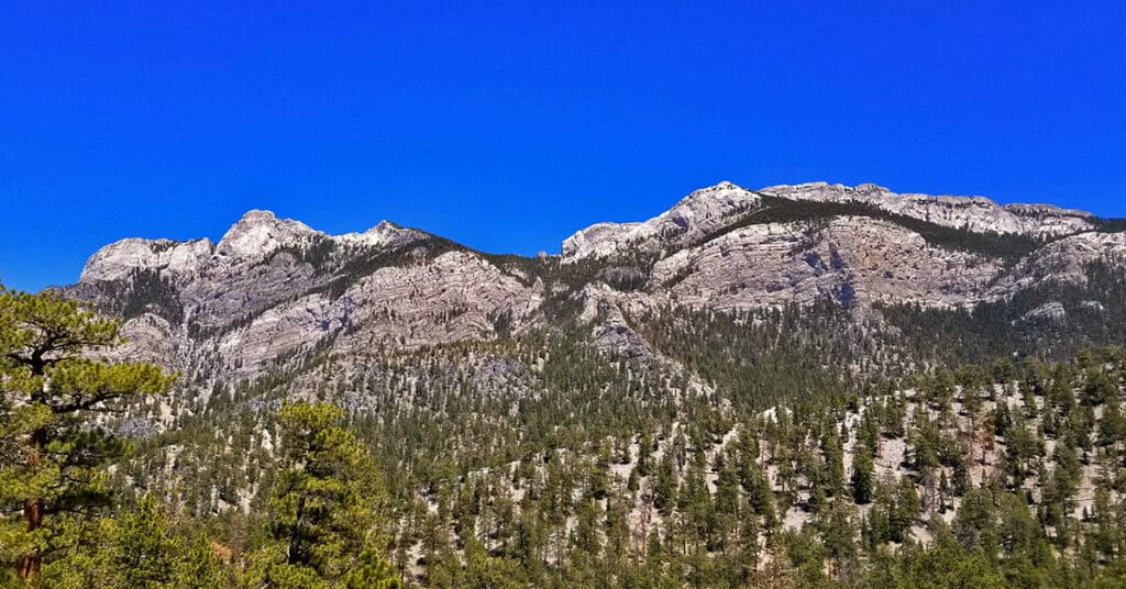
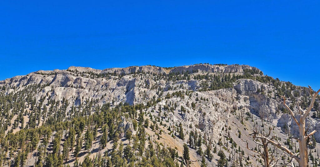
Lee to Kyle Canyon | Gradual Mid Ridge Approach | Mt Charleston Wilderness | Spring Mountains, Nevada
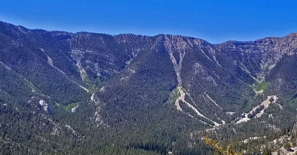
This approach to Kyle Canyon’s upper rim appears to be the most gradual approach from Lee Canyon. It begins roughly across from the Lee Canyon Meadow and gradually ascends to a plateau that connects with the Charleston North Loop Trail about a mile or two South of Lee Peak. This route is mostly pure wilderness: wild and beautiful. You will see no one during the entire route. In fact, though I looked closely for footprints and signs of human passage along the way, I found little of that. There were occasional faint use trails that appeared unused for years, and there were a few old cairns at a couple key points. But it looked as though absolutely no human had ascended this ridge for over a year or more, and then perhaps only one human ascent per year at most. Route Details: 14 mi RT/ Approx. 8,000 > 11,535ft; **Mostly Wilderness** Click image or title above for more…
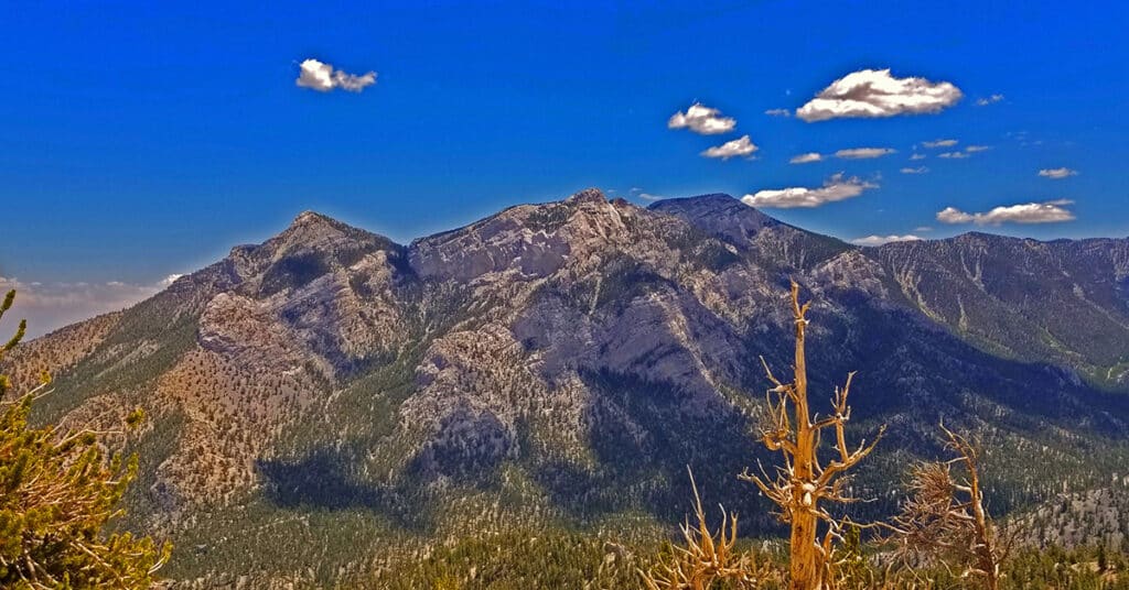
Macks Peak | Mt Charleston Wilderness | Spring Mountains, Nevada
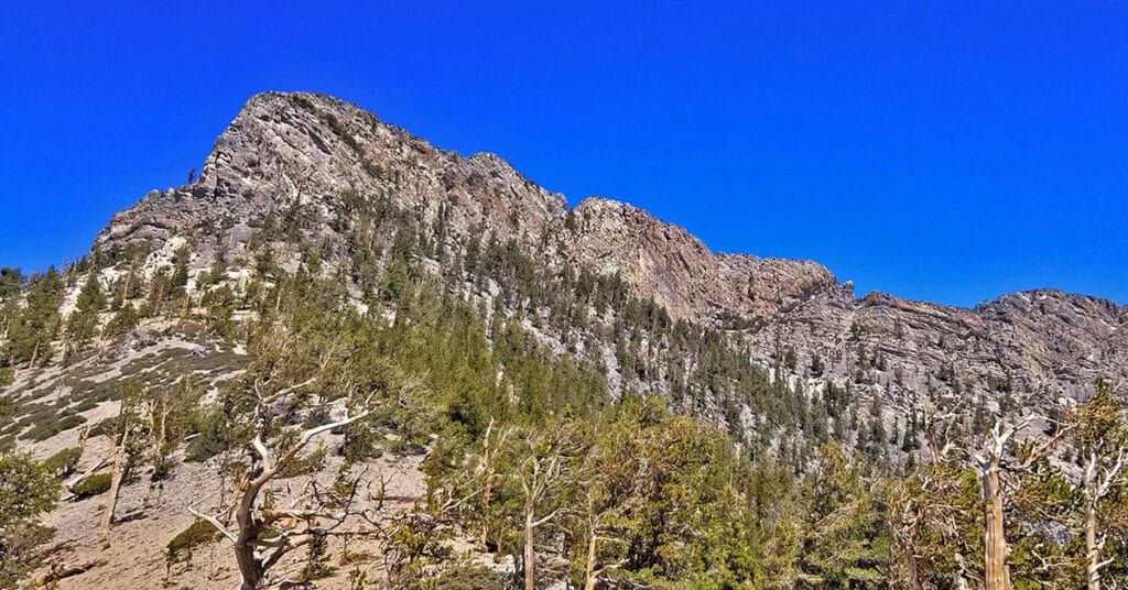
Macks Peak is located in the Spring Mountains near Las Vegas, Nevada. There are 2 summits: SE summit, elevation 9,924ft and NW summit, elevation 10,036ft with a long ridgeline between. Once you rise along the approach ridge over about 8,500ft the wilderness assumes a beautiful, untouched alpine feel with various wildflowers, pine forests and eventually Bristlecone Pines. There are spectacular 360 degree views all along the approach ridge including the Sisters peaks, Charleston Peak, Lee Peak and Mummy Mountain along with the high ridgeline between, Angel Peak, the Northern part of the Las Vegas Valley, Gass Peak and the Sheep Range. Route details: 14 mi RT/ Approx. 7,000 > 9,500ft; **Road, Trail, Wilderness** Click image or title above for more…
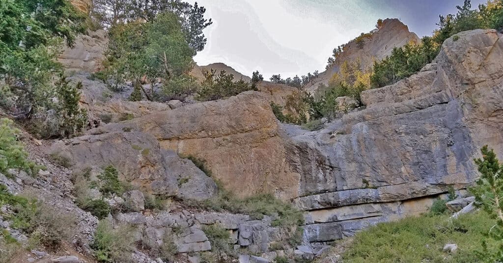
McFarland Peak from Bristlecone Pine Trailhead | Lee Canyon, Spring Mountains, Nevada
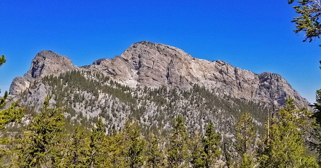
The route to the base of McFarland Peak via the Bristlecone Pine and Bonanza Trails is a true show stopper! Most of the route winds through an ancient pristine Bristlecone Pine forest. As if that were not enough, all along the way there are spectacular views including Mummy Mountain, the North Ridge of Kyle Canyon from Mummy Mountain to Lee Peak and then on to the summit of Charleston Peak, the Sisters Peaks bordering Lee Canyon, Pahrump Valley and Telescope Peak in the Panamint Range on the far side of Death Valley as a faint high point in the background and of course the full spectacular Western side of McFarland Peak with its sheer majestic cliffs. Route Details: 15 mi RT/ Approx. 8,690 > 9,600ft; **Excellent Trail** Click image or title above for more…
McFarland Peak Summit | Lee Canyon | Spring Mountains, Nevada
McFarland Peak is one of Nevada’s most challenging peaks to summit. Watch for this adventure in an upcoming Spring or Fall. Route details: About 15 miles RT; **Mostly Trails, Some Wilderness on the Summit Approach** Click image or title above for more…
Mud Springs Loop | Lee Canyon | Mt Charleston Wilderness | Spring Mountains, Nevada
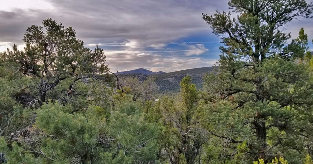
Mud Springs Loop is beautiful, though heavily forested. For this reason, the hiker often has no larger point of reference and can get lost in a maze of rabbit trails, and the directional markers are missing when you most need them. My first two attempts at the loop resulted in spinning off in other directions: One to Macks Peak, another to Pinyon Pine Loop! Route details: 15 miles circuit, About 6,500 – 7,500ft **Confusing network of rabbit trails with directional markers missing when you need them**
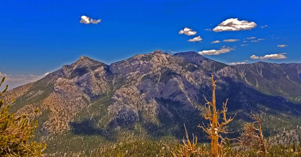
Mummy Mountain Head from Lee Canyon Rd | Additional Approaches | Spring Mountains, Nevada
Once you’ve summited Mummy’s Head from Lee Canyon Road, there are a number of options. You can precede to Mummy’s Nose and Chin, attempt an ascent to Mummy’s Summit or circle around down to the Deer Creek Road or Foxtail area. All these options present challenging climbs. Route details: 10 mi RT/ Approx. 8,000 > 11,535ft; **Some unmarked trails and cairns, mostly wilderness** Click image or title above for more…
Mummy Mountain Summit from Lee Canyon | Mt Charleston Wilderness | Spring Mountains, Nevada
This adventure takes you up a canyon wash on the far Northwestern edge of Mummy Mountain. Though the wash is filled with boulders, branches and tree trunks, one can find a pretty easy class 2 stairway dramatically ascending upward through unique climate and plant life zones from the beginning of the adventure at 8,000ft on Lee Canyon Road to the 11,532ft summit of Mummy Mountain. Of course, expect a few of Mummy Mountain’s signature avalanche slopes. There are spectacular views all the way up… Route details: 10 mi RT/ Approx. 8,000 > 11,535ft; **Mostly Wilderness** Click image or title above for more…
Mummy Mt Grand Crossing | Foxtail Canyon > Mummy Summit > Deer Creek Road | Spring Mountains, Nevada
This adventure begins at the Foxtail Picnic Area in Lee Canyon, summits Mummy Mountain, descends the Eastern cliffs and Cougar Ridge Trail, then takes Deer Creek and Lee Canyon Roads back to the Foxtail Picnic Area. I recommend a base conditioning level of at least 5-miles running 4 times weekly along with one day topping 10-15 miles. Be altitude conditioned at the 11,000ft level, have wilderness navigation experience and ability to navigate very steep, long avalanche slopes. Route details: 18 mi RT/ Approx. 8,000 > 11,520ft; **Mostly Wilderness** Click image or title above for more…
Mummys Head from Lee Canyon Rd | Mt. Charleston Wilderness | Spring Mountains, Nevada
This is the most direct approach route to Mummy’s Head. It begins from a wide parking area on the right side (West) of Lee Canyon Road to summit Mummy’s Head by unmarked trails and wilderness. Route details: 10 mi RT/ Approx. 8,000 > 11,535ft; **Mostly Wilderness** Click image or title above for more…
