Potosi Mt Summit via Western Cliffs Ridge | Spring Mountains, Nevada
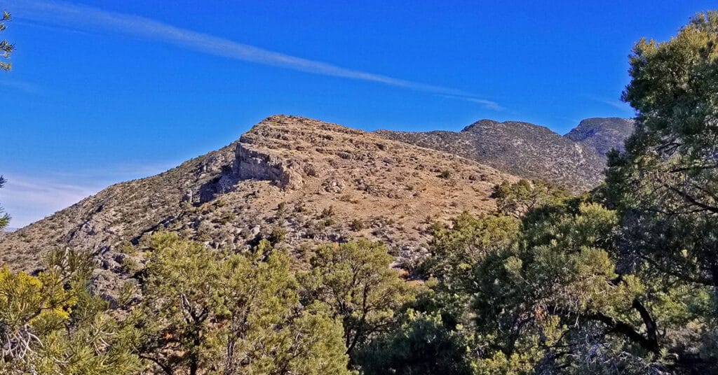
The Potosi Mt Western Cliffs Ridge is not only a spectacular route with views that do not end, but it is also a historical site, the location of Potosi Mine. This route discovers a nice trail beginning at the end of Potosi Springs Road and heading upward to the old route from the aerial tram site to the Potosi Mine. I believe wide, well constructed route between the high point of the tram and the mine was the route of the baby gauge railroad. Upon meeting the Potosi Mine route another very faint use trail continues up and along the Western Cliffs Ridge. That faint trail appears and disappears, but the ridge eventually leads to Potosi Mountain summit. Route details: 20+ mi RT from Hwy 160/ 5,500ft > 8,500ft; **Unpaved Road, Some Trails, Some Wilderness** Click image or title above for more…
03 Rainbow Mountains South Upper Crest Ridgeline | Rainbow Mountain Wilderness, Nevada
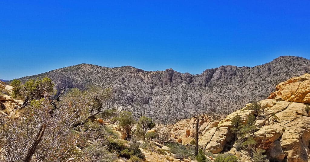
The Rainbow Mountains Upper Crest Ridgeline stretches above the Rainbow Mountains summits from its Southern point at Mountain Springs Trailhead on Highway 160 to its Northern point around the Willow Springs area of Red Rock Park. Here we focus on the Southern half of the Rainbow Mountains Upper Crest Ridgeline from Mountain Springs to Hidden Peak. Route details: 12 mi/ 5,900 > 7,000ft (approx.); Some Trails, Some Wilderness. Click image or title above for more…
North Peak | Rainbow Mountain Wilderness, Nevada
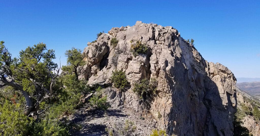
The summit of North Peak is like the turret of a medieval European castle with amazing views in all directions. Views to the East include Red Rock Canyon all the way to Lake Mead. The Mt. Charleston Wilderness can be seen to the West. The Keystone Thrust and La Madre Mountains Wilderness is to the North and the span of the Rainbow Mountains to Potosi Mountain to the South. Route details: 17 mi/ 4500 > 7003ft; **Some Trails, Some Wilderness**. Click image or title above for more…
Bridge Mountain in Rainbow Mountain Wilderness, Nevada
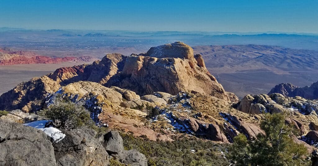
Bridge Mountain in the Rainbow Mountain Wilderness of Nevada is one of the most popular rock climbing destinations in the area. Summiting Bridge Mountain is challenging and there is at least one class 3+ exposed stretch. The most customary summit approach begins in the Willow Creek Picnic Area in Red Rock Park and ascends Rocky Gap Road to a high point before branching off to the approach trail. Route Details: 17 mi/ 4500 > 7003ft; Some Trails, Some Wilderness. Click image or title above for more…
Juniper Peak | Rainbow Mountain Wilderness, Nevada
If you’re looking to climb your first peak in the Rainbow Mountains, Juniper Peak is a good start. Many of the surrounding peaks dwarf it in comparison: Mt. Wilson; Rainbow Mountain; Bridge Mountain. Experience all the beauty and challenge of a Jurassic Era Aztec red rock peak in the Rainbow Mountains of Nevada. When you are facing Juniper Peak there appear to be 3 routes from the Red Rock Park side: Two narrow chutes to the left and what looks like a more gradual approach to the right. I ended up selecting the middle of these routes – the right chute of the two chutes to the left. Hindsight says that the easier, and likely the more traditional route is the more gradual climb up the slope on the right (just before Pine Creek Canyon). Route Description: 8.7 mi/ 3,909 > 6,109ft; **Some Trails, Some Wilderness** Click image or title above for more…
