Mummy Mt Grand Crossing | Foxtail Canyon > Mummy Summit > Deer Creek Road | Spring Mountains, Nevada
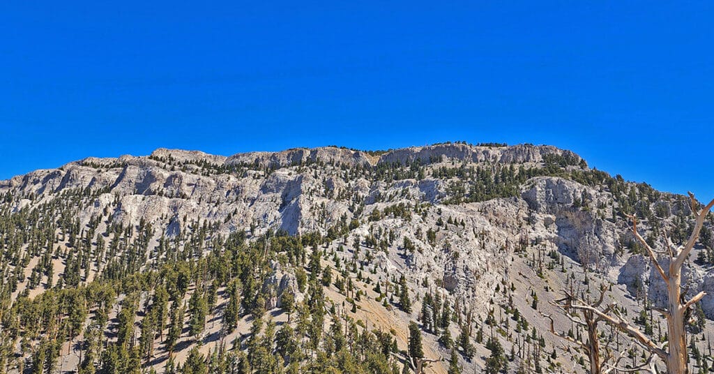
This adventure begins at the Foxtail Picnic Area in Lee Canyon, summits Mummy Mountain, descends the Eastern cliffs and Cougar Ridge Trail, then takes Deer Creek and Lee Canyon Roads back to the Foxtail Picnic Area. I recommend a base conditioning level of at least 5-miles running 4 times weekly along with one day topping 10-15 miles. Be altitude conditioned at the 11,000ft level, have wilderness navigation experience and ability to navigate very steep, long avalanche slopes. Route details: 18 mi RT/ Approx. 8,000 > 11,520ft; **Mostly Wilderness** Click image or title above for more…
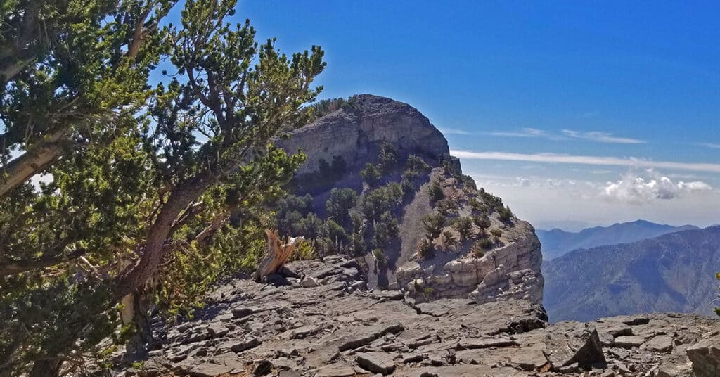
Mummy Springs Loop | Cougar Ridge Trail | Mt. Charleston Wilderness, Nevada
Mummy Springs Loop is an awesome hiking or trail running workout! You’ll park at the North Loop Trailhead, take a short 1/8th-mile stretch down Deer Creek Road to Cougar Ridge Trail Road, ascend that road and trail about 2000 feet straight up the healthy incline of Cougar Ridge Trail, take a left at Mummy Springs Trail, Cross beneath Mummy Springs, head to Raintree then take a left down the North Loop Trail back to the North Loop Trailhead. Route details: 10 mi / Approx. 8,439 > 10,023ft **Excellent Trail** Click image or title above for more…
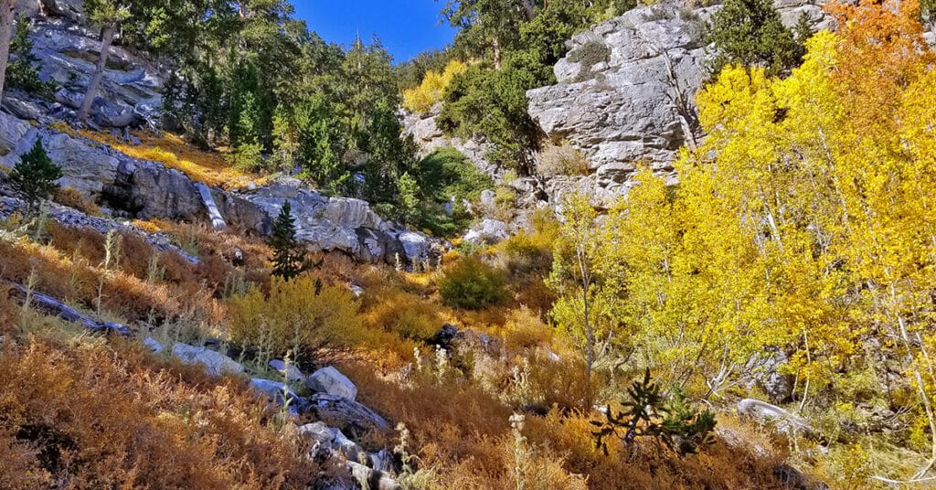
Mummy’s Toe, Knees, Raintree, Fletcher Peak Circuit from Deer Creek Park
This cool circuit adventure is packed with spectacular views and enchanting waypoints. Yet it is compact enough to accomplish in less than one incredible day. The circuit begins at the North Loop Trailhead in the Mt. Charleston Wilderness. From there descend on Deer Creek Road about a quarter to a half mile to Deer Creek Picnic Area. From the Deer Creek Picnic Area parking area, ascend through Deer Creek Park and on up via the Cougar Ridge Trail to Mummy’s Knees. Then traverse over to Mummy’s Toe. Descend to Mummy Springs and then on over to Raintree. Take the North Loop Trail from Raintree toward Fletcher Peak. Take the Fletcher Peak out and back trail from the North Loop Trail to the summit of Fletcher Peak. Finally, descend from Fletcher Peak summit back to the North Loop Trailhead where you began. Route details: 15-18 mi / Approx. 8,439 > 11,000ft **Some Trail > Some Wilderness** Click image or title above for more…
Robbers Roost and Beyond | Mt Charleston Wilderness | Spring Mountains, Nevada
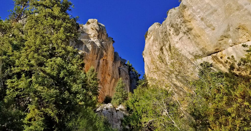
Robbers Roost, located on Hwy 158 just above Kyle Canyon, is a world class rock climbing destination. The mile-long impressive wall of limestone cliffs can be approached via a short 1/4th mile trail which begins on Hwy 158. The trail ends just beyond a huge limestone cave. Here one can continue to ascend a slot opening in the cliff wall by bouldering up approximately 100 yards of huge boulders that are thought to be the collapsed roof of an ancient limestone cave. The views from both the base of the cliffs and above are spectacular. Route details: 5 mi / Approx. 7,914 > 8,500ft **Mostly Wilderness** Click image or title above for more…
