The Bristlecone Pine Trail in the Mt. Charleston Wilderness is a delightful 6-mile loop that gives the hiker or runner an experience of rising up to the bristlecone pine zone without having to ascend steep inclines or engage in a long-distance hike or run. It’s actually one of the first Spring Mountains mountain adventures a person might experience as they are conditioning for higher altitudes and heavier exertion. Alternately, as with this hiker/runner, it’s a good trail to experience when you’re strained or injured from prior runs.
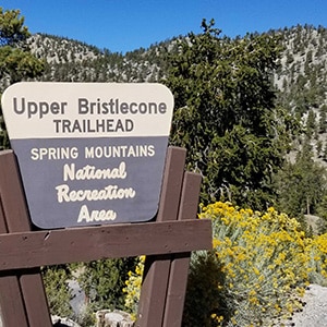
The Bristlecone Pine Trail can be accessed from two separate trailheads: Upper Bristlecone Pine Trailhead and Lower Bristlecone Pine Trailhead. The trailheads to both are located in Lee Canyon near the ski area at the end of the canyon. The lower Bristlecone Pine Trailhead can be accessed about a half mile below the ski area, the upper Bristlecone Pine Trailhead can be accessed about 200ft above the ski area.
See the directions to the trailhead on the Lee Peak page of this website.
Strategy to Begin at the Upper Bristlecone Pine Trailhead
I suggest you park and start at the upper Bristlecone Pine trailhead because you’ll be ascending during the rockiest portion of the trail. To descend this portion, especially when running, would slow you down and could expose you to greater possibility of injury. On the other hand, if you begin with the ascent through this rocky portion of the trail, your descent to the lower Bristlecone Pine Trailhead will be on a beautiful gravel fire-road surface. Once at the Lower Bristlecone Pine Trailhead you’ll need to take surface roads for about a half mile to re-ascend back to the Upper Bristlecone Pine Trailhead, where you parked your car. It’s a bit of a pain to end with an ascent, but overall, I found this to be the best strategy.
Initial Ascent From the Upper Bristlecone Pine Trailhead
From the upper Bristlecone Pine Trailhead, ascend about a half to 3/4th miles through a forested trail before breaking into the opening and seeing the first grand views of Lee Peak, Mummy Mountain and the North Ridge of Kyle Canyon stretching between these two peaks. If you’re scoping out a route from Lee Canyon to Lee Peak, these views will provide a good perspective. In fact, in the video I discuss a possible route to Lee Peak that may be most gradual rising along a wilderness ridge.
Alternate Deviation to the Upper Lee Canyon Ski Area
Back to the initial part of the Bristlecone Pine Trail, about 1/4th of a mile in you’ll see the familiar Spring Mountains avalanche slope warning sign. If you were to take a sharp left at this point, you would rise to the upper portion of the ski area. However, today you’re preceding around the Bristlecone Pine Trail loop, so continue straight past the avalanche slope warning sign.
Circle Around, Descend to the Lower Bristlecone Pine Trailhead, then Ascend Back to the Upper Bristlecone Pine Trailhead
Once you break into the opening, spectacular views continue for the next 3 miles as you ascend above 9000ft. Continue to ascend, then at the 1.5 mile point you’ll begin to descend. At the 2 mile point there is a junction. To the left you will see the 13-mile Bonanza trail. Continuing straight, the trail surface becomes a 3-mile long gravel fire road with a gradual descent to the Lower Bristlecone Pine trailhead. This is an ideal running surface! At the bottom, you’ll arrive at the Lower Bristlecone Pine Trailhead. Take a short 100ft jog to the main Lee Canyon road, turn left and ascend for about a half mile back to the Upper Bristlecone Pine Trailhead.
Alternate Deviation to a Small 9453ft Rocky Peak
Earlier, about 1/8th mile after passing the Bonanza Trail junction, that rocky peak you see to the left can be ascended as about a one mile round trip side adventure. See the video for ideas.


Return often to experience one new adventure each week! From the home page scroll to “Most Recent Adventures“. More about David Smith…
The trail adventures on this website require proper conditioning, preparation and safety precautions. There are many factors beyond our control including weather conditions, unstable ground, loose rocks, insects and snakes, people you may encounter, your own level of physical conditioning, the potential of getting lost just to mention a few. While this site offers guidance, helpful tips, direction and training, the reader assumes full responsibility for whatever may occur during their trail adventure. Have fun and be safe!