A Wilderness Destination in Itself | Deer Creek Road | Mt Charleston Wilderness, Nevada
You’ve just left Kyle Canyon, the first great destination in the Mt. Charleston Wilderness. Now you’re headed on the Deer Creek connector road (Hwy 158) toward Lee Canyon. Slow down to discover that Deer Creek Road is far more than a connector road between Kyle Canyon and Lee Canyon. Deer Creek Road is, itself, the second great destination in the Mt. Charleston Wilderness!
As with Kyle Canyon, Deer Creek Road has its own trailheads, along with unique picnicking and camping areas. You could spend weeks exploring the wilderness opportunities to be found on Deer Creek Road.
Watch for two campgrounds along Deer Creek Road: The Hilltop Campground and the Mahogany Grove Group Campground. And stop by the Deer Creek Picnic Area to rest and explore the cool, shaded Deer Creek Canyon. There’s even ATV access to Lucky Strike Road for a rugged backroad adventure. Before you cross over to Lee Canyon, don’t miss the spectacular Desert View Overlook.
Wilderness Opportunities on Deer Creek Road | Mt Charleston Wilderness, Nevada
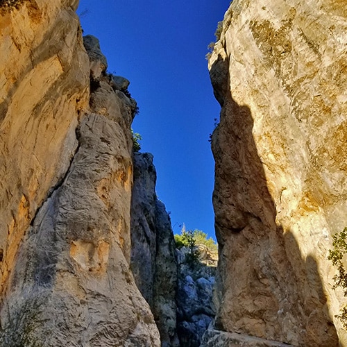
Deer Creek Catch Pen Loop Trail East (Circuit to Angel Peak)
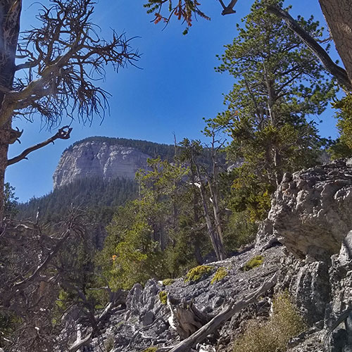
Mummy’s Forehead & Chin from Deer Creek Road
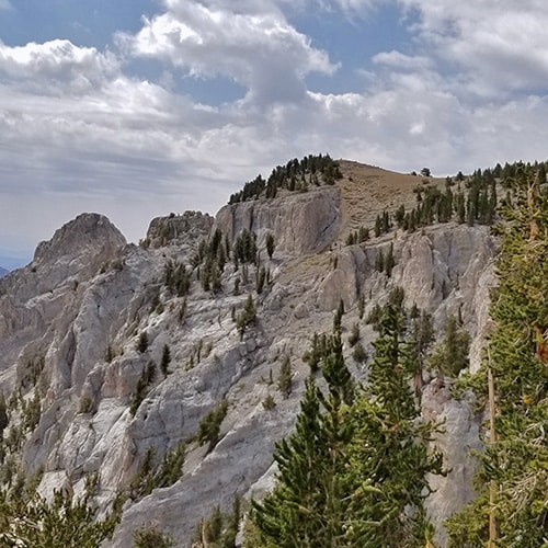
Wildhorse Canyon/North Loop Trail Circuit
Mummy Summit from NNE Ridge
Summary
Article Name
Mt Charleston Wilderness Deer Creek Road Trails Overview | Spring Mountains, Nevada
Description
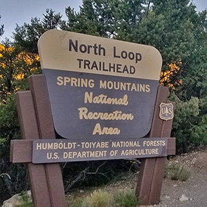
Deer Creek Road, the approximately 10-mile connector stretch between Kyle Canyon and Lee Canyon Roads, is the jumping off place for trails connected to the North Loop Trailhead, Robbers Roost Trailhead and a number of additional unmarked trailheads.
To provide the best experiences, we use technologies like cookies to store and/or access device information. Consenting to these technologies will allow us to process data such as browsing behavior or unique IDs on this site. Not consenting or withdrawing consent, may adversely affect certain features and functions.
Functional
Always active
The technical storage or access is strictly necessary for the legitimate purpose of enabling the use of a specific service explicitly requested by the subscriber or user, or for the sole purpose of carrying out the transmission of a communication over an electronic communications network.
Preferences
The technical storage or access is necessary for the legitimate purpose of storing preferences that are not requested by the subscriber or user.
Statistics
The technical storage or access that is used exclusively for statistical purposes.The technical storage or access that is used exclusively for anonymous statistical purposes. Without a subpoena, voluntary compliance on the part of your Internet Service Provider, or additional records from a third party, information stored or retrieved for this purpose alone cannot usually be used to identify you.
Marketing
The technical storage or access is required to create user profiles to send advertising, or to track the user on a website or across several websites for similar marketing purposes.