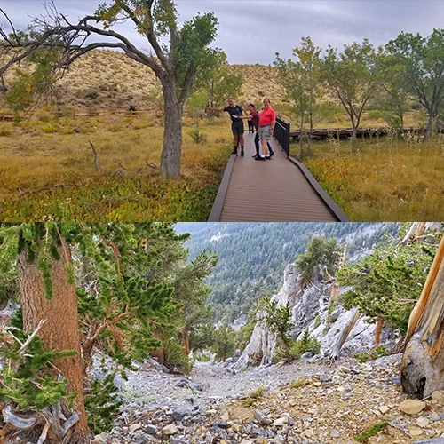
Route Complexity Options Range from a Boardwalk to Deep Mountain Wilderness
For Maximum Enjoyment and Safety, Select the Adventure that Best Fits the Following Criteria

The thumbnail images on the overview pages for each wilderness area on this website include notes indicating route complexity (i.e. established trails, wilderness, distance, altitude…etc.). These thumbnail images can be found on the overview page for each wilderness area.
Route complexity is probably one of the most unique factors that sets this Las Vegas Area Trails website apart from other wilderness sites. My passion is wilderness exploration. Therefore, a major portion of the routes described on this site do not have trails. I look at a wilderness feature (mountain, desert) and set out to explore the entire surrounding area, constantly making new discoveries. In addition, there are plenty of established trails on this site. In fact, the established trails are a jumping off point to the uncharted wilderness (often routes to a mountain summit).
I’ve developed my wilderness navigation skills over years of trial and error. What you will learn here is purely from my own experience.
In addition, my wilderness navigation technique is uniquely fitted to the Las Vegas area. I would not follow this technique in another area of the country. I navigate by feel, instinct and by sight.
Many people now navigate using GPS. Were I back in Oregon and Washington’s Cascade Mountain Range, I might be using GPS. But with 211 sunny days/year in the Las Vegas area, I find it possible and more enjoyable to navigate by sight vs. constantly referring to a small device which will at times loose cell coverage or run out of battery charge…etc.
High Landmarks: So, I always check for points of reference and use these as a guide. For example, in the Mt. Charleston Wilderness, knowing the position of Harris Mountain, Griffith Peak, Charleston Peak, Fletcher Peak, Mummy Mountain, Cathedral Rock, Cockscomb Ridge, Potosi Mountain, the Sheep Range and other landmarks will go a long way to keeping me on course. One of these will nearly always be visible and can be used as a point of reference. Every adventure route has these high points of reference once you become familiar with the area. As I head off trail, I know what point of reference to shoot for on the return trip as I navigate high wilderness areas or low open desert.
Footprints: Another thing to watch for is your foot prints. Know the unique prints your shoes make. Now you have two reference points: That high mountain landmark and an occasional footprint you’ll recognize on your return trip.
Navigating by Sight (continued)
Topography: Most washes whether in the desert or in the mountains provide a steady path back down to your point of origin. So, follow the wash. Alternately, I find it sometimes very helpful to head for the high ridges where I can see more landmarks. Most ridges provide greater perspective and are easier to navigate than washes which tend to have more barriers including boulders, brush and dry waterfall dropoffs.
Feel and Instinct: This sense develops over time. As you navigate wilderness areas your subconscious is recording images and feelings of your surroundings. Your ability to recall and recognize these images on your return trip will sharpen over time as you develop your powers of observation and ability to tap into that deeper awareness and memory. It’s not easy to explain here, but simply practice your 360 degree awareness of plants, rocks, bluffs, cliffs, washes…everything around you as you traverse wilderness areas. Your position awareness will sharpen over time. It’s a liberating feeling not to be bound by electronic instruments and small screens but rather to be about as one with the beautiful wide earth and sky.
From time to time as I navigate uncharted areas I’ll make wilderness navigation strategy observations. See my wilderness navigation videos.
In your Las Vegas Area wilderness adventures you can expect the following:
Established Trails: Established trails may seem like a no brainer slam dunk easy experience, but this too simple perspective may trip you up. Trails tend to branch off offering multiple route choices. You can be on what looks like a great trail and suddenly find on the return trip that you’ve somehow branched off and are in totally unfamiliar territory! You may not even be able to find your way back to the last familiar point. To avoid getting disoriented and lost on trails, always be aware of your surroundings and larger points of reference just as you would if you were in uncharted wilderness. And, be aware of every alternate branch you pass. Turn around often. Take a mental snapshot of what the trail will look like on the return trip. Believe me, the return trip may feel as if you are on an entirely different planet…so get a view backwards often as you progress along your way.
Incline is also a big factor as many routes ascend to high points. Refine your basic form and technique for ascending whether on or off-trail. Basically, lean forward a bit and let your advancing foot gently fall to the next higher level. Your advancing knee is bent. Now raise yourself up by straightening your advancing leg. Do not try to push yourself upward with the leg that is behind. That’s an energy drain. Let the leg behind rise and move forward based on the action of the advancing leg. This technique can to a large part make an incline nearly disappear and you may find yourself with as much energy at the summit as you had when you began at the trailhead.
Complexity of Terrain (continued)
Avalanche Slopes: You won’t get far in your off-trail adventures before encountering avalanche slopes. Mummy Mountain in the Mt. Charleston Wilderness is definitely a primary avalanche slope territory. An avalanche slope is a very steep incline on a loose rocky surface. Stick to the larger rocks on the ascent. These will slide less frequently, while the smaller gravel surfaces tend to slide backward with every step adding dramatically to your energy expenditure on the ascent. However, on the descent, go for the deeper, smaller gravel sections. Your foot will slide downward a bit with each step, but the depth of the gravel will stop you. This makes for a more rapid descent. On avalanche slopes I find trekking poles highly useful. I make my own lite, strong poles and here is how I do it:
These trekking poles have 4 great benefits:
Down-sides:
Light Rock Climbing: Light class 3 scrambling is about as far as I’ve gotten at this point. I’m mostly a glorified trail runner, not a rock climber. Class 3 scrambles require use of both hands and feet. My hand made trekking poles are often left behind at this point. I always wear a good quality trail running shoe, which is lighter than a boot but has great traction on various surfaces. However, due to less ankle support I train off trail every day, strengthening my ankles and have developed a technique that creates stability on and off trail without the ankle support of a boot. In class 3 and above climbing, just remember to always have 3 points of contact on a secure surface.
Advanced Rock Climbing: Beyond class 3 I am in relatively insecure unpracticed territory. Now you’re talking about special climbing shoes, ropes and a partner. I strongly suggest training under an experienced rock climber before attempting this level of climbing.


Return often to experience one new adventure each week! From the home page scroll to “Most Recent Adventures“. More about David Smith…
The trail adventures on this website require proper conditioning, preparation and safety precautions. There are many factors beyond our control including weather conditions, unstable ground, loose rocks, insects and snakes, people you may encounter, your own level of physical conditioning, the potential of getting lost just to mention a few. While this site offers guidance, helpful tips, direction and training, the reader assumes full responsibility for whatever may occur during their trail adventure. Have fun and be safe!