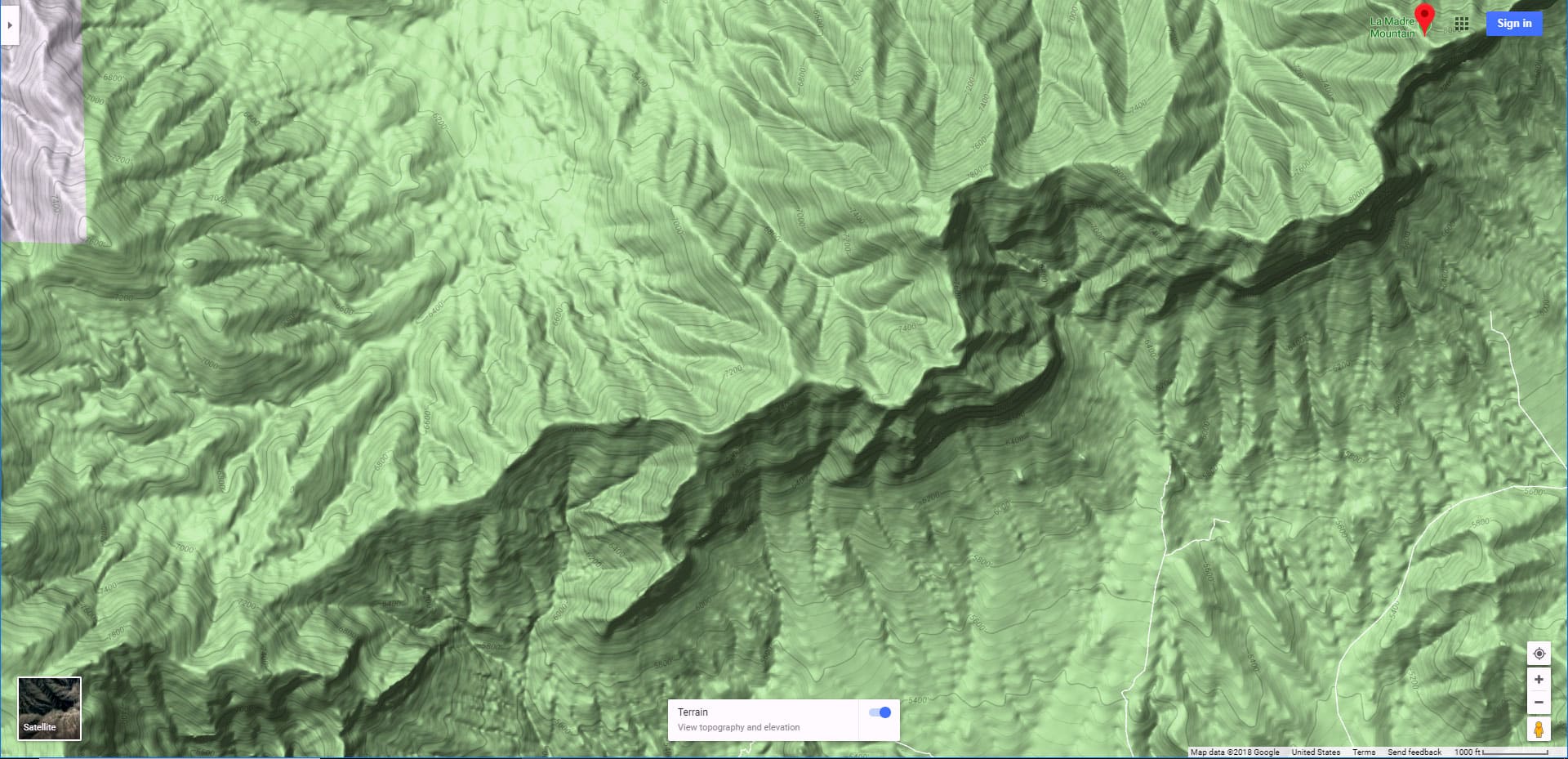
Overview | Keystone Thrust Summit from Willow Spring | Red Rock Canyon National Conservation Area, Nevada
This is the easiest route to the Keystone Thrust summit from the South in Red Rock Canyon. It is entirely class 1 and 2 climbing (no hands necessary to maintain stability). There is one brief 20-30ft class 3 rock climb half way up the Keystone Thrust, but it is not too difficult.
Additional benefits to this approach to the Keystone Thrust Summit:
- Great parking area at Willow Spring picnic area.
- Start out on very good trails.
- Ascend through the La Madre Spring area and enjoy the sights and sounds of year-round flowing water.
- Visit an historic miner’s cabin
- Touch 3 major wilderness areas: Red Rock Canyon National Conservation Area, Rainbow Mountain Wilderness and La Madre Mountains Wilderness
- Experience spectacular views of Kyle Canyon, Red Rock Canyon and the Las Vegas Valley
Major view points of reference include:
There’s a lot more. This was the short list!
Best Time of Year for This Adventure
Spring and Fall. Summer can get too hot at these elevations and Winter may require snow navigation skills.
Trailhead Directions | Keystone Thrust Summit from Willow Spring | Red Rock Canyon National Conservation Area, Nevada
From I-215 take the Charleston Blvd exit (at Red Rock Casino) and head upward through Summerlin toward Red Rock Canyon National Conservation Area. Take the Red Rock Canyon scenic drive past the high point overlook to the Willow Spring picnic area between White Rock Mountain and the Rainbow Mountains that border the West side of Red Rock Canyon.
Route Observations | Keystone Thrust Summit from Willow Spring | Red Rock Canyon National Conservation Area, Nevada
View prior explorations of this route on the La Madre Mountains Western Approach page.
New Explorations 3 Years After the Initial Explorations
This exploration follows a 3-year lapse with this route. The intervening time has brought some significant changes resulting in a re-start:
- During the original adventures I had not yet explored the La Madre Mountains Wilderness from the North, so that entire area was a mystery. Now I have summited La Madre Mountain, El Padre Mountain and Burnt Peak and explored the saddle between Burnt Peak and El Bastardo — all from Kyle Canyon.
- The earlier adventures were in the Spring. These initial re-adventures began in the Fall when the vegetation in the La Madre Spring area was more dense.
- The intervening 3 years had filled the final 1-mile approach to the summit of the Keystone Thrust with brush and fallen trees obscuring the route.
- The Willow Spring Picnic area in Red Rock Canyon had undergone quite an overhaul. Many attractive new interpretation signs had been installed.
Re-Discovery and Streamlining of the Route from Willow Spring Picnic Area to the Keystone Thrust Summit
Traversing the North side of White Rock Mountain from Willow Spring
From the Willow Spring Picnic Area take the White Rock Mountain Loop in a counter-clockwise direction. You’ll begin heading up Rocky Gap Road until the White Rock Mountain Loop quickly splits off to the right. There’s a La Madre Mountains Wilderness entrance sign at that point. Where the trail splits you are at the junction of 3 major wilderness areas: The Rainbow Mountain Wilderness, Red Rock Canyon National Conservation Area and the La Madre Mountains Wilderness.
Continue along the North side of White Rock Mountain, with White Rock Mountain to your right, the Keystone Thrust ridgeline to your left, the Rainbow Mountains behind you and the high cliffs of the El Bastardo Mountain area ahead. It’s an incredibly beautiful stretch. Notice the lush vegetation on this North side of White Rock Mountain compared to the more stark desert environment on the South side and in Red Rock Canyon. If you’re on this stretch in the morning on a clear day before the sun tops White Rock Mountain the entire area literally sparkles and the upper ridge of White Rock Mountain glows in the brightness of the rising sun.
Junction of La Madre Spring Trail and White Rock Mountain Loop
In about a half mile the White Rock Mountain Loop Trail splits off to the right to continue around White Rock Mountain. The trail from the Willow Spring Picnic Area all the way to La Madre Spring is well graded and could accommodate park service vehicles. If you’re looking to do the White Rock Mountain loop, don’t blink because you’ll miss your right turn onto that loop. The loop trail is pretty obscure and looks more like a trail than the main trail/road up to La Madre Spring.
Arrival at La Madre Spring
By the time you hear water flowing below you to your right, indicating you have reached La Madre Spring, you have ascended over 500-800ft from your starting point at the Willow Spring Picnic Area. Now you’ve arrived at the canyon through which La Madre Spring flows. Notice the dramatic difference between the lush band of vegetation at the base of the canyon and the more barren desert above on either side. Also, notice that at this point the road ends and you’ll continue upward on a narrow trail bordering La Madre Spring. The trail is often obscured by brush. To make things a little more challenging, the trail is unmarked and crosses the spring a few times. If you miss a crossing, you’ll find yourself on the rather steep surrounding slopes and cliffs lining the spring. To further add to the challenge, every time you cross the spring your feet get wet, then you need to ascend smooth rocks with those wet feet! But the springs are truly beautiful and flow year-round.
Experience the sights and sounds of flowing water at La Madre Spring.
Ascending Above La Madre Spring to the Miner’s Cabin
After crossing the spring a few times, you’ll find yourself on the left side ascending some steep smooth rock sections (with wet feet) to the more barren desert above the spring. You’re very close to the miner’s cabin at this point. Keep moving forward, it’s about 1/8th mile to go!
The miner’s cabin is not the traditional log cabin, but rather two small rooms lined with 5-ft high stone walls and a ceiling of branches that has mostly caved in. There are a few rusty cans scattered about. The imagination runs wild as you try to picture a lone miner living in these cramped conditions in such isolation. But then, as you emerge from the cabin look at the spectacular view from the front door: White Rock Mountain, Red Rock Canyon, Blue Diamond Mountain, the Rainbow Mountains, portions of the Las Vegas Valley and as far as the eye can see to the distance beyond these points! Then, you look up behind to the majestic cliffs of the Keystone Thrust. Perhaps it wasn’t such a bad life there in that isolated cabin!
Ascending the Keystone Thrust Above the Miner’s Cabin
Your ascent of the Keystone Thrust begins at the miner’s cabin. There is no trail marking, so you will need to explore the surrounding brush to the left of the cabin until you find something that looks like a pathway. Actually, you’ll see multiple rabbit trails branching out in different directions. A video on this page walks you through that initial confusing stretch. In short, just aim for the ridge to the left and behind the cabin and you’ll eventually come across a decent little trail.
Keystone Thrust Ascent Divided into 2 Parts
The remaining stretch to the summit of the Keystone Thrust can be divided into two halves with a brief 20-30ft class 3 cliff climb between. Below the cliff line there is a fairly good trail that will take you to a weakness in the cliff line where you can ascend a slightly challenging rock climb. Once above the half-way cliff line the trails again become obscure, branching off in multiple directions. I created a cairn-marked path to the summit that begins when you take a right at the top of the brief class 3 section. By the way, in climbing terminology, class 3 means you need to use both hands and feet to ascend, but you don’t need ropes and climbing gear. Class 2 means you can walk along without barriers that require use of your hands.
The great thing about this approach to the Keystone Thrust summit is that, with the exception of the brief class 3 section, it’s a walk all the way to the summit! Good trail on the lower half, cairns marking the upper half.
Arrival at the Keystone Thrust Summit!
You’ll know when you have reached the summit of the Keystone Thrust. Suddenly an expansive view opens including the Mt. Charleston Wilderness, the La Madre Mountain Wilderness, Kyle Canyon nearly from end to end and the Hwy 95 corridor stretching beyond as far as the eye can see. Turn the other direction and you’re looking into Red Rock Canyon, the entire stretch of the Rainbow Mountain Wilderness with all the familiar peaks (Bridge Mountain, Rainbow Mountain, Mt Wilson) all the way to Potosi Mountain at the Southern edge of the Spring Mountains. And of course, there are Turtlehead Peak, the Calico Hills and the Las Vegas Valley with parts of the Strip. You’re seeing quite a slice of Southern Nevada!
Closing the Gap to Complete the Kyle Canyon Grand Crossing
In this initial exploration I took time to clearly mark and streamline the approach to the Keystone Thrust summit. It took me only 2 and a half hours to return to the Willow Springs Picnic Area and a future trip round trip to the Keystone Thrust summit will take between 4-5 hours, leaving 5 hours or more to take a right on the Keystone Thrust summit ridge toward El Bastardo and explore traversing around that mountain to Burnt Peak where an easy descent can be made to Harris Springs and Kyle Canyon Road, completing the Kyle Canyon Grand Crossing!


