Trails Bordering Las Vegas Metro Area, But Not in a Designated Wilderness Area
Las Vegas Metro Area Trails
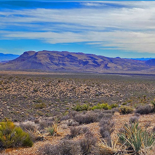
Cheyenne Mountain
Las Vegas Metro Area Trails
Lone Mountain
Las Vegas Metro Area Trails
Little Red Rock
Las Vegas Metro Area Trails
Little La Madre, Little El Padre, Little Burnt Peak (aka Summerlin Peak)
Las Vegas Metro Area TrailsHarris Springs Canyon RidgelineLas Vegas Metro Area TrailsCalico Basin Daily Workout Conditioning TrailsLas Vegas Metro Area TrailsBlue Diamond Hill Workout Conditioning TrailsLas Vegas Metro Area Trails
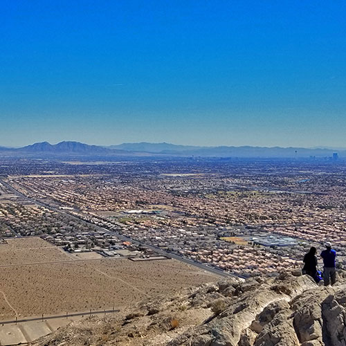
Frenchman Mountain
Las Vegas Metro Area Trails
Sunrise Mountain
Las Vegas Metro Area Trails
Lava Butte
Las Vegas Metro Area TrailsRed Bluff TowerLas Vegas Metro Area TrailsLake Las Vegas Western RidgelinesLas Vegas Metro Area TrailsFrenchman Mountain East Slope LoopLas Vegas Metro Area TrailsNorth McCullough WildernessLas Vegas Metro Area TrailsBlack Mountain North LoopLas Vegas Metro Area TrailsPetroglyph CanyonLas Vegas Metro Area TrailsThe King, The Queen & The Jack PeaksLas Vegas Metro Area TrailsRiver Mountains Loop Trail
The Las Vegas Metro Area Trails below are in wilderness areas within 10 minutes of the Las Vegas Metro Area. This makes them convenient places for daily conditioning workouts.
Enjoy hiking, biking and trail running on these trails. Explore their surrounding trail networks. Find adjacent boulders and cliffs for climbing practice.
Wilderness Areas
Unlike working out in a closed, cramped gym, you’re in a wilderness area with expansive, inspiring views throughout your workout! This is the only place you will find a collection of local wilderness areas like the collection below.
In addition to the areas below, also check out some of the daily workout trails in the Calico Basin and on Blue Diamond Hill.
Wherever you are in Las Vegas, you’re within 10 minutes of an awesome daily workout wilderness trail!
There are places within metro area Las Vegas or close to the metro boundary that can transport you instantly into a wilderness setting. Follow the thumbnail images on this page to detailed adventure descriptions complete with videos and images.
To provide the best experiences, we use technologies like cookies to store and/or access device information. Consenting to these technologies will allow us to process data such as browsing behavior or unique IDs on this site. Not consenting or withdrawing consent, may adversely affect certain features and functions.
Functional
Always active
The technical storage or access is strictly necessary for the legitimate purpose of enabling the use of a specific service explicitly requested by the subscriber or user, or for the sole purpose of carrying out the transmission of a communication over an electronic communications network.
Preferences
The technical storage or access is necessary for the legitimate purpose of storing preferences that are not requested by the subscriber or user.
Statistics
The technical storage or access that is used exclusively for statistical purposes.The technical storage or access that is used exclusively for anonymous statistical purposes. Without a subpoena, voluntary compliance on the part of your Internet Service Provider, or additional records from a third party, information stored or retrieved for this purpose alone cannot usually be used to identify you.
Marketing
The technical storage or access is required to create user profiles to send advertising, or to track the user on a website or across several websites for similar marketing purposes.