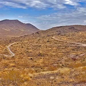
Overview | Sloan Canyon North from McCullough Hills Trailhead, Nevada
The 14,763 acre
North McCullough Wilderness portion of the 48,438 acre
Sloan Canyon National Conservation Area is itself one and a half times the size of
Red Rock Canyon National Conservation Area. This ancient volcanic area contains a network of hiking and biking trails weaving through lava flows, glassy zones and ash falls. The area remains in its pristine ancient condition and includes incredible views of the
Las Vegas Valley and its surrounding mountains.
Mountain Bike Circuit Around the Northern Sloan Canyon Area
The main trail in the Northern part of the
Sloan Canyon National Conservation Area is 8 miles in length and begins at the
McCullough Hills Trailhead at the end of
Mission Drive (close to the intersection of
East Horizon Ridge Pkwy and
Mission Drive). The trail ends at
Del E Webb Middle School in the
City of Anthem. To make a mountain bike circuit back to your starting point:
- Head down to Reunion Drive from the school.
- Take a right on Reunion Drive, then another right on Anthem Parkway.
- Take a right on Eastern and another right on Sunridge Heights Pkwy.
- Take a final right on W Horizon Ridge Parkway which becomes East Horizon Ridge Parkway.
- Take a right on Mission Drive and return to your starting point in about 1/4th mile.
You’ve just made a complete circuit of the North end of the
Sloan Canyon National Conservation Area!
Directions to Start Point | Sloan Canyon North from McCullough Hills Trailhead, Nevada
Note that older maps refer to this as the “
Mission Hills Trailhead”. Current Google Maps as of December 2020 refers to this same trailhead as the
McCullough Hills Trailhead. To get to the trailhead from the
Las Vegas Strip area take I-515 South. Continue past the intersection with I-215. Note that I-515 changes in name to I-11. Take a right off the
E. Horizon Dr. exit. After 100ft or so take a left onto
E. Horizon Ridge Pkwy. Take a final right after about 3/4 miles on
E. Mission Dr. In less than 2000ft
E. Mission Dr. will end at the
McCullough Hills Trailhead.
↓ Narrative Guide ↓
Narrative Guide | Sloan Canyon North from McCullough Hills Trailhead, Nevada
Ascent to the High Point Near the 5-Mile Marker
The 8-mile
McCullough Hills Trail is a good uphill climb with a number of brief rough cobblestone sections to cross at points where a wash crosses the trail. The trail is in excellent condition, though with some scattered stones to navigate. There are a number of off-shoot trails numbered in the 600 series that split off leading to most of the high points you can see from the main trail. If you can see a high point, there is probably a trail leading to it. The trail system in all forms quite a network of hiking, running and mountain biking options with grand views on the first 5 miles back to Henderson and beyond to the hills on the West side of
Lake Mead and further in the distance to mountains further to the East.
Descent to the City of Anthem
After a high point at 3,125ft the
Las Vegas Valley appears with a backdrop of
Potosi Mountain, the
Rainbow Mountains on the far side of
Red Rock Canyon National Conservation Area, the
Mt. Charleston Wilderness and the
Las Vegas Strip as you descend the last 3 miles to the
City of Anthem. When you see the paved
East Anthem Trail splitting off to the right about 1/2 mile above the
City of Anthem, take it. It’s much smoother going if you’re on a bike, though it winds around a lot. If you’re hiking or running, skip the
East Anthem Trail and just head straight down the very rocky final hill to the trailhead at the
Del E Webb Middle School in Anthem.
Pristine, Untouched, Peaceful Mojave Desert Area
The area is a pretty typical, untouched example of the
Mojave Desert with scrub brush, scattered creosote and yucca plants. The benefits of this trail are its easy access to the major population areas in the
Las Vegas Valley, good cell phone coverage and the feeling of quickly being in another world…peaceful, untouched desert. Late Fall to Spring or early in the morning would enable you to avoid the high heat of Summer days where temperatures can rise toward 120 degrees. For this reason, you’ll see reminders at every trail marker to dial 911 if you experience an emergency (i.e. ran out of water during the excessive heat of a mid-Summer day).