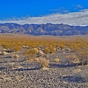
In this initial exploration of Alamo Road by mountain bike, we travel from the Desert National Wildlife Refuge headquarters to the intersection of Alamo Road and Cow Camp Road. This 12-mile stretch skirts the entire West side of the Sheep Range from South to North, and then begins to circle around the Northern tip of the Sheep Range. We’re scoping out a potential huge circuit adventure that will begin at the DNWR headquarters, take Alamo Road to Cow Camp Road, Cow Camp Road to the trailhead for Sheep Peak, ascend the West side of the range to Sheep Peak, ferrying the bike along the way, descend the East side to Pine Nut Road, take Pine Nut Road to Mormon Well Road and then return on that road to our starting point at the DNWR headquarters. I’m pretty confident this has not been done before and not sure it is possible, but it’s a goal.
The stretch along lower Alamo Road offers awesome views of the entire West and Northwest side of the Sheep Range, Gass Peak, the La Madre Mountains Wilderness and the Mt. Charleston Wilderness including especially Mummy Mountain, Fletcher Peak and Griffith Peak. Otherwise, it’s a pretty barren, windswept stretch of desert. The unpaved 4WD road is pretty firm for a mountain bike but does have a few stretches of deeper gravel and many washboard sections which can scramble the brain on the downhill return!
Take 1-95 North from the Las Vegas Strip about 10 miles past the Mt. Charleston/Kyle Canyon Road exit. Then take a hard right (no off ramp) onto Corn Creek Road…small brown directional sign marks the Desert National Wildlife Refuge headquarters. Travel up Corn Creek Road about 3 miles to its end at the DNWR headquarters where there is usually ample parking.
At the end of Corn Creek Road take a left onto Alamo Road. From the perspective of a mountain bike, the road starts out firm enough, though a bit bumpy. There are washboard sections which are very bumpy, but still not too bad. Alternately, there are rocky sections, but not enough to bog you down. The elevation gain is gradual. In all, lower Alamo Road is faster than Mormon Well Road.
The views of the entire West side of the Sheep Range are spectacular. Looking in the West across the valley, the views of the Mt. Charleston and La Madre Mountains wilderness areas are similarly spectacular. However, this is a long straight road across open desert with no points of access to the Sheep Range other than Joe May Road at the 3-mile point, Cow Camp Road at the 12-mile point and Hidden Forest Road at the 16-mile point. These roads promise to be a bit more challenging with steeper elevation gain and a 3-4 mile approach to the base of the Sheep Range.
Joe May Road is the approach to the Black Gate Canyon and Little Joe May Canyon. Cow Camp Road is the main approach to ascend Sheep Peak. Hidden Forest Road is the main approach to ascend Hidden Forest Ridge and Hayford Peak. One can head across the desert, ferrying the mountain bike toward the Sheep Range at any point to find additional approach ridges and canyons. It looks as if there are many possibilities as there are from the East side of the range from Mormon Well Road. We’ll explore many of these soon. Even a 4WD vehicle cannot access these additional approaches as there are few places to legally park on Alamo Road and Mormon Well Road. New possibilities for total coverage of the Sheep Range via a hybrid model of mountain biking and trail running!


Return often to experience one new adventure each week! From the home page scroll to “Most Recent Adventures“. More about David Smith…
The trail adventures on this website require proper conditioning, preparation and safety precautions. There are many factors beyond our control including weather conditions, unstable ground, loose rocks, insects and snakes, people you may encounter, your own level of physical conditioning, the potential of getting lost just to mention a few. While this site offers guidance, helpful tips, direction and training, the reader assumes full responsibility for whatever may occur during their trail adventure. Have fun and be safe!