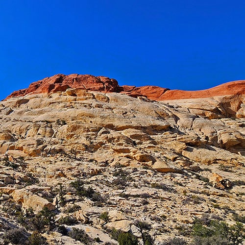
Red Cap Peak Summit | Red Rock Canyon NCA, Nevada Jurassic Sandstone Peak Overlooking Red Rock Canyon, aka "Little Turtlehead" Red Cap Peak Summit | Red Rock Canyon NCA, Nevada Tinaja (Ephemeral Pool) Near the Summit Red Cap Peak Summit | Red Rock Canyon NCA, Nevada Red Cap Peak Viewed from Below in Ash Canyon Area Jurassic Era Sandstone Peak Overlooking Red Rock Canyon, Aka "Little Turtlehead" | Red Cap Summit | Calico Basin to La Madre Mountains Wilderness, Nevada Red Cap Peak Viewed from Ash Canyon Area Below | Calico Basin to La Madre Mountains Wilderness, Nevada Tinaja (Ephimeral Pool) Near the Summit | Red Cap Peak Summit | Red Rock Canyon NCA, Nevada

First Relive Adventure Route by Glenn M

(most direct, easy)

Second Relive Adventure Route by Glenn M

(very difficult, involves class 4-5 rock climbing)

Overview | Red Cap Peak Summit | Red Rock Canyon NCA, Nevada

Slide guide coming soon!

Red Cap Peak, also referred to as “Little Turtlehead“, is a Jurassic Era Sandstone Summit in Red Rock Canyon National Conservation Area, Nevada. This adventure begins at the Kraft Mountain Trailhead in the Calico Basin and is called the “Double Slot” summit approach for reasons you will discover below.

Wins the Award for Variety

The following just begins to touch the variety of experiences and challenges provided by this adventure:

  • Terrain
  • Tinajas (Ephemeral Pools)
  • Spectacular Views
  • Rock Climbing Challenges
  • Route Finding
  • Some Stretches on Trails

The Terrain to and from Red Cap Peak Summit

The terrain along this adventure includes Jurassic Era sandstone rocks, cliffs and boulders. The first long stretch on the ascent is Aztec Red Rock, later it’s white sandstone. The peak is again Aztec Red Rock, thus the name “Red Cap”. The descent slot is white sandstone.ย 

Tinajas (Ephemeral Pools) on Red Cap

On this day in February, following a pretty significant Winter storm, we came across two large Tinajas, both near the summit. The ponds brilliantly reflected the surrounding sandstone sculptures and were large enough to last into the early Summer. Many smaller pools will probably disappear by April.

Spectacular Expansive Views

As you approach the upper ledges, views become more and more expansive, eventually including at least 4 major wilderness areas:

In fact, Red Cap is technically located in the La Madre Mountains Wilderness.

Rock Climbing Challenges

The biggest rock climbing challenges are the class 3-4 inclines along the ascent slot. I nicknamed this slot “Lucifer’s Ladder”. Imagine ascending a ladder only to find again and again that 10 rungs of the ladder are missing! You’re ascending a steep, steady incline and just when you feel “this isn’t that difficult”, around the next bend is a vertical barrier–missing rungs in the ladder! Fortunately two in our party of four — Glenn and his son Matt — were mountain goats. Glenn has navigated this route over 12 times — once during a Winter storm! They scurried up the vertical sections, then dropped webbing down to ferry up our backpack and aid our ascent! I wouldn’t attempt this route alone for the first time. My real guide was Olivia, Matt’s girlfriend. Though less experienced than Glenn and Matt and more at my level, Olivia had a knack of picking out the easiest routes up challenging sections. I watched Glenn and Matt scurry up the challenges, then I watched Olivia figure out an easier way, finally, I took Olivia’s route! It was a winning strategy.ย 

Route Finding Challenges

There are trails to guide your way to and from the base of Red Cap Peak. Once you begin ascending there are no trails until you’ve descended to the base of the peak. You’d think it would be simple navigating up what appears from a distance to be a distinct slot. However, it’s a maze in there! And once you leave the slot and begin navigating the upper regions there are many options…some good and others dead-ends. The rock climbing and route finding challenges help make this a fun, exciting adventure.

Some Stretches on Trails

Though none of the trails are marked, there are a series of use trails leading from the parking area to the initial slot at the base of Red Cap Peak’s ridgeline above Ash Canyon. Once you descend you’re on established trails with names, but no markings: The Rattlesnake Trail and Kraft Mountain Loop Trail.

Best Time of Year to Summit Red Cap

Stick to Fall through Spring. Mid-Summer can bring excessively high temperatures — over 100 degrees! Avoid this route within 24-48 hours of rain, snow or ice. When wet or icy, the sandstone surface becomes line a skating rink…in many places vertical or near vertical!

Trailhead Directions | Red Cap Peak Summit | Red Rock Canyon NCA, Nevada

From Hwy 215 in the Summerlin area, take the Charleston Blvd exit, turn upward (West) on Charleston Blvd toward the mountains. Charleston Blvd becomes Blue Diamond Rd. (159) as you leave the city. Take the Calico Basin exit off 159 (right turn) onto Calico Basin Road. Continue on Calico Basin Road to the end of the road. On the way you will pass the Red Springs Desert Oasis parking area as the road veers right and becomes Calico Drive, then Sandstone Drive. Sandstone Drive ends with the Kraft Mountain parking lot, on the left.

Adventure Description | Red Cap Peak Summit | Red Rock Canyon NCA, Nevada

Getting Your Bearings

While standing in the Kraft Mountain trailhead parking area, locate three main high points:

  • Kraft Mountain: The pinkish sandstone peak immediately above the trailhead parking area.
  • New Peak (also referred to as El Hijo Peak): The large limestone peak immediately to the left (West) of Kraft Mountain
  • Red Cap Peak’s long ridgeline: Immediately to the left (West) of New Peak
  • Pink Goblin Pass: The pass between Kraft Mountain and New Peak
  • Ash Canyon: The canyon between New Peak and Red Cap Peak’s long ridgeline
  • Ash Spring: The small grassy valley immediately West of the parking area, populated by Ash, Gamble’s Oak and Desert Holly trees.ย 

Adventure Route Summary

The adventure route begins at the Kraft Mountain Trailhead parking area. From there, follow a series of unmarked trails through Ash Spring. Cross the lower entrance of Ash Canyon and ascend a long red sandstone slot up Red Cap Peak’s long ridgeline. That slot becomes white sandstone on the upper ledges as it angles a bit to the right, then levels off somewhat, continuing along the upper ridgeline toward Red Cap Peak. Circle around the East side of Red Cap, then ascend to the summit. For the descent, head North (toward the La Madre Ridgeline), then descend slightly to the right (East) down a long gradual white sandstone slot with few obstacles to arrive on the Rattlesnake Trail. Take a right on the trail to the upper end of Ash Canyon. Then take a left and descend through Rattlesnake Gulch to the Kraft Mountain Loop Trail. Finally, take a right onto the Kraft Mountain Loop Trail to ascend Pink Goblin Pass, then descend to the trailhead.

Trailhead Parking Area to “Lucifer’s Ladder” Ascent Slot

At the trailhead parking area, set your sights on the distinct slot ascending up the side of Red Cap Peak’s ridgeline. The slot begins roughly at the base of Ash Canyon and heads up the red rock area on the ridgeline. Where it meets the white rock above, it angles slightly to the right continuing upward. The base of this slot is your first target. Now navigate the network of “rabbit trails” leading through Ash Spring. The trails merge into one trail ascending along the base of New Peak and toward Ash Canyon and that slot which is your target. When you reach the edge of Ash Canyon across from the slot, descend into Ash Canyon and cross over to begin ascending the slot.

Lucifer’s Ladder Slot (Red Rock Stretch)

As you begin to ascend the slot up Red Cap Peak’s ridgeline, you’ll notice at first that it’s a pretty steep sandstone slab. I realized this when I saw Olivia ascending some sections on all fours. I was soon to follow in a similar manner. Stay close to the wall on your right using it as a source of hand holds and stability.

I can’t remember all the specific challenges up the slot. They’re fairly well documented in the video. There are a series of brief near-vertical rises (6-25ft). Many have good hand and footholds. A few are smooth sandstone with limited anchors. A couple of the largest rises required the aid of webbing for hoisting backpacks upward and providing that extra hold during the ascent. I can remember a few places where I depended heavily on the webbing. The Vibram soles on my boots were crucial. They grabbed the sandstone providing good stability, security and confidence.

In addition to the near vertical chutes there were a couple rabbit holes under large boulders. I made it through these with my backpack on, though with little room to spare.ย I remember ascending steep honeycomb boulders a few times. Again, the Vibram soles grabbed the surface. At no point was there a steep ascent coupled with a yawning exposure. During the tricky places there was never more than 15-20 feet of exposure below, though that seemed significant while searching for holds during the ascent. I also remember some narrow ledges with yawning exposure below. But the ledges were generous enough and the walls along the ledges help provide stability.

Funny thing: After each challenging, sometimes frightening stretch Glenn would say, from above, “It’s easier after this!” But then, there was the next stretch, and it wasn’t easier!!

All that aside, the terrain was beautiful and each challenge overcome brought additional confidence. I’d say about 90% of the ascent was mostly fun, 10% a little scary. I wouldn’t trade the adventure for anything!

Lucifer’s Ladder Slot (White Rock Stretch)

As you hit the white rock, the views suddenly begin to expand. The expanse of Ash Canyon is below — almost directly below — New Peak across the canyon, and you can see all the way over to the Las Vegas Strip. Turtlehead Peak and the La Madre Ridgeline are also coming into view. White rock cliffs tower above to your left. Ash Canyon drops below to your right. You’re navigating a fairly narrow pathway between the two, but never feeling like you’re risking a slip into the chasm below. There are a few additional challenging rock scrambles during this stretch, but never over large exposures. Note that the white rock has a slightly sandier surface and is slightly less stable than the iron-infused red rock. Not horribly different, just be aware.

On a large, wide white sandstone slab, there’s a huge, beautiful Tinaja (Ephemeral Pool). You’ll circle around the left (West) side of the pool, then Red Cap Peak comes into view ahead.

Ascending Red Cap Peak

Head up the gully on the right (East) side of Red Cap Peak. Once at the gully summit, descend the opposite side of the gully for about 200ft, then make a u-turn up an adjoining gully. Soon you’ll need to cross that gully and ascend a 15ft wall with scarce hand and footholds. This was probably the most difficult challenge of the day. At the top of the wall was a boulder with a very narrow squeeze hole underneath. I sent my backpack ahead, then ascended, relying nearly totally on the webbing. I had to turn sideways to squeeze under the boulder at the top of the wall. Challenging, but rewarding!

Once over the wall another large, beautiful Tinaja presented itself in the midst of a wide shelf. Red Rock Canyon and the Rainbow Mountains were now is spectacular view! Circling around the Tinaja counterclockwise, there was the final summit approach to Red Cap Peak. It began with another 15ft wall, not as difficult as the last (but webbing needed), then a left turn up a slightly more gradual 10ft honeycomb surface to the summit! The summit area is generous, there’s a summit box and a spectacular 360-degree view of the surrounding wilderness areas!

Descending Red Cap Peak

The descent slot was much easier than the ascent. It was a straight shot down a gradual incline ending on the Rattlesnake Trail. I believe this descent ramp is the easier, light class 3 route to the summit. You don’t need to scale the Lucifer’s Ladder slot to summit Red Cap Peak. But you’ll miss a lot of Jurassic sandstone challenge and beauty.

Rattlesnake Trail to the Kraft Mountain Loop Trail

Once you hit the Rattlesnake Trail you’re on trails all the way back to the Kraft Mountain Trailhead, unless you decide to descend Ash Canyon. After all the rock scrambling, trails were a welcome change. Take a right on the Rattlesnake Trail and ascend that trail to the upper end of Ash Canyon. Take a left there and descend the Rattlesnake Trail down Rattlesnake Gulch along the North side of New Peak. At the base of Rattlesnake Gulch there’s actually a trail post indicating the right turn up the Kraft Mountain Loop Trail, over Pink Goblin Pass and down to the Kraft Mountain Trailhead.

Conslusion

This was an unforgettable adventure! I can see why Glenn has, at this point, made the circuit to the summit of Red Cap Peak over a dozen times. With familiarity, this would make a great, spectacular full body workout. The route grows on you. Practice would make this route more familiar and rapid with each circuit. Every stretch along the way could easily become an old, beloved friend.ย 

ย 

Summary
Red Cap Peak Summit | Red Rock Canyon NCA, Nevada
Article Name
Red Cap Peak Summit | Red Rock Canyon NCA, Nevada
Description
Red Cap Peak, also referred to as "Little Turtlehead", is a Jurassic Era Sandstone Summit in Red Rock Canyon National Conservation Area, Nevada. This adventure begins at the Kraft Mountain Trailhead in the Calico Basin and navigates through Ash Canyon before summiting the peak.
Author
Publisher Name
LasVegasAreaTrails.com
Publisher Logo
Translate ยป