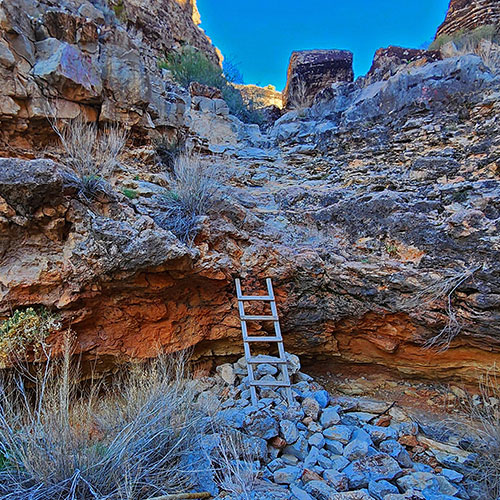
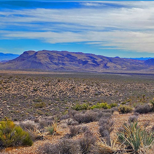
Blue Diamond Hill, Nevada | OverviewBlue Diamond Hill Viewed from Base of White Rock MountainEastern Outer Circuit | Blue Diamond Hill, NevadaRed Rock Canyon from Blue Diamond Hill Eastern CliffsWestern Outer Circuit | Blue Diamond Hill, NevadaView Toward Maverick Helicopter Windsock Hill from Far Western RidgeWestern Trails & Ridges | Blue Diamond Hill, NevadaAmazing Composite Rock Pillars on the Kibbles 'N Bits Trail
The “Un-Ski Slopes” of North Blue Diamond Hill, Nevada
North Blue Diamond Hill has these similarities with a ski area:
Runs of various difficulties with names like: “Bunny”, “Muffin”, “Radio Tower”, “Overlook Ridge”, “Bone Shaker”, “Bob Gnarly”.
Names like “First Finger”, “Second Finger”, “Cowboy Canyon” and “Skull Canyon” recall possible names that could appear on ski slopes.
Ski slopes have a “diamond” rating system:
Green Diamond: Beginner – Easy (“Bunny”, “Muffin”) hills with 6-25% incline.
Blue Diamond: Intermediate – 25-40% incline. “Bob Gnarly”?
Black Diamond: Difficult – 40% and steeper incline. “Bone Shaker”?
Where North Blue Diamond Hill is Different Than a Ski Area
There’s no snow!
There are no skiers – mountain bikers instead.
There’s no ski lodge.
All that aside, it’s fun to think of North Blue Diamond Hill as an “Un-Ski Slope”. And, if you’re a mountain biker hurtling down one of the runs you may get the feeling skiers have as they hurtle down ski slopes.
About 8-9 Miles, 3,600-4,400ft Elevation, *Some Trails, Some Wilderness*
West Blue Diamond Hill
Where is West Blue Diamond Hill?
Most people, even avid hikers and wilderness wanderers do not know this area exists. Yet it is as massive as the familiar North Blue Diamond Hill area…and a lot more isolated and pristine.
The Western area of Blue Diamond Hill is a 4-mile ridgeline with descent ridges and canyons located across Hwy 159 from Red Rock Canyon Overlook, Middle Oak Creek, South Oak Creek, First Creek Trailheads and across from Spring Mountain Ranch State Park and Bonnier Springs. Suggested access: Any of the above trailheads, and parking areas on Hwy 159 across from the trailheads. More to come…
Most people, even avid hikers and wilderness wanderers do not know this area exists. Yet it is as massive as the familiar North Blue Diamond Hill area…and a lot more isolated and pristine.
The Southern area of Blue Diamond Hill is located across Hwy 159 from Wheeler Camp Spring Parking area and the Town of Blue Diamond. One suggested access: Wheeler Camp Spring Parking Area. More to come…
To provide the best experiences, we use technologies like cookies to store and/or access device information. Consenting to these technologies will allow us to process data such as browsing behavior or unique IDs on this site. Not consenting or withdrawing consent, may adversely affect certain features and functions.
Functional
Always active
The technical storage or access is strictly necessary for the legitimate purpose of enabling the use of a specific service explicitly requested by the subscriber or user, or for the sole purpose of carrying out the transmission of a communication over an electronic communications network.
Preferences
The technical storage or access is necessary for the legitimate purpose of storing preferences that are not requested by the subscriber or user.
Statistics
The technical storage or access that is used exclusively for statistical purposes.The technical storage or access that is used exclusively for anonymous statistical purposes. Without a subpoena, voluntary compliance on the part of your Internet Service Provider, or additional records from a third party, information stored or retrieved for this purpose alone cannot usually be used to identify you.
Marketing
The technical storage or access is required to create user profiles to send advertising, or to track the user on a website or across several websites for similar marketing purposes.


