Overview of Burnt Peak, La Madre Mountains Wilderness, Nevada
View from Burnt Peak Summit
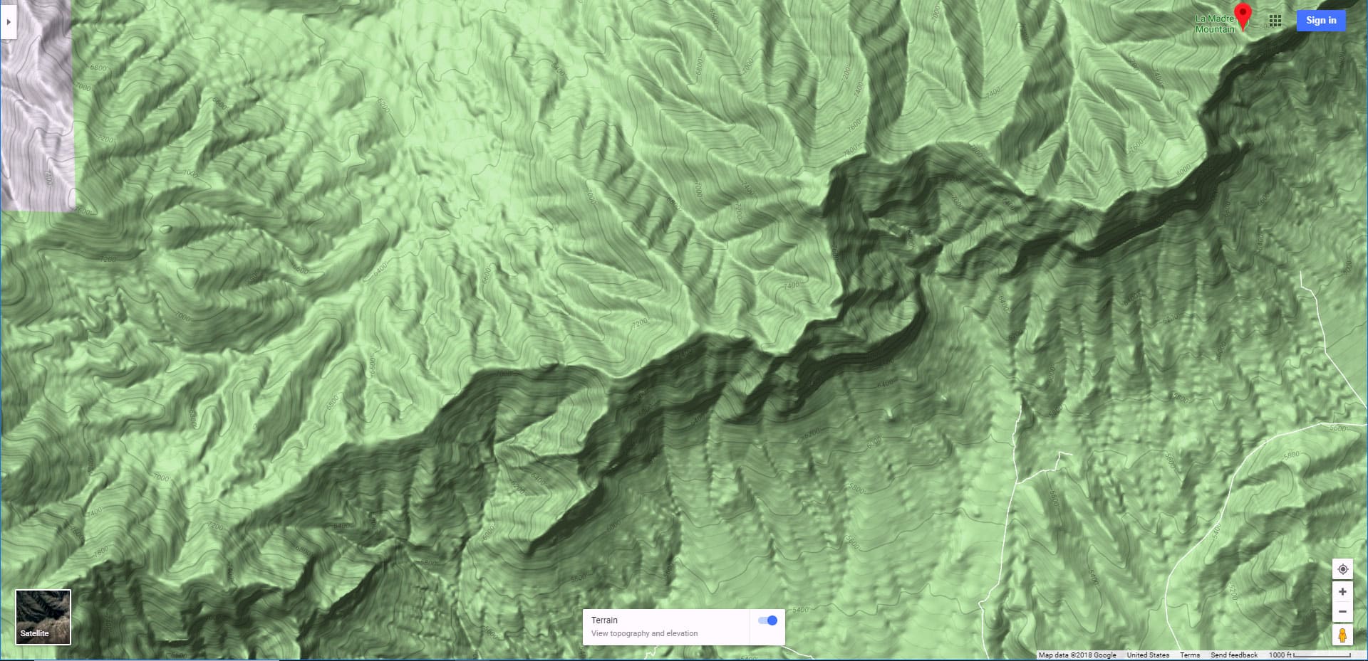
Burnt Peak is located in the La Madre Mountains Wilderness of Nevada just a mile or two from La Madre Mountain. The summit is about 7,900ft, similar to the summits of La Madre Mountain and El Padre Mountain. All three mountains make up the section of the Keystone Thrust at the rear (North end) of Red Rock Canyon National Conservation Area and Calico Basin in Nevada. From the summit of Burnt Peak there are spectacular views of Red Rock Canyon National Conservation Area, Calico Basin, Damsel Peak, Bridge Mountain, Juniper Peak, Rainbow Mountain, Mt. Wilson, Gass Peak, the Sheep Range, the Mt. Charleston Wilderness, Frenchman Mountain, Lake Mead National Recreation Area and, of course, La Madre Mountain and most of the Las Vegas Valley. The 6,200ft Turtlehead Peak summit is nearly 2000ft directly below and a little to the South. There are many more landmarks visible but to name them all would be to name most of the landmarks in Southern Nevada!
Summary of Area Summits
La Madre Mountain: 8154ft
El Padre Mountain: 8093ft
Burnt Peak: 7900ft
El Bastardo: 7986ft
Strategy for 8000ft Explorations in Mid-Late Spring
Water and Temperature Planning
Know your own personal limits through careful study of your experience. Don’t push the envelop too far beyond your most recently measured personal limit. Temperature Limits: I would not myself climb El Padre Mountain if the temperature in Las Vegas Valley exceeded 85 degrees on the day of the climb or during the previous week. That’s my upper limit. Why take the previous week’s temperature into consideration? Because the earth stores up the heat and a same temperature in the Las Vegas Valley on the day of the climb can result in up to 15 degrees or more variation all the way up to the summit. Here’s proof: Previous week to last week’s climb, average temperature was around 80 degrees. Temperature in the Las Vegas Valley the day of the climb was 90 degrees, at 7,800ft about 70 degrees. This week’s previous temperature average was around 90-95 degrees. Temperature in Las Vegas Valley the day of the climb was 91 degrees, just 1 degree hotter than the day of the climb last week. However, the temperature at 7,800ft today was a whopping 14 degrees hotter–84 degrees! Also, I would not climb El Padre Mountain were it covered with snow. The slopes are too steep for me in snow and ice. This leaves Fall and Spring as my best seasons for El Padre Mountain.
Water Consumption: On this test trip where the Las Vegas Valley was 91 degrees the day of the climb and the previous week went up to 98 degrees I carried 6 liters of water and consumed 5 liters. Only consumed 4 powerbars…nothing else. On that day my weight was 155lbs, my age nearly 65yrs, and I was in marathon conditioning. The round trip was 25 miles from my point of origin at the intersection of Kyle Canyon Rd and Harris Springs Rd. If your stats (age, weight, conditioning) are different, adjust accordingly!
Space Out Your Adventures
Oh, one more consideration: I almost never do these ultra 20-mile 4000ft adventures 2 weeks in a row. I give myself a rest week between. My water and temperature discoveries (strategy documented above) are also documented in the video on this page.
Route Observations for Burnt Peak, La Madre Mountains Wilderness, Nevada
The temperature on this day was 91 degrees in the Las Vegas Valley and still between 80 and 84 degrees at the 8000ft summit of El Padre Mountain. So, I also use this as an adventure to test and refine my high temperature running strategy in the desert. In addition, on the return trip I got off course and used this as an example of how to systematically locate your course when lost in the wilderness. Both are described in real time in the video on this page. This trip was my second week back-to-back ultra as I was trying to beat the coming of the Summer heat. As a result I tired more quickly and probably needed more water, power bars over a trip that took longer.
Timing: This adventure took me 10 hours.
Wild Card: I stopped about 1 mile short of El Padre Mountain due to a cliff obstacle (will refine the course next trip), so add 2 miles and about one hour to all the above stats had I continued on to the summit. However, I added about 30-45 minutes due to getting off course on the return trip, so that may nearly even things out.
Route Beginning Point
This adventure up Burnt Peak in the La Madre Mountains Wilderness of Nevada began on the first Saturday of May in 2020 on a crystal clear day due to the lack of traffic during the Covid19 world pandemic social distancing. The starting point was the intersection of Kyle Canyon Road and Harris Springs Road. There is a parking area on the right side of Kyle Canyon Road just about 100 yards beyond where it intersects with Harris Springs Road.
Route Beginning to the Base of Burnt Peak
The first leg of the adventure involves a 3-4 mile run up Harris Springs Road to where it intersects a 4wd road 3-4 miles North of the base of La Madre Mountain, El Padre Mountain and Burnt Peak.
At the turn-around loop end of the 4wd road set your sites on Burnt Peak, a 7,900ft pointy hilltop straight ahead to the South and at the summit of the Keystone Thrust ridge system. The faint trail will be good for about 1/4th mile then disappear. But the approximately 3-mile ridge you are ascending toward that high point is pretty distinct, so stay in the center of that ridge. You’ll face a series of about 8 rocky bluffs along the way. For the most part the ascent is class 2 climbing with just a couple class 3 sections.
Views While Ascending the Ridge Toward Burnt Peak
As you ascend the ridge toward Burnt Peak, look around to see spectacular views of the Mt. Charleston Wilderness to the West, the Sheep Range and Gass Peak to the North and Northeast, and La Madre Mountain to the East. When you finally reach the 7,900ft Burnt Peak, continue beyond into a lush Juniper and Pine forest. Just a few hundred feet beyond (and behind) Burnt Peak summit you will be standing at the top of those cliffs you may have seen at the rear of Red RockCanyon National Conservation Area (see the overview above). You are now standing on the summit of the Keystone Thrust.
Stopped 1 Mile and about 200ft Elevation Short of El Padre Mountain Summit
The next summit about a mile to the East is the long 8093ft high El Padre Mountain summit. There is an intervening cliff ridge that stopped me on this day. However, had I descended about 3-500ft I may have been able to skirt it and continue on the summit of El Padre Mountain. The temperature on this day hit 84 degrees at a couple times at this altitude and the return trip was 12-13 miles through low lands approaching the low 90s in temperature. In the video I describe my high temperature navigation strategy which involves a headdress, lots of water (6 liters of which I drank 5!) and the ability to some extent to lower my metabolism in an extreme heat environment.
Navigating When Lost
Another experience that comes through in the video on this page is the ability to navigate even when lost. It helps not navigating by trails but rather by landmarks. I’m continually triangulating landmarks of the surrounding mountains and ridges. This enabled me to locate the return ridge when it looked from the summit as though there were two ridges that might have been the return ridge. I picked the right ridge then watched for signs of my earlier ascent. This assured me that I had selected the correct return ridge. However, near the base of that ridge I failed to remember that the ridge split and so ended up taking the wrong lower split-off. I missed the top of the 4wd road and instead found myself wandering down a totally strange wilderness area in temperatures approaching 90 degrees! The strategy here was to get out of the lower canyon and ascend to a ridge where I could view surrounding landmarks. These indicated I might have strayed too far West and totally missed the return road. So I headed East until I emerged back onto the road. To get back on course I was triangulating a lower ridge to the West that intersected with Harris Springs Road and also viewing the position of La Madre Mountain, the high point on the Keystone Thrust I had earlier attained, the Mt. Charleston Wilderness and the Mt. Charleston Observatory. Even with all these land features I was not 100% sure of my course until I actually emerged on the 4wd road.
Be Prepared for the Unexpected
It’s amazing how one can so easily get off course even in a barren desert area. The canyons and ridges you are traveling all begin to look the same! I was saved by keeping in the higher reasoning centers of my brain (vs. panic mode) and by having started out with so much water! I only lost about 40 minutes, but it seemed longer at the time. Getting off course in the desert and running out of water on a high temperature day has cost many their lives and there are scattered memorials in the desert (one in Valley of Fire State Park for John G. Clark, pictured on this website). Enjoy the desert, but always have contingency plans and resources for the unexpected!
Heading for the Higher Elevations
As the temperature below 8000ft is now beginning to approach 100 degrees (99 degrees forecasted for next week), I’ll begin ascending to higher trailheads and destinations. The challenge is that many of these destinations are still blocked by snow and their trailheads closed due to Covid19! Time to be extra creative!!


