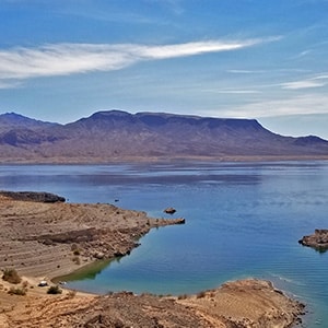
Callville Summit Trail is a great way to experience the area around the Lake Mead shoreline in a brief 1-2-mile excursion. You’ll get an idea of hiking conditions in desert terrain without committing yourself to a more extensive remote adventure. Hiking conditions include navigating loose rock, sudden drop-offs, high desert heat and additional conditions related in the video on this page.
Though the trail is brief, there are some spectacular views: Lake Mead, Fortification Hill in Arizona, the Black Mountains and Mt. Wilson also in Arizona, the Hamblin Mountain area, the Muddy Mountains, Black Mesa, Frenchman Mountain, Sunrise Mountain, the Mt. Charleston Wilderness, the Rainbow Mountains, Potosi Mountain and the Sloan Canyon Area.
Take Northshore Road North to the intersection of Callville Bay Road. Callville Bay is its own distinct community with a Restaurant/General Store and a pretty substantial marina. There’s quite a history including an isolated military post established to protect Mormon settlers from a Native American invasion that never materialized. In the meantime, the military post was plagued with suicides and desertions. See the video on this page for more of the story.
Callville Summit Trailhead is located across from a national park interpretive center and RV Park approached by a right turn to the South off Callville Bay Road a few hundred feet before Callville Bay Road ends at the Marina. There is a dump station just beyond the interpretative center and across the road. A distinct trail can be seen just beyond this dump station. There is no trailhead marking.
As you begin to ascend the ridge above the dump station moving in a direction toward Lake Mead you’ll quickly notice that there is no one distinct trail, but a series of what I’ll call “rabbit trails” that lead in all directions along various ridges toward Lake Mead. On this day I chose to keep to the ridge furthest to the left and just above the Callville Bay marina. Along this ridge there are a number of high points you can ascend to the right and to the left. Each high point affords great 360-degree views of the surrounding areas pointed out above. It’s well worth it to ascend these high points which involve only about 50-150 feet of navigation weaving around rocks and boulders.
Continuing along the ridges, within about 3/4th mile or so from the first high point you’ll arrive at the cliffs above the Western shoreline of Lake Mead. The lake on this day was a beautiful turquoise. It’s a great spot for a picnic with an awesome overlook of the lake, but probably not during the hot Summer months when temperatures here easily top 120 degrees.


Return often to experience one new adventure each week! From the home page scroll to “Most Recent Adventures“. More about David Smith…
The trail adventures on this website require proper conditioning, preparation and safety precautions. There are many factors beyond our control including weather conditions, unstable ground, loose rocks, insects and snakes, people you may encounter, your own level of physical conditioning, the potential of getting lost just to mention a few. While this site offers guidance, helpful tips, direction and training, the reader assumes full responsibility for whatever may occur during their trail adventure. Have fun and be safe!