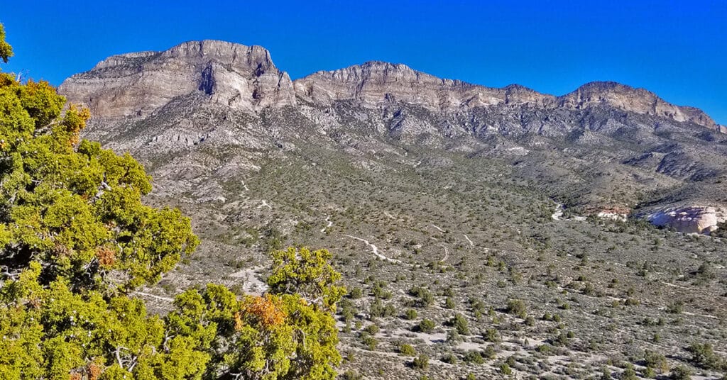
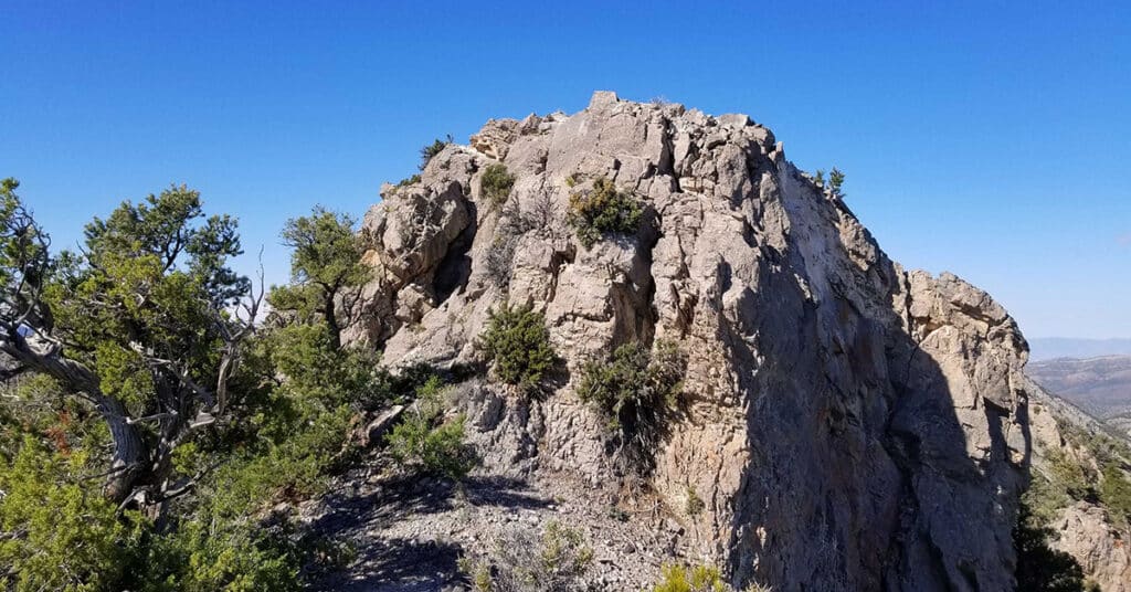
Keystone Thrust Summit from Willow Spring | Red Rock Canyon, Nevada
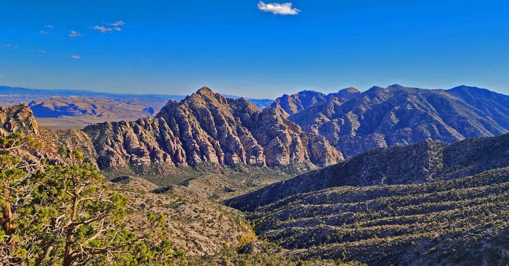
Summit the Keystone Thrust from Willow Spring in Red Rock Canyon National Conservation Area. Touch Two Additional Wilderness Areas: Rainbow Mountain Wilderness and La Madre Mountains Wilderness. Route goes along the North side of White Rock Mountain, up to La Madre Spring, past Miner’s Cabin and on to Keystone Thrust summit.
Knoll Trail | Red Rock Canyon, Nevada
The 1.9-mile Knoll Trail in Red Rock Canyon NCA, Nevada, skirts the Eastern base of the Rainbow Mountains between Oak Creek and Pine Creek Canyons. It is part of the Rainbow Mountains Eastern Baseline Trails that include, from North to South: The SMYC Trail, Dales Trail, The Knoll Trail and The Arnight Trail. These four trails skirt the Eastern base of The Rainbow Mountains in Red Rock Canyon between Willow Spring at the North end of The Rainbow Mountains and Oak Creek Canyon at the Southern end of Red Rock Canyon. The best time of year to hike these trails is mid-Fall to mid-Spring. Summer temperatures can easily rise above 110 degrees! Click the image or title above to learn more about The Knoll Trail.
Kyle Canyon Grand Crossing Northern Half | La Madre Mountains Wilderness, Nevada
The Kyle Canyon Grand Crossing North is the Northern half of the larger Kyle Canyon Grand Crossing which begins at the intersection of Kyle Canyon and Harris Springs Roads, ascends to the El Bastardo Mountain area on the Keystone Thrust above Red Rock Canyon, then descends to Red Springs Desert Oasis in the Calico Basin. This Northern half of the adventure takes you to the saddle between Burnt Peak and El Bastardo Mountain on the Keystone Thrust Ridgeline, looks down to Red Rock Park and contemplates various routes into the park below before returning to the starting point on Kyle Canyon Road. Highlights include a walk though the beautiful La Madre Mountains Wilderness camping, navigating numerous rocky plateaus through the wilderness up the Burnt Peak approach ridge, exploring a section of the upper Keystone Thrust and seeing spectacular 360-degree views all along the route. Route details: 20 Miles + RT / 4500-7900ft; *Some Road, Mostly Wilderness* Click image or title above for more…
Kyle Canyon Grand Crossing Southern Half | Red Rock Canyon NCA, Nevada
This is the Southern half of the Kyle Canyon Grand Crossing from the intersection of Kyle Canyon and Harris Springs Roads in Kyle Canyon, up over the Keystone Thrust and down to the base of White Rock Mountain in Red Rock Canyon National Conservation Area. The entire Kyle Canyon Grand Crossing gives an experience of the La Madre Mountains Wilderness and Red Rock Canyon. In addition, there are views of the Sheep Range, Gass Peak, Mt. Charleston Wilderness, Rainbow Mountains Wilderness, Las Vegas Valley including the Strip and many points beyond. But this Southern portion of the route included what can be seen from the Keystone Thrust in Red Rock Canyon. Route details: 10-15 miles RT; **Some trails, mostly wilderness** Click image or title above for more…
La Madre Mountain Southern Approach from Red Rock Canyon | La Madre Mountains Wilderness, Nevada
La Madre Mountain is 8,154ft in elevation. It is the highest central feature of the Keystone Thrust, the cliff system that spans the rear area of Red Rock Park in Nevada. The La Madre Mountain Southern approach, from a distance, looks impossible as you’re facing a sheer cliff wall between 1000 and 2000 feet high. However, as you approach the base of the cliff from Calico Basin it’s evident that there is a passage between the two peaks. The summit view is amazing featuring Las Vegas Valley with Lake Mead across and to the East, Gass Peak and the Sheep Range to the North, spectacular views of Mt. Charleston Wilderness to the East and the awesome total expanse of Red Rock Canyon National Conservation Area and Calico Basin to the Southwest. Route details: 22 mi / 4306-8000ft; *Wilderness, No Trail* Click image or title above for more…
La Madre Mountain Western Approach from Red Rock Canyon NCA | La Madre Mountains Wilderness, Nevada
This is my favorite approach to La Madre Mountain due to the beauty of the terrain and the scenery. You begin in the scenic Willow Springs area (ample parking available), circle around between the Keystone Thrust Cliffs and White Mountain. Head up through the La Madre Springs area, pass an old Miner’s Cabin, then ascend to the top of the Keystone Thrust (the cliff system at the back of Red Rock Park). At the top take a right and travel along the very top of the Keystone Thrust ridge to La Madre Mountain. Route Details: 28 mi / 4306-8000ft; *Wilderness, No Trail* Click image or title above for more…
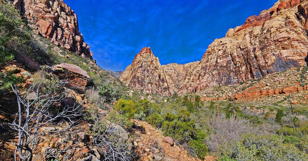
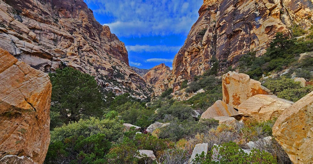
Middle Oak Creek Trail in Red Rock Canyon, Nevada
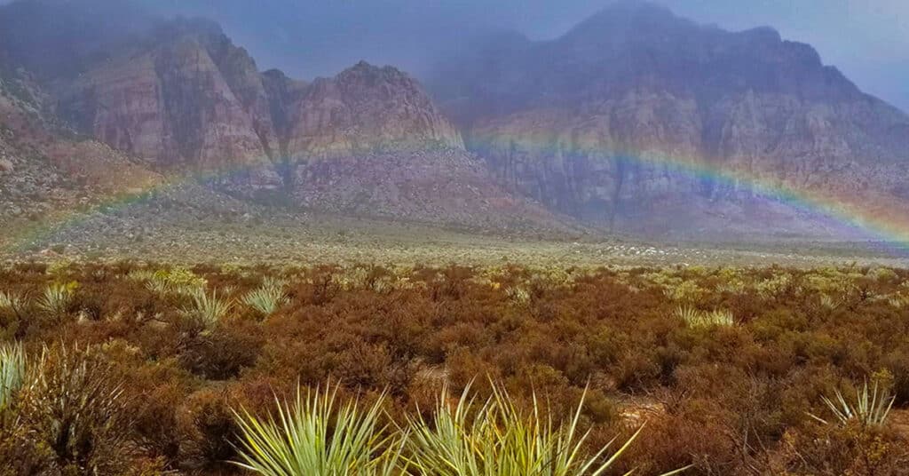
The videos on this page are an example of rains and flash floods in the desert. I recorded water cascading down canyon walls in the Rainbow Mountains of Nevada. It wasn’t a major life-threatening flash flood, but enough to get an idea how quickly things can change in the desert during a storm. Route Details: 4 miles RT; 300ft elevation gain; **Mostly wilderness, few trails.** Click image or title above for more…
Mt. Wilson, Rainbow Mountain Wilderness, Nevada
Mt. Wilson, Nevada, at 7070ft elevation is the highest mountain in the Rainbow Mountain Wilderness to the West. It’s one of the more challenging Rainbow Mountains to climb due to thick brush at its base and the cliffs above. I’ve seen countless hikers staring at their smart phones trying to follow granular directions (turn this way at this rock or tree…etc.) and totally lost in an elaborate maze of rabbit trails. I myself did this in the beginning, until I finally put my smart phone down and focused on the big picture. Route details: 12 mi/ 3,757 > 7070ft; Some Trails, Mostly Wilderness. Click image or title above for more…
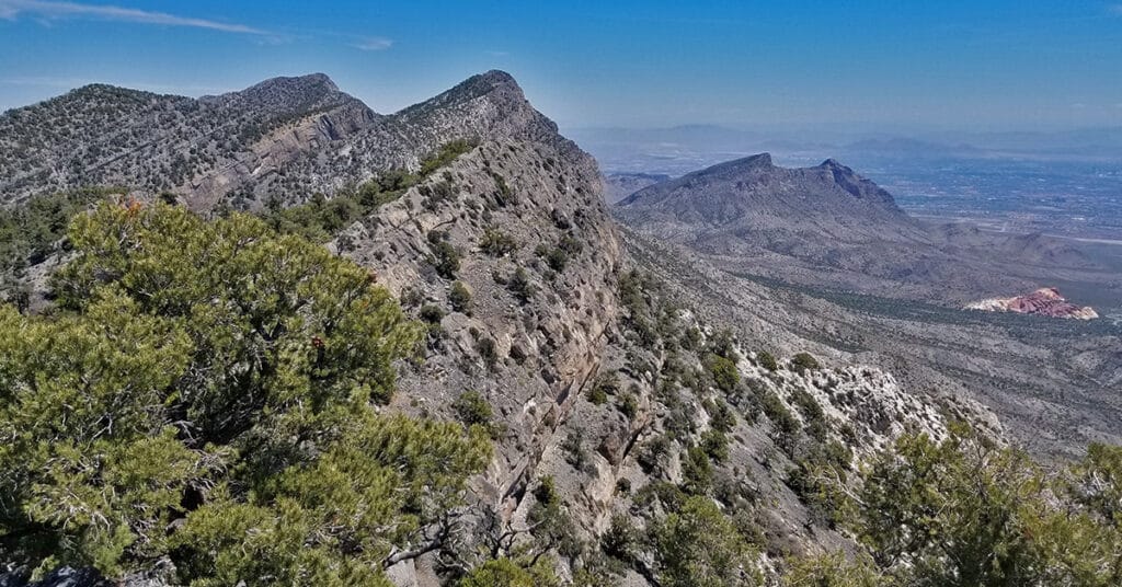
North Peak | Rainbow Mountain Wilderness, Nevada
The summit of North Peak is like the turret of a medieval European castle with amazing views in all directions. Views to the East include Red Rock Canyon all the way to Lake Mead. The Mt. Charleston Wilderness can be seen to the West. The Keystone Thrust and La Madre Mountains Wilderness is to the North and the span of the Rainbow Mountains to Potosi Mountain to the South. Route details: 17 mi/ 4500 > 7003ft; **Some Trails, Some Wilderness**. Click image or title above for more…
Oak Creek Canyon North Branch to Rainbow Mountains Upper Crest Ridgeline, Nevada
Beginning on Middle Oak Creek Trail in the Rainbow Mountain Wilderness of Nevada, hike to Oak Creek Canyon, then continue to explore the North branch of the canyon between Rainbow Mountain and Mt. Wilson on a Route Toward The Rainbow Mountains Upper Crest Ridgeline.
