Silica Dome | Valley of Fire State Park, Nevada

Silica Dome in Valley of Fire State Park, Nevada is just a very fun experience offering a combination of trail hiking and light but exciting rock climbing on an amazing surface. Silica, from which Silica Dome get’s its name, is the major constituent of sand. The dome itself is composed of very pure nearly white silica in rock solid form. Apparently, you do not want to breathe in the silica dust because it is a lung carcinogen and exposure can result in the disease of silicosis. Route details: 2mi RT Wander Around and On the Dome. Click image or title above for more…
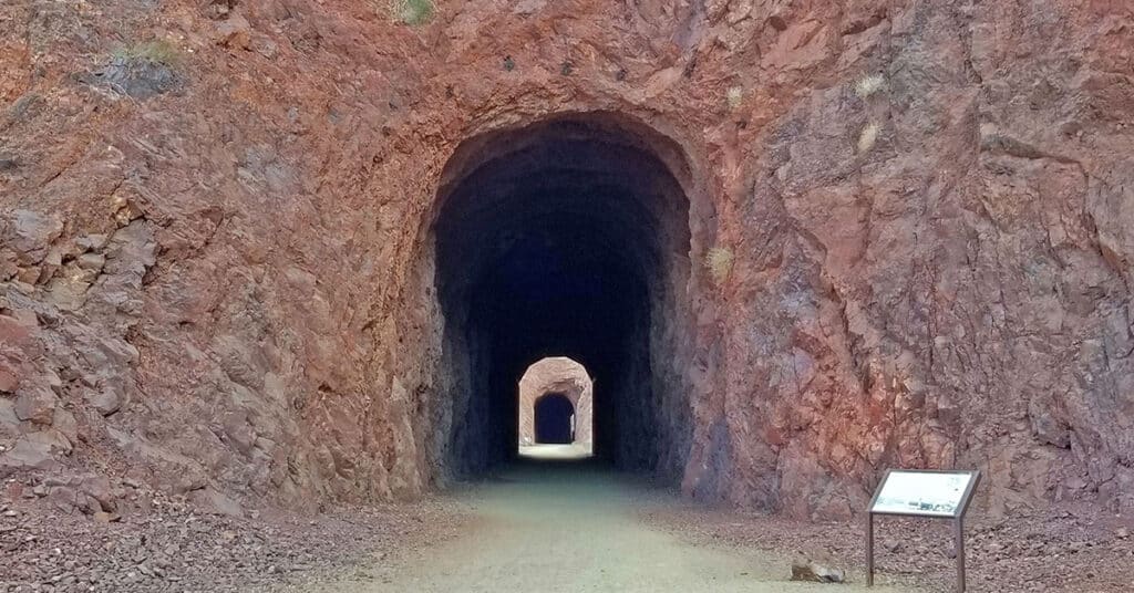
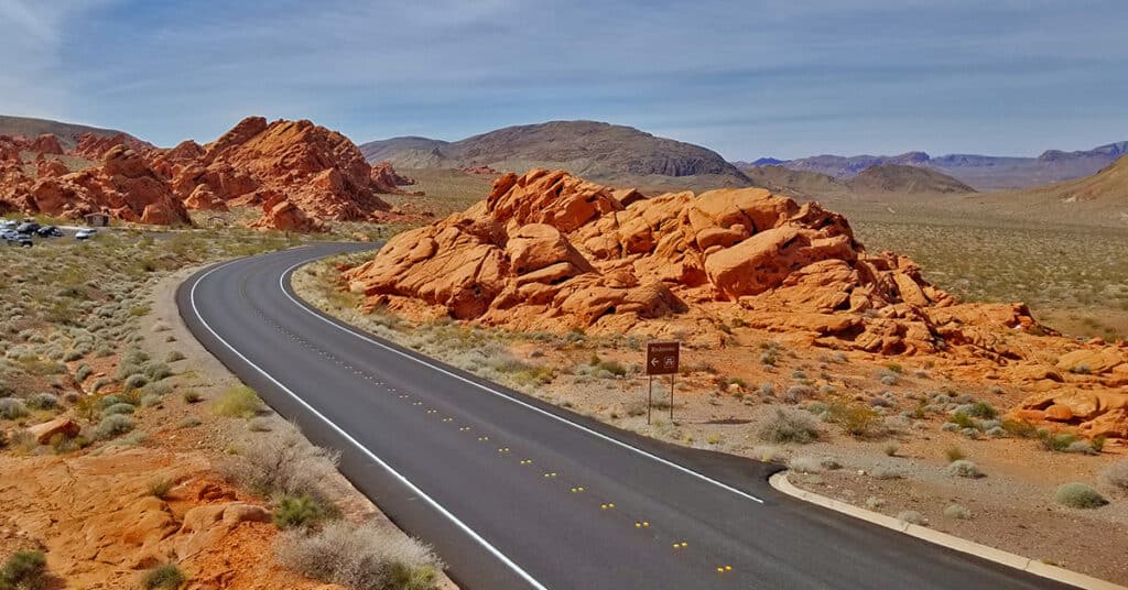
White Domes Loop Trail in Valley of Fire State Park, Nevada

White Domes Loop Trail in Valley of Fire State Park, Nevada is a relatively easy but totally amazing 1-mile loop trail featuring colorful red Aztec sandstone that was originally sand dunes 200 million years ago in the Jurassic age of the dinosaurs. Another feature of the loop is an abandoned Hollywood set from the 1966 American western film “The Professionals“. Route details: 1-Mile Loop; **Decent trail, some stairs.** Click image or title above for more…
Anniversary Narrows, Muddy Mountains Wilderness, Nevada

Anniversary Narrows in The Muddy Mountains Wilderness of Nevada is one of the most beautiful slot canyons in the state. If you’re into slot canyons, Anniversary Narrows is a must see no matter where you’re from. The intricate turns in the canyon along polished rock walls carved into millions of unique shapes lit up by a narrow slit 100s of feet above change in color with the advance of the sun throughout the day. It’s like wandering through a magical maze with a new, unexpected view beyond your wildest imagination around every turn. Route details: 10 mi RT; **Some Trail, Some Wilderness** Click image or title above for more…
Muddy Mountains Wilderness Northwestern Panorama, Nevada

A high point on the third ridge from the Muddy Mountains Wilderness Northern border offers a great panoramic view of the Muddy Mountains Wilderness. This is a good place to get the big picture of this wilderness 1/3rd the size of the state of Rhode Island. Route details: 6 mi RT, **Wilderness** Click image or title above for more…
Historic Railroad Trail | Lake Mead National Recreation Area, Nevada
The Historic Railroad Trail is about a 10-mile out and back adventure in the Lake Mead National Recreation Area in Nevada. This trail is a side trail branching off from the 31-mile River Mountains Loop Trail and spans the distance from the Lake Mead Visitor Center to Hoover Dam. You could combine this trail with a tour of Hoover Dam and a walk across the old memorial bridge. The well-graded path, with it’s very gradual inclines and descents makes for an easy hike or run. Route details: 5 mi RT | 200ft Elevation Gain/loss; **Wide, Graded Railroad Bed** Click image or title above for more…
Hamblin Mountain, Lake Mead National Recreation Area, Nevada

Though Hamblin Mountain in the Lake Mead National Recreation Area of Nevada is only 3312ft in elevation, it is positioned in a location that provides an incredible view hard to match anywhere else in Southern Nevada. This is in part due to it having 849ft prominence and being the highest point within 2.72 miles. The summit affords one of the best views of Lake Mead down to the Hoover Dam area and up towards the Overton arm. Route Details: 7mi | 1,965 > 3,291ft; **Some Trail, Some Wilderness** Click image or title above for more…
Fortification Hill | Lake Mead National Recreation Area | Arizona

Fortification Hill on the Arizona side of Lake Mead, like Black Mesa across Lake Mead on the Nevada side has the most incredible view of Lake Mead to be found anywhere. From the flag-topped summit you can see the full panorama of Lake Mead minus the Overton Arm stretching below, the Mt. Charleston Wilderness including Griffith Peak, Charleston Peak, Fletcher Peak and Mummy Mountain, the Rainbow Mountains on the West side of Red Rock Canyon National Conservation Area, Potosi Mountain, Hoover Dam, Mt. Wilson, the Muddy Mountains and many other features in Nevada and Arizona. However, getting there involves 4WD roads. Route details: 4mi | 2,313 > 3,717ft; **Mostly Trail – Sometimes Faint** Click image or title above for more…
Northshore Road | Lake Mead National Recreation Area, Nevada
Though Lake Mead National Recreation Area includes a few commercial developments, it is largely an untouched wilderness rivaling places like the Mt. Charleston Wilderness, the La Madre Mountains Wilderness and the Sheep Range. Here’s a quick tour of Northern Lake Mead NRA. Our overview adventure begins at the East entrance to Valley of Fire State Park. We note landmarks by the mile markers on Northshore Road which begins at mile 45.1 and ends towards Hoover Dam at mile 0. Route details: 45.1-mile tour of Northshore Road and various waypoints. Click image or title above for more…
Callville Summit Trail, Lake Mead National Recreation Area, Nevada

Callville Summit Trail is a great way to experience the area around the Lake Mead shoreline in a brief 1-2-mile excursion. You’ll get an idea of hiking conditions in desert terrain without committing yourself to a more extensive remote adventure. Hiking conditions include navigating loose rock, sudden drop-offs, high desert heat and other conditions unique to low desert adventures in the Southwestern U.S. Route description: 2-3mi | 1,229 > 1,500ft; ** Rabbit Trails – Take Your Pick** Click image or title above for more…
Southern Bowl of Fire | Lake Mead National Recreation Area, Nevada

You can stand in the midst of the Bowl of Fire and see the entire Bowl of those beautiful Aztec formations in one of the most incredible 360 degree vistas available anywhere. And then proceed through a gentle valley to the North surrounded on both sides by more formations. Route details: 5-6mi | 1,965 > 1,905ft; ** Some Trail, Some Wilderness** Click image or title above for more…