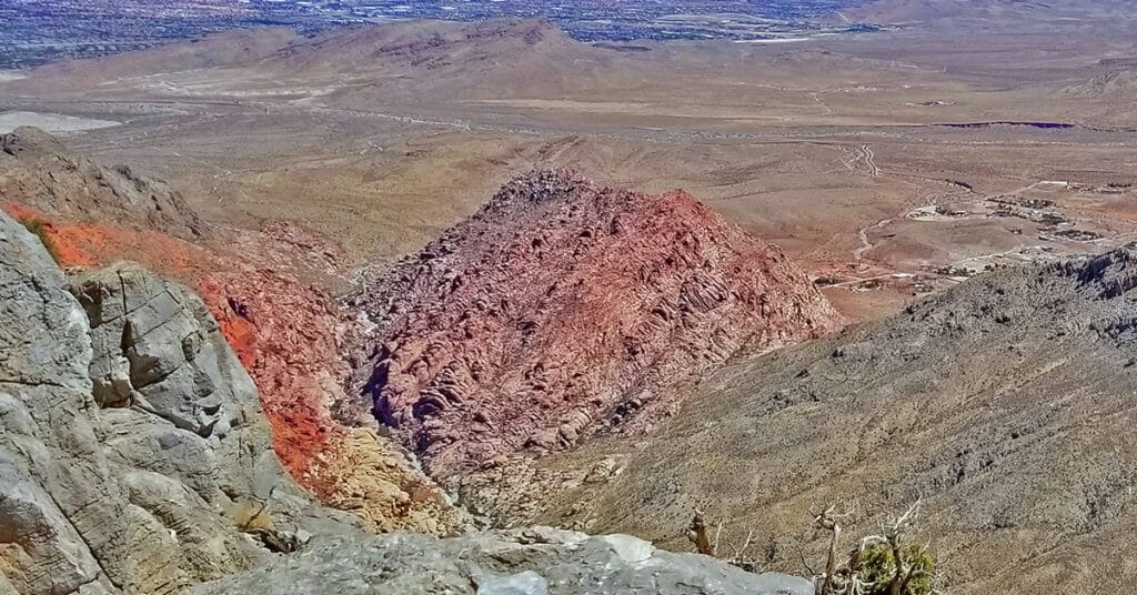
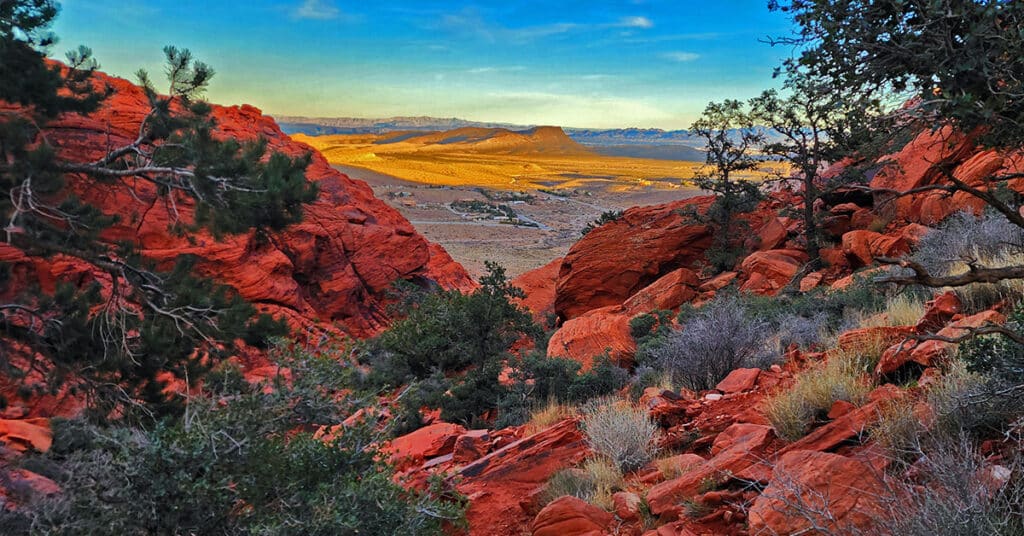
Grand Staircase | Calico Basin | Red Rock National Conservation Area, Nevada
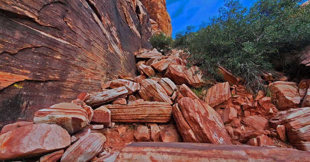
The Calico Hills form a boarder between lower Red Rock Canyon and lower Calico Basin in Nevada. These ancient sand dunes have been frozen into an artistic display of fantastic shapes, colors and designs. The most popular route up the Calico Hills is called The Grand Staircase. As you stand in the parking area in the Red Springs Desert Oasis in the Calico Basin and look closely at the Calico Hills towering above you’ll see a natural diagonal route that begins in the mid section and angles up to the right and to the summit of the hills. This is the Grand Staircase. Route Details: Approx. (2 mi. RT); **Wilderness, Sketchy Path, Class 3 Rock Climbing** Click image or title above for more…
Gray Cap Ridge Brownstone Basin Loop | La Madre Mountains Wilderness, Nevada
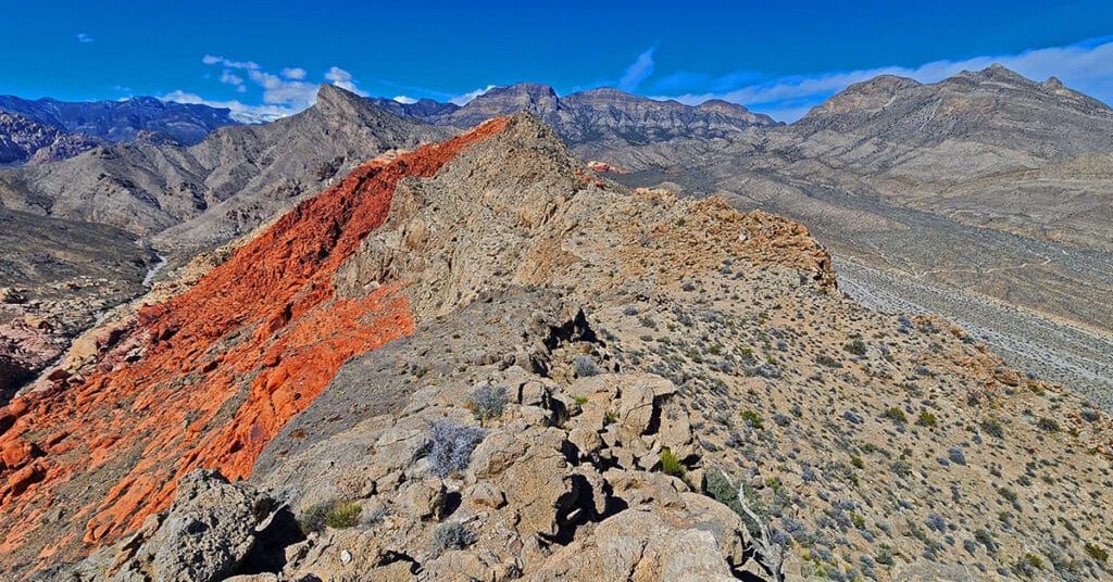
Beginning at Gene’s Trailhead in the Calico Basin, traverse most of Gray Cap Ridgeline from the SE Summit, then return to the Calico Basin by way of the Brownstone Trail and Road. Best time of year for this adventure is Spring or Fall. Click the image or title above for all the details.
Gray Cap Ridge Southeast Summit | La Madre Mountains Wilderness, Nevada
Gray Cap Ridge Southeast Summit in Nevada is an easy hike with spectacular views. Trails get you nearly to the summit. Hike begins at Gene’s Trailhead in the Calico Basin and navigates to the summit in the La Madre Mountains Wilderness. Best time of year for this adventure is Spring or Fall. Click the image or title above for more details.
Kraft Mountain – Gateway Canyon Loop | Calico Basin | Red Rock Canyon National Conservation Area, Nevada
On this day I intentionally set out to head up Gateway Canyon thinking it might be a short cut to Damsel Peak. Wrong! Between figuring out the best way to navigate 10-15 class 3 and class 3 barriers, I ate up so much time that I decided to just make a large loop out of Gateway Canyon, continuing all the way to Brownstone Basin at the base of Damsel Peak, and then taking Brownstone Basin down to a cross-over point back to Kraft Mountain. Many hikers have mistakenly taken this route thinking they are on the Kraft Mountain Loop. I made this very mistake on my first attempt to do the Kraft Mountain Loop! In fact, during today’s adventure, I redirected 2 groups of appreciative hikers back to the Kraft Mountain Loop. Here’s how that error happens… Route details: Approx . (12 mi.) | 3,700-5,400ft Elevation; **Some Trail, Mostly Wilderness** Click image or title above for more…
Kraft Mountain Loop | Calico Basin | Red Rock Canyon National Conservation Area, Nevada
Kraft Mountain Loop circles the base of Kraft Mountain located in the Calico Basin, Nevada (last turn-off before Red Rock Park). During this 3.5 mile loop you will experience navigating colorful Jurassic era frozen sand dune formations, incredible vistas of the surrounding area and some class 2-3 scrambling up and down sandstone ledges in a desert wash. It’s highly recommended that you undertake this adventure on a Fall, Winter or Spring day to avoid excessive Summer temperatures that can exceed 115 degrees. And, do not attempt this under wet conditions (rain, snow) because the sandstone you will need to traverse and climb can become as slick as ice! Route description: **3.5 Miles, 3,710 – 4,299ft Elevation ** Click image or title above for more…
La Madre Mountain Southern Approach from Red Rock Canyon | La Madre Mountains Wilderness, Nevada
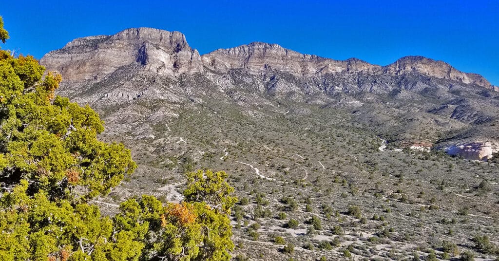
La Madre Mountain is 8,154ft in elevation. It is the highest central feature of the Keystone Thrust, the cliff system that spans the rear area of Red Rock Park in Nevada. The La Madre Mountain Southern approach, from a distance, looks impossible as you’re facing a sheer cliff wall between 1000 and 2000 feet high. However, as you approach the base of the cliff from Calico Basin it’s evident that there is a passage between the two peaks. The summit view is amazing featuring Las Vegas Valley with Lake Mead across and to the East, Gass Peak and the Sheep Range to the North, spectacular views of Mt. Charleston Wilderness to the East and the awesome total expanse of Red Rock Canyon National Conservation Area and Calico Basin to the Southwest. Route details: 22 mi / 4306-8000ft; *Wilderness, No Trail* Click image or title above for more…
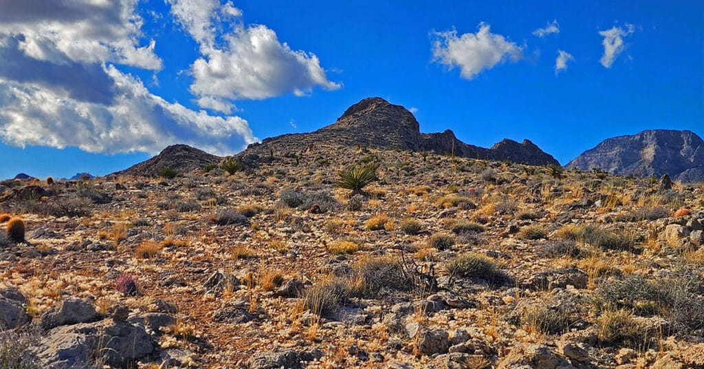
Red Cap Peak Summit | Red Rock Canyon NCA, Nevada
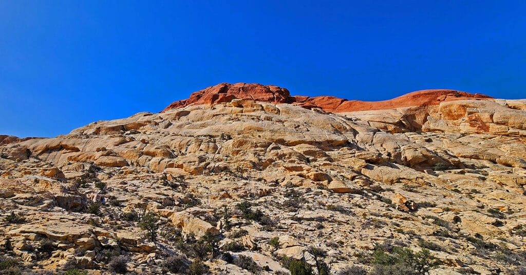
Red Cap Peak, also referred to as “Little Turtlehead”, is a Jurassic Era Sandstone Summit in Red Rock Canyon National Conservation Area, Nevada. This adventure begins at the Kraft Mountain Trailhead in the Calico Basin and navigates through Ash Canyon before summiting the peak. The best time of year for this adventure is Spring and Fall. Click the title or image above for more details.
Red Springs Desert Oasis | Calico Basin | Red Rock Canyon National Conservation Area, Nevada
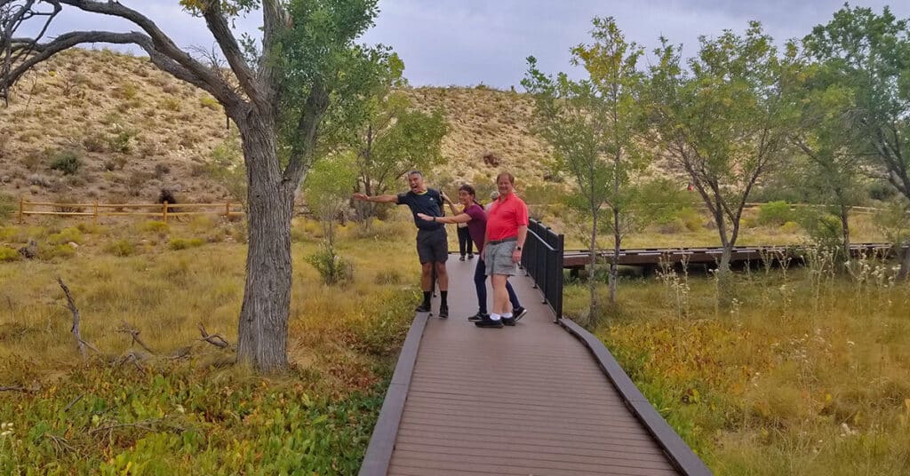
What makes Red Springs Desert Oasis so amazing is the lush, spring-fed vegetation in the midst of a surrounding desert. And, there’s a half-mile board walk, wheel-chair accessible, that brings the entire oasis within easy reach. Both the elderly and families with toddlers can easily enjoy this desert oasis experience. If you’re a serious walker, the boardwalk makes a great alternative to walking on boring asphalt neighborhood roads. You could do laps and extend your walk for a few miles. Route details: 1 mile board walk loop. Click image or title above for more…
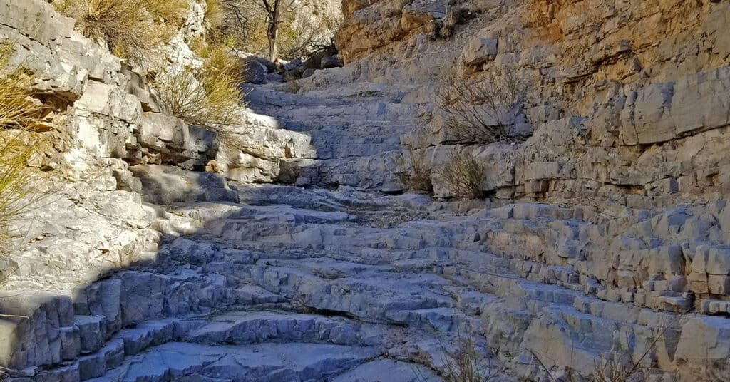
Upper Calico Hills Loop | Calico Basin & Red Rock Canyon National Conservation Area, Nevada
This spectacular 6-mile loop combines 6 or more trails to circle the upper Calico Hills in Red Rock Canyon & Calico Basin, Nevada. The trail passes through two beautiful wild passes in the Calico Hills: Ash Canyon and the mid-Calico Hills Black Corridor Pass. Click the image or title above for all the details.
