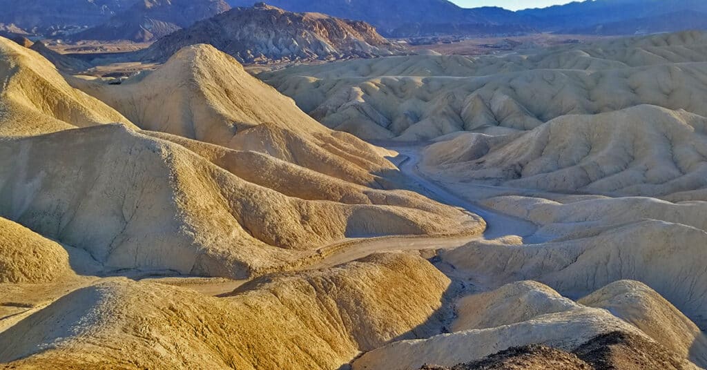
Golden Canyon to Zabriskie Point | Death Valley National Park, California
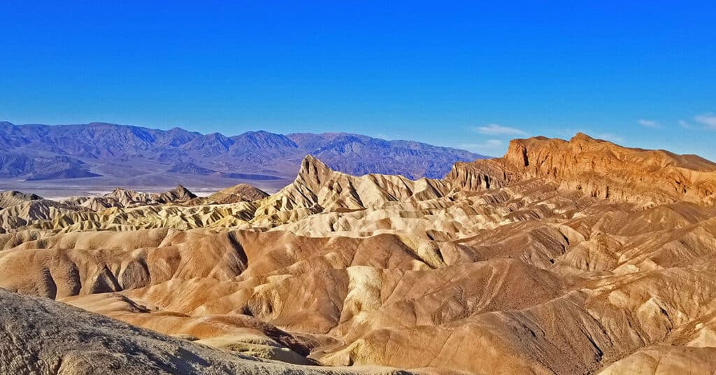
Golden Canyon in Death Valley is one of the most popular destinations to visitors of the valley. This is because of its unique beauty and easy accessibility. The entrance to Golden Canyon is only a few miles from Furnace Creek Ranch and The Inn at Death Valley along the well-traveled, paved Badwater Road. Within a few steps you find yourself in a beautiful canyon with high walls that instantly take you back in geological time. In places it’s clear even to this non-geologist where walls in the canyon were once horizontal, perhaps on an ancient lake bed, but over time were pushed upward to 45 degree angles. Route details: Approx. 8 Miles Circuit 535 > about 834ft **Well Marked & Traveled Route** Click image or title above for more…
Fall Canyon | Death Valley National Park, California
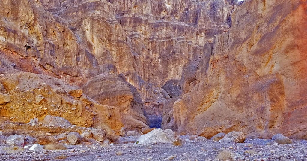
Fall Canyon in Death Valley National Park is the wilder, lesser known neighbor just a short walk to the North of the more popular Titus Canyon. Unlike Titus Canyon you cannot drive through Fall Canyon. However, the show stopper here are the towering cliff walls surrounding you in Fall Canyon. Many of the walls have brilliant stripes and designs composed of orange and black dolomite and limestone, referred to as Banded Bonanza King formations. Alternately there are narrows with high walls smoothed by the rushing water and rocks from past flash floods. In addition there are what I refer to as “The Hanging Gardens of Fall Canyon” as you pass between cliffs decorated with hanging plants seemingly growing out of the solid rock walls. Route Details: Approx. 6 Miles RT; 2,460ft Elevation Gain **Rocky Canyon Wash Trail** Click image or title above for more…
Dante’s View to Mt Perry | Death Valley National Park, California
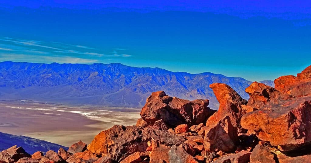
The elevation of Dante’s View is 5,475ft and the elevation of Mt. Perry is 5,716ft, but that alone is not the entire story. The scenery from Dante’s View all the way to Mt. Perry is uniquely spectacular. From Dante’s View’s 5,475ft perspective one can look almost straight down into Badwater Basin, at -282ft below sea level, the lowest point in the Western Hemisphere. But that is not all. From Dante’s view one can look directly across the width of the vast expanse of Death Valley 20.6 miles away to the 11,049ft Telescope Peak and the entire expanse of the Panamint Mountain Range along with much of Death Valley’s 100-mile length. Route Details: Approx. 8 Miles RT; 5,575 > 5,738ft **Well Established Trail** Click image or title above for more…
Artist’s Drive Hikes | Death Valley National Park, California
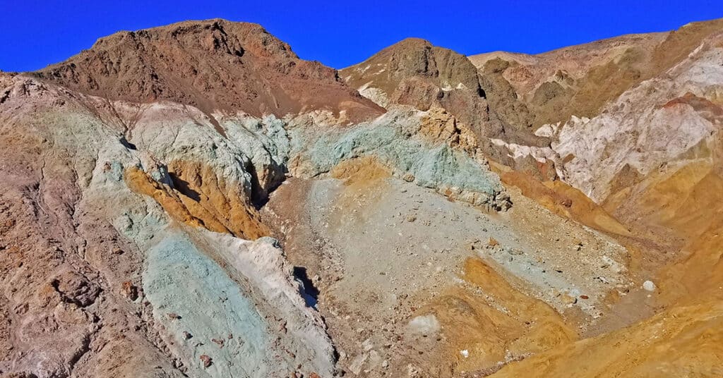
Few visitors to Artist Drive realize that there are at least 4 short adventure hikes off the main loop. The first is a ridge hike at the first pull-out parking area about 2 miles up the loop. The second two are canyon hikes at the base of 2 dips (actually marked by a yellow highway “Dip” warning sign. The fourth series of canyon hikes are the canyons surrounding the hills of Artist’s Pallet. Route details: 4 Hikes Approx. 6 Miles Total **Elevation Gain 300ft | Ridge and Canyon Wash Trails** Click image or title above for more…
Twenty Mule Team Canyon | Death Valley National Park, California
Twenty Mule Team Canyon is the original late 19th century bad lands route for the famous Twenty Mule Team wagons that hauled borax ore from the Harmony Borax Works in Furnace Creek out of Death Valley, 165 miles away to Mojave, California. Today you can drive through Twenty Mule Team Canyon on a good unpaved road to see the same surroundings the original Twenty Mule Team Canyon wagon drivers viewed. You will also see signs of historic borax prospecting in the canyon. Approx. 4 Miles Loop; 500ft Elevation Gain **Unpaved and Paved Roads** Click image or title above for more…
