Gass Peak Nevada Eastern Summit Ultra Marathon | Desert National Wildlife Refuge, Nevada
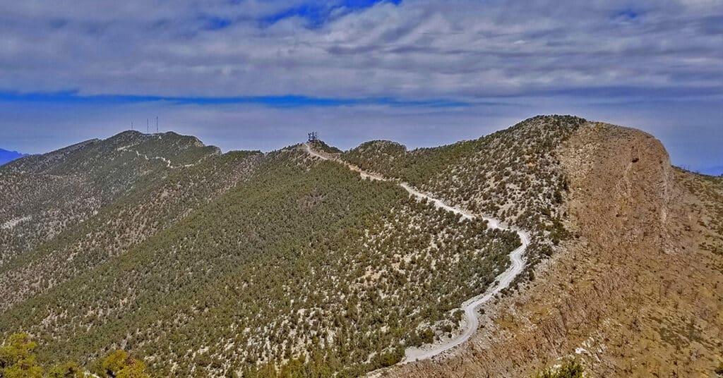
Gass Peak, Nevada Eastern summit at 6943ft is the true summit of Gass Peak. The Eastern summit is about 1000ft higher than the other two summit areas, however each has a unique view, and the most challenging part of the adventure is navigating what I call the “Gass Peak Gauntlet”–the route between the mid-summit and the Eastern summit. The route I take begins at the North end of Rainbow Blvd. in Las Vegas and turns this adventure into a 30-mile ultra-marathon with a 5000ft elevation gain and, if the additional elevation gain and loss on the return trip is taken into account an overall 6000ft elevation gain. To put this into perspective, I can do the 18-mile Mt. Charleston loop in 7.5 hours. On this day it took 13.5 hours to complete the Gass Peak Ultra! Route details: 20 mi RT from Rainbow Ave / Approx. 2,300 > 7,000ft; **Mostly Wilderness** Click image or title above for more…
Old Arrowhead Trail in Valley of Fire State Park, Nevada
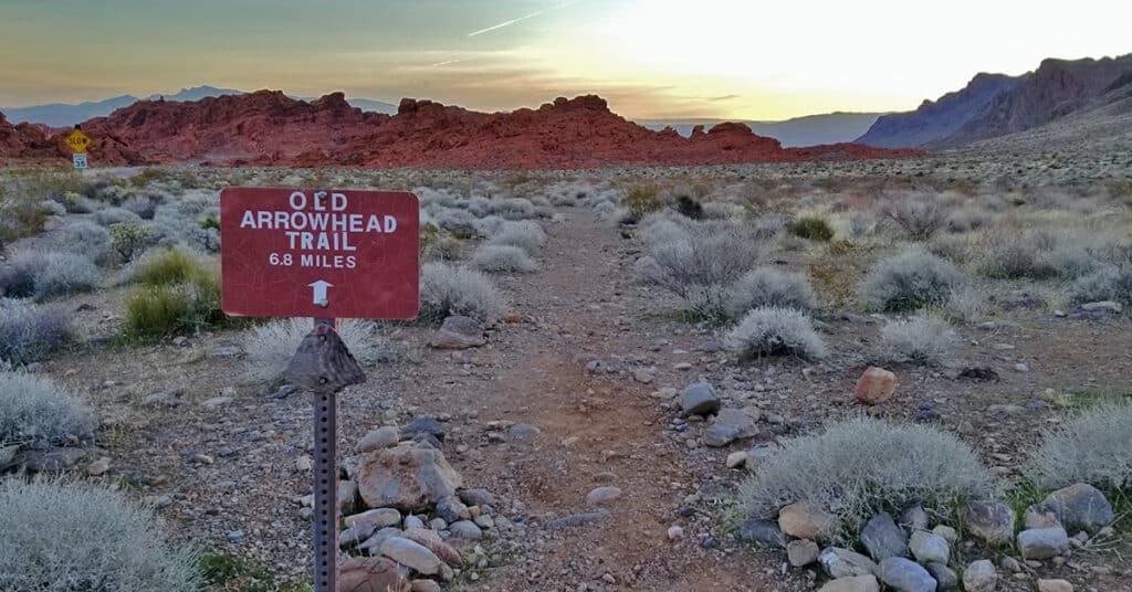
Old Arrowhead Trail in Valley of Fire State Park, Nevada, traverses the park East-West, just as Prospect Trail traverses the park North-South. It is part of an original 1915 era road from Las Vegas to Salt Lake City. The Western trailhead is located just beyond the West park entrance (near the Bee Hives); the Eastern trailhead is located just beyond the East park entrance (near Elephant Loop). Route details: 13.6 miles RT. Sketchy trail, fairly level but overall descends a gradual wash for 6.8 miles. Click image or title above for more…
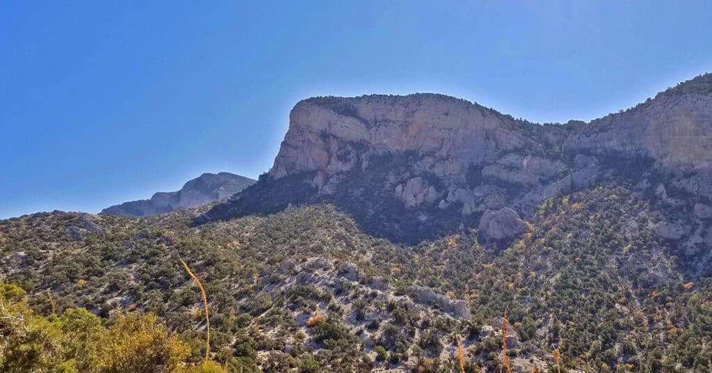
Muddy Mountains Wilderness Northwestern Panorama, Nevada
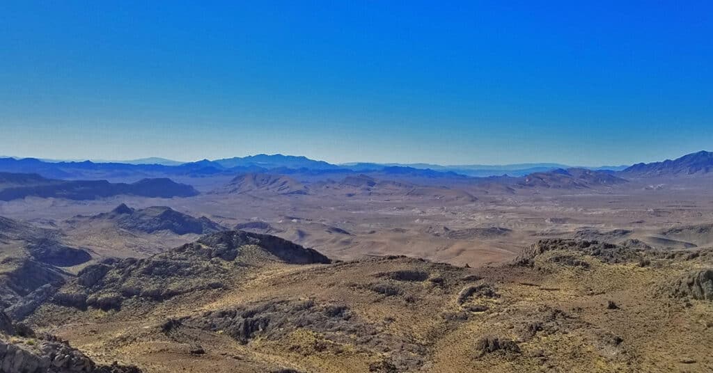
A high point on the third ridge from the Muddy Mountains Wilderness Northern border offers a great panoramic view of the Muddy Mountains Wilderness. This is a good place to get the big picture of this wilderness 1/3rd the size of the state of Rhode Island. Route details: 6 mi RT, **Wilderness** Click image or title above for more…
Potosi Mountain Southern Approach | Spring Mountains Wilderness | Nevada
The Southern approach to Potosi Mountain is nothing less than a huge endurance test. Though it’s only 14 miles out and back from my starting point at the “warning rock” parking area, and you’re on a pretty good road all the way to the summit, the angle of incline is the challenge. Think streets of San Francisco, only instead of a one block steep incline you’re looking at half-mile sections of incredibly steep incline. The incline is so steep in places that you’re gaining nearly one foot elevation gain per stride! One note: your total ascent is between 3,500 and 4,000ft. Route details: 14 mi RT/ 4,700ft > 8,500ft; **Paved and Unpaved Maintenance Roads** Click image or title above for more…
Potosi Mountain | Northern Hills Exploration | Spring Mountains, Nevada
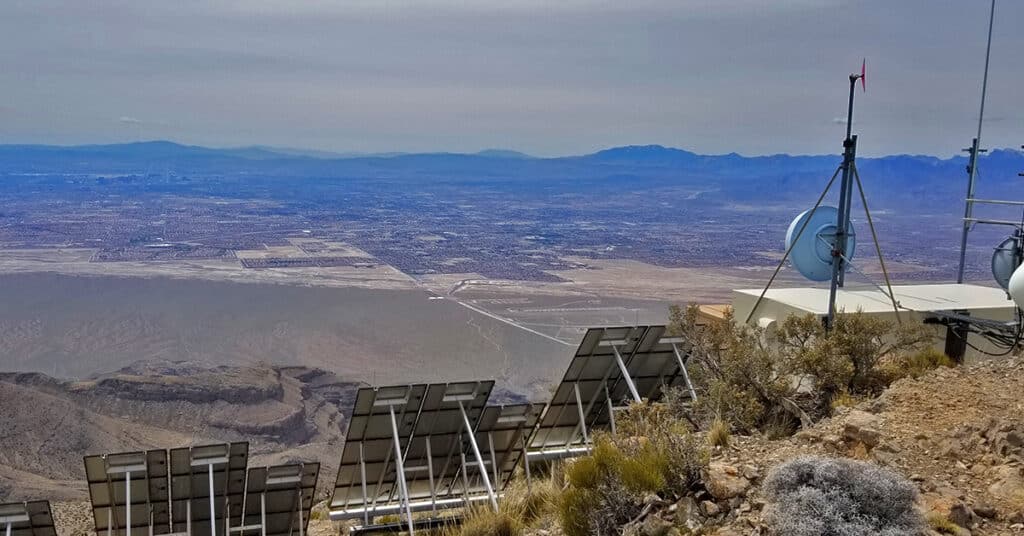
During this adventure, though I do not ascend to the summit, I scope out the Northwestern area of Potosi Mountain and discover a few alternate summit approaches. Potosi Mountain, Elevation 8,517ft, is the last high point along the horizon in the Spring Mountains as you’re viewing the skyline from Las Vegas. From Potosi Mountain’s 8,517ft summit, populated with a number of communications towers, you can look across the entire stretch of the Rainbow Mountains. Route details: 16 mi RT from Hwy 160/ 5,500ft > 7,200ft; **Unpaved Road then Wilderness (no trails)** Click image or title above for more…
