Mummy Mountain Western Approach | Mt. Charleston Wilderness | Spring Mountains, Nevada
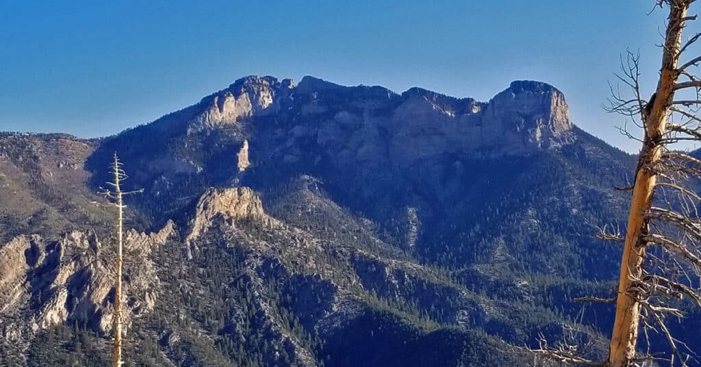
Mummy Mountain, at 11,528 feet, is the second highest peak in the Spring Mountains, just 390ft short of Mt. Charleston, the highest, 11,918ft. This is the traditional popular route to the summit. However, when it comes to sheer massiveness, Mummy Mountain surpasses Mt. Charleston with a summit an entire half mile in length and wider than a football field. In terms of beauty Mummy Mountain again surpasses the barren Mt. Charleston with a landscape of ancient living bristlecone pine trees and sculpted, sun bleached bristlecone pine wood. Route details: 16 mi / Approx. 8,439 > 11,530ft;**Some Trail, Some Wilderness** Click image or title above for more…
Mummy Mountain NE Summit Approach in Mt Charleston Wilderness | Spring Mountains, Nevada
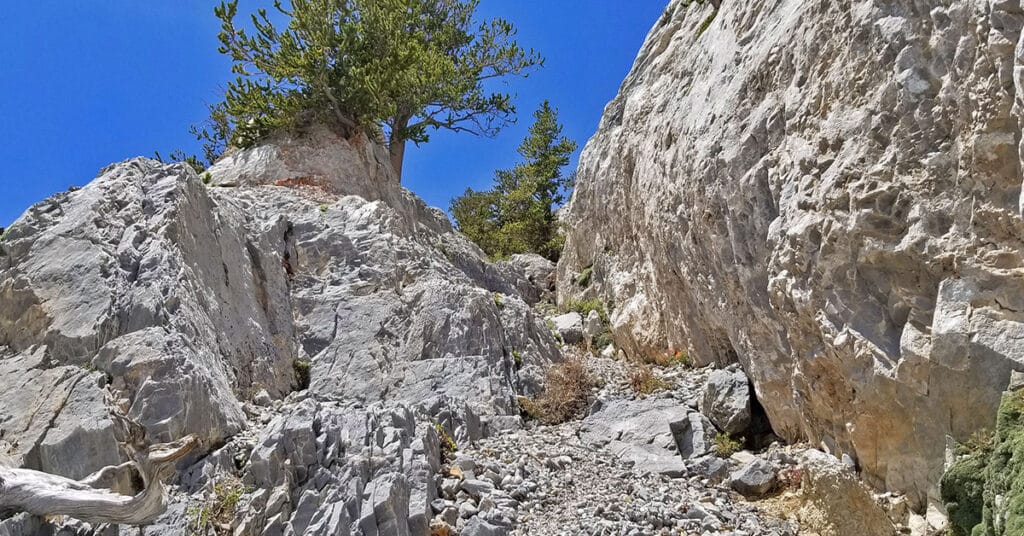
This is my preferred Eastern Ascent route to the summit of Mummy Mountain. Unlike the Southeastern Mummy Mountain Ascent where you ascend a horrifying rock wall exposed to a 100ft drop, the Northeastern ascent route involves absolutely no dangerous exposure. However, the avalanche slopes are very steep and at times I found myself on hands and knees ascending a few slippery stretches. Had I totally lost my hold on that slope I would have flattened myself out and slid a couple feet to a gentle stop. Route details: 16 mi / Approx. 8,439 > 11,530ft; **Some Trail, Then Wilderness** Click image or title above for more…
Mummy Mountain Knees | Mt. Charleston Wilderness | Spring Mountains, Nevada
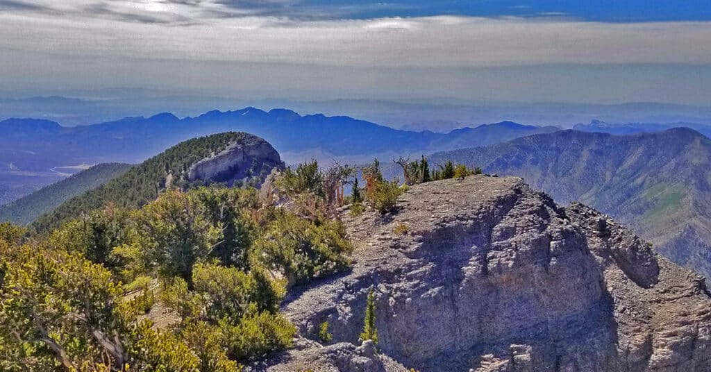
Mummy’s knees, pretty much unknown to most hikers, are a beautiful bristlecone pine forest arising out of what appears to be a solid slab of limestone. The view from Mummy’s knees is spectacular including Mummy Mountain summit area, the North Ridge of Kyle Canyon, Lee Peak, Charleston Peak, the South Ridge of Kyle Canyon, Griffith Peak, Harris Mountain and the saddle between the two framing the length of Lovell Canyon with Potasi Mountain in the background. Route details: 14 mi / Approx. 8,439 > 11,151ft **Some Trail > Wilderness Faint Trail** Click image or title above for more…
Harris Springs & Harris Mountain Roads | Spring Mountains | Nevada | Off-Road Cycling
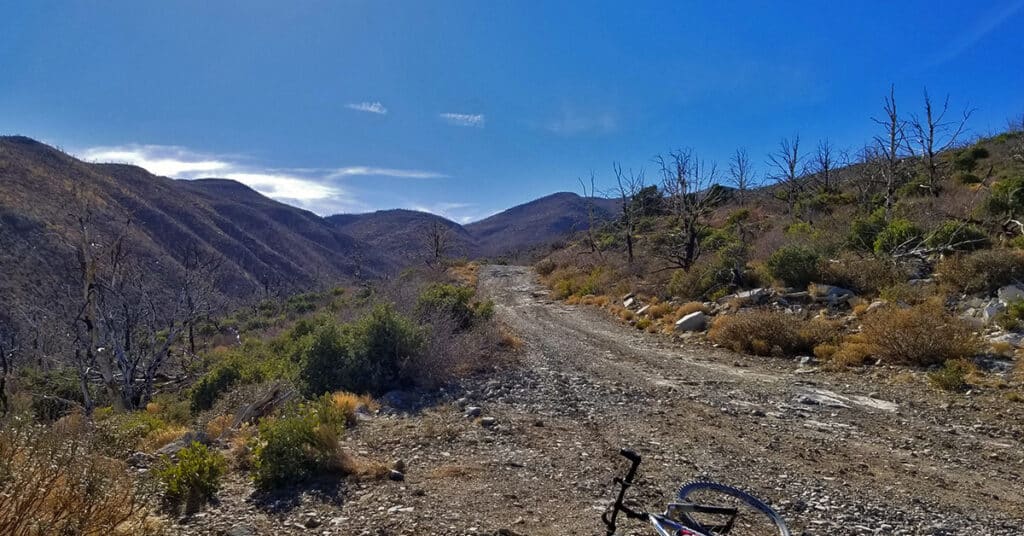
The important Harris Springs and Harris Mountain Roads system is one of the main access points for the La Madre Mountains Wilderness (4 times the size of Red Rock Park), Harris Mountain and even the Lovell Canyon area and a back door wilderness ascent to Griffith Peak. We take time to show these important wilderness access points. The views from upper Harris Mountain Road are spectacular. One can look straight down the canyon to see the entire Sheep Range, Fossil Ridge and Gass Peak in addition to La Madre Mountain and El Padre Mountain. Route details: 6 mi RT if you start at the end of Harris Mountain Road / Approx. 9,000 > 10,018ft; **Some Trail, Some Wilderness** Click image or title above for more…
Harris Mountain | Mt Charleston Wilderness | Spring Mountains, Nevada
See the Harris Griffith Circuit page on this website. That adventure shows the Harris Mountain summit approach from South Climb Trailhead at Cathedral Rock. A future adventure posted to this page will show Harris Mountain summit approach from Harris Springs and Harris Mountain Roads, which is the most popular summit approach. Route details: 12-15-miles RT from the intersection of Kyle Canyon and Upper Harris Springs Road; **Unpaved roads and established trails all the way.** Click image or title above for more…
