Gass Peak Grand Crossing | Desert National Wildlife Refuge | North of Las Vegas, Nevada
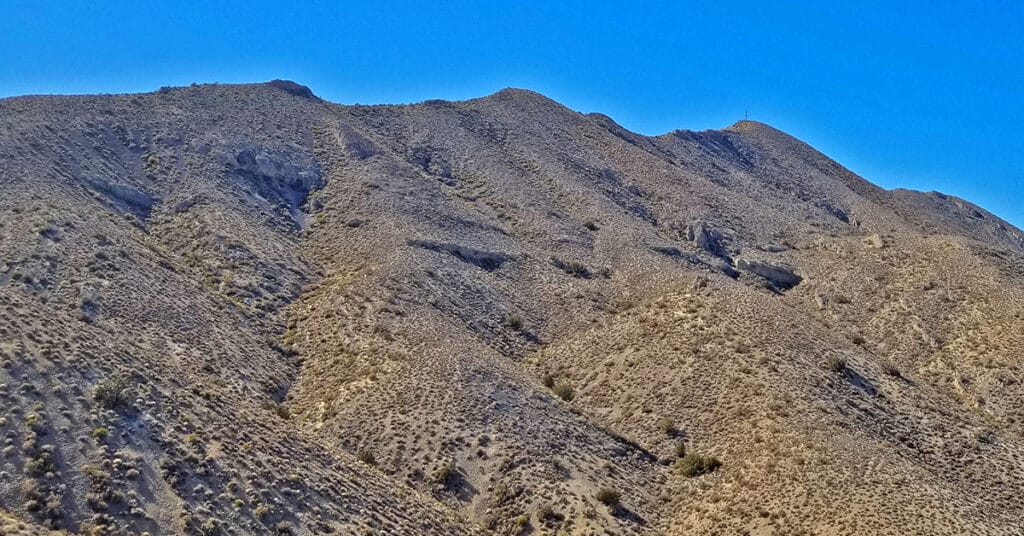
The Gass Peak Grand Crossing is a 30-40-mile ultra marathon distance on foot on a few roads, but mostly across desert wilderness canyons, ridges and avalanche slopes from the Desert National Wildlife Refuge visitor center off Hwy 95 Corn Creek Rd exit to the North end of Rainbow Avenue in Las Vegas. 6,937ft Gass Peak is the 5000ft elevation gain midway. The route begins at the Desert National Wildlife Refuge headquarters North of Las Vegas Nevada, heads up Mormon Well Road, turns onto Gass Peak Road, ascends the main Gass Peak trail off Gass Peak Road to the true, Eastern summit of Gass Peak, traverses the steep avalanche slope summit ridge of Gass Peak via what I refer to as “The Gass Peak Gauntlet” to the Gass Peak Mid Summit ridge, descends the mid summit ridge to a 4WD road on the lower Northern slopes of Gass Peak, circles around the West side of Gass Peak on that road and finally, navigates the desert to a conclusion at the very North end of Rainbow Avenue in Centennial Hills Las Vegas! Route details: 30-40 Miles, 5000ft Elevation Gain **Few roads and trails, mostly wilderness** Click image or title above for more…
Historic Railroad Trail | Lake Mead National Recreation Area, Nevada
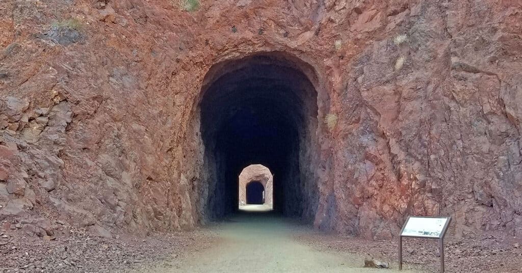
The Historic Railroad Trail is about a 10-mile out and back adventure in the Lake Mead National Recreation Area in Nevada. This trail is a side trail branching off from the 31-mile River Mountains Loop Trail and spans the distance from the Lake Mead Visitor Center to Hoover Dam. You could combine this trail with a tour of Hoover Dam and a walk across the old memorial bridge. The well-graded path, with it’s very gradual inclines and descents makes for an easy hike or run. Route details: 5 mi RT | 200ft Elevation Gain/loss; **Wide, Graded Railroad Bed** Click image or title above for more…
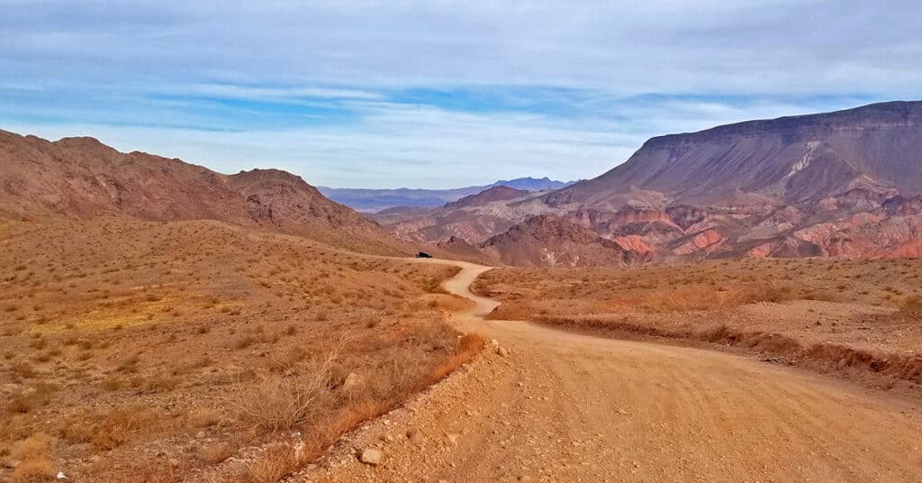
Horse Thief Canyon Loop | Mt. Wilson | Black Mountains | Lake Mead National Recreation Area, Arizona
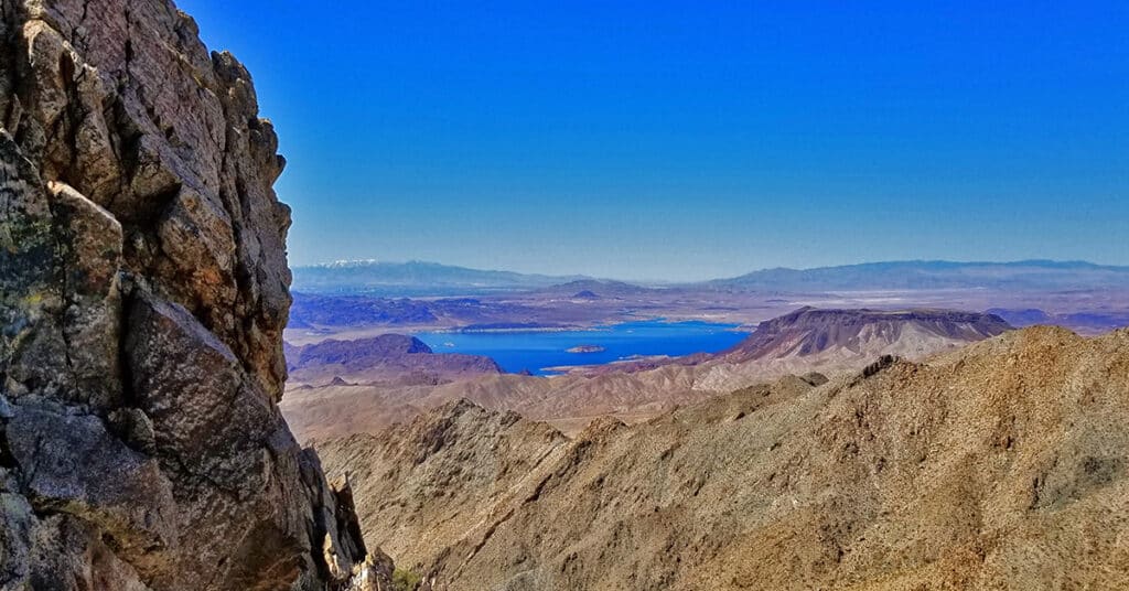
This adventure has got to win an award for variety of terrain including 6 miles of unpaved roads, traversing a few miles up the entire length of a rugged mountain canyon with beautiful springs, an 800 foot scramble up the avalanche slope side of the canyon, a short class 3 rock climb and a descent down a 2-mile ridge with incredible views of Lake Mead, Potosi Mountain, the Rainbow Mountains, La Madre Mountains Wilderness, Mt Charleston Wilderness, Gass Peak, the Sheep Range, Frenchman Mountain, Fortification Hill, the Hoover Dam area, and additional points to the South and to the East. Route Details: 16mi | 1,536 > 5,446ft; ** Some Road, Mostly Wilderness** Click image or title above for more…
Mt. Wilson | Black Mountains, Arizona | Adjacent to Lake Mead National Recreation Area
Mt. Wilson is a distinctive high point in the Black Mountains and offers incredible 360 degree views of the surrounding wilderness including Lake Mead, Potosi Mountain, the Rainbow Mountains, La Madre Mountains Wilderness, Mt Charleston Wilderness, Gass Peak, the Sheep Range, Frenchman Mountain, Fortification Hill, the Hoover Dam area and points further East. The adventure begins at the Arizona Hot Springs trailhead on Arizona Highway 93, 4 miles South of the Nevada/Arizona border. Route details: 16mi RT | 1,536 > 5,446ft; **Some Road, Mostly Wilderness; Click image or title above for more…
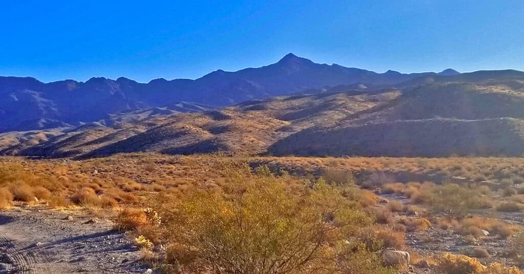
Kingman Wash Access Road | Lake Mead National Recreation Area, Arizona
This section of Kingman Wash Access Road is about 4 miles in length. It’s an unpaved road that leads down to the shore of Lake Mead at Temple Bar Marina where there is boating, fishing and hiking. I traveled it by mountain bike. There are 3 additional unpaved roads splitting off to the right. The first is South Mine Access Road; second is North Mine Access Road which later connects with South Mine Access Road and continues on as South Mine Access Road. The third road splitting off from Kingman Wash Road near its end and to the right of a restroom structure is the unpaved Fortification Hill Road which leads to Fortification Hill Trailhead. Route Details: 7 Miles | 1,197 > 1,465; ** Good Unpaved Road** Click image or title above for more…
