Escarpment Trail | Mt Charleston Wilderness | Spring Mountains, Nevada
The Escarpment Trail in The Mt. Charleston Wilderness, Spring Mountains, Nevada is a moderate 3.6 mile loop trail around an escarpment with spectacular views of Kyle Canyon and surroundings. The trail is accessed from the Fletcher Canyon Trailhead or The Spring Mountains Visitor Gateway.
Acastus Trail | Mt Charleston Wilderness | Spring Mountains, Nevada

The Acastus Trail in The Mt Charleston Wilderness, Spring Mountains, Nevada features the nature, history and geology of the area. Many attractive interpretive signs along the way, each with a bench for rest and reflection, invite hikers to slow down, pause, take in the environment and in so doing deepen consciousness and awareness of The Spring Mountains and one’s place within that setting. Walking The Acastus Trail can be somewhat like making a spiritual pilgrimage.
Eagles Nest Loop | Mt Charleston Wilderness | Spring Mountains, Nevada

The Eagles Nest Loop in Nevada’s Mt Charleston Wilderness runs along the South base of Fletcher Peak offering spectacular views of Kyle Canyon! Click the image or title above for details.
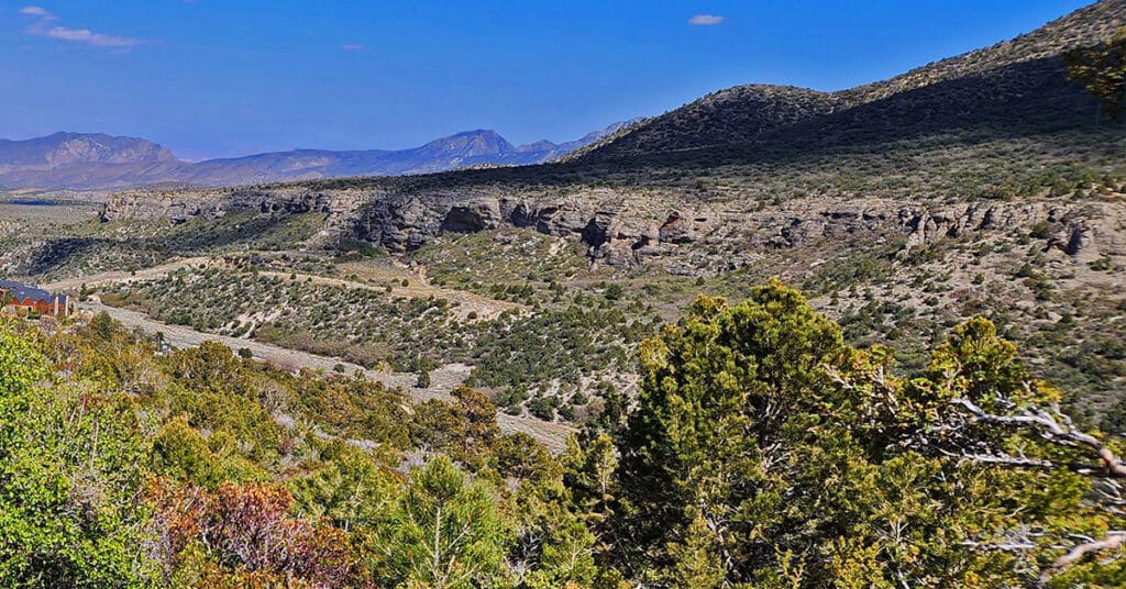
Fletcher Canyon Trail | Mt Charleston Wilderness, Nevada

Fletcher Canyon Trail in The Mt. Charleston Wilderness, Spring Mountains, Nevada is an easy 4.2-mile round trip hike along a creek in a beautiful forested area with spectacular mountain views. It’s a great trail for altitude conditioning. Beyond the trail’s end may be a possible extreme adventure to Fletcher Peak summit.
Fletcher Canyon Trails Overview | Mt Charleston Wilderness, Nevada

Trails Accessed from The Fletcher Canyon Trailhead in The Mt. Charleston Wilderness, Nevada include Fletcher Canyon Trail; Eagle’s Nest Loop; Acastus Trail and Escarpment Trail. These are great introductory trails to the Mt. Charleston Wilderness and excellent initial altitude conditioning trails.
Lee to Kyle Canyon | East Ski Run Route | Mt Charleston Wilderness | Spring Mountains, Nevada

This adventure will begin by ascending the Eastern ski run in Lee Canyon. The route will continue beyond the summit of the ski run and summit the Lee/Kyle Canyon upper rim on the right (West) side of a prominent plateau just East (left) of Lee Peak. The views straight down into the ski area and beyond will be spectacular. As you can see, this adventure is still in progress, but will be documented here once complete! Route Details: 10 mi RT/ Approx. 8,000 > 11,535ft; **Ski Run Wilderness** Click image or title above for more…
Lee to Kyle Canyon | Gradual Mid Ridge Approach | Mt Charleston Wilderness | Spring Mountains, Nevada

This approach to Kyle Canyon’s upper rim appears to be the most gradual approach from Lee Canyon. It begins roughly across from the Lee Canyon Meadow and gradually ascends to a plateau that connects with the Charleston North Loop Trail about a mile or two South of Lee Peak. This route is mostly pure wilderness: wild and beautiful. You will see no one during the entire route. In fact, though I looked closely for footprints and signs of human passage along the way, I found little of that. There were occasional faint use trails that appeared unused for years, and there were a few old cairns at a couple key points. But it looked as though absolutely no human had ascended this ridge for over a year or more, and then perhaps only one human ascent per year at most. Route Details: 14 mi RT/ Approx. 8,000 > 11,535ft; **Mostly Wilderness** Click image or title above for more…
Lee to Kyle Canyon | Foxtail Canyon Route | Mt Charleston Wilderness | Spring Mountains, Nevada

This beautiful route ascends through the Foxtail Canyon picnic area and an abandoned Girl Scout camp and then gradually weaves around passing just right (south) of the beautiful Foxtail Canyon Springs before ascending to the upper rim of Kyle Canyon. A left (North) turn there will take you along the summit of Kyle Canyon’s upper rim to Mummy Mountain’s main summit area. However, in this adventure we turn right to traverse the high Lee/Kyle Canyons ridge top before connecting with the Mt. Charleston upper North Loop Trail then descending back to the Foxtail Picnic Area via Lee Canyon’s gradual mid-ridge making this a circuit adventure. Route details: 15 mi RT/ Approx. 8,000 > 11,000ft; **Brief Initial Road, Then Wilderness** Click image or title above for more…
02 Lee to Kyle Canyon | Overview | Mt Charleston Wilderness | Spring Mountains, Nevada

Ascending the ridge from Lee to Kyle Canyon is like crossing a bridge to another world. I’ll never forget that first moment, after long weaving through deep wilderness slopes, that I reached the Lee/Kyle Canyon upper rim. Topping that last hill, suddenly the world of Kyle Canyon with its familiar peaks was there! There are no trails from Lee to Kyle Canyon. However, this point I have found a number of wilderness routes that ascend from Lee to Kyle Canyon, each uniquely magical in nature. This page lists those routes and provides links to the individual adventure pages with the details, videos and images for each route. Best time of year for adventures here: Early Summer to Mid-Fall. Temperatures at the higher elevations are usually in the mid-70s even when Las Vegas Valley is up to 115 degrees! Expect to navigate snow at other times of the year. Follow thumbnail images to view the details you will need to plan your adventures here. Click image or title above for more…
Cockscomb Ridge Wilderness Circuit | Mt. Charleston Wilderness | Spring Mountains, Nevada
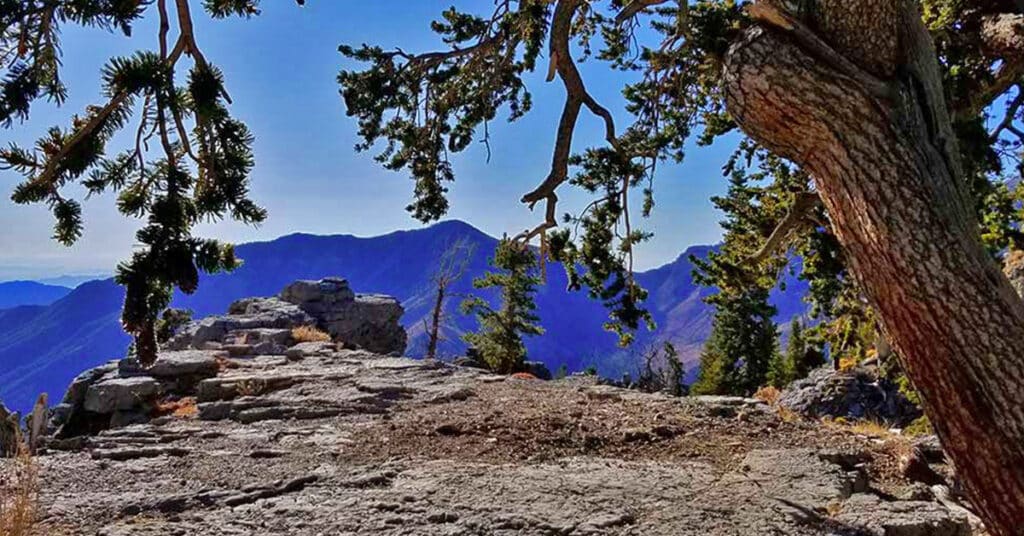
The Cockscomb Ridge Wilderness Circuit is an extension of the Cockscomb Ridge hike/run. The difference is that it includes a descent from Cockscomb Ridge through the wilderness back to the trailhead on Kyle Canyon Road just beyond the Rainbow Subdivision turnoff. Depending on your comfort level you will grow the ability to navigate by large landmarks vs. depending on compass, electronic guidance systems or maps. This will bring you closer to the experience of dissolving the artificial barriers that commonly exist between yourself and nature. Route details: 8 mi / Approx. 7,713 > 9,307ft; **Some Trail, Mostly Wilderness** Click image or title above for more…