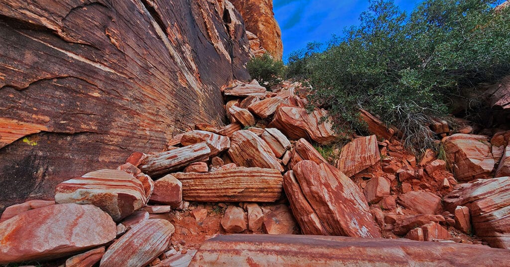
Kraft Mountain Loop | Calico Basin | Red Rock Canyon National Conservation Area, Nevada

Kraft Mountain Loop circles the base of Kraft Mountain located in the Calico Basin, Nevada (last turn-off before Red Rock Park). During this 3.5 mile loop you will experience navigating colorful Jurassic era frozen sand dune formations, incredible vistas of the surrounding area and some class 2-3 scrambling up and down sandstone ledges in a desert wash. It’s highly recommended that you undertake this adventure on a Fall, Winter or Spring day to avoid excessive Summer temperatures that can exceed 115 degrees. And, do not attempt this under wet conditions (rain, snow) because the sandstone you will need to traverse and climb can become as slick as ice! Route description: **3.5 Miles, 3,710 – 4,299ft Elevation ** Click image or title above for more…
Kraft Mountain – Gateway Canyon Loop | Calico Basin | Red Rock Canyon National Conservation Area, Nevada

On this day I intentionally set out to head up Gateway Canyon thinking it might be a short cut to Damsel Peak. Wrong! Between figuring out the best way to navigate 10-15 class 3 and class 3 barriers, I ate up so much time that I decided to just make a large loop out of Gateway Canyon, continuing all the way to Brownstone Basin at the base of Damsel Peak, and then taking Brownstone Basin down to a cross-over point back to Kraft Mountain. Many hikers have mistakenly taken this route thinking they are on the Kraft Mountain Loop. I made this very mistake on my first attempt to do the Kraft Mountain Loop! In fact, during today’s adventure, I redirected 2 groups of appreciative hikers back to the Kraft Mountain Loop. Here’s how that error happens… Route details: Approx . (12 mi.) | 3,700-5,400ft Elevation; **Some Trail, Mostly Wilderness** Click image or title above for more…
Damsel Peak Southern Approach Route from Calico Basin, Nevada

The Southern approach to the summit of Damsel Peak (aka Pincushion Mt) in Nevada begins at the trailhead parking area in Calico Basin, navigates to the South side of Damsel Peak, traverses to the North side, descends into Brownstone Basin then navigates back to the starting point in Calico Basin. Incredible views from the summit of Damsel Peak include almost all of the Las Vegas Valley, Brownstone and Calico Basins, Turtlehead Peak, the Calico Hills, Mt. Wilson, Rainbow Mountain, Juniper Peak, North Peak and Bridge Mountain and finally the huge expanse of the Keystone Thrust cliffs with La Madre Mountain as the high point. To the North one can see Gass Peak, the Sheep Range and Fossil Ridge. Route details: Approx 15 mi RT; **No Trails, Some Class 3 Climbing** Click image or title above for more…
Damsel Peak Northern Approach | Red Rock Canyon National Conservation Area, Nevada

From the top of Damsel Peak outside of Las Vegas, Nevada one can see almost all of the Las Vegas Valley in the same way that Damsel Peak is visible from just about anywhere in Las Vegas Valley. In addition, there is an awesome view of the entire Calico Basin, Turtlehead Peak, the Calico Hills, Mt. Wilson, Rainbow Mountain, Juniper Peak, North Peak and Bridge Mountain and finally the huge expanse of the Keystone Thrust cliffs with La Madre Mountain as the high point. To the North one can see Gass Peak, the Sheep Range and Fossil Ridge. Route details: 16 mi Start Sandstone Quarry Red Rock | 4370 > 6977ft; **Wilderness, No Trail** Click image or title above for more…
02 Red Rock Canyon Scenic Drive | Red Rock Canyon NCA, Nevada

General information for Red Rock Canyon NCA including how to work the reservation system is on this page. In addition, the 10 points of interest along the Red Rock Canyon Scenic Drive are described. I’ll mention the trailheads from these points as jumping off points for wilderness adventures, but realize that the scenic drive is in itself a totally rewarding experience even if you don’t get out of your car! 13-mile scenic loop drive. Click image or title above for more…
Grand Circle | Calico Basin | Red Rock Canyon National Conservation Area, Nevada

The Calico Hills form a boarder between lower Red Rock Canyon and lower Calico Basin in Nevada. The Calico Hills form a boarder between lower Red Rock Canyon and lower Calico Basin in Nevada. The Lower Calico Hills Loop follows a 5-mile series of 4 trails around the circumference of the Calico Hills. The Calico Hills are composed of ancient Jurassic Era sand dunes that have been frozen into an artistic display of fantastic shapes, colors and designs. From a distance the Calico Hills are dwarfed by the larger surrounding formations. However looks are very deceiving as the closer you get these formations become huge with 30-40ft sheer drop-offs. Route description: 5mi Loop Circles Calico Hills; *Fairly Good Trail, Sketchy in Places – Some Steep Rocky Stretches* Click image or title above for more…
Grand Staircase | Calico Basin | Red Rock National Conservation Area, Nevada
The Calico Hills form a boarder between lower Red Rock Canyon and lower Calico Basin in Nevada. These ancient sand dunes have been frozen into an artistic display of fantastic shapes, colors and designs. The most popular route up the Calico Hills is called The Grand Staircase. As you stand in the parking area in the Red Springs Desert Oasis in the Calico Basin and look closely at the Calico Hills towering above you’ll see a natural diagonal route that begins in the mid section and angles up to the right and to the summit of the hills. This is the Grand Staircase. Route Details: Approx. (2 mi. RT); **Wilderness, Sketchy Path, Class 3 Rock Climbing** Click image or title above for more…
Turtlehead Peak, Red Rock Canyon National Conservation Area, Nevada

Turtlehead Peak is one of the most popular hikes in Red Rock Canyon. The best time to hike Turtlehead Peak is in the Fall, Winter or Spring, or as early as possible on a Summer morning to avoid high temperatures after 10am. Bring at least 2 quarts of water. The hike takes about 4 hours, allowing for some time to enjoy the summit. In terms of difficulty, it’s a cross between a hike and a climb with some brief boulder sections and a lot of scrambling on loose gravel. Route details: 4.94 mi / 4,306 > 6.285 ft; **Fairly clear trail, but possible to get off track.** Click image or title above for more…
White Rock Mountain Loop Red Rock Canyon National Conservation Area, Nevada

White Rock Mountain Loop Trail in Red Rock Canyon National Conservation Area, Nevada is the ultimate trail for training and for a brief immersion in a rugged desert environment without spending too much time getting there. There are sections with lots of twists and turns which build agility and create the feeling of driving down a curvy road in a fine sports car. And you can easily double the 6.5 mile loop for a 13 mile half marathon, or run it 4 times for a full marathon! Route details: 6.28 mi. / 4,429 > 5,453ft; **Good, well-marked trail.** Click image or title above for more…
Sisters South to the Sisters North | Mt. Charleston Wilderness | Spring Mountains, Nevada
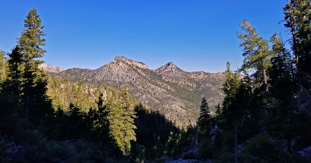
There is a popular circuit route including Sisters South, Sisters North and Black Rock Sister. The route can be taken in either direction and includes about a half day of challenging hiking and climbing (Class 3 at most) in a beautiful pristine wilderness setting. Route details: About 8-9 miles circuit; **Some trail, some wilderness.** Click image or title above for more…