Fletcher Peak Adventures Overview | Mt Charleston Wilderness | Spring Mountains, Nevada

Fletcher Peak has a beautifully wooded summit area. You’re likely to see deer on the summit, along with the best view of Harris Peak, Griffith Peak and the remote saddle between. Find a number of summit approaches to Fletcher Peak from the nice main trail to some unknown challenging wilderness routes. Click the image or title above to discover some cool routes to Fletcher Peak.
Harris Mountain Adventures Overview | Mt Charleston Wilderness | Spring Mountains, Nevada

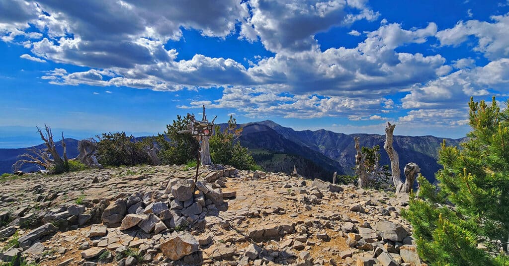
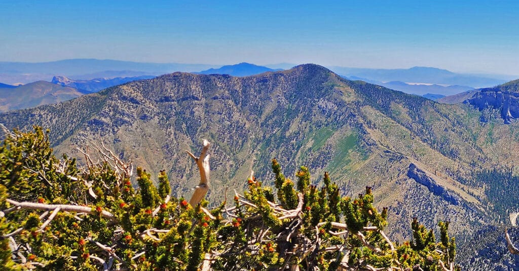
Harris Mountain is the most pristine of the six highest Mt. Charleston Wilderness summits. I’ve never seen anyone on that summit. The wildflowers, Acastus butterflies and Bristlecone pines are untouched. The views are spectacular! Click the image or title above to view multiple routes to Harris Mountain Summit.
Mummy Mountain Adventures Overview | Mt Charleston Wilderness | Spring Mountains, Nevada

You could easily fit a couple football fields on Mummy Mountain’s vast and beautiful summit. Ancient Bristlecone pines are sculpted into unique shapes beyond the capability of human art. Discover multiple wilderness routes to and around Mummy Mountain. This mountain could easily form its own entire wilderness! Click the image or title above to view this great collection of Mummy Mountain adventures!
Charleston Peak Adventures Overview | Mt Charleston Wilderness | Spring Mountains, Nevada

As the highest point in the Mt. Charleston Wilderness and Southern Nevada, Charleston Peak, at 12,019 feet elevation, is a highly sought-after destination. The approach trails are nice, but be prepared for a grueling overall ascent of around 8,000 feet. 360-degree views from the summit are unmatched. However, some of the most beautiful scenes are along the approach trails! Click the image or title above to view multiple routes to Charleston Peak summit.
Lee Peak Adventures Overview | Mt Charleston Wilderness | Spring Mountains, Nevada

Lee Peak, often overlooked, is the one summit in the Mt. Charleston Wilderness that offers expansive views down the entire length of Kyle Canyon, Lee Canyon and the Northern stretch of the Spring Mountains. To stand on that summit is like standing on the bow of a ship! At the same time, the surrounding Bristlecone Pine forest gives it an intimate touch. Click the image or title above to view multiple routes to the summit of Lee Peak.
Griffith Peak Adventures Overview | Mt Charleston Wilderness | Spring Mountains, Nevada
Griffith Peak in the Mt. Charleston Wilderness of Nevada has more than one approach. We’ll show you at least 8 approaches to Griffith Peak, each presenting a unique perspective on the surrounding wilderness. Click the image or title above to view multiple routes to Griffith Peak summit.
Harris Mountain Triangle | Mt Charleston Wilderness, Nevada
Harris Mountain Triangle in the Mt Charleston Wilderness, Nevada is formed by an Eastern and Western ridge that meet at Harris Mountain summit, the apex. The triangle base is Kyle Canyon Road. Beginning at the Fletcher Canyon Trailhead, ascend the East ridge, descend the West ridge.
Fletcher View Ridge | Mt Charleston Wilderness, Nevada

Fletcher View Ridge ascends between The Fletcher View Campground and the final summit approach to Harris Mountain. The ridge originates in The Fletcher Canyon area on Kyle Canyon Road in The Mt. Charleston Wilderness, Nevada. Expect non-stop spectacular views of the highest peaks on The Mt. Charleston Loop along with a good aerial view of Fletcher Canyon and potential route to Fletcher Peak summit. Elevation: 7,000-9,000ft. wilderness route, no trails or trail signs. Best time of year for this adventure: July through September. Click the image or title above for details.
Wilson Ridge / Sexton Ridge Circuit | Lovell Canyon, Nevada

Make a huge circuit of Lovell Canyon, Nevada taking in Wilson Ridge (East side), The Harris / Griffith Saddle (top), Sexton Ridge (West side). This is a total day-long wilderness immersion with spectacular views of Southern Nevada wilderness and beyond. Elevation gain: 8-9,000ft or more when gain and loss are added up. Best time of year for this adventure: Close to the longest day of the year. Click the image or title above for details.
Fletcher Canyon Trailhead / Harris Mt Griffith Peak Circuit | Mt Charleston Wilderness, Nevada

Make a circuit from The Fletcher Canyon Trailhead to Harris Mountain and Griffith Peak, then return to your start point. After accomplishing the most direct approach to Harris Mountain summit, cross the saddle to Griffith Peak, descend to The South Loop Trailhead and finally return on Kyle Canyon Road to Fletcher Canyon Trailhead. This route is half wilderness and half trails. Elevation gain is from 7,000-11,060ft plus additional ascent and descent along the way. Best time of year for this adventure: Summer through mid-Fall. Click the title or image above for details.