Black Mountain North Loop | McCullough Hills | Sloan Canyon National Conservation Area, Nevada

Experience Some of the Highest Viewpoints in Nevada’s McCullough Hills! Click the image or title above for details.
River Mountains Loop Trail | Lake Mead National Recreation Area, Nevada

35-Mile Paved Hiking/Biking Loop Trail Completely Circling the River Mountains in Nevada. Click the image or title above for details.
Railroad Mountains Overview, Nevada

Last Updated on November 19, 2025 by David Smith City of Las Vegas Public Park Finder Railroad Mountains Overview, Nevada (Click Through to Individual Trails and Hiking Routes Below) (Mileage Below is Round Trip. Altitude and Mileage are Approximate) LasVegasNevada.gov Parks & Facilities Web Pages Scorpion Peak Loop 5 mi / Approx. 2,400 > 4,089ft**Trails […]
Scorpion Peak Loop | Railroad Mountains, Nevada

Fun Route to a Challenging Summit with Unique 360-Degree Views! Click the image or title above for details.
Frenchman Mt East Approach Loop | Near Lake Mead, Nevada

Experience the steeper, wilder approach to Frenchman Mt. in Nevada. You’ll wonder why you ever complained about switchbacks on the main trail! Click the image or title above for details.
Harris Springs Canyon Ridgeline | La Madre Mountains Wilderness, Nevada

Harris Springs Canyon Ridgeline is right on the edge of the Las Vegas Metro Area making this an awesome convenient location for hiking, mountain biking, climbing and wilderness exploration. It’s like a remote wilderness experience at the edge of Las Vegas, and the views are spectacular! Click the image or title above for details.
The King, The Queen, The Jack Peaks | Sloan Canyon NCA, Nevada

The King, The Queen and The Jack Peaks make a rugged wilderness loop adventure in th Sloan Canyon National Conservation Area just South of Las Vegas, Nevada. Click the image or title above for details.
Lake Las Vegas Western Ridgelines, Nevada

The Lake Was Vegas Western ridgelines are a hidden, magical wilderness just West of the Las Vegas Wash. Explore this hidden world of foreign landscapes and spectacular views. There are ancient volcanic landscapes, some of the oldest rocky ridges on the planet, huge volcanic spires and brilliantly painted canyons. Click the image or title above for details!
Red Bluff Tower Above Lake Las Vegas, Nevada

Ascend from Terrazza Park near Lake Las Vegas, Nevada, to Red Bluff Ridgeline for spectacular views. Explore stone towers. Click the image or title above for details.
Flash Flood in Northwest Las Vegas, Nevada
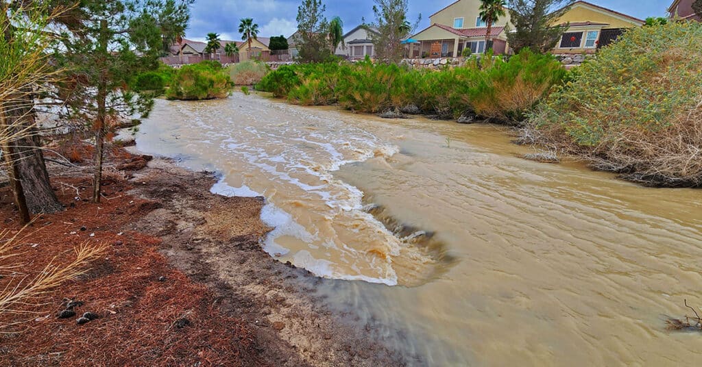
See the streaming river with cascading rapids created by a flash flood in Northwest Las Vegas, Nevada. Watch desert homes become waterfront properties! The torrent was dramatic enough to name the separate rapids and other features normally associated with a wild raging river! Click the image or title above for the entire story.