01 Las Vegas Metro Area Trails Overview | Nevada
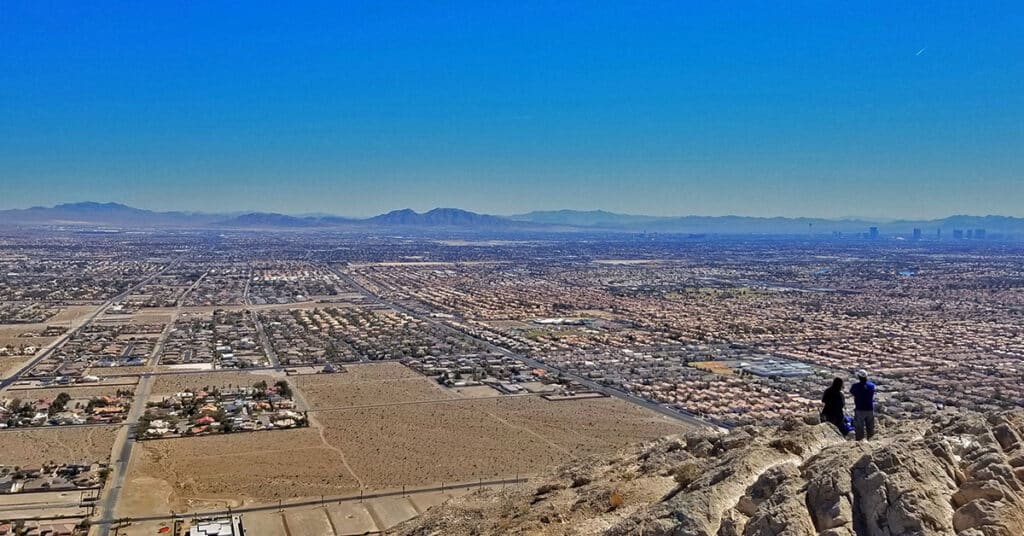
Vegas Metro Area Trails, Nevada, is a category that includes trails both within the Las Vegas Metro Area and on the outskirts of Las Vegas, but not within any of the surrounding wilderness areas. Las Vegas is surrounded by some of the most spectacular wilderness areas in the U.S. However, there are trails in and near Las Vegas where the hiker, trail runner, biker or climber may enjoy a wilderness experience close to home. The trails in this category fit that scenario. There are places here that can transport you instantly into a wilderness setting. Best time of year for adventures here: Mid-Fall to Mid-Spring. When temperatures in the Las Vegas Valley rise above 75-80 degrees these destinations can become uncomfortable and even dangerous. However, during the Winter months expect comfortable mid-day temperatures around 60 degrees. Follow the thumbnail images on this page to detailed adventure descriptions complete with videos and images. Click image or title above for more…
Cheyenne Mountain | Las Vegas, Nevada
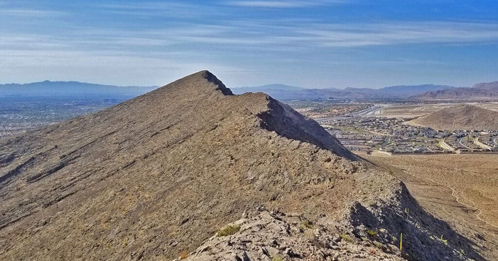
Cheyenne Mountain, elevation 3833ft with an elevation gain of 900ft, is one of the many desert hills surrounding Las Vegas. Located in the Summerlin area, Cheyenne Mountain has a commanding view of Lone Mountain, the Las Vegas Valley and many surrounding high points. When you’re on the Toove Trail circling around the West side of Cheyenne Mountain there’s the feeling of being hundreds of miles from civilization in an isolated wilderness area. There are numerous points along the circuit route where you can ascend to the summit experiencing nearly every level of rock climbing difficulty. Route details: **6 Miles RT, 2,967 – 3,833ft; Elevation ** Click image or title above for more…
Flash Flood in Northwest Las Vegas, Nevada
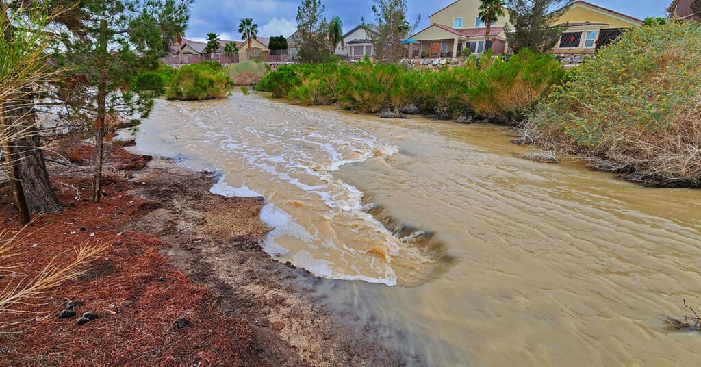
See the streaming river with cascading rapids created by a flash flood in Northwest Las Vegas, Nevada. Watch desert homes become waterfront properties! The torrent was dramatic enough to name the separate rapids and other features normally associated with a wild raging river! Click the image or title above for the entire story.
Frenchman Mountain Overlooking Lake Mead National Recreation Area, Nevada
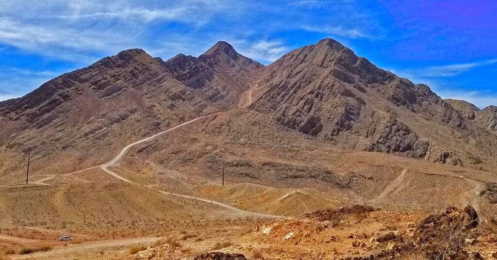
There is no more commanding view of both the Las Vegas Valley and Lake Mead National Recreation Area than the summit of Frenchman Mountain, Nevada. From the summit one can look down on the Las Vegas Strip, across to the West to the Rainbow Mountains on the far side of Red Rock National Park, the La Madre Mountains and the Mt. Charleston Wilderness. To to Northwest one can see Gass Peak and the Sheep Mountain Range. To the Northeast one can see the Muddy Mountains and then gaze East and Southeast to see the Jimbilnan Wilderness, Virgin Ridge, Gold Butte, Lake Mead and the Hualapai Mountains. Route details: 5mi | 2,184 > 3,972ft ** Excellent Trail/Service Road** Click image or title above for more…
Las Vegas Northern Growth Edge 2021
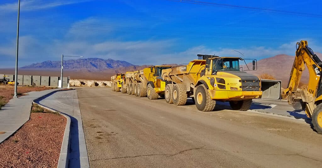
Las Vegas is one of the most rapidly growing population areas in the U.S. as of January, 2021. Clark county was rated as the 2nd of the top 10 U.S. counties in numeric growth (2017-2018) according to Census.gov and our rate of growth has only increased. View this video snapshot in time of the Northern growth edge of Las Vegas in 2021.
Lava Butte | Volcanic Cone Between Las Vegas and Lake Mead, Nevada
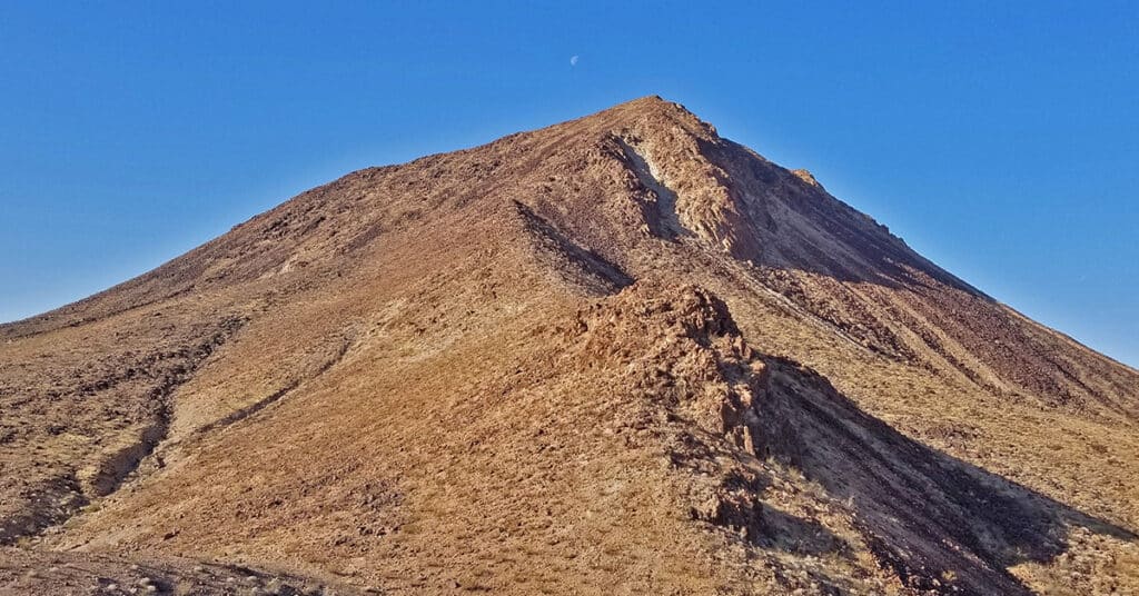
Lava Butte is a distinctive stand-alone volcanic cone below Frenchman Mountain and to the East. It can be seen from many high points in and around the Lake Mead National Recreation Area including Fortification Hill, Mt. Wilson, Frenchman Mountain and others. It’s a fun, challenging climb to go up one side and down the other, weaving around huge volcanic boulders. Route description: 7mi | 1,835 > 2,871ft; ** Service Road / Lava Ridge** Click image or title above for more…
Little La Madre Mt | Little El Padre Mt (aka) Summerlin Peak, Nevada
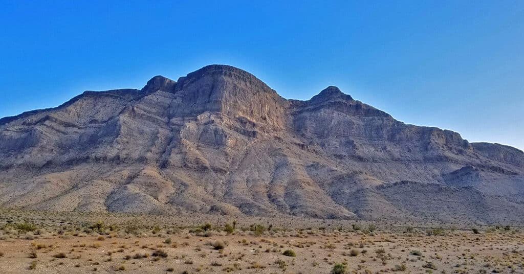
These two features are not in the La Madre Mountains Wilderness. To my knowledge they have no names other than being on a ridge referred to as Summerlin Ridge just beyond the Northwestern growth area of Las Vegas, Nevada. When Little La Madre & El Padre are compared to the actual La Madre and El Padre, they look like miniature versions of the originals (see the first 2 slides of the slide show on this page to compare the two features). Of course, no geological features are exact duplicates, but the similarity here, to me, is pretty striking. On this initial exploration day, my route was to head up the main trail at the base of the Little La Madre, El Padre and Burnt Peak cliffs, circle around the upper end of the canyon, then take the trail leading to the top of the ridge overlook of the Little Red Rock area. Route Details: 8 Miles RT / 3,000-5,00ft; *Half Trails, Half Wilderness* Click image or title above for more…
Little Red Rock | Las Vegas, Nevada
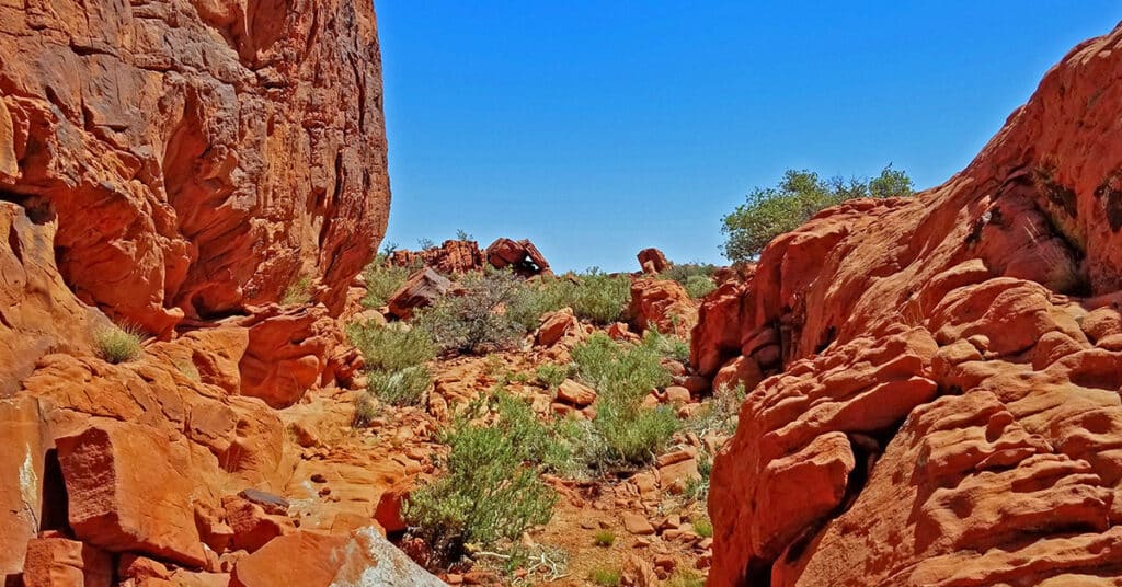
Little Red Rock is a smaller version of the more well-known Red Rock National Conservation Area just West of Las Vegas. It’s located close to the Summerlin area of Las Vegas and the La Madre Mountains Wilderness. Similar to Red Rock National Conservation Area, Little Red Rock contains beautiful ancient Jurassic Era Aztec Red Rock frozen sand dunes. In addition, similar to Red Rock National Conservation Area, Valley of Fire State Park, and Sloan Canyon National Conservation Area ancient petroglyphs may be found in this area. Route details: 8 Miles RT / 4,000-4,700ft; *Some Road, Mostly Wilderness* Click image or title above for more…
Lone Mountain | Las Vegas, Nevada
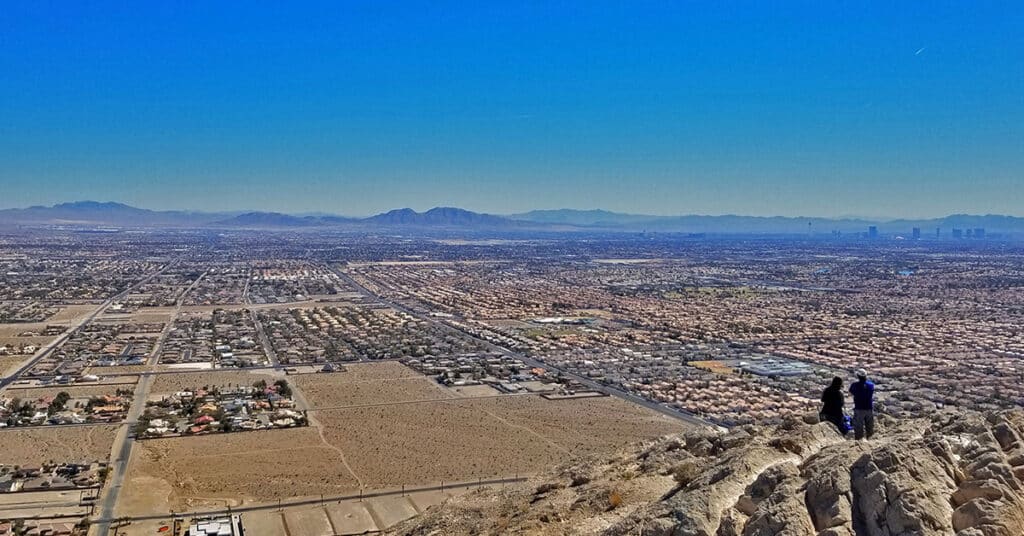
Lone Mountain is pretty awesome with a lot of bang for the buck in this short but spectacular hike. Two trails completely circle Lone Mountain: A wide multi-use trail and above that, a smaller hiking trail. In addition there are multiple routes to the summit that provide the experience of being in a remote wilderness on top of the world even though you’re within the boundaries of Metro Las Vegas in the populated Summerlin area. Route details: 4 mi RT | 7-800ft Elevation Gain/Loss **Unmarked Trailhead, Use Trail at First, Some Wilderness Navigation** Click image or title above for more…
Sunrise Mountain, Lake Mead National Recreation Area, Nevada
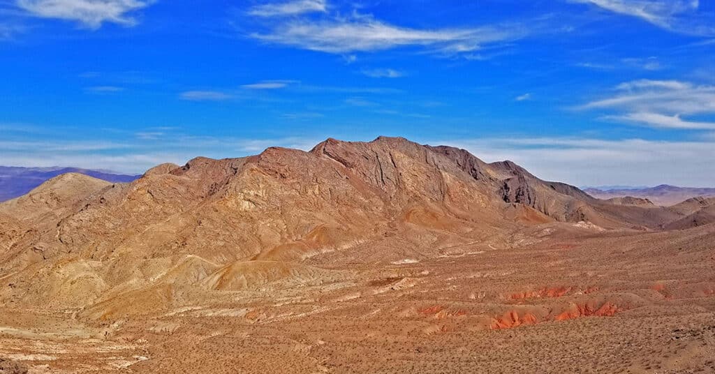
Sunrise Mountain offers a grand view of both the Lake Mead region and Nellis AFB below. In addition, you will find a lot more wilderness solitude than the more heavily traveled Frenchman Mountain trail just across Lake Mead Blvd. And, in my thinking, the Sunrise Mountain adventure is more rugged, wild, challenging and interesting. Route details: 4 mi RT | 7-800ft Elevation Gain/Loss; **Unmarked Trailhead, Use Trail at First, Some Wilderness Navigation** Click image or title above for more…

