Boulder City Ridgeline Loop | Lake Mead National Recreation Area, Nevada

Traverse this great ridgeline bordering NW Boulder City with spectacular views of Lake Mead, the River Mountains, Promontory Point, Fortification Hill and points beyond! Click the image or title above for details.
River Mountains Overview | Lake Mead NRA, Nevada

Explore this huge, rugged volcanic mountainous area circled by a great 34-mile hiking / biking loop trail just South of Las Vegas, Nevada! Click the image or title above for details.
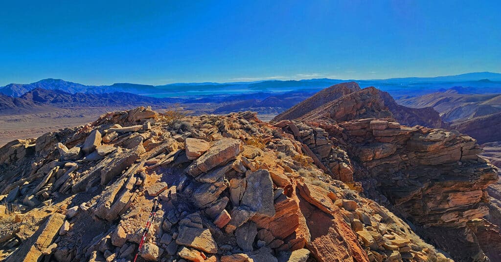
Red Mountain, Black Mountain, Radar Mountain | River Mountains | Lake Mead NRA, Nevada

Visit highpoints on and around River Mountain Trail in the River Mountains above Boulder City, Nevada. Observe a fascinating VORTAC tower! Click the image or title above for details.
Leaning Arch Loop | River Mountains | Lake Mead NRA, Nevada

This challenging 5-mile volcanic terrain adventure has a remarkable destination point! It’s a huge vertical arch you can easily stand under for an awesome framed photo. Click the image or title above for details.
Frenchman Mt East Approach Loop | Near Lake Mead, Nevada

Experience the steeper, wilder approach to Frenchman Mt. in Nevada. You’ll wonder why you ever complained about switchbacks on the main trail! Click the image or title above for details.
Mt. Wilson Summit | Lake Mead National Recreation Area, Arizona

This stand-alone mountain has a spectacular 360-degree view with Mt. Charleston Wilderness to the Northwest, the Sheep Range to the North, Virgin Mountains to the Northeast, Grand Canyon area to the East , Colorado River & Black Mountains to the South. Discover how to reach this incredible summit! Click the image or title above for details.
Anniversary Ridge | Muddy Mountains Wilderness, Nevada
Anniversary Ridge, the highest overlook point in its area on the Eastern border of the Muddy Mountains Wilderness, offers a spectacular aerial view of the Bowl of Fire, almost immediately below, and views all the way to Lake Mead. Ascending Anniversary Ridge involves a rather involved unmarked approach route and finally, traversing a very narrow ridge with dramatic drop-offs on either side. Route details: 10 mi RT; **Some Trail, Some Wilderness** Click image or title above for more…
Anniversary Narrows, Muddy Mountains Wilderness, Nevada

Anniversary Narrows in The Muddy Mountains Wilderness of Nevada is one of the most beautiful slot canyons in the state. If you’re into slot canyons, Anniversary Narrows is a must see no matter where you’re from. The intricate turns in the canyon along polished rock walls carved into millions of unique shapes lit up by a narrow slit 100s of feet above change in color with the advance of the sun throughout the day. It’s like wandering through a magical maze with a new, unexpected view beyond your wildest imagination around every turn. Route details: 10 mi RT; **Some Trail, Some Wilderness** Click image or title above for more…
Historic Railroad Trail | Lake Mead National Recreation Area, Nevada
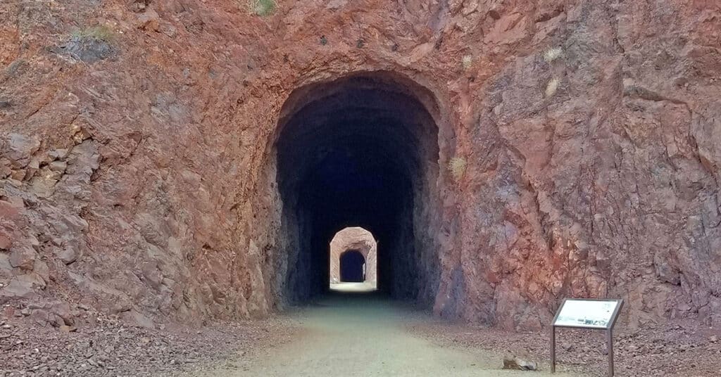
The Historic Railroad Trail is about a 10-mile out and back adventure in the Lake Mead National Recreation Area in Nevada. This trail is a side trail branching off from the 31-mile River Mountains Loop Trail and spans the distance from the Lake Mead Visitor Center to Hoover Dam. You could combine this trail with a tour of Hoover Dam and a walk across the old memorial bridge. The well-graded path, with it’s very gradual inclines and descents makes for an easy hike or run. Route details: 5 mi RT | 200ft Elevation Gain/loss; **Wide, Graded Railroad Bed** Click image or title above for more…
Horse Thief Canyon Loop | Mt. Wilson | Black Mountains | Lake Mead National Recreation Area, Arizona

This adventure has got to win an award for variety of terrain including 6 miles of unpaved roads, traversing a few miles up the entire length of a rugged mountain canyon with beautiful springs, an 800 foot scramble up the avalanche slope side of the canyon, a short class 3 rock climb and a descent down a 2-mile ridge with incredible views of Lake Mead, Potosi Mountain, the Rainbow Mountains, La Madre Mountains Wilderness, Mt Charleston Wilderness, Gass Peak, the Sheep Range, Frenchman Mountain, Fortification Hill, the Hoover Dam area, and additional points to the South and to the East. Route Details: 16mi | 1,536 > 5,446ft; ** Some Road, Mostly Wilderness** Click image or title above for more…