Railroad Mountains Overview, Nevada

City of Las Vegas Public Park Finder Railroad Mountains Overview, Nevada (Click Through to Individual Trails and Hiking Routes Below) (Mileage Below is Round Trip. Altitude and Mileage are Approximate) LasVegasNevada.gov Parks & Facilities Web Pages Scorpion Peak Loop 5 mi / Approx. 2,400 > 4,089ft**Trails & Wilderness**
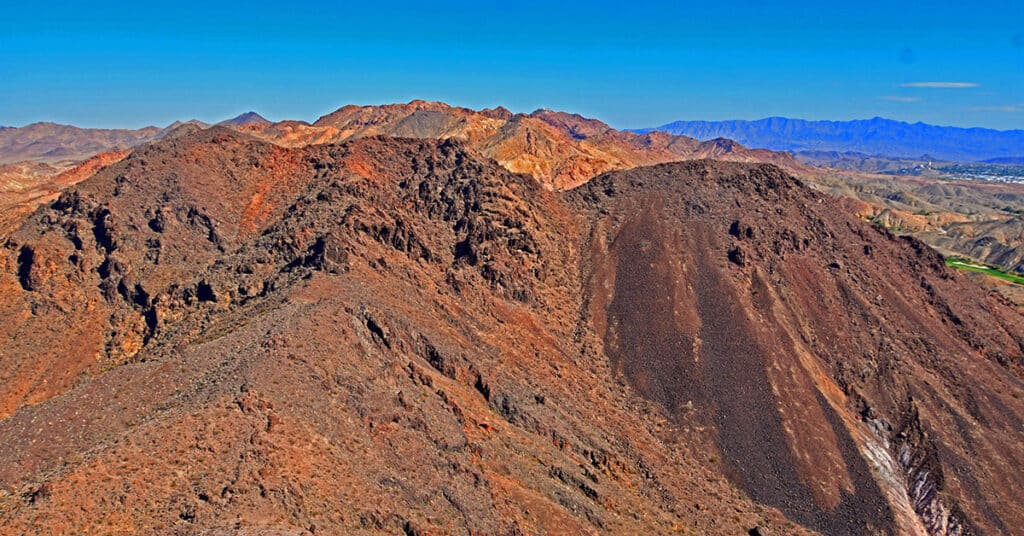
Scorpion Peak Loop | Railroad Mountains, Nevada

Fun Route to a Challenging Summit with Unique 360-Degree Views! Click the image or title above for details.
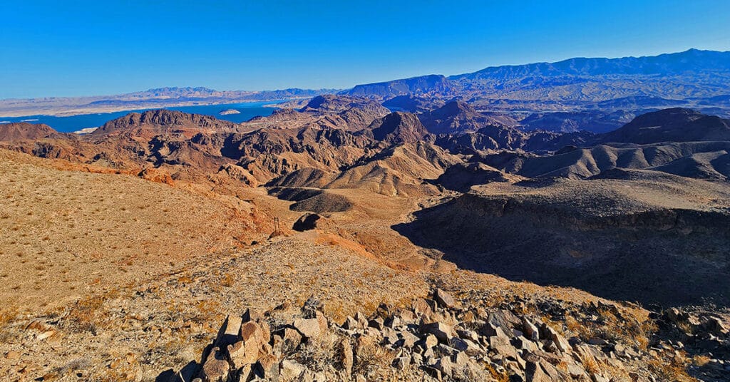
Boulder City Ridgeline Loop | Lake Mead National Recreation Area, Nevada

Traverse this great ridgeline bordering NW Boulder City with spectacular views of Lake Mead, the River Mountains, Promontory Point, Fortification Hill and points beyond! Click the image or title above for details.
River Mountains Overview | Lake Mead NRA, Nevada
Explore this huge, rugged volcanic mountainous area circled by a great 34-mile hiking / biking loop trail just South of Las Vegas, Nevada! Click the image or title above for details.
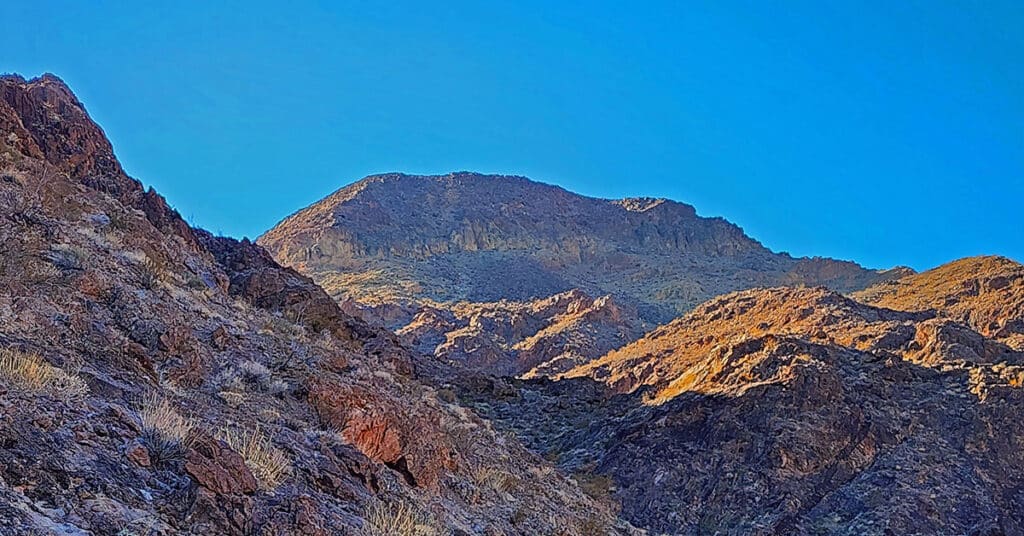
Red Mountain, Black Mountain, Radar Mountain | River Mountains | Lake Mead NRA, Nevada

Visit highpoints on and around River Mountain Trail in the River Mountains above Boulder City, Nevada. Observe a fascinating VORTAC tower! Click the image or title above for details.
Leaning Arch Loop | River Mountains | Lake Mead NRA, Nevada
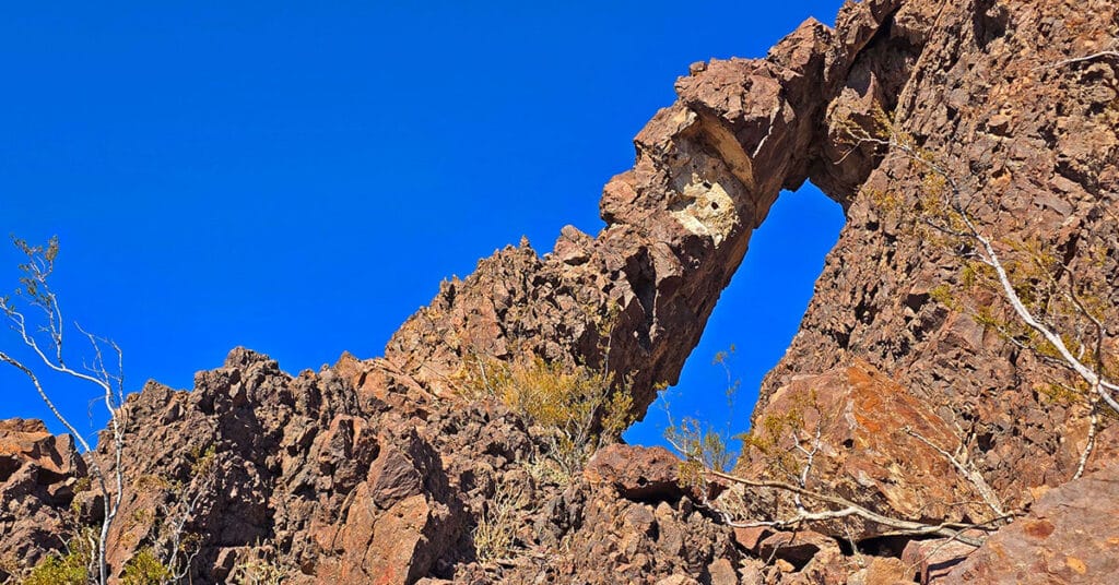
This challenging 5-mile volcanic terrain adventure has a remarkable destination point! It’s a huge vertical arch you can easily stand under for an awesome framed photo. Click the image or title above for details.
Black Canyon Overlook Loop | Lake Mead NRA, Nevada
Make a complete loop above and below the spectacular Black Canyon overlook cliffs. Enjoy the best 360-degree views of Black Canyon and navigate the canyons and ridges below the cliffs. Click the image or title above for details.
Gold Strike Mountain Loop | Hoover Dam Area | Lake Mead NRA, Nevada
Park Brochure Hoover Dam Area Lake Mohave Area Gold Strike Mountain Loop | Hoover Dam Area | Lake Mead NRA, Nevada Temple Bar Area Overton Arm All Lake Mead Maps .gov Adventure Video Goes Here Overview | Gold Strike Mountain Loop | Hoover Dam Area | Lake Mead NRA, Nevada Adventure to occur Winter 2025 […]
Sugarloaf Mountain | Hoover Dam Area | Lake Mead NRA, Arizona
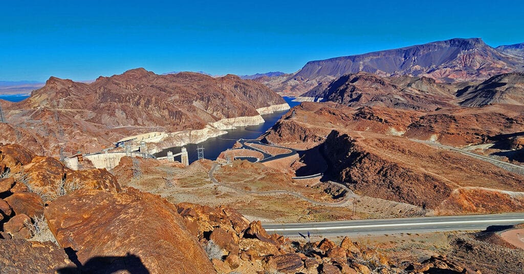
Sugarloaf Mountain in Arizona towers above Hoover Dam, offering one of the dam’s most spectacular vantage points. Click the image or title above for details.
North River Bend View | Hoover Dam Area | Lake Mead NRA, Arizona
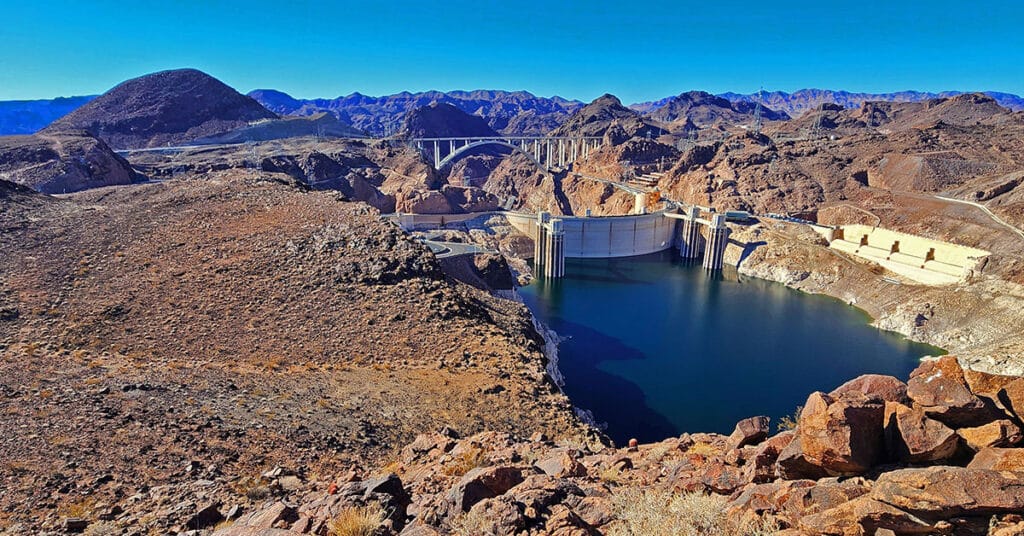
Hike to the best aerial view of Lake Mead’s Southern tip at Hoover Dam. Click the image or title above for details.