Mummy Mountain Toe, Mt. Charleston Wilderness | Spring Mountains, Nevada

The Southwestern edge of Mummy Mountain forms a sheer cliff over 1,000ft in height on 3 sides and that cliff is referred to as Mummy’s Toe. Mummy’s Toe, though unknown by most hikers in the Mt. Charleston Wilderness, is a awesome destination hike in itself. Like the bow of a ship the 270 degree view to the South, East and North is unmatched. Route details: 14 mi / Approx. 8,439 > 11,000ft **Some Trail > Some Wilderness** Click image or title above for more…
Mummy’s Toe, Knees, Raintree, Fletcher Peak Circuit from Deer Creek Park

This cool circuit adventure is packed with spectacular views and enchanting waypoints. Yet it is compact enough to accomplish in less than one incredible day. The circuit begins at the North Loop Trailhead in the Mt. Charleston Wilderness. From there descend on Deer Creek Road about a quarter to a half mile to Deer Creek Picnic Area. From the Deer Creek Picnic Area parking area, ascend through Deer Creek Park and on up via the Cougar Ridge Trail to Mummy’s Knees. Then traverse over to Mummy’s Toe. Descend to Mummy Springs and then on over to Raintree. Take the North Loop Trail from Raintree toward Fletcher Peak. Take the Fletcher Peak out and back trail from the North Loop Trail to the summit of Fletcher Peak. Finally, descend from Fletcher Peak summit back to the North Loop Trailhead where you began. Route details: 15-18 mi / Approx. 8,439 > 11,000ft **Some Trail > Some Wilderness** Click image or title above for more…
Mummy Mountain Knees | Mt. Charleston Wilderness | Spring Mountains, Nevada
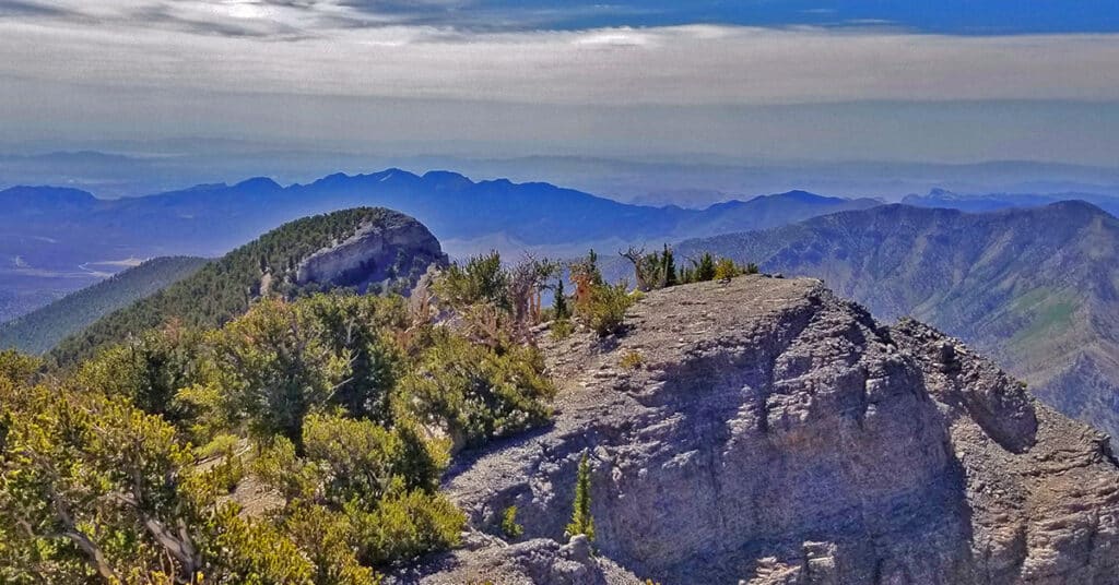
Mummy’s knees, pretty much unknown to most hikers, are a beautiful bristlecone pine forest arising out of what appears to be a solid slab of limestone. The view from Mummy’s knees is spectacular including Mummy Mountain summit area, the North Ridge of Kyle Canyon, Lee Peak, Charleston Peak, the South Ridge of Kyle Canyon, Griffith Peak, Harris Mountain and the saddle between the two framing the length of Lovell Canyon with Potasi Mountain in the background. Route details: 14 mi / Approx. 8,439 > 11,151ft **Some Trail > Wilderness Faint Trail** Click image or title above for more…