Deer Creek Rd, Mummy Springs, Raintree, Fletcher Peak Circuit Adventure | Mt. Charleston Wilderness | Spring Mountains, Nevada
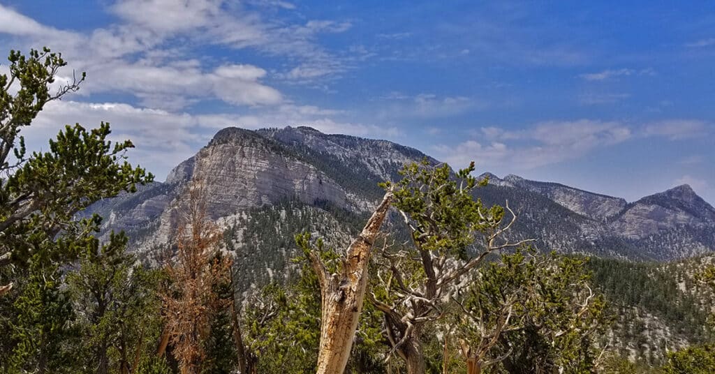
This comprehensive circuit adventure covers most of the entire Eastern section of the Mt. Charleston Wilderness including the canyon off Deer Creek Road at the base of Mummy’s Head, the ridge leading up the left (East) side of that canyon to the very Northeastern tip of Mummy Mountain’s mid and highest section (Mummy’s Tummy), the route across the wilderness at the base of Mummy’s Eastern cliffs to Mummy Springs, then on to Raintree and the intersection of the North Loop Trail, the brief stretch of the North Loop Trail to its intersection with Fletcher Peak Trail, the summit of Fletcher Peak, then the return past Raintree and Mummy Springs to the Cougar Ridge Trail and finally the descent back to Deer Creek Picnic Area and Deer Creek Road where the adventure began. Route Details: 15-18 mi / Approx 8,000ft > 10,500ft; **Some Trail > Some Wilderness** Click image or title above for more…
Mummy’s Toe, Knees, Raintree, Fletcher Peak Circuit from Deer Creek Park
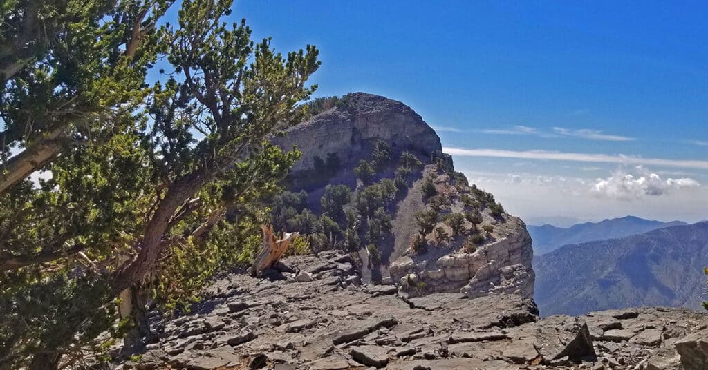
This cool circuit adventure is packed with spectacular views and enchanting waypoints. Yet it is compact enough to accomplish in less than one incredible day. The circuit begins at the North Loop Trailhead in the Mt. Charleston Wilderness. From there descend on Deer Creek Road about a quarter to a half mile to Deer Creek Picnic Area. From the Deer Creek Picnic Area parking area, ascend through Deer Creek Park and on up via the Cougar Ridge Trail to Mummy’s Knees. Then traverse over to Mummy’s Toe. Descend to Mummy Springs and then on over to Raintree. Take the North Loop Trail from Raintree toward Fletcher Peak. Take the Fletcher Peak out and back trail from the North Loop Trail to the summit of Fletcher Peak. Finally, descend from Fletcher Peak summit back to the North Loop Trailhead where you began. Route details: 15-18 mi / Approx. 8,439 > 11,000ft **Some Trail > Some Wilderness** Click image or title above for more…