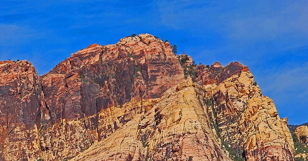
Petroglyph Wall & Lost Creek Canyon | Red Rock Canyon NCA, Nevada

View Petroglyph Wall, a waterfall in Lost Creek Canyon and the Willow Spring Loop in Red Rock Canyon National Conservation Area, Nevada. These are three short trails packed with discovery and adventure for all ages. Traverse multiple climate and fauna zones, witness Native American history, walk on ancient Jurassic Era frozen sand dunes.
Oak Creek Canyon North Branch to Rainbow Mountains Upper Crest Ridgeline, Nevada

Beginning on Middle Oak Creek Trail in the Rainbow Mountain Wilderness of Nevada, hike to Oak Creek Canyon, then continue to explore the North branch of the canyon between Rainbow Mountain and Mt. Wilson on a Route Toward The Rainbow Mountains Upper Crest Ridgeline.
Pine Creek Canyon Rock Climber Observations | Rainbow Mountain Wilderness, Nevada

This non rock climber discovered the best route through Pine Creek Canyon to the Rock Climber ascent points and filmed some rock climbing from an awesome perspective across the canyon. In addition, I point out some great hiking trails and potential approaches to the Rainbow Mountains Upper Crest Ridgeline above the canyon.
Far North Upper Crest Ridgeline | Rainbow Mountain Wilderness, Nevada

This is a circuit composed of the Northernmost 3 miles of the Rainbow Mountains Upper Crest Ridgeline. The circuit begins at the Willow Spring Area of Red Rock Canyon National Conservation Area, Nevada. From there, ascent the ridge from its Northernmost point, head South, then return to Willow Spring via Rocky Gap Road.
Turtlehead Peak with a Twist | Red Rock Canyon National Conservation Area, Nevada

View detailed directions and a video for hiking from the Sandstone Quarry parking area in Red Rock Canyon, NCA to the summit of Turtlehead Peak, along with tips. Also find directions for a cool alternate route to the summit. The alternate route is why this is called Turtlehead Peak with a “Twist”.
Calico Tanks | Red Rock Canyon National Conservation Area, Nevada

View detailed directions and a video for this artistically beautiful 5mi out and back hike to a large pond surrounded by sandstone cliffs and a spectacular viewpoint at the trail summit.
Keystone Thrust Summit from Willow Spring | Red Rock Canyon, Nevada

Summit the Keystone Thrust from Willow Spring in Red Rock Canyon National Conservation Area. Touch Two Additional Wilderness Areas: Rainbow Mountain Wilderness and La Madre Mountains Wilderness. Route goes along the North side of White Rock Mountain, up to La Madre Spring, past Miner’s Cabin and on to Keystone Thrust summit.
Kyle Canyon Grand Crossing Northern Half | La Madre Mountains Wilderness, Nevada

The Kyle Canyon Grand Crossing North is the Northern half of the larger Kyle Canyon Grand Crossing which begins at the intersection of Kyle Canyon and Harris Springs Roads, ascends to the El Bastardo Mountain area on the Keystone Thrust above Red Rock Canyon, then descends to Red Springs Desert Oasis in the Calico Basin. This Northern half of the adventure takes you to the saddle between Burnt Peak and El Bastardo Mountain on the Keystone Thrust Ridgeline, looks down to Red Rock Park and contemplates various routes into the park below before returning to the starting point on Kyle Canyon Road. Highlights include a walk though the beautiful La Madre Mountains Wilderness camping, navigating numerous rocky plateaus through the wilderness up the Burnt Peak approach ridge, exploring a section of the upper Keystone Thrust and seeing spectacular 360-degree views all along the route. Route details: 20 Miles + RT / 4500-7900ft; *Some Road, Mostly Wilderness* Click image or title above for more…
Juniper Peak Summit | Rainbow Mountain Wilderness, Nevada
If you’re looking to climb your first peak in the Rainbow Mountains, Juniper Peak is a good start. Many of the surrounding peaks dwarf it in comparison: Mt. Wilson; Rainbow Mountain; Bridge Mountain. Experience all the beauty and challenge of a Jurassic Era Aztec red rock peak in the Rainbow Mountains of Nevada. When you are facing Juniper Peak there appear to be 3 routes from the Red Rock Park side: Two narrow chutes to the left and what looks like a more gradual approach to the right. I ended up selecting the middle of these routes – the right chute of the two chutes to the left. Hindsight says that the easier, and likely the more traditional route is the more gradual climb up the slope on the right (just before Pine Creek Canyon). Route Description: 8.7 mi/ 3,909 > 6,109ft; **Some Trails, Some Wilderness** Click image or title above for more…
Middle Oak Creek Trail in Red Rock Canyon, Nevada
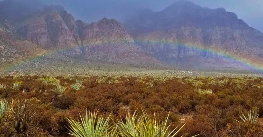
The videos on this page are an example of rains and flash floods in the desert. I recorded water cascading down canyon walls in the Rainbow Mountains of Nevada. It wasn’t a major life-threatening flash flood, but enough to get an idea how quickly things can change in the desert during a storm. Route Details: 4 miles RT; 300ft elevation gain; **Mostly wilderness, few trails.** Click image or title above for more…