Bighorn Sheep in Nevada Deserts
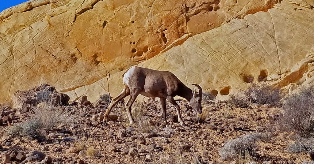
The most certain location to view wild bighorn sheep in Nevada Deserts is in Valley of Fire State Park. Here is a collection of video sightings at the Bee Hives formations, Silica Dome and Fire Canyon. It’s always an unexpected surprise and good fortune to come face-to-face with wild bighorn sheep! They seldom appear when you’re searching for them.
Water in the Desert | Southwest US
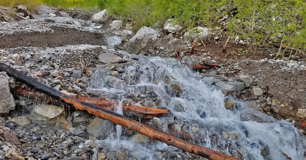
Transport yourself to a calm desert pool. Loose yourself in the sound of flowing and falling water. This page is filled with videos that each last about 4 minutes with only the sight and the sound of water in the desert. Turn on multiple videos in the “Individual Water Videos” section and listen to a unique orchestra of water sounds of your own creation. Turn on all the videos at once and create a flash flood effect. Take at least the full 4 minutes to listen, watch and experience stress and worry being washed away with the natural sound of water! Click image or title above for more…
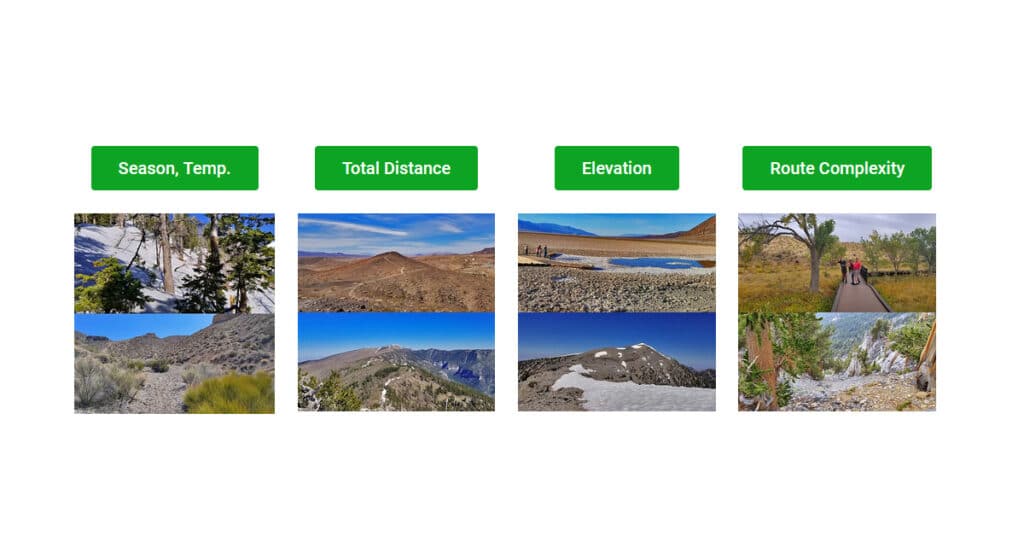
Plan Your Las Vegas Area Wilderness Adventure by Route Complexity
I’ve developed my wilderness navigation skills over years of trial and error. What you will learn here is purely from my own experience. In addition, my wilderness navigation technique is uniquely fitted to the Las Vegas area. I would not follow this technique in another area of the country. I navigate by feel, instinct and by sight. Click image or title above for more…
Plan Your Las Vegas Area Wilderness Adventure by Elevation and Elevation Gain
There is roughly 1/3rd less effective oxygen at the summit of Charleston Peak compared to the effective oxygen on the Las Vegas Strip! Learn how to condition for altitude, what to wear, sun exposure protection and more. Click image or title above for more…
Plan Your Las Vegas Area Wilderness Adventure by Total Distance
How far can you go before leaving the “fun zone”? The “fun zone” is the amount of distance you can generally cover during an adventure while still feeling relatively good. Find out how to determine your “fun zone”. Given about 5 days of walking/running exercise per week over the most recent 2-month period, average out the total number of miles you cover per week. Your “fun zone” is likely to be about half that distance. Click image or title above for more…
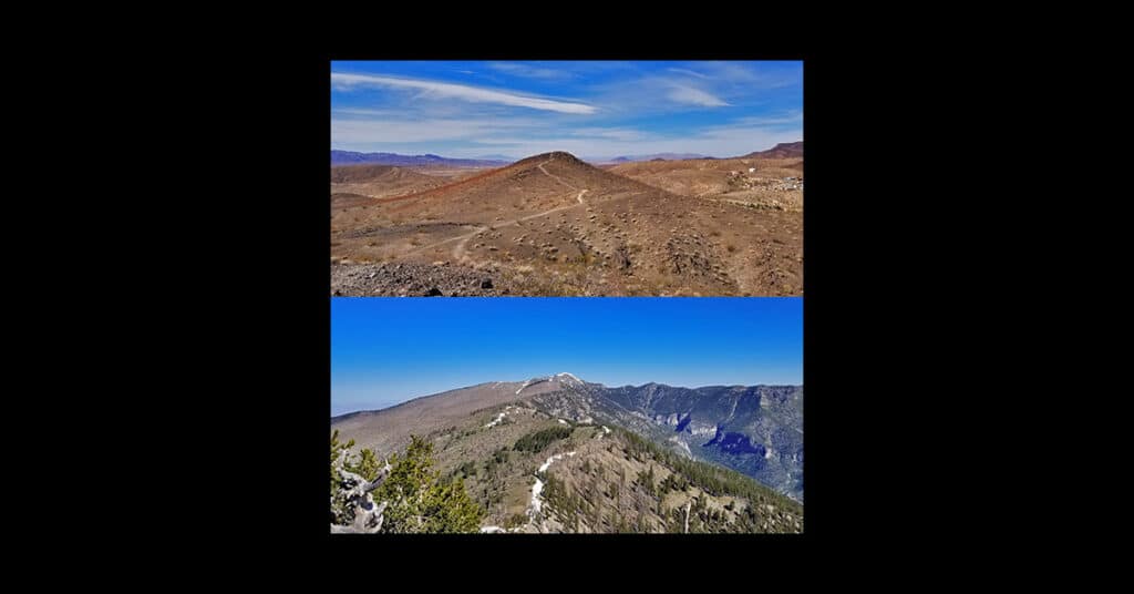
Plan Your Las Vegas Area Wilderness Adventure by Season and Temperature
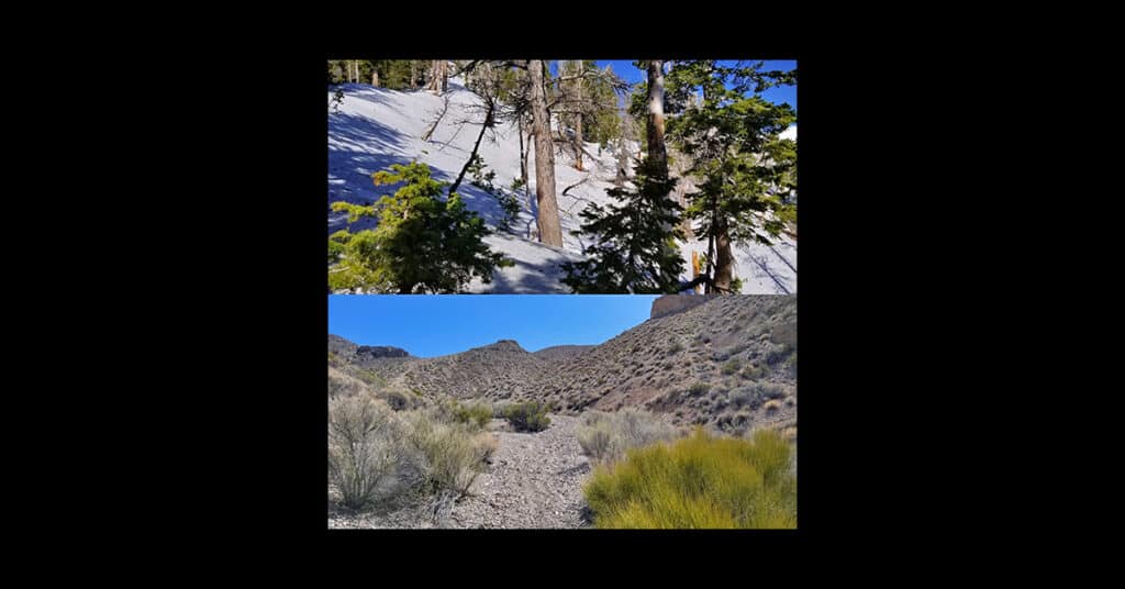
You can generally count on a decrease of about 5 degrees for every 1,000ft elevation rise. Since the elevation of the Las Vegas Strip is about 2000ft and the elevation of Charleston Peak is nearly 12,000ft there is a 10,000ft elevation difference between the two. Doing the math, 10,000ft X 5 degrees per 1,000ft = 50 degrees. Therefore, generally, the temperature at the summit of Charleston Peak is about 50 degrees lower than the temperature on the Las Vegas Strip. Click image or title above for more…
01 Plan Your Las Vegas Area Wilderness Adventure | Overview
The Las Vegas Area Uniquely Provides Year-Round Wilderness Adventures for All Levels of Conditioning and Varieties of Terrain. For Maximum Enjoyment and Safety, Select the Adventure that Best Fits the Following Criteria. Taking into account a few of the most critical considerations that apply to any Las Vegas Area wilderness adventure will help you to a more enjoyable and safe experience. Click image or title above for more…
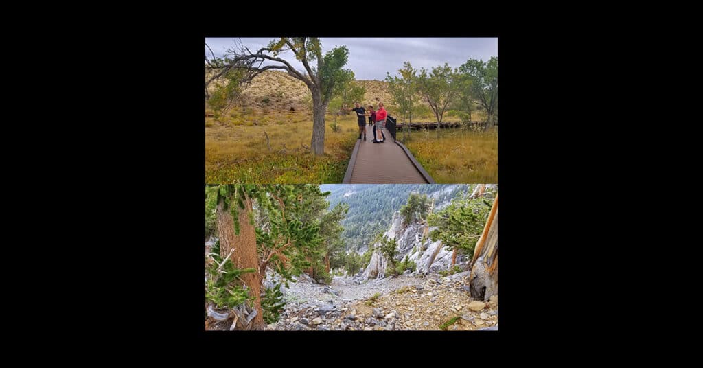
Zion National Park, Utah, Overview
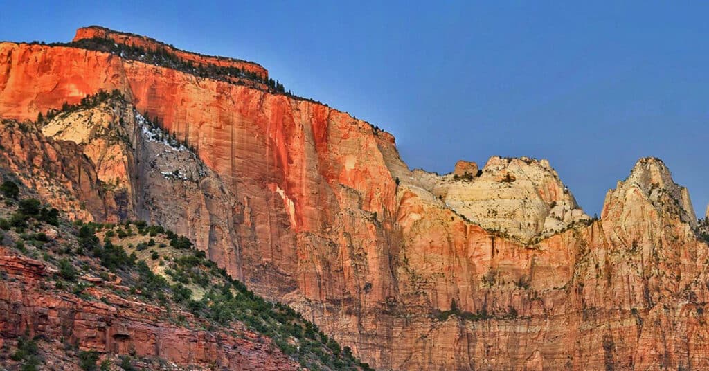
Click on the images on this page to plan your adventures to specific locations in Zion National Park. We’ll begin exploring and documenting adventures during an upcoming Spring or Fall season! Unlike other wilderness areas such as Death Valley National Park, Mt. Charleston Wilderness and many others, you can’t just drive up to a trailhead in Zion National Park and start hiking due to rules designed to protect this popular wilderness area from overcrowding. So, your adventures in Zion National Park will take a little more pre-planning along with permit applications in some cases. Here’s how the system works at Zion National Park… Click image or title above for more…
Hidden Hills and Jungle Above Kahana in West Maui, Hawaii
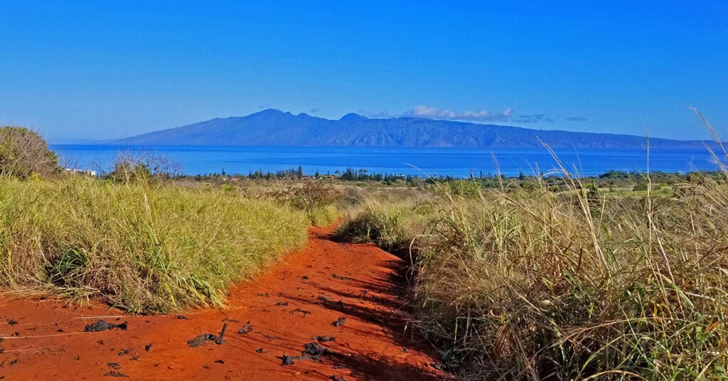
My goal here was to apply the same wilderness exploration strategy I use in the vast wilderness around Las Vegas to an entirely new and unknown area. The goal was to find the best daily trail running conditioning course that could be accessed by foot from the commercial tourist area of Kahana. The only problem was to find access to the interior above Kahana. So I set out to explore potential access points. What I discovered went way beyond expectations including a seemingly endless network of unpaved roads with a perfect surface for running, spectacular views of the ocean West and Northwest of Maui including the islands of Lanai and Moloka’i, total peace entirely devoid of any traffic. Route Details: “”A series of 5-10-mile daily running courses on secluded unpaved roads with spectacular views, including jungle excursions.** Click image or title above for more…
Hualapai Mountain Park, Arizona
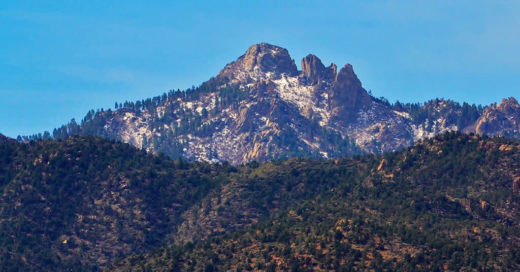
Hualapai Mountain Park offers 10 miles of trails for hikers, mountain bikers and equestrians to enjoy. Situated atop the Hualapai Mountains, the trails provide spectacular views of the desert below and the mountain ranges in the distance. On the trail, users will experience a variety of mountain habitats and have the opportunity to see many species of wildlife. Route Details: 8.2 mile loop trail; 6,200 – 8,250ft **Excellent Trail** Click image or title above for more…