Overview | La Madre Ridgeline Grand Crossing | La Madre Mts. Wilderness & Red Rock Canyon NCA, Nevada
This is a complete, 11-hour immersion in the wilderness. It covers two unique, major wilderness areas bordering one spectacular ridgeline in Southern Nevada. From the ridgeline you can see much of the greater Southern Nevada wilderness including portions of Arizona and California. One of the incredible features of this adventure is that it traverses a number of climate zones as it moves from high desert cacti, yucca and Joshua trees to mountainous junipers and ponderosa pines before descending into a world-famous area of Jurassic Era sandstone mountains and hills.
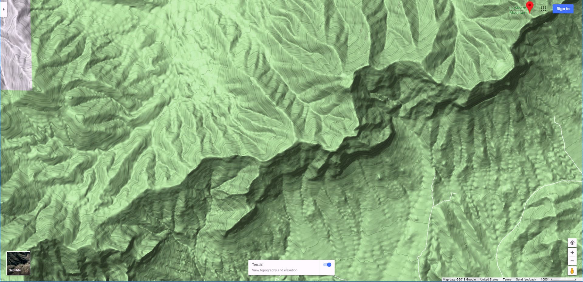
Adventure Route Summary
This adventure of about 25 miles with about 3,000 feet of ascent begins at the Twilight Zone parking area near the intersection of Kyle Canyon & Harris Springs Roads. Take Harris Springs Road West for about 2 miles before turning South onto the unmarked La Madre Wilderness approach road. Take that road South for about a mile and a half before setting a direction through canyon washes and along approach ridgelines to the La Madre Ridgeline about 1,000 feet West of El Bastardo Peak. Continue West along the La Madre Ridgeline for a little over a mile until the La Madre Springs gully is just below flowing to a point mid-way on the Northwestern base of White Rock Mountain. Take the steep descent ridgeline and then the La Madre Springs Trail from the La Madre Ridgeline to the base of White Rock Mountain. Take a right on the White Rock Mountain Loop Trail to Willow Springs Picnic Area on the West side of White Rock Mountain. Descend Rocky Gap Road from Willow Springs to the Red Rock Canyon Scenic Loop Drive. Take a left on the Scenic Loop and ascend the first short hill on the loop before turning right onto the Grand Circle Loop Trail. Finally, take the Grand Circle Loop Trail to the entrance of the Red Rock Canyon National Conservation Area on Highway 159.
Optional Way to Shorten the Hiking Distance
If you have two rugged 4WD vehicles you can cut off about 10 miles of hiking. Park one vehicle at the Willow Spring Picnic Area for the return trip. Drive the other vehicle from the adventure starting point up the unpaved Harris Springs Road and rugged La Madre Mountains approach road to the point where you will depart the La Madre Mountains approach road and begin heading across the wilderness. In this adventure I had only my Smart Car, “The Beast”, and so did the entire adventure on foot. So the video will show more of the beginning and end stretches in detail as opposed to if I had driven those stretches.
Spectacular Views Along the Way
Here is a short list of major landmarks you will see along the way (listed counterclockwise):
Best Time of Year for This Adventure
Due to the altitude range from about 4,500 – 7,500 feet, the temperature is at its best when the temperature in the Las Vegas Valley is in the low to mid-80’s. Winter can bring ice and snow creating hazardous conditions on and near the La Madre Ridgeline. Since you’ll need a long period of daylight, you’re looking at early Fall or late Spring for the most ideal conditions.
Route Starting Point Directions | La Madre Ridgeline Grand Crossing | La Madre Mts. Wilderness & Red Rock Canyon NCA, Nevada
Begin at the intersection of Kyle Canyon Road and Harris Springs Road. There is a parking area on the right side of Kyle Canyon Road just about 100 yards beyond where it intersects with Harris Springs Road. Head 3-4 miles up Harris Springs Road to where it intersects a 4wd road 3-4 miles North of the base of the La Madre Mountains Ridgeline. The adventure can begin either at the intersection of Kyle Canyon & Harris Springs Roads (if on foot) or about 2 miles up the 4WD road (if you have a 4WD vehicle).
Narrative Guide | La Madre Ridgeline Grand Crossing | La Madre Mts. Wilderness & Red Rock Canyon NCA, Nevada
Kyle Canyon Road to The La Madre Wilderness Approach Road
It’s a long day so you’ll want to begin at or before sunrise. From the parking area head about 500ft down Kyle Canyon Road, then take a right onto Harris Springs Road, continuing on that road for about 2 miles. The sunrise views of the Sheep Range, Gass Peak, the La Madre Ridgeline and the peaks in the Mt. Charleston Wilderness are spectacular. These views will add interest to the otherwise long, low initial stretch on Harris Springs Road. Enjoy the rugged high-desert Yucca and Joshua Trees that seem to pop out of a Western movie!
As you ascend Harris Springs Road, be watching for the left turn-off onto the La Madre Wilderness Approach Road. Don’t take the first left onto the wide road (about a mile up). Watch for the next left onto a much smaller, narrow, easy to miss rugged 4WD road about another mile up Harris Springs Road. A sign you’re getting close to the La Madre turnoff is that about 1,000ft before you get there, there is a short hill with a moderately steep incline on Harris Springs Road.
La Madre Wilderness Approach Road to the Wilderness Departure
Once you’ve turned left onto the La Madre Wilderness Approach Road, the incline increases as you’re now heading toward the La Madre Ridgeline. Notice the high points on the ridgeline in order to get your bearings for the next stretch. From left to right there is Little La Madre, La Madre Mountain (highest point), El Padre Mountain (not immediately visible at first), Burnt Peak and El Bastardo Peak. El Bastardo is on the right of the group of high points. Notice the approach ridgelines heading upward toward El Bastardo. There is one that ascends to the summit and another that ascends to a point on the La Madre Ridgeline a bit to the right of El Bastardo. Your goal will be to navigate to the approach ridge that ascends to the right of El Bastardo. Notice the intervening valleys, gullies and ridges between you and the approach ridge you’ve spotted. The view of this terrain from the La Madre Wilderness Approach Road is the best overall view you’ll get! Notice the terrain changes from Joshua Trees and Yucca Plants to Junipers and Pinyon Pines as you ascend the approach road.
Wilderness Departure to the Base of the Approach Ridge
Your first target as you leave the La Madre Wilderness Approach Road is a valley between El Bastardo to the left and a distinctive lower hill to the right. Angle to the right off the La Madre Wilderness Approach Road, heading to this valley. There’s a large wash running through the base of the valley. Locate the most gradual descent point you can find to enter into the wash, keeping your eye on El Bastardo and your target ridgeline just to the right of El Bastardo. Continue in the wash (easiest navigation) rounding the left side of the distinctive lower hill you saw earlier. Now it’s just a matter of locating the base of the approach ridge which is your target. If you leave the wash too soon to head for the approach ridge you’ll be faced with navigating a lot of intervening ridgelines and gullies. If you leave the wash too late you’ll need to backtrack. Watch for the ideal point to leave the wash.
Approach Ridge to the La Madre Ridgeline Summit
Once you’re on the correct approach ridge that summits the La Madre Ridgeline just to the right of El Bastardo, route finding becomes easy. Just stay on the ridge and ascend. It will take you to the La Madre Ridgeline without any large obstacles. As you ascend, notice the emerging views of the Sheep Range below, along with changing perspective of the Mt. Charleston Wilderness peaks. Notice the La Madre Ridgeline heading to the right where it will connect with the Wilson Ridgeline. Identify a low point in the La Madre Ridgeline shortly before it begins a dramatic ascent toward the Wilson Ridgeline. The La Madre Ridgeline descends from El Bastardo to that low point, then ascends to the Wilson Ridgeline. That low point is the point where you will eventually descend from the La Madre Ridgeline into Red Rock Canyon. At this time, just notice these big picture features.
Near the summit of the approach ridge you are on, just before it reached the La Madre Ridgeline, there will be a series of brief rocky stretches to navigate. The rock scrambling is a light class 3, nothing major. You just need to study the rocky sections to identify the best route to weave around and up through each. A pretty easy route always emerges.
Now notice how the approach ridge meets the La Madre Ridgeline at a high point on the ridgeline to the right of El Bastardo. As you approach that high point, angle a bit to your right to summit the La Madre Ridgeline just below and to the right of that high point.
La Madre Ridgeline to the La Madre Springs Descent Point
As you summit the La Madre Ridgeline you’re welcomed by a breathtaking view of Red Rock Canyon and the Rainbow Mountains to the South below the ridgeline! This may look like an entirely different world from the world you just left on the North side of the La Madre Ridgeline.
Now take a right (West) on the La Madre Ridgeline for the next mile and a half. The ridgeline has spectacular non-stop views! It’s about as easy to navigate as the approach ridge was. The series of a few mild high points have some rocky stretches, but nothing difficult beyond a basic walk with brief intermittent rock scrambles. Overall, you’re gradually descending toward the low point in the ridgeline above La Madre Springs and the mid-section of White Rock Mountain. Begin watching for these features as you enjoy the beautiful, hidden ridgeline world you are in!
La Madre Ridgeline Descent into Red Rock Canyon
You’ll know when you’ve reached the low point in the La Madre Ridgeline. The ridgeline begins to rapidly ascend beyond that point to the Wilson Ridgeline. Below you can see the mid-section of White Rock Mountain, and pick out the White Rock Mountain Loop Trail winding along the mountain’s base. You can also see the La Madre Springs gully flowing toward White Rock Mountain. Between the La Madre Ridgeline and that gully there’s a distinctive steep descent ridge. That’s the ridge that will take you down from the La Madre Ridgeline. Find a descent point where that descent ridge meets the La Madre Ridgeline. Stay aware of the big picture of how that ridge is formed. While descending the steep ridge you’ll need to find your own switchback route. It can be a bit complicated. And, there is a brief class 3 rock scramble down a rocky ledge about half-way down the ridge. Again, nothing major, no great exposure, but do carefully study and lower yourself down the ledge. There are ample hand and footholds.
Below the rock scramble, as above, you’ll notice faint trails that appear and disappear. Just keep your sights on the big picture of how the descent ridge is formed, and stay on the center of the ridge.
La Madre Springs to the Base of White Rock Mountain
Navigation can get pretty complicated in the La Madre Springs gully below the descent ridgeline. In the Spring there’s a visible trail in the gully. In late Summer and Fall the gully can be so choked with vines, reeds, grasses and other vegetation that the trail is only visible for brief stretches, leaving you to manage moving through vegetation as you figure out where the trail crisscrosses La Madre Springs multiple times. At many points the brush can be so thick that you need to carefully determine whether your next step will unexpectedly plunge you down a few feet into the running spring below or slide off a hidden ledge. Again, it’s nothing major. Just take your time. Trekking poles will help you locate firm ground below your feet.
Base of White Rock Mountain to the Grand Circle Loop Trail
Near the bottom of the La Madre Springs gully, a narrow trail appears which soon becomes a wide gravel trail. Now it’s good trails for the remainder of your adventure! Head downward along the trail toward the base of White Rock Mountain. Take a right along the base of White Rock Mountain as the trail you’re on joins the White Rock Mountain Loop Trail. Continue to Willow Springs Picnic Area on the West (right) side of White Rock Mountain. Continue down the road (Rocky Gap Road) below the picnic area until that road connects with the Red Rock Canyon Scenic Drive. Take a left onto the scenic drive (if you’re on foot) and ascend a brief hill. At the summit of that hill you’ll see a sign marking where the Grand Circle Loop crosses the scenic drive. Take a right onto the Grand Circle Loop.
Grand Circle Loop to Red Rock Canyon Scenic Drive Entrance
Now it’s a pretty straight shot downhill on the Grand Circle Loop to the Red Rock Canyon Visitor Center and Scenic Drive entrance. Enjoy the spectacular Jurassic Era sandstone peaks and canyons of the Rainbow Mountains to your right (West); the Calico Hills and Turtlehead Peak to you left (East). Ahead is the massive Blue Diamond Hill on the opposite side of Highway 159. Behind you are the vertical cliffs of the La Madre Ridgeline where you were standing not long ago. Take time to appreciate that along with all the life memories you’ve created during this magical day of wilderness immersion!


