Deer Creek North Fork Canyon | Mt Charleston Wilderness, Nevada
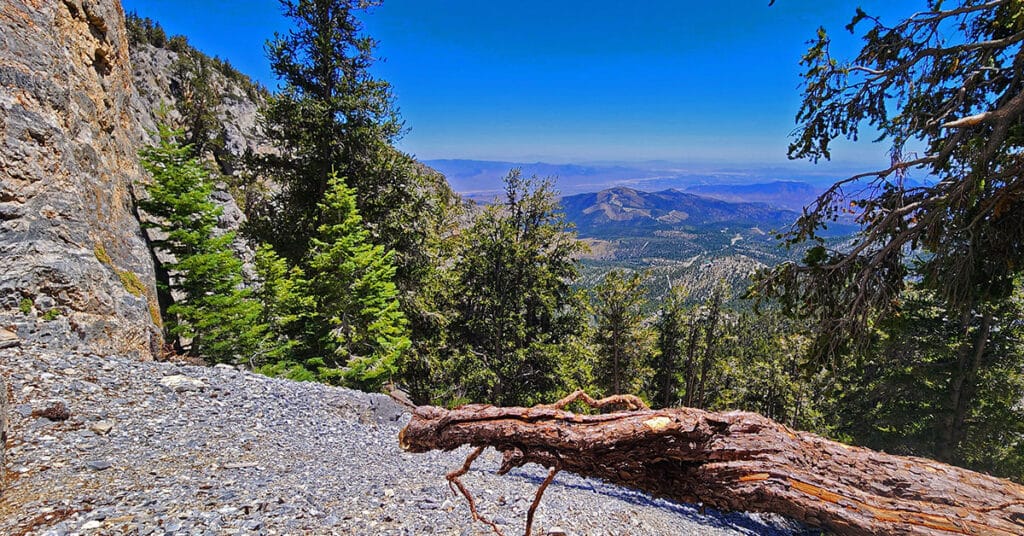
The majestic ancient Bristlecone Pines and sculpted limestone formations create an incredible backdrop to the remote, pathless, rarely visited upper Deer Creek North Fork Canyon. At the base of the canyon just above Deer Creek Road is Camp Stimpson. The canyon summit is the ridgeline between Mummy’s Forehead to the North and Mummy’s Chin to the South. Click the image or title above for details.
Mummy’s Forehead Summit | Mt. Charleston Wilderness, Nevada
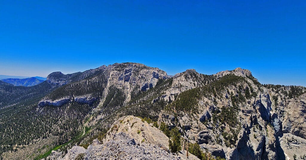
Mummy’s Forehead is the Beautiful, Isolated Northernmost Summit on Mummy Mountain in Southern Nevada’s Mt. Charleston Wilderness. Click the image or title above for details.
Mummy’s Chin Summit Ridge Loop | Mt Charleston Wilderness, Nevada

Approach this wild, fairly untouched and unknown rocky alpine ridgeline from Deer Creek Road, enjoy spectacular views, then return via the Lee Canyon Mummy’s Nose approach saddle for an incredible loop of the Mummy’s Head region. Click the image or title above for details.
Mummy’s Forehead Summit Approach Gully | Mt Charleston Wilderness, Nevada

This is a streamlined approach from Deer Creek Rd. Catch Pen Loop trailhead parking area to connect with Mummy’s Forehead Summit Approach Gully midway to the summit. On the return trip we explore the large area of ridges and gullies between Camp Stimpson and the Catch Pen Loop trailhead. Click the image or title above for details.
Mummy’s Nose East Cliff Plane Crash Site | Mt Charleston Wilderness, Nevada

While streamlining a route to Mummy’s Forehead I stumbled across a plane crash site at the Eastern cliffs of Mummy’s Nose. Initial research shows no record of this crash site. Click the image or title above for details.
Catch Pen West | Deer Creek Road | Mt. Charleston Wilderness, Nevada

Explore the region between the West end of Deer Creek Catch Pen Loop and Lee Canyon Road. Experience dramatic changes in climate and flora and fauna similar to changes between Southern Nevada and Canada! Click the image or title above for details.
Mummy’s Nose Final Summit Approach from Deer Creek Road, Nevada

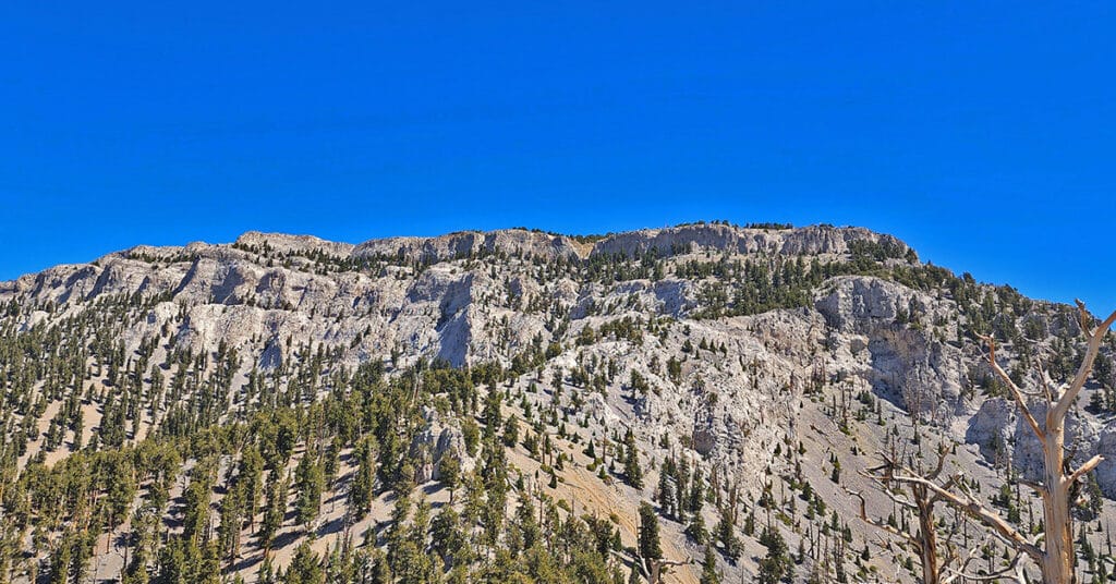
Take a beautiful alpine route from Deer Creek Road to the spectacular summit of Mummy’s Nose in the Mt. Charleston Wilderness, Nevada. Mummy’s Nose is a prominent 10,700ft summit with an incredible 360-degree view! This unique route focuses on the final stretch navigating the cliffs to the summit. It’s mostly class 2 with a few brief class 3 rock scrambles below the summit. Click the image or title above for details.
Mummy’s Nose North Alpine Loop | Mt Charleston Wilderness, Nevada

This spectacular 6-7-mile pristine wilderness loop makes a wide circuit between the 8,300ft starting point on Deer Creek Road and the 10,200ft elevation, less than a half-mile below Mummy’s Nose. It’s a great route to practice basic wilderness navigation skills as you always have multiple distinct points of reference and can’t miss intersecting Deer Creek Road during the descent. Click the image or title above for details.
Mummy Mountain’s Nose from Deer Creek Rd | Mt. Charleston Wilderness, Nevada

This is the most direct, streamlined approach to Mummy Mountain’s Nose, a prominent 10,751 ft. elevation with a spectacular 360-degree view. Click the image or title above for details…
Mummy Mt Grand Crossing | Foxtail Canyon > Mummy Summit > Deer Creek Road | Spring Mountains, Nevada
This adventure begins at the Foxtail Picnic Area in Lee Canyon, summits Mummy Mountain, descends the Eastern cliffs and Cougar Ridge Trail, then takes Deer Creek and Lee Canyon Roads back to the Foxtail Picnic Area. I recommend a base conditioning level of at least 5-miles running 4 times weekly along with one day topping 10-15 miles. Be altitude conditioned at the 11,000ft level, have wilderness navigation experience and ability to navigate very steep, long avalanche slopes. Route details: 18 mi RT/ Approx. 8,000 > 11,520ft; **Mostly Wilderness** Click image or title above for more…