Harris Springs Canyon, Nevada | Mountain Biking from Centennial Hills in Las Vegas
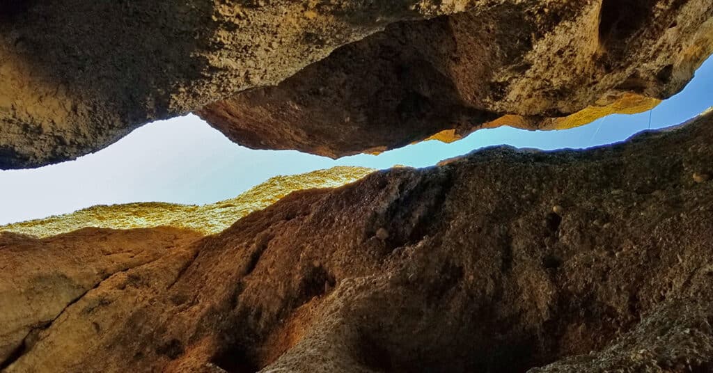
Harris Springs Canyon parallels upper Kyle Canyon Road around 5-8 miles below the Charleston Village area. The most notable feature of the canyon is the incredible slot canyon at its lower opening near the intersection of upper Harris Springs Road and Kyle Canyon Road. Though the canyon parallels Kyle Canyon Road it seems as though it is in an entirely untouched wilderness area as there are no sounds of the vehicles just over the ridge on Kyle Canyon Road. Very often as you round a bend there is a direct view of Charleston Peak. Route Details: About 20 miles to the intersection of Kyle Canyon and upper Harris Springs Roads, then 2-4mi RT in the canyon / Approx. 8,439 > 10,255ft; **Good Route from Upper Harris Sprs. Rd.** Click image or title above for more…
Harris Springs & Harris Mountain Roads | Spring Mountains | Nevada | Off-Road Cycling
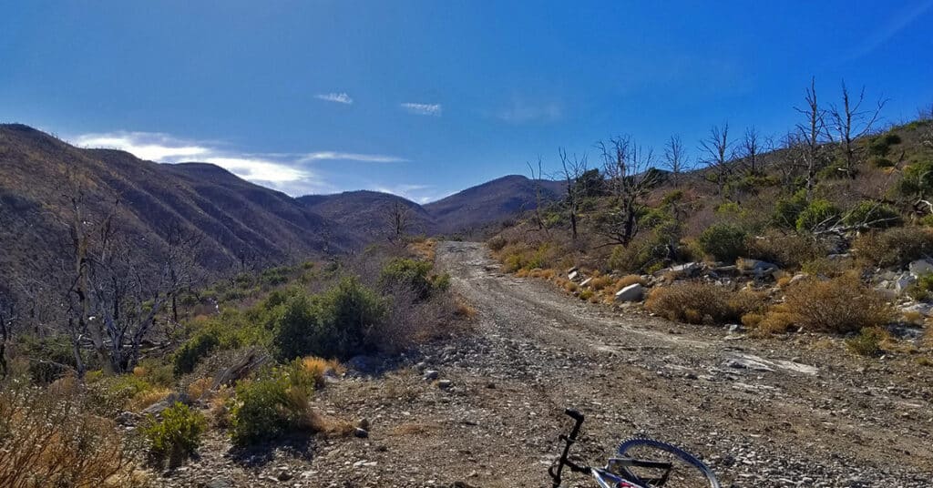
The important Harris Springs and Harris Mountain Roads system is one of the main access points for the La Madre Mountains Wilderness (4 times the size of Red Rock Park), Harris Mountain and even the Lovell Canyon area and a back door wilderness ascent to Griffith Peak. We take time to show these important wilderness access points. The views from upper Harris Mountain Road are spectacular. One can look straight down the canyon to see the entire Sheep Range, Fossil Ridge and Gass Peak in addition to La Madre Mountain and El Padre Mountain. Route details: 6 mi RT if you start at the end of Harris Mountain Road / Approx. 9,000 > 10,018ft; **Some Trail, Some Wilderness** Click image or title above for more…
Harris Mountain Triangle | Mt Charleston Wilderness, Nevada

Harris Mountain Triangle in the Mt Charleston Wilderness, Nevada is formed by an Eastern and Western ridge that meet at Harris Mountain summit, the apex. The triangle base is Kyle Canyon Road. Beginning at the Fletcher Canyon Trailhead, ascend the East ridge, descend the West ridge.
Harris Mountain Griffith Peak Circuit | Mt Charleston Wilderness | Spring Mountains, Nevada

The Harris Mountain Griffith Peak Circuit is largely untouched wilderness with spectacular views of all the peaks in the Mt. Charleston Wilderness: Harris Mountain, Griffith Peak, Charleston Peak, Lee Peak, Mummy Mountain and Fletcher Peak. In addition there are spectacular views up and down the entire length of Kyle Canyon and Lovell Canyon along with views of the La Madre Mountains Wilderness area including La Madre Mountain and El Padre Mountain. You can see the tips of Bridge Mountain, Rainbow Mountain and Mt. Wilson in the Rainbow Mountains Wilderness and even catch a glimpse of the Las Vegas Strip. And to the North, there are views of the Sheep Range and Gass Peak. Route Details: 15 mi / Approx. 7,713 > 11,060ft; **Some Trail, Mostly Wilderness** Click image or title above for more…
Harris Mountain Adventures Overview | Mt Charleston Wilderness | Spring Mountains, Nevada

Harris Mountain is the most pristine of the six highest Mt. Charleston Wilderness summits. I’ve never seen anyone on that summit. The wildflowers, Acastus butterflies and Bristlecone pines are untouched. The views are spectacular! Click the image or title above to view multiple routes to Harris Mountain Summit.
Harris Mountain | Mt Charleston Wilderness | Spring Mountains, Nevada
See the Harris Griffith Circuit page on this website. That adventure shows the Harris Mountain summit approach from South Climb Trailhead at Cathedral Rock. A future adventure posted to this page will show Harris Mountain summit approach from Harris Springs and Harris Mountain Roads, which is the most popular summit approach. Route details: 12-15-miles RT from the intersection of Kyle Canyon and Upper Harris Springs Road; **Unpaved roads and established trails all the way.** Click image or title above for more…
Griffith Peak Harris Mountain Circuit | Mt Charleston Wilderness | Spring Mountains, Nevada

The Griffith Peak / Harris Mountain Circuit actually takes over 2 hours longer than the entire Mt. Charleston Loop! I’ve completed the Mt. Charleston loop in about 7.5 hours including the run from the Trail Canyon parking lot to the South Climb parking lot. Adding in Griffith Peak, Lee Peak and Mummy Mountain, the Mt. Charleston 4-Peak Circuit takes me a little under 12 hours. On the other hand, the Griffith Peak / Harris Mountain Circuit took me 9hrs and 50 minutes! Why? Find out in this article. Route details: 15 mi / Approx. 7,713 > 11,060ft; **Some Trail, Mostly Wilderness** Click image or title above for more…
Griffith Peak Adventures Overview | Mt Charleston Wilderness | Spring Mountains, Nevada

Griffith Peak in the Mt. Charleston Wilderness of Nevada has more than one approach. We’ll show you at least 8 approaches to Griffith Peak, each presenting a unique perspective on the surrounding wilderness. Click the image or title above to view multiple routes to Griffith Peak summit.
Griffith Peak | Mt Charleston Wilderness | Spring Mountains, Nevada

At 11,056ft, Griffith Peak is the third highest peak in the Spring Mountain range and Southern Nevada. Though often overlooked by hikers whose destination is Mt. Charleston, the highest peak at 11,918ft, Griffith Peak is a great summit destination in itself. It has a unique view of the Eastern portion of Las Vegas, the Strip and the mountains bordering Red Rock Canyon and Calico Basin which are not visible from Mt. Charleston or Mummy Mt. The summit itself is more interesting than the barren Mt. Charleston summit. And finally, Griffith Peak makes a great out and back conditioning run for trail runners as the trail is a fairly good running surface, the incline is steady and steep and the round trip is just under 10 miles so one can travel fairly light and fast. Route Details: 9.3 mi RT / Approx. 7,713 > 11,060ft; **Excellent Trail** Click image or title above for more…
Griffith Peak & Charleston Peak Circuit | Mt Charleston Wilderness | Spring Mountains, Nevada

This out and back adventure involves starting at the Charleston Peak South Climb Trailhead, summiting Griffith Peak, taking the South Rim of Kyle Canyon from Griffith to Charleston Peak, then returning down the South Climb Trail back to that Trailhead. The South Climb Trail out and back is the most direct way to get to Charleston Peak if you’re pressed for time. Adding Griffith Peak to the adventure is a relatively short detour (about 1/2 mile each way off the main route) and well worth the effort. Route Details: 18 mi / Approx. 7,713 > 11,918ft; **Excellent Trails** Click image or title above for more…