Remote Wilderness Experience at the Edge of Las Vegas! Harris Springs Canyon Ridgeline | La Madre Mts, Nevada Ridgeline Viewed from Centennial Hills, Las Vegas Harris Springs Canyon Ridgeline | La Madre Mts, Nevada Convenient Trailhead Up Kyle Canyon Rd. A Few Miles from Hwy 95 Harris Springs Canyon Ridgeline | La Madre Mts, Nevada Trailhead Display: 2013 Carpenter Fire Damage and Recovery Harris Springs Canyon Ridgeline | La Madre Mts, Nevada Head SE Toward Harris Springs Canyon and Ridgeline on Horizon Harris Springs Canyon Ridgeline | La Madre Mts, Nevada Descend into Canyon Wash. NW Vegas is Just Beyond Ridgeline Harris Springs Canyon Ridgeline | La Madre Mts, Nevada Ascend Toward Ridgeline. Many Mountain Bike/Horse Trails Harris Springs Canyon Ridgeline | La Madre Mts, Nevada Cross Intervening Canyon. View NE To Sheep Range/Gass Peak Harris Springs Canyon Ridgeline | La Madre Mts, Nevada Sheep Range View Enlarged. 90 Miles of Backcountry Roads There. Harris Springs Canyon Ridgeline | La Madre Mts, Nevada Opposite View Up Same Wash Toward La Madre Mt. High Points. Harris Springs Canyon Ridgeline | La Madre Mts, Nevada La Madre Mt. High Points Enlarged Harris Springs Canyon Ridgeline | La Madre Mts, Nevada Ascending Ridgeline Base. View Back To Emerging Wilderness West. Harris Springs Canyon Ridgeline | La Madre Mts, Nevada Continue Up Nice Gradual Ridgeline Approach Slope Heading SW. Harris Springs Canyon Ridgeline | La Madre Mts, Nevada View Across Lower Canyon Toward La Madre Mts. High Points. Harris Springs Canyon Ridgeline | La Madre Mts, Nevada I Skirted Upper Left Edge of Rift Canyon. Other Ascent Options. Harris Springs Canyon Ridgeline | La Madre Mts, Nevada Watching for Additional Exploration Routes During Ascent Harris Springs Canyon Ridgeline | La Madre Mts, Nevada View Back Down Slope Across Rift Canyon & Entire Approach Route Harris Springs Canyon Ridgeline | La Madre Mts, Nevada View Back Down Over Edge of Rift Canyon Harris Springs Canyon Ridgeline | La Madre Mts, Nevada Continuing Along Edge of Rift Canyon Toward Ridgeline Summits. Harris Springs Canyon Ridgeline | La Madre Mts, Nevada View West to Ever Expanding Charleston Wilderness. Harris Springs Canyon Ridgeline | La Madre Mts, Nevada Near Summit of Rift Canyon Slope Beginning to Gently Round Harris Springs Canyon Ridgeline | La Madre Mts, Nevada View Across Upper End of Rift Canyon to La Madre Heights Harris Springs Canyon Ridgeline | La Madre Mts, Nevada Higher View Back Toward Sheep Range, Gass Peak, N Vegas Valley Harris Springs Canyon Ridgeline | La Madre Mts, Nevada Upper Ridgeline Ahead. True Summit (Peak 6080) to the Right. Harris Springs Canyon Ridgeline | La Madre Mts, Nevada Can Loop Down North or South End of Ridgeline Harris Springs Canyon Ridgeline | La Madre Mts, Nevada Approaching Ridgeline North Summit. True Summit on South End Harris Springs Canyon Ridgeline | La Madre Mts, Nevada Cross Over to Next Gentle Ridge Leading to Ridgeline Summit Ahead Harris Springs Canyon Ridgeline | La Madre Mts, Nevada View Across Ridgeline Saddle from North to South Summit. Harris Springs Canyon Ridgeline | La Madre Mts, Nevada View North from North Summit. Harris Springs Canyon Ridgeline | La Madre Mts, Nevada View North from North Summit. Sheep Range, Gass Peak, N Vegas Harris Springs Canyon Ridgeline | La Madre Mts, Nevada Vegas Valley View from North Summit Harris Springs Canyon Ridgeline | La Madre Mts, Nevada Ready to Cross Saddle to South Summit Harris Springs Canyon Ridgeline | La Madre Mts, Nevada Summit Jar on South Summit (Peak 6080) Harris Springs Canyon Ridgeline | La Madre Mts, Nevada Begin 360 Decree Clockwise View from South Summit Harris Springs Canyon Ridgeline | La Madre Mts, Nevada SW View from South Summit Harris Springs Canyon Ridgeline | La Madre Mts, Nevada Charleston Wilderness: Griffith, Charleston, Mummy, Fletcher Peaks Harris Springs Canyon Ridgeline | La Madre Mts, Nevada Wider View Surrounding Mt. Charleston Wilderness. Harris Springs Canyon Ridgeline | La Madre Mts, Nevada NW from Charleston to Kyle Canyon, Angel Peak, Approach Route. Harris Springs Canyon Ridgeline | La Madre Mts, Nevada North View Up Hwy 95 Corridor Toward Reno Harris Springs Canyon Ridgeline | La Madre Mts, Nevada Sheep Range Now Visible (right). Harris Springs Canyon Ridgeline | La Madre Mts, Nevada North Ridgeline, Sheep Range, Gass Peak, North Vegas Valley in View Harris Springs Canyon Ridgeline | La Madre Mts, Nevada Sheep Range (Left) Fossil Ridge (Right); Huge Yucca Valley Beyond. Harris Springs Canyon Ridgeline | La Madre Mts, Nevada North Vegas Valley. Frenchman & Sunrise Mts. in View (right). Harris Springs Canyon Ridgeline | La Madre Mts, Nevada Fossil Ridge (left), Gass Peak with Clark County Gun Range (right) Harris Springs Canyon Ridgeline | La Madre Mts, Nevada Gass Peak and N Vegas Valley (Skye Canyon, Centennial Hills Area) Harris Springs Canyon Ridgeline | La Madre Mts, Nevada Enlarged View of Gass Peak Harris Springs Canyon Ridgeline | La Madre Mts, Nevada Faint Virgin Mts. (left); Muddy Mts. to the Right. Harris Springs Canyon Ridgeline | La Madre Mts, Nevada Wider View of North Vegas Valley. What a Spectacular Vantage Point! Harris Springs Canyon Ridgeline | La Madre Mts, Nevada Mid Vegas Valley. Sunrise Mt.; Frenchman Mt. Double Hump (Right) Harris Springs Canyon Ridgeline | La Madre Mts, Nevada Larger View of Sunrise & Frenchman Mts. Harris Springs Canyon Ridgeline | La Madre Mts, Nevada Frenchman Mt. Enlarged. Harris Springs Canyon Ridgeline | La Madre Mts, Nevada Toward South Vegas Valley. Note Wilderness Contours Below. Harris Springs Canyon Ridgeline | La Madre Mts, Nevada Many Pathways, Hiking, Biking, Horseback in Wilderness Below Harris Springs Canyon Ridgeline | La Madre Mts, Nevada Passage Through Wilderness Toward Summerlin Area on Right Harris Springs Canyon Ridgeline | La Madre Mts, Nevada Gottlieb Peak (right); Summerlin Ridge (left) Area Below. Harris Springs Canyon Ridgeline | La Madre Mts, Nevada Summerlin Ridge Enlarged Harris Springs Canyon Ridgeline | La Madre Mts, Nevada Back to Southern Ridgeline View from Peak 6080 High Point Harris Springs Canyon Ridgeline | La Madre Mts, Nevada Loop Possibility Down S End of Ridge. La Madre E Heights Approach Harris Springs Canyon Ridgeline | La Madre Mts, Nevada Many Options for Gradual Ridge Descent or Loop Around Ridge Base. Harris Springs Canyon Ridgeline | La Madre Mts, Nevada Remote Wilderness Experience at the Edge of Las Vegas | Harris Springs Canyon Ridgeline | La Madre Mountains Wilderness, Nevada Ridgeline Viewed from Centennial Hills, Las Vegas | Harris Springs Canyon Ridgeline | La Madre Mountains Wilderness, Nevada Convenient Trailhead Up Kyle Canyon Rd. Just a Few Miles from Hwy 95 | Harris Springs Canyon Ridgeline | La Madre Mountains Wilderness, Nevada Trailhead Display: 2013 Carpenter Fire Damage and Recovery | Harris Springs Canyon Ridgeline | La Madre Mountains Wilderness, Nevada Head SE Toward Harris Springs Canyon and Ridgeline on Horizon | Harris Springs Canyon Ridgeline | La Madre Mountains Wilderness, Nevada Descend into Canyon Wash. NW Vegas is Just Beyond Ridgeline | Harris Springs Canyon Ridgeline | La Madre Mountains Wilderness, Nevada Ascend from Wash Toward Ridgeline. Many Mountain Bike/Horse Trails in Area. | Harris Springs Canyon Ridgeline | La Madre Mountains Wilderness, Nevada Cross Intervening Canyon at Base of Ridgeline. View NE To Sheep Range/Gass Peak | Harris Springs Canyon Ridgeline | La Madre Mountains Wilderness, Nevada Sheep Range View Enlarged. 90 Miles of Backcountry Roads There, | Harris Springs Canyon Ridgeline | La Madre Mountains Wilderness, Nevada Opposite Direction View Up Same Wash Toward La Madre Mt. High Points. | Harris Springs Canyon Ridgeline | La Madre Mountains Wilderness, Nevada La Madre Mt. High Points Enlarged. | Harris Springs Canyon Ridgeline | La Madre Mountains Wilderness, Nevada Now Ascending Ridgeline Base. View Back To Emerging Western Wilderness. | Harris Springs Canyon Ridgeline | La Madre Mountains Wilderness, Nevada Continue Up Nice Gradual Ridgeline Approach Slope Maintaining SW Direction. | Harris Springs Canyon Ridgeline | La Madre Mountains Wilderness, Nevada View Across Lower Canyon Toward La Madre Mts. High Points. | Harris Springs Canyon Ridgeline | La Madre Mountains Wilderness, Nevada I Skirted Upper Left Edge of Rift Canyon. Could Have Ascended Canyon. | Harris Springs Canyon Ridgeline | La Madre Mountains Wilderness, Nevada Watching for Additional Exploration Routes During Ascent | Harris Springs Canyon Ridgeline | La Madre Mountains Wilderness, Nevada View Back Down Ridge Approach Slope. Rift Canyon & Entire Approach Route Below | Harris Springs Canyon Ridgeline | La Madre Mountains Wilderness, Nevada View Back Down Over Edge of Rift Canyon | Harris Springs Canyon Ridgeline | La Madre Mountains Wilderness, Nevada Continuing Along Edge of Rift Canyon Toward Ridgeline Summit. | Harris Springs Canyon Ridgeline | La Madre Mountains Wilderness, Nevada View West to Ever Expanding Charleston Wilderness. Entire Approach Route Below. | Harris Springs Canyon Ridgeline | La Madre Mountains Wilderness, Nevada Near Summit of Rift Canyon Slope Beginning to Gently Round | Harris Springs Canyon Ridgeline | La Madre Mountains Wilderness, Nevada View Across Upper End of Rift Canyon and Lower Canyon Wash to La Madre Heights | Harris Springs Canyon Ridgeline | La Madre Mountains Wilderness, Nevada Cross Over to Next Gentle Ridge Leading to Ridgeline Summit Ahead | Harris Springs Canyon Ridgeline | La Madre Mountains Wilderness, Nevada Higher View Back Toward Sheep Range, Fossil Ridge, Gass Peak, Northern Vegas Valley | Harris Springs Canyon Ridgeline | La Madre Mountains Wilderness, Nevada Note the Upper Ridgeline Ahead. True Summit (Peak 6080) to the Right. | Harris Springs Canyon Ridgeline | La Madre Mountains Wilderness, Nevada North End of Ridgeline. Loop Possibilities Down Either N or S End of Ridgeline | Harris Springs Canyon Ridgeline | La Madre Mountains Wilderness, Nevada Approaching Ridgeline North Summit Area. True Summit on South End. | Harris Springs Canyon Ridgeline | La Madre Mountains Wilderness, Nevada View Across Ridgeline Saddle from North to South Summit. Saddle Between. | Harris Springs Canyon Ridgeline | La Madre Mountains Wilderness, Nevada View North from North Summit. | Harris Springs Canyon Ridgeline | La Madre Mountains Wilderness, Nevada Vegas Valley View from North Summit | Harris Springs Canyon Ridgeline | La Madre Mountains Wilderness, Nevada Ready to Cross Saddle to South Summit | Harris Springs Canyon Ridgeline | La Madre Mountains Wilderness, Nevada Now on South Summit Looking South to La Madre Mts. Wilderness Heights | Harris Springs Canyon Ridgeline | La Madre Mountains Wilderness, Nevada View North from North Summit. Sheep Range, Gass Peak, N Vegas Valley | Harris Springs Canyon Ridgeline | La Madre Mountains Wilderness, Nevada Summit Jar on South Summit (Peak 6080) | Harris Springs Canyon Ridgeline | La Madre Mountains Wilderness, Nevada Begin 360 Decree Clockwise Circle View with SW View from South Summit | Harris Springs Canyon Ridgeline | La Madre Mountains Wilderness, Nevada Mt. Charleston Wilderness Enlarged: Griffith, Charleston, Mummy, Fletcher Peaks | Harris Springs Canyon Ridgeline | La Madre Mountains Wilderness, Nevada Wider View Surrounding Mt. Charleston Wilderness. | Harris Springs Canyon Ridgeline | La Madre Mountains Wilderness, Nevada Panning NW from Charleston Wilderness to Kyle Canyon, Angel Peak, Ridge Approach Route | Harris Springs Canyon Ridgeline | La Madre Mountains Wilderness, Nevada North View Up Hwy 95 Corridor Toward Reno | Harris Springs Canyon Ridgeline | La Madre Mountains Wilderness, Nevada Sheep Range Now Visible (right). | Harris Springs Canyon Ridgeline | La Madre Mountains Wilderness, Nevada North Ridgeline, Sheep Range, Gass Peak, North Vegas Valley in View | Harris Springs Canyon Ridgeline | La Madre Mountains Wilderness, Nevada Sheep Range (Left) Fossil Ridge (Right). Spectacular Yucca Valley Beyond Fossil Ridge | Harris Springs Canyon Ridgeline | La Madre Mountains Wilderness, Nevada North Vegas Valley. Frenchman Mt. Coming into View (left). | Harris Springs Canyon Ridgeline | La Madre Mountains Wilderness, Nevada Fossil Ridge (left), Gass Peak with Clark County Gun Range (right) | Harris Springs Canyon Ridgeline | La Madre Mountains Wilderness, Nevada Gass Peak and North Vegas Valley (Skye Canyon, Centennial Hills Area) | Harris Springs Canyon Ridgeline | La Madre Mountains Wilderness, Nevada Enlarged View of Gass Peak | Harris Springs Canyon Ridgeline | La Madre Mountains Wilderness, Nevada Faint Virgin Mts. (middle); Muddy Mts. to the Right. | Harris Springs Canyon Ridgeline | La Madre Mountains Wilderness, Nevada Wider View of North Vegas Valley. What a Spectacular Vantage Point! | Harris Springs Canyon Ridgeline | La Madre Mountains Wilderness, Nevada Mid Vegas Valley. Sunrise Mt.; Frenchman Mt. (double hump) to the Right | Harris Springs Canyon Ridgeline | La Madre Mountains Wilderness, Nevada Larger View of Sunrise & Frenchman Mts. | Harris Springs Canyon Ridgeline | La Madre Mountains Wilderness, Nevada Frenchman Mt. Enlarged. Lake Mead Beyond. | Harris Springs Canyon Ridgeline | La Madre Mountains Wilderness, Nevada Panning Toward South Vegas Valley. Note Wilderness Contours Below. | Harris Springs Canyon Ridgeline | La Madre Mountains Wilderness, Nevada Many Pathways, Hiking, Biking, Horseback Routes in Wilderness Below | Harris Springs Canyon Ridgeline | La Madre Mountains Wilderness, Nevada Passage Through Wilderness Toward Summerlin Area on Right | Harris Springs Canyon Ridgeline | La Madre Mountains Wilderness, Nevada Gottlieb Peak (right); Summerlin Ridge (left) Area Below. Future Exploration. Many Fossils. | Harris Springs Canyon Ridgeline | La Madre Mountains Wilderness, Nevada Enlarged Gottlieb Peak Area. Summerlin Beyond to Right | Harris Springs Canyon Ridgeline | La Madre Mountains Wilderness, Nevada Back to Southern Ridgeline View from Peak 6080 High Point | Harris Springs Canyon Ridgeline | La Madre Mountains Wilderness, Nevada Loop Possibility Down Southern End of Ridge. La Madre East Heights Approach Below. | Harris Springs Canyon Ridgeline | La Madre Mountains Wilderness, Nevada Many Options for a Gradual Ridgeline Descent or Loop Around Base. | Harris Springs Canyon Ridgeline | La Madre Mountains Wilderness, Nevada

Overview | Harris Springs Canyon Ridgeline | La Madre Mountains Wilderness, Nevada

Slide Guide coming soon.

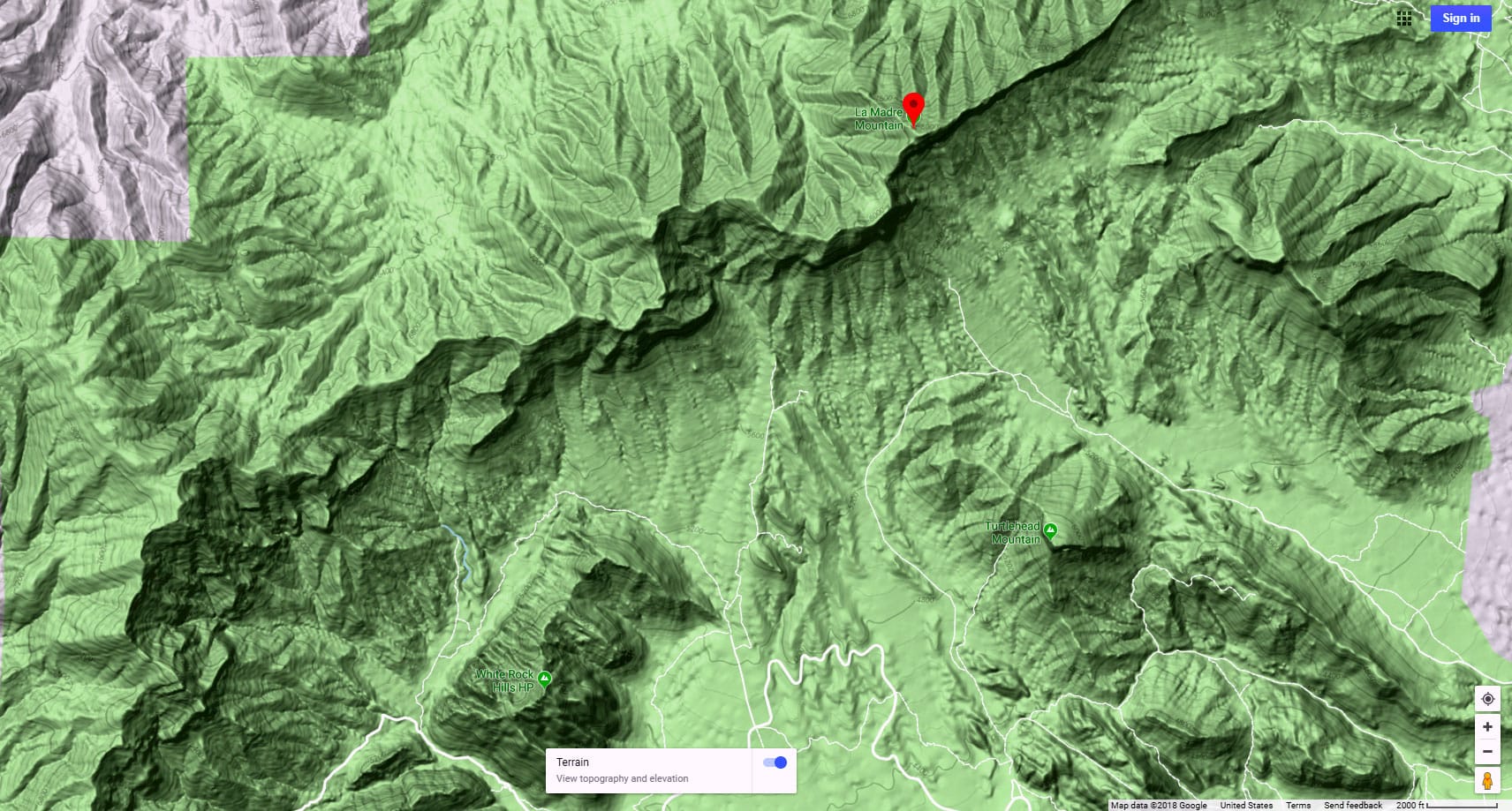
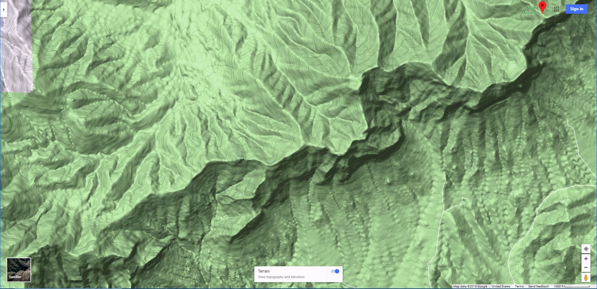
Harris Springs Canyon Ridgeline forms a border to the Northwestern edge of metropolitan Las Vegas. It stretches from just West of the upper end of Lone Mountain Road to the edge of Kyle Canyon Road. In terms of its wilderness location, this massive ridgeline with its 6080ft summit is located at the very Northeastern edge of the La Madre Mountains Wilderness. Yes, it’s massive! The trail circling the base of the ridgeline is about 30 miles in length!

In terms of its basic configuration, the Eastern side of the ridgeline is vertical with cliffs towering over 1,500ft in height. The Western side of the ridgeline is a gradual slope that can be summited at a walk. There are some cracks and gullies on the Western slopes lined with vertical limestone cliffs. The Northern and Southern ends of the ridgeline offer some gradual ascent points. The highest points exceeding 6,000ft are on the Southern end of the ridgeline.

No Official Name for the Ridgeline

I consulted a number of maps and found no official name for this incredible ridgeline feature. It seems to have been overlooked! The 6,080ft summit is listed on some maps as “Peak 6080”, but that doesn’t really name the long ridgeline which, itself holds a summit elevation above 5,000ft for a distance of nearly 3 miles. This means the long summit ridgeline ranges from 2,500 to 3,500ft higher than the 2,500ft metropolitan area below. Harris Springs Canyon borders the Northwestern end of the ridgeline, thus the name I’m giving for the sake of reference: Harris Springs Canyon Ridgeline. 

Setting for Daily Conditioning Workouts

Harris Springs Canyon Ridgeline fulfills many of the requirements of an excellent setting for daily conditioning workout setting:

  1. Convenient: The trailhead parking area on Kyle Canyon Road is located only 10 minutes from the edge of the Las Vegas metropolitan area.
  2. Meets the Following Physical Conditioning Requirements:
    1. Strength Building: Gradual slopes with a 2,000ft elevation gain.
    2. Endurance: 30-mile baseline trail. In addition, the trailhead parking area offers access to a vast network of trails and roads that run throughout the La Madre Mountains Wilderness.
    3. Agility: Navigating the limestone surface on the slopes.
    4. Flexibility and Coordination: Though you can easily get to the summit at a walk (all under a class 3 rock scrambling level, no hands needed), there are cliffs, ledges and other rocky features excellent for bouldering and rock climbing.
  3. Inspiring Setting: There are non-stop expansive views in this terrain that has the feel of a remote wilderness, hundreds of miles from civilization.

Spectacular Views from Harris Springs Canyon Ridgeline

Here of just a few of the surrounding views that will astonish:

Best Time of Year to Visit Harris Springs Canyon Ridgeline

Stick to Fall through Spring months. Mid-day Summer temperatures can exceed 110 degrees. However, a brief visit during Summer morning or evening hours could work.

Trailhead Directions | Harris Springs Canyon Ridgeline | La Madre Mountains Wilderness, Nevada

Take Hwy 95 North from Las Vegas. Exit left onto Kyle Canyon Road toward Mt. Charleston (around the end of the Northern metro area). In about 3 miles, shortly beyond the edge of the housing and horse ranch area, watch for a small trailhead parking area on the left (South) side of Kyle Canyon Road. This is your access to the Harris Springs Canyon Ridgeline and its network of trails.   

Narrative Guide | Harris Springs Canyon Ridgeline | La Madre Mountains Wilderness, Nevada

There are many class 1 and 2 walking adventure routes up the Western slopes and along the summit ridgeline. You could create quite a few large loop adventures for variety and spice it up with rock climbing in the approach gullies. For this adventure I made a fairly straight-line course from the trailhead to the ridgeline summit.

Getting Your Bearings

From the trailhead parking area you can see the highest summit points on the Harris Springs Canyon Ridgeline. They’re on the upper right (South) edge. In addition, you can see much of the intervening route all the way to the summit point. It’s a fairly straight line. This means that from the summit, you will be able to see most of your return route all the way back to the trailhead. There’s one big exception to route visibility: At sunrise, as the sun it just topping the ridgeline, it can partially blind you from making out the details of the terrain features (see the video). Still, I was able to navigate the approach slopes all the way to the summit for the first time though the rising sun was directly in my line of vision.

Trailhead to Base of the Western Slopes

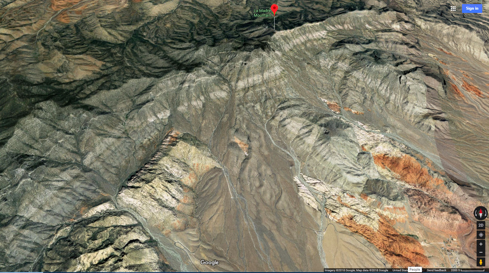
You’ll find trails to aid your progress to the base of the Western slopes. From the trailhead, begin on the trail that leads toward the summit points you identified. The trail will quickly take you to the edge of a huge canyon wash with high walls. This is Harris Springs Canyon and it runs from up in the Mt. Charleston Wilderness all the way down past the Northern edge of Harris Springs Canyon Ridgeline, finally emptying into the Las Vegas Valley. See one of my adventures and videos in upper Harris Springs Canyon and through a slot canyon area.

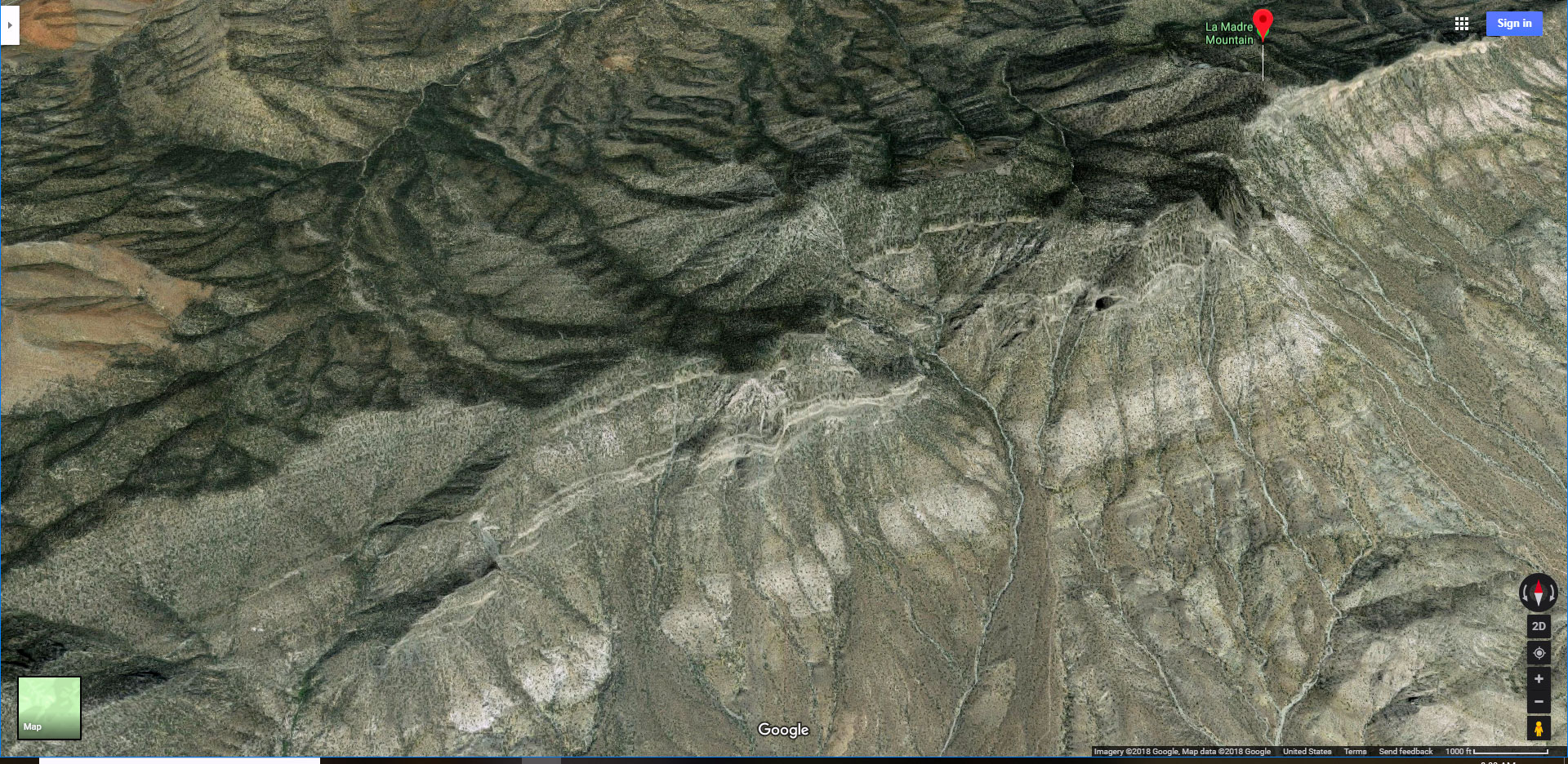
Fortunately, the trail you are on will angle to the left and eventually take you easily down into the base of the wash. Additional trails will take you over the opposite side of the canyon continuing roughly along a line toward the ridgeline summit. After ascending the opposite side of Harris Springs Canyon you’ll descend into another large wash (with more gradual sides) that originates in the La Madre Mountains, runs along the base of Harris Springs Canyon Ridgeline and joins Harris Springs Canyon Wash before emptying into the Las Vegas Valley. 

This second canyon wash along the Western base of the ridgeline is actually an incredibly beautiful valley populated by a Joshua Tree and Yucca Plant forest. Looking toward the La Madre Mountains, the wash paints a spectacular scene! Looking down the wash, the Sheep Range and Gass Peak are beautifully framed in the Desert National Wildlife Refuge beyond.

Ascending the Western Slopes: Two False Summits!

Still heading in a fairly straight line toward the ridgeline summit point, I took a route that ran just above the Northern (left) edge of a large narrow crack. Once on the slopes, the summit is no longer visible. Just ascend along the upper left side of the crack. There are at least two major false summits along the way. That first rocky height you see above may look like the summit. It’s only about a third of the way up! When you reach that height, angle a little over to the left to continue upward on an adjacent gradual slope toward the next high point, a smooth ridgeline on the horizon. I thought this was the summit ridge, but it was a second false summit!

Ascent Toward the True Summit

Once on the second false summit, the true ridgeline summit line becomes visible. Along the summit line you’ll see a series of small rounded hills with shallow saddles between. The gentle slope of that second false summit angles around a bit to the right, gently taking you to the true summit line. You’ll arrive one high point North (to the left) of the summit. That high point is marked by a lone pinyon pine tree, the only pine I saw on the ridgeline this day.

As you top that high point the expansive view ahead is astonishing! Almost immediately below (nearly 4000ft below!), spreading out before you is the Las Vegas Valley and metro area. You may feel as if you’re in an airplane, but with a better view, not limited by small windows. To the North are the Sheep Range and Gass Peak. To the East beyond the Las Vegas Valley are the Muddy Mountains, Sunrise Mountain and Frenchman Mountain. To the South and West is the La Madre Mountain Ridgeline angling over to the Mt. Charleston Wilderness behind to the West. Below are Summerlin Ridge, Cheyenne Mountain and Lone Mountain. Quite the surprising view!   

Arrival on the True Summit

To your right, that next high point, more rocky, is the true summit with the “summit jar” to sign in. Between you and the true summit is a shallow saddle. Enjoy traversing the saddle and experiencing the expansive surrounding view the entire way. As I mentioned earlier, there are many alternate descent points along the Western slopes of Harris Springs Canyon Ridgeline. Knock yourself out! 

Return to the Trailhead

For this initial adventure, constrained by time limitations, I retraced my way back across the saddle to that initial high point, then down toward the trailhead, visible from both high summit points and the saddle between. From there, descend to the second false summit and watch for the long narrow crack you used to guide yourself up the slope. This time you’re keeping to the upper right side of the crack, but you can also see the trailhead below. Just let the crack and the direction of the trailhead guide you all the way back to the base of the ridgeline. From above, while descending, you can see a pathway across the canyon at the base of the ridgeline continuing your route back to the trailhead. This path will lead you to the deep Harris Springs Canyon. Across that canyon you can see the point of your original descent into the canyon from the trailhead. Cross the canyon, ascend the road and return to the trailhead.

Timing of This Adventure

I took a lot of time exploring, so it took me about 4 hours from the trailhead to the summit. The return took under 2 hours. With practice it should be possible to walk the entire route out and back in under 3 hours. You might walk/run the entire out and back route in under 2 hours. What a workout and a wilderness adventure!

Summary
Harris Springs Canyon Ridgeline | La Madre Mountains Wilderness, Nevada
Article Name
Harris Springs Canyon Ridgeline | La Madre Mountains Wilderness, Nevada
Description
Harris Springs Canyon Ridgeline is right on the edge of the Las Vegas Metro Area making this an awesome convenient location for hiking, mountain biking, climbing and wilderness exploration. It's like a remote wilderness experience at the edge of Las Vegas, and the views are spectacular!
Author
Publisher Name
LasVegasAreaTrails.com
Publisher Logo
Translate »