Cow Camp Road | Sheep Range | Desert National Wildlife Refuge, Nevada
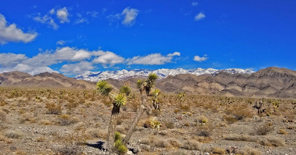
Cow Camp Road is a branch off of Alamo Road (at the 12-mile point) in the Desert National Wildlife Refuge in Southern Nevada. On the Northern tip of the Sheep Range the 5.7-mile long Cow Camp Road provides a great approach to the Sheep Peak trailhead, Sheep Peak being the 2nd highest point in the Sheep Range at 9750ft. The trailhead elevation is about 5,750ft. In addition there are camping areas in and beyond the canyon pass on Cow Camp Road and beautiful views of the Northern area of the Sheep Range. I took the trip up Alamo Road on a mountain bike, then ascended Cow Camp Road on foot so there are ample 360-degree video views along the way. Route details: 28 Miles RT from DNWR HQ – 4WD Roads Click image or title above for more…
Lower Mormon Well Road, Sheep Range, Nevada
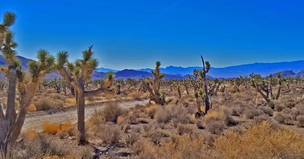
Travel the lower 15-mile stretch of Mormon Well Road from the Desert National Wildlife Refuge headquarters on Corn Creek Road to the intersection of Mormon Well Road and Pine Nut Road by mountain bike. Points of interest are the intersection of Gass Peak Road at the 4-mile point; Yucca Gap between the Southern tip of the Sheep Range and Fossil Ridge at the 5-mile point; and the incredibly massive Yucca Tree Forest spanning the entire Sheep Range valley beyond Yucca Gap. Route details: 30 Miles RT; **4WD Road** Click image or title above for more…
Lower Alamo Road | Sheep Range | Desert National Wildlife Refuge, Nevada
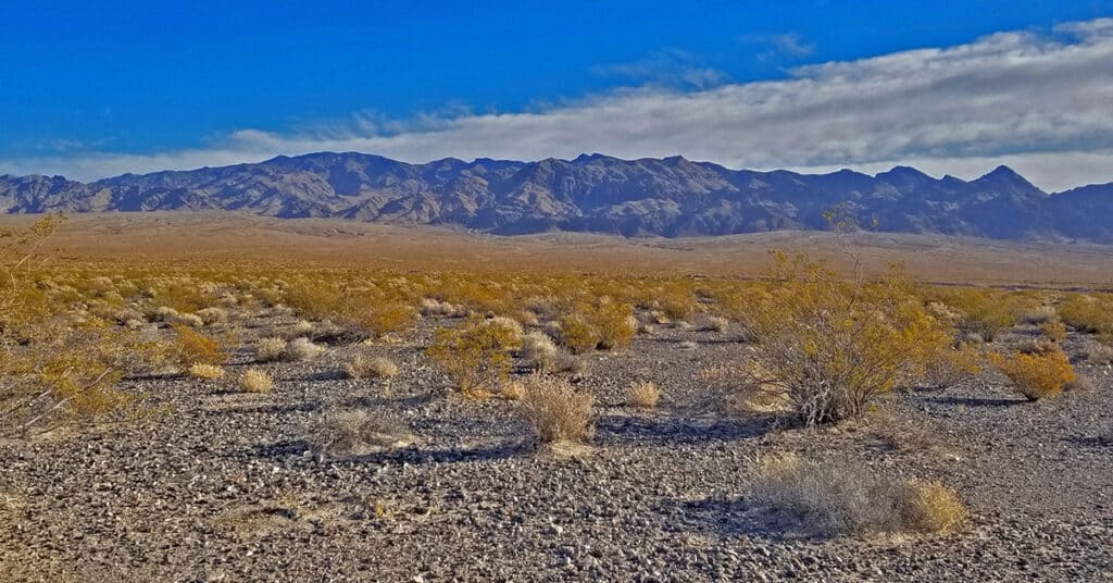
Travel from the Desert National Wildlife Refuge headquarters to the intersection of Alamo Road and Cow Camp Road. This 12-mile stretch skirts the entire West side of the Sheep Range from South to North, and then begins to circle around the Northern tip of the Sheep Range to access trailheads to Sheep Peak and Hayford Peak. The stretch along lower Alamo Road offers awesome views of the entire West and Northwest side of the Sheep Range, Gass Peak, the La Madre Mountains Wilderness and the Mt. Charleston Wilderness including especially Mummy Mountain, Fletcher Peak and Griffith Peak. Otherwise, it’s a pretty barren, windswept stretch of desert. The unpaved 4WD road is pretty firm for a mountain bike but does have a few stretches of deeper gravel and many washboard sections which can scramble the brain on the downhill return! Route details: 24 Miles RT – **4WD Road**. Click image or title above for more…
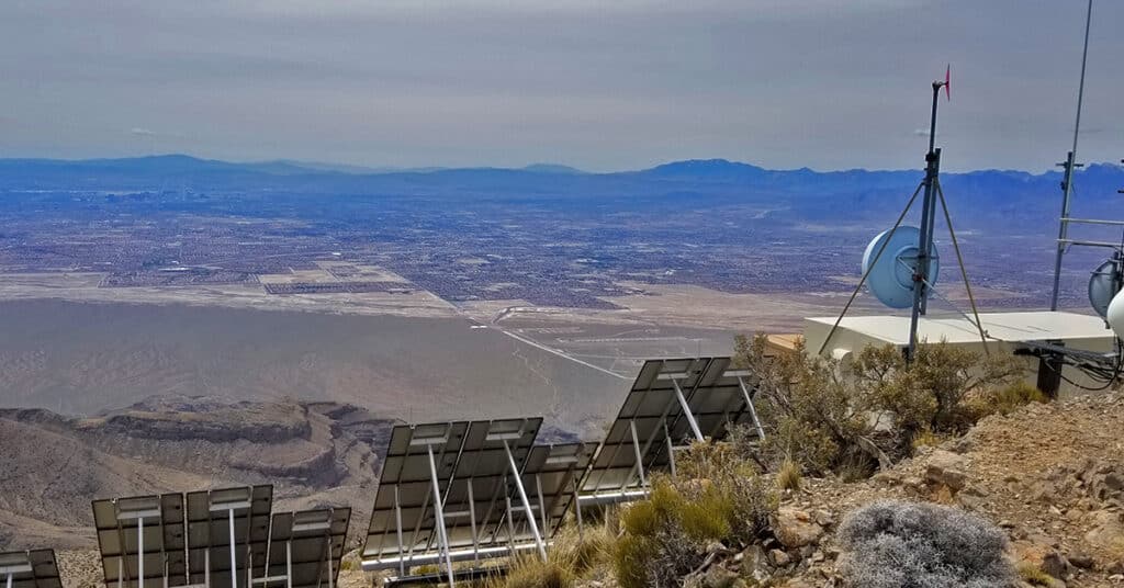
Gass Peak | Mid-Summit Ridge | Las Vegas, Nevada
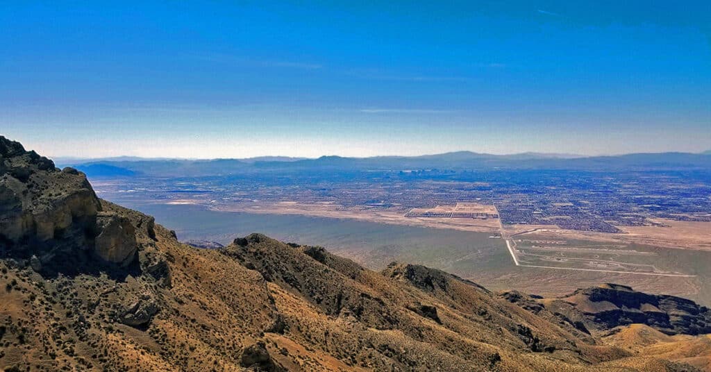
Gass Peak by the route I take beginning at the North end of Rainbow Avenue in Las Vegas is an ultra-marathon of about 30 miles with a 5000ft elevation gain. To stand on any of the 3 Gass Peak summits is like looking straight down into Las Vegas from an airplane! I’ve separated the Gass Peak pages into 2 pages. This page is for all those attempts that end shy of the true summit. The first video on this page shows the best route to the mid-summit, which served as a base adventure from which to later reach the true Eastern summit. Some of the videos eon this page actually show parts of this and other trips on even clearer days including lower canyons and ridges on the West side and a trip to the Western summit. Route description: 15 mi RT from Rainbow Ave / Approx. 2,300 > 6,000ft; **Mostly Wilderness** Click image or title above for more…
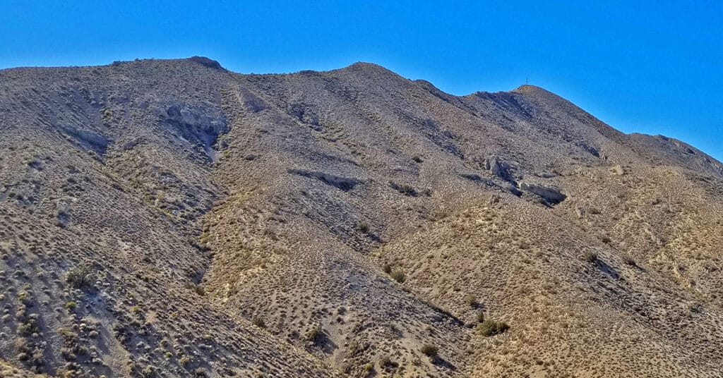
Gass Peak Road Circuit | Desert National Wildlife Refuge, Nevada

It’s possible to completely circle Gass Peak via the unpaved road system accessed from the Desert National Wildlife Refuge headquarters. However, as you will see below, some of the roads will require 4WD, a dirt bike or mountain bike. It’s a huge adventure well worth the effort. The 7,000ft Gass Peak mountain complex is immense, nearly a mountain range in its own right. It’s a well-defined landmark from nearly everywhere in the Las Vegas Valley. The complete circuit adventure gives you an excellent experience of the terrain North of Las Vegas. Route Details: 35 mi Mountain Bike; **Unpaved Roads** Click image or title above for more…
Gass Peak Nevada Eastern Summit Ultra Marathon | Desert National Wildlife Refuge, Nevada
Gass Peak, Nevada Eastern summit at 6943ft is the true summit of Gass Peak. The Eastern summit is about 1000ft higher than the other two summit areas, however each has a unique view, and the most challenging part of the adventure is navigating what I call the “Gass Peak Gauntlet”–the route between the mid-summit and the Eastern summit. The route I take begins at the North end of Rainbow Blvd. in Las Vegas and turns this adventure into a 30-mile ultra-marathon with a 5000ft elevation gain and, if the additional elevation gain and loss on the return trip is taken into account an overall 6000ft elevation gain. To put this into perspective, I can do the 18-mile Mt. Charleston loop in 7.5 hours. On this day it took 13.5 hours to complete the Gass Peak Ultra! Route details: 20 mi RT from Rainbow Ave / Approx. 2,300 > 7,000ft; **Mostly Wilderness** Click image or title above for more…
Gass Peak Grand Crossing | Desert National Wildlife Refuge | North of Las Vegas, Nevada
The Gass Peak Grand Crossing is a 30-40-mile ultra marathon distance on foot on a few roads, but mostly across desert wilderness canyons, ridges and avalanche slopes from the Desert National Wildlife Refuge visitor center off Hwy 95 Corn Creek Rd exit to the North end of Rainbow Avenue in Las Vegas. 6,937ft Gass Peak is the 5000ft elevation gain midway. The route begins at the Desert National Wildlife Refuge headquarters North of Las Vegas Nevada, heads up Mormon Well Road, turns onto Gass Peak Road, ascends the main Gass Peak trail off Gass Peak Road to the true, Eastern summit of Gass Peak, traverses the steep avalanche slope summit ridge of Gass Peak via what I refer to as “The Gass Peak Gauntlet” to the Gass Peak Mid Summit ridge, descends the mid summit ridge to a 4WD road on the lower Northern slopes of Gass Peak, circles around the West side of Gass Peak on that road and finally, navigates the desert to a conclusion at the very North end of Rainbow Avenue in Centennial Hills Las Vegas! Route details: 30-40 Miles, 5000ft Elevation Gain **Few roads and trails, mostly wilderness** Click image or title above for more…
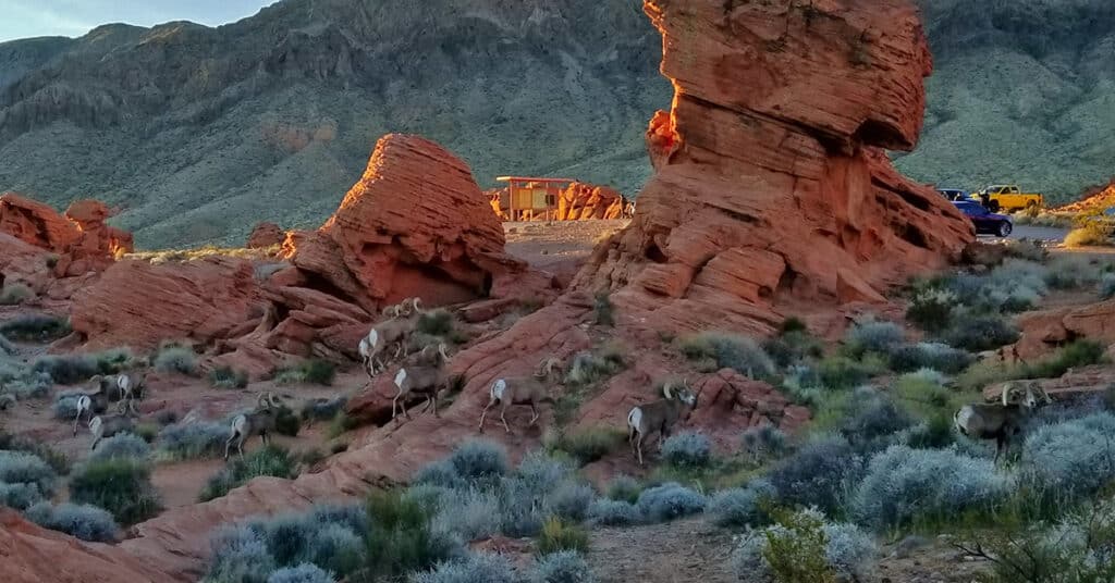
Valley of Fire State Park Panorama Video, Nevada
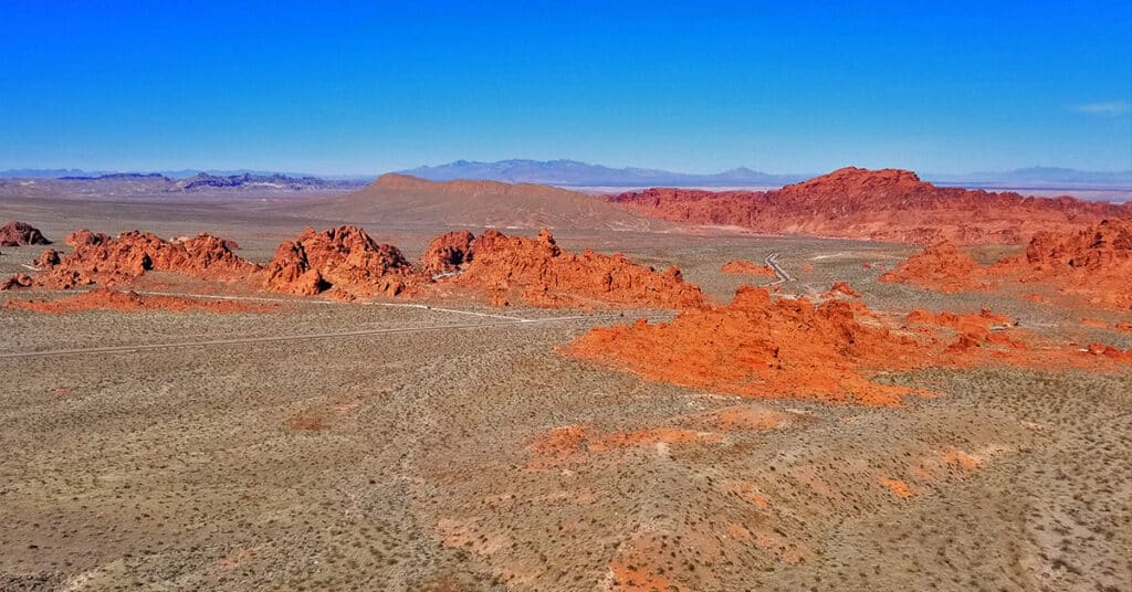
The Muddy Mountains ridgeline on the Southern Boundary of Valley of Fire State Park in Nevada was the perfect aerial vantage point from which to film this panorama video taking in most of the park. Click image or title above for more…
Valley of Fire State Park Nevada 30 Waypoints
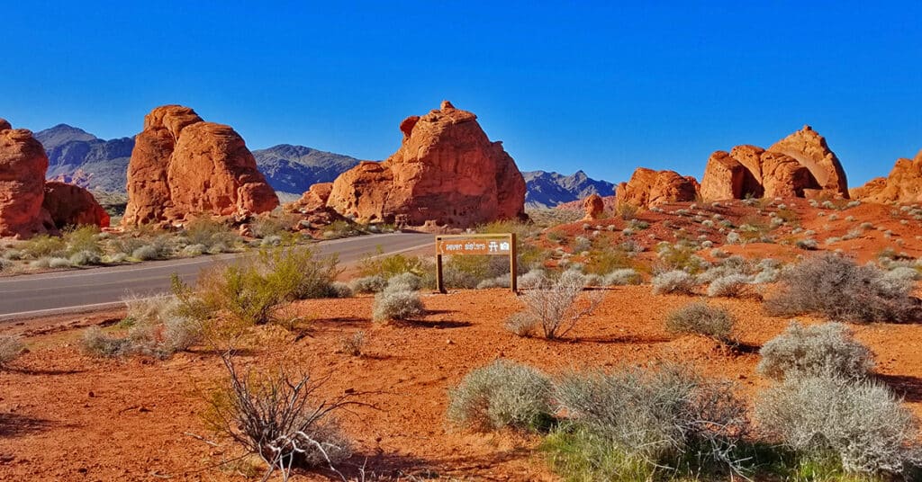
Here is a quick list of 30 waypoints in Valley of Fire State Park, Nevada. Each waypoint is on one of the scenic drives in the park. Use this list for:
*A drive-through overview of Valley of Fire State Park before exploring more deeply.
*A guide for your deeper exploration waypoint by waypoint
*A review of your exploration of Valley of Fire State Park
*A quick reference to the trails and waypoints in Valley of Fire State Park
Click image or title above for more…
Valley of Fire Park Exploration – 6 Day Strategy, Nevada
set out to systematically explore Valley of Fire State Park in Nevada in 5 or 6 days, given 6 1/2 hours per day (about 6:30am – 1:00pm). Feel free to follow my strategy or mix it up and either accelerate your own discovery to 2 or 3 days or pace it out over 2 weeks or more. My adventures occurred during January and early February. Here’s how my exploration went… Click image or title above for more…