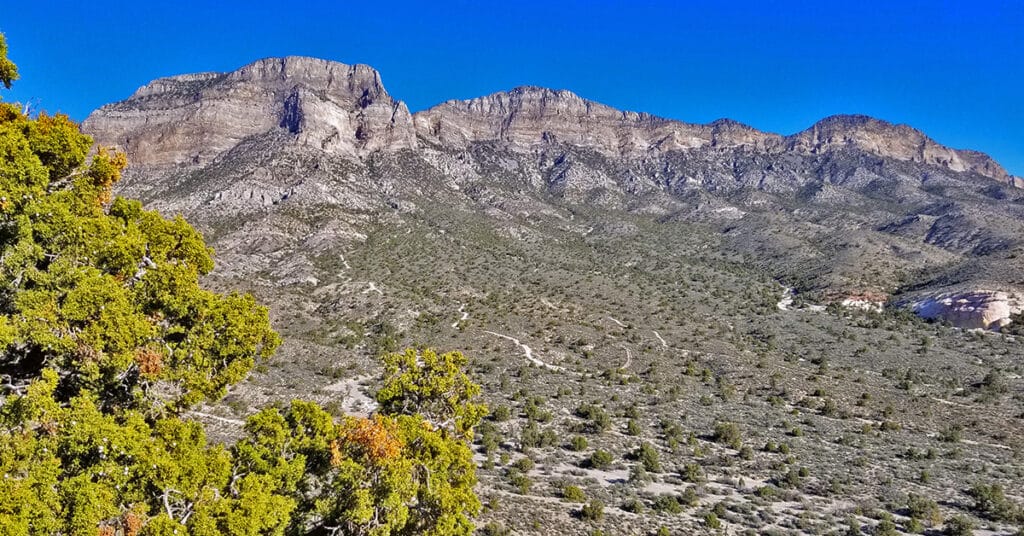
Windy Peak | Rainbow Mountain Wilderness, Nevada
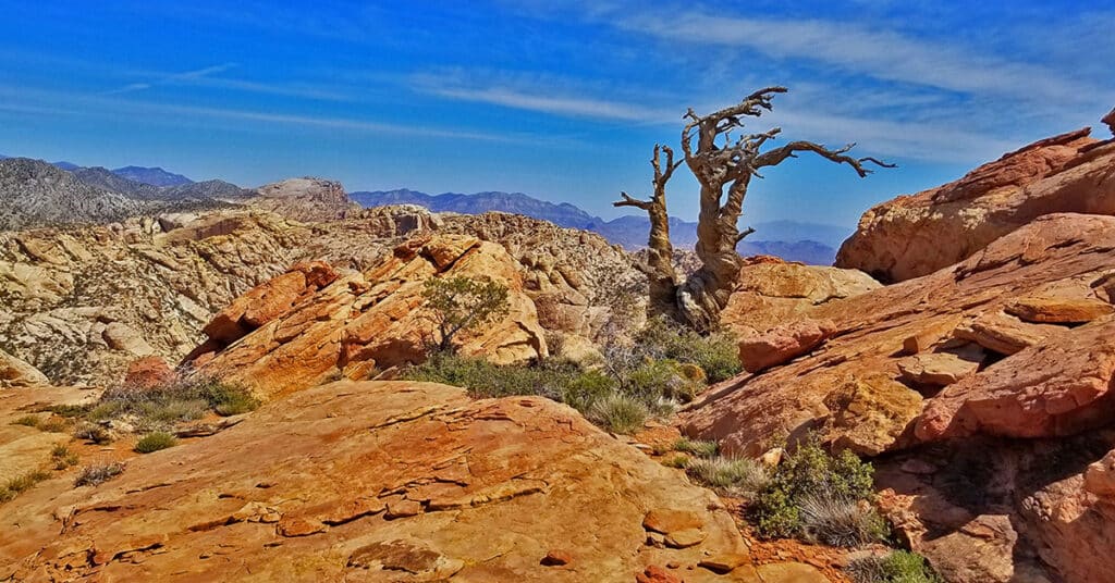
Windy Peak in Nevada is the third peak from the South end of the Rainbow Mountain Wilderness and a good jumping off point to explore the Wilson Ridge which borders Red Rock Canyon NCA to the East and Lovell Canyon to the West. It’s one of the Rainbow Mountains beautiful Jurassic Era Aztec red rock frozen sand dunes similar to the famous formations in Red Rock Canyon National Conservation Area. To stand in that place is to be surrounded by the artistic beauty of red and white rock with occasional bonsai-like pine trees. Route details: 5.2 mi RT/ 5,470ft > 6,238ft; **Mostly Good Trails, Some Class 3 Climbing** Click image or title above for more…
Griffith Crater? Exploration of a Potential Meteor Crater Below Griffith Peak, Nevada
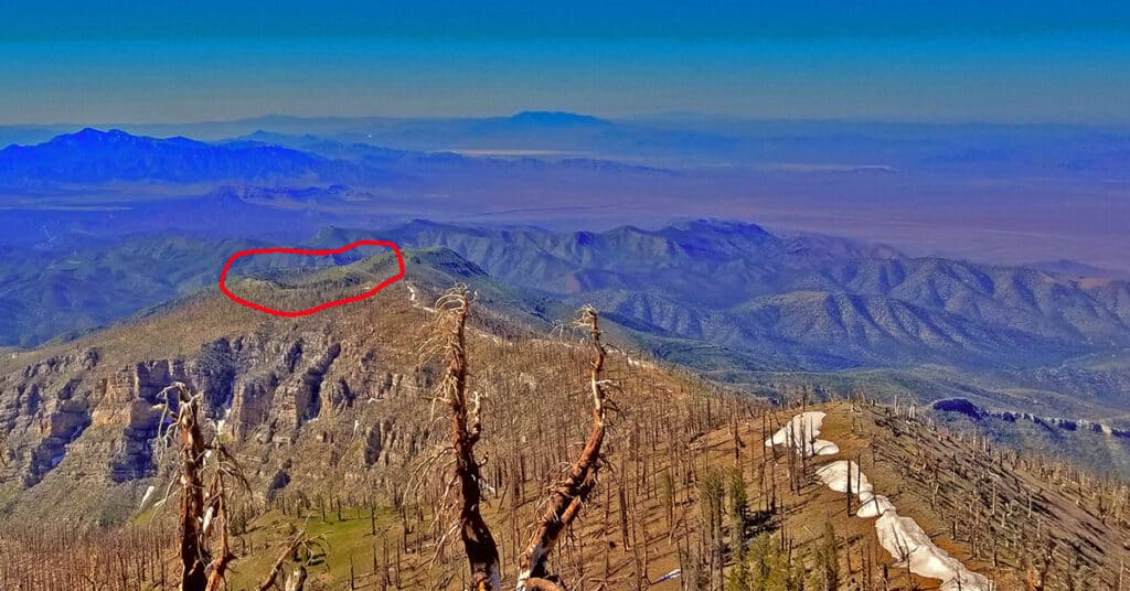
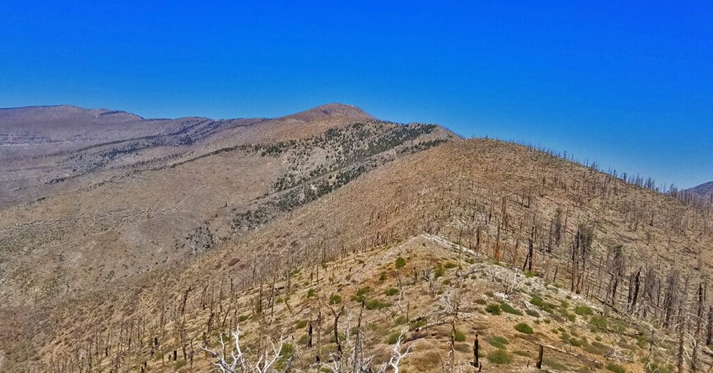
While going over images I’d previously taken from the summit of Griffith Peak and refining the images using Photoshop, I noticed a curious formation on Sexton Ridge about a mile below Griffith Peak. There appeared to be a perfect meteor crater. From the image, the dimensions of the crater would be a near perfect circular shape, about 600ft in circumference, and about 75-150ft deep. Sexton Ridge is the ridge system that borders the West side of Lovell Canyon spanning the approximate 10-mile distance from the 11,060ft Griffith Peak to the Lovell Canyon Trailhead at about 5,500ft. Route Details: About 16 miles RT; *Some Trail, Mostly Wilderness* Click image or title above for more…
Sexton Ridge Descent from Griffith Peak | Mt Charleston Wilderness | Spring Mountains, Nevada
Sexton Ridge is rarely if ever traveled by humans in part due to the difficulty getting there. The route taken today from Griffith Peak Summit involves ascending Griffith Peak twice, beginning at the Charleston South Climb Trailhead at Cathedral Rock, ascending about 3,500ft to the 11,060ft summit of Griffith Peak, descending Sexton Ridge on the far side of Griffith Peak (I descended about 1,800ft today), then re-ascending back to the summit of Griffith Peak before heading back down to the South Climb Trailhead. Psychologically, it’s difficult to gear yourself up to ascend Griffith Peak twice!
Griffith Peak Southern Approach from Sexton Ridge Above Lovell Canyon, Nevada
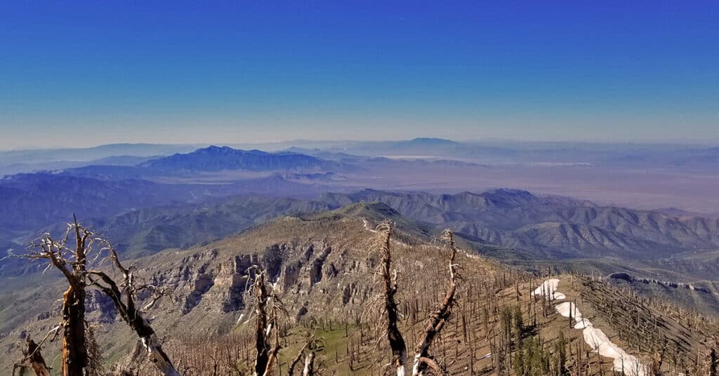
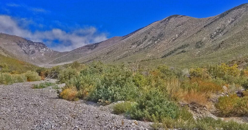
Sexton Ridge is a 5-7 mile ridge South of Griffith Peak beginning at about 8,400ft and leading to the 11,060ft summit of Griffith Peak. However, it requires an additional 2,500ft ascent to get to the beginning of Sexton Ridge! The entire ridge including its access point from the summit of the Griffith Shadow Loop in Lovell Canyon is pure wilderness with some major brush navigation at points. Otherwise, this is a class 2 level climbing/scrambling experience. The views along the entire route are spectacular including Lovell Canyon, Griffith Peak, Harris Mountain and the saddle between, Potosi Mountain, Gass Peak, the Sheep Range, Las Vegas Valley and beyond, the Nopah Range, Telescope Peak, Mummy Mountain, Fletcher Peak, Lee Peak, Charleston Peak and too many more incredible points of reference to mention here! This could be a grand 2-day adventure with incredible nighttime views. Route details: 25 mi / 5000-11,060ft; *Some Trail, Mostly Wilderness* Click image or title above for more…
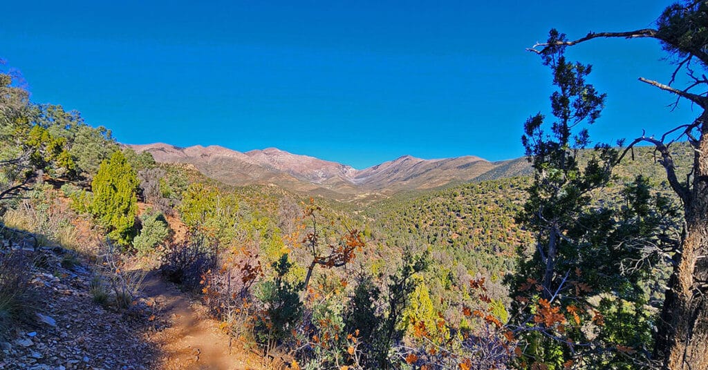
Griffith Peak South Approach from Lovell Canyon | Spring Mountains, Nevada
Overview at least 3 approaches to Griffith Peak summit from the Lovell Canyon Trail Trailhead. This approach to the summit will be longer than the traditional Kyle Canyon approach, with 2000ft more elevation gain, but the view is wide open all the way to Griffith Peak summit and the terrain snow-free for an additional month both earlier and later in the season! With this approach route you could be the first and last person to summit Griffith Peak this year. Click image or title above for more…
Harris Mountain from Lovell Canyon | La Madre Mountains Wilderness | Spring Mountains, Nevada
Harris Mountain from Lovell Canyon is a challenging long distance adventure with an elevation gain of over 4,000ft. However, the elevation gain and the distance are not the main challenge. The greatest difficulty factor is the terrain covered which includes a 5-mile rocky canyon wash, navigating brush and burned out fallen trees and at least 2 miles of steep avalanche slopes – all with no trails.
However, even given these difficulties the rewards are great including:
*A unique high altitude perspective of Lovell Canyon from its East side
*Total peace and solitude – the experience of having a major canyon all to yourself
*Views of the entire expanse of Lovell Canyon all the way to Potosi Mountain, Griffith Peak, Sexton Ridge and the Lovell Canyon, Handy Peak, Griffith Shadow Loop trails area.
Lovell Canyon Trail & Loop | Lovell Canyon, Nevada
Lovell Canyon trail quickly ascends and then follows a ridge on the Western side of Lovell Canyon with many grand views up the canyon to Griffith Peak and Harris Mountain. The canyon is beautiful, fairly untouched and features spectacular views of Griffith Peak, Harris Mountain and their long descent ridges on either side of Lovell Canyon. Lovell Canyon Trail branches into Lovell Canyon Loop which makes a large circuit around Handy Peak. Lovell Canyon Loop descends into Lovell Canyon’s main wash. In addition it provides access to Schaefer Springs Loop and Griffith Shadow Loop. Route details: About 5.5 Miles RT; **Excellent Trail** Click image or title above for more detail…
La Madre Mountain Eastern Approach from Red Rock Park, Nevada

The Eastern approach route will begin following the same path as the Southern approach route starting at the Sandstone Quarry parking area (Turtlehead Peak trailhead). From there head up Red Rock Wash and circle around the upper end of the Turtlehead Peak ridge system into Calico Basin, cross the upper Calico Basin, circle around the East end of the Keystone Trust and finally ascend the North side of La Madre Mountain.
It’s important to note that as with the other routes up La Madre Mountain, this route is quite the marathon and the most limiting factor will be enduring the distance and altitude gain. Image: Damsel Peak from La Madre Mt. East approach. Route description: 28 mi / 4306-8000ft; *Wilderness, No Trail* Click image or title above for more…
La Madre Mountain Western Approach from Red Rock Canyon NCA | La Madre Mountains Wilderness, Nevada
This is my favorite approach to La Madre Mountain due to the beauty of the terrain and the scenery. You begin in the scenic Willow Springs area (ample parking available), circle around between the Keystone Thrust Cliffs and White Mountain. Head up through the La Madre Springs area, pass an old Miner’s Cabin, then ascend to the top of the Keystone Thrust (the cliff system at the back of Red Rock Park). At the top take a right and travel along the very top of the Keystone Thrust ridge to La Madre Mountain. Route Details: 28 mi / 4306-8000ft; *Wilderness, No Trail* Click image or title above for more…
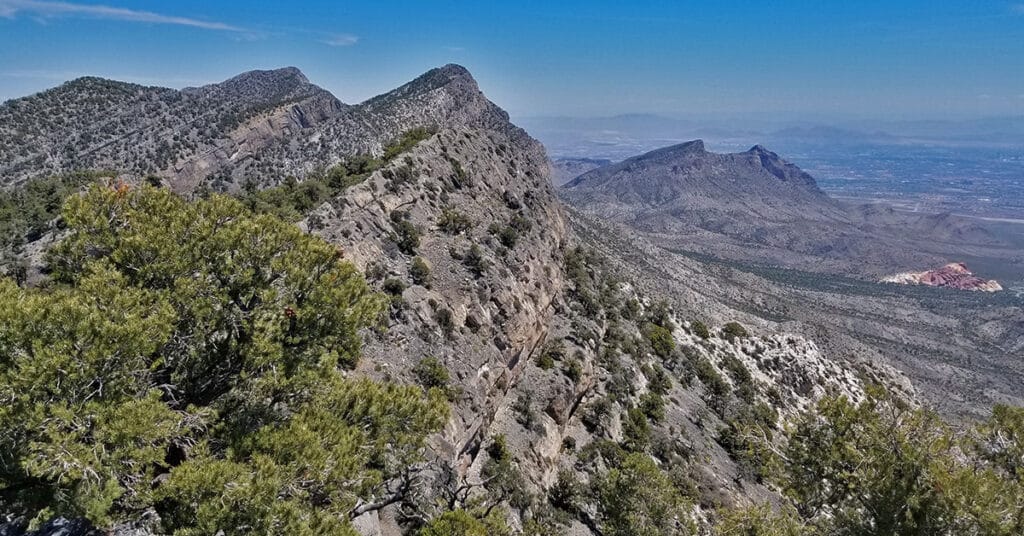
La Madre Mountain Southern Approach from Red Rock Canyon | La Madre Mountains Wilderness, Nevada
La Madre Mountain is 8,154ft in elevation. It is the highest central feature of the Keystone Thrust, the cliff system that spans the rear area of Red Rock Park in Nevada. The La Madre Mountain Southern approach, from a distance, looks impossible as you’re facing a sheer cliff wall between 1000 and 2000 feet high. However, as you approach the base of the cliff from Calico Basin it’s evident that there is a passage between the two peaks. The summit view is amazing featuring Las Vegas Valley with Lake Mead across and to the East, Gass Peak and the Sheep Range to the North, spectacular views of Mt. Charleston Wilderness to the East and the awesome total expanse of Red Rock Canyon National Conservation Area and Calico Basin to the Southwest. Route details: 22 mi / 4306-8000ft; *Wilderness, No Trail* Click image or title above for more…