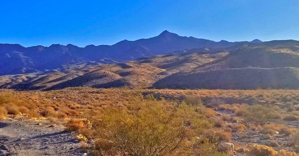
Horse Thief Canyon Loop | Mt. Wilson | Black Mountains | Lake Mead National Recreation Area, Arizona
This adventure has got to win an award for variety of terrain including 6 miles of unpaved roads, traversing a few miles up the entire length of a rugged mountain canyon with beautiful springs, an 800 foot scramble up the avalanche slope side of the canyon, a short class 3 rock climb and a descent down a 2-mile ridge with incredible views of Lake Mead, Potosi Mountain, the Rainbow Mountains, La Madre Mountains Wilderness, Mt Charleston Wilderness, Gass Peak, the Sheep Range, Frenchman Mountain, Fortification Hill, the Hoover Dam area, and additional points to the South and to the East. Route Details: 16mi | 1,536 > 5,446ft; ** Some Road, Mostly Wilderness** Click image or title above for more…
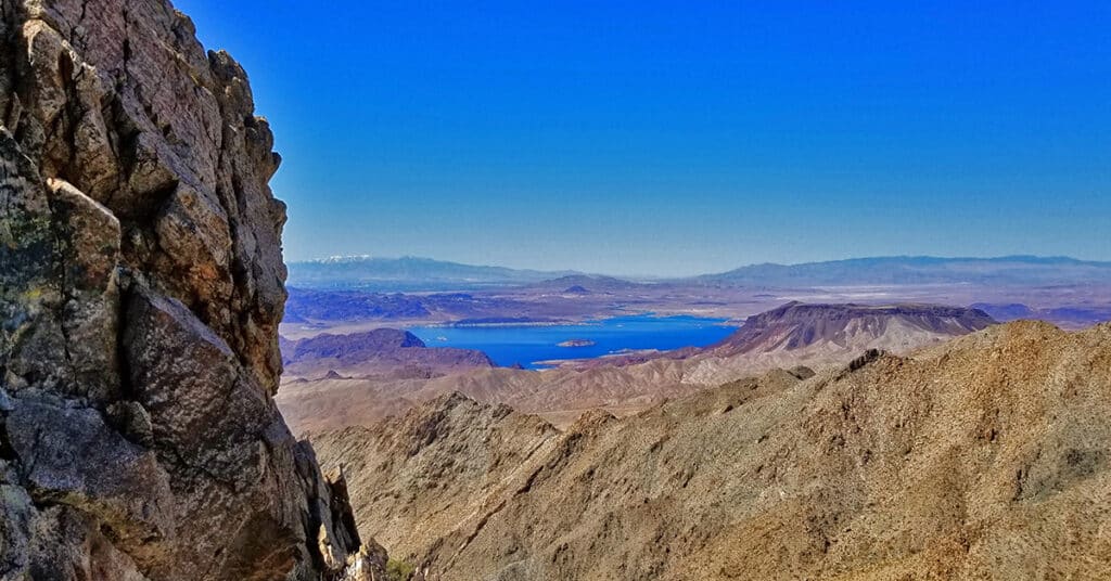
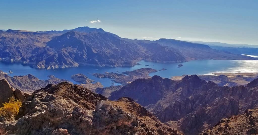
Mt. Wilson | Black Mountains, Arizona | Adjacent to Lake Mead National Recreation Area
Mt. Wilson is a distinctive high point in the Black Mountains and offers incredible 360 degree views of the surrounding wilderness including Lake Mead, Potosi Mountain, the Rainbow Mountains, La Madre Mountains Wilderness, Mt Charleston Wilderness, Gass Peak, the Sheep Range, Frenchman Mountain, Fortification Hill, the Hoover Dam area and points further East. The adventure begins at the Arizona Hot Springs trailhead on Arizona Highway 93, 4 miles South of the Nevada/Arizona border. Route details: 16mi RT | 1,536 > 5,446ft; **Some Road, Mostly Wilderness; Click image or title above for more…
Kingman Wash Access Road | Lake Mead National Recreation Area, Arizona
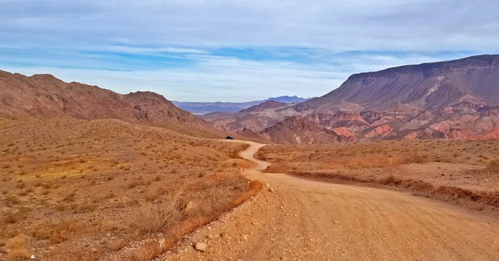
This section of Kingman Wash Access Road is about 4 miles in length. It’s an unpaved road that leads down to the shore of Lake Mead at Temple Bar Marina where there is boating, fishing and hiking. I traveled it by mountain bike. There are 3 additional unpaved roads splitting off to the right. The first is South Mine Access Road; second is North Mine Access Road which later connects with South Mine Access Road and continues on as South Mine Access Road. The third road splitting off from Kingman Wash Road near its end and to the right of a restroom structure is the unpaved Fortification Hill Road which leads to Fortification Hill Trailhead. Route Details: 7 Miles | 1,197 > 1,465; ** Good Unpaved Road** Click image or title above for more…
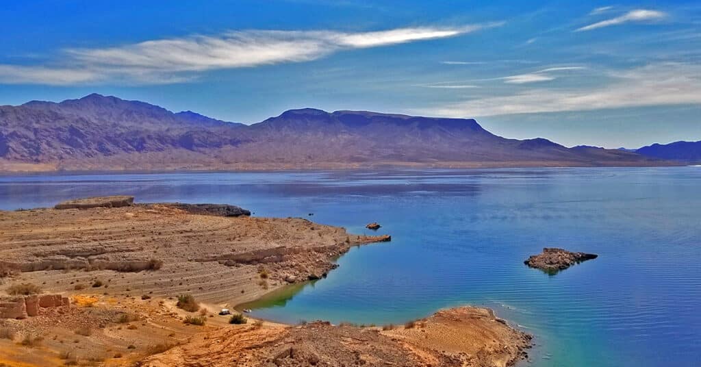
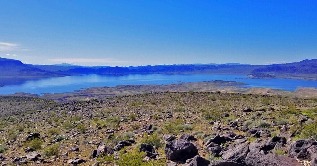
Hamblin Mountain, Lake Mead National Recreation Area, Nevada
Though Hamblin Mountain in the Lake Mead National Recreation Area of Nevada is only 3312ft in elevation, it is positioned in a location that provides an incredible view hard to match anywhere else in Southern Nevada. This is in part due to it having 849ft prominence and being the highest point within 2.72 miles. The summit affords one of the best views of Lake Mead down to the Hoover Dam area and up towards the Overton arm. Route Details: 7mi | 1,965 > 3,291ft; **Some Trail, Some Wilderness** Click image or title above for more…
Fortification Hill | Lake Mead National Recreation Area | Arizona
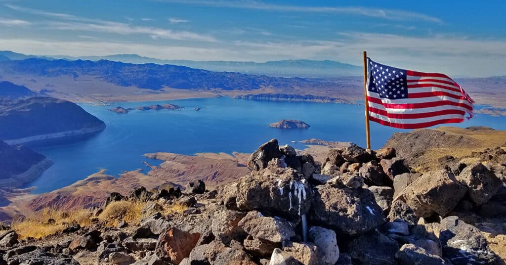
Fortification Hill on the Arizona side of Lake Mead, like Black Mesa across Lake Mead on the Nevada side has the most incredible view of Lake Mead to be found anywhere. From the flag-topped summit you can see the full panorama of Lake Mead minus the Overton Arm stretching below, the Mt. Charleston Wilderness including Griffith Peak, Charleston Peak, Fletcher Peak and Mummy Mountain, the Rainbow Mountains on the West side of Red Rock Canyon National Conservation Area, Potosi Mountain, Hoover Dam, Mt. Wilson, the Muddy Mountains and many other features in Nevada and Arizona. However, getting there involves 4WD roads. Route details: 4mi | 2,313 > 3,717ft; **Mostly Trail – Sometimes Faint** Click image or title above for more…
Northshore Road | Lake Mead National Recreation Area, Nevada
Though Lake Mead National Recreation Area includes a few commercial developments, it is largely an untouched wilderness rivaling places like the Mt. Charleston Wilderness, the La Madre Mountains Wilderness and the Sheep Range. Here’s a quick tour of Northern Lake Mead NRA. Our overview adventure begins at the East entrance to Valley of Fire State Park. We note landmarks by the mile markers on Northshore Road which begins at mile 45.1 and ends towards Hoover Dam at mile 0. Route details: 45.1-mile tour of Northshore Road and various waypoints. Click image or title above for more…
Callville Summit Trail, Lake Mead National Recreation Area, Nevada
Callville Summit Trail is a great way to experience the area around the Lake Mead shoreline in a brief 1-2-mile excursion. You’ll get an idea of hiking conditions in desert terrain without committing yourself to a more extensive remote adventure. Hiking conditions include navigating loose rock, sudden drop-offs, high desert heat and other conditions unique to low desert adventures in the Southwestern U.S. Route description: 2-3mi | 1,229 > 1,500ft; ** Rabbit Trails – Take Your Pick** Click image or title above for more…
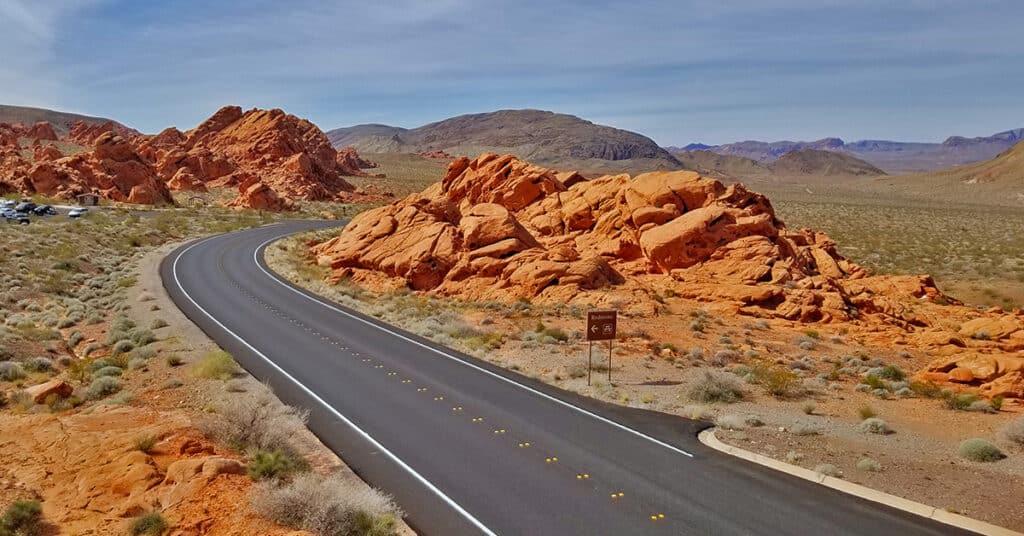
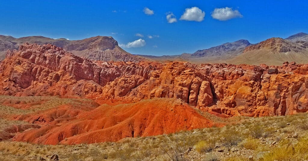
Southern Bowl of Fire | Lake Mead National Recreation Area, Nevada
You can stand in the midst of the Bowl of Fire and see the entire Bowl of those beautiful Aztec formations in one of the most incredible 360 degree vistas available anywhere. And then proceed through a gentle valley to the North surrounded on both sides by more formations. Route details: 5-6mi | 1,965 > 1,905ft; ** Some Trail, Some Wilderness** Click image or title above for more…
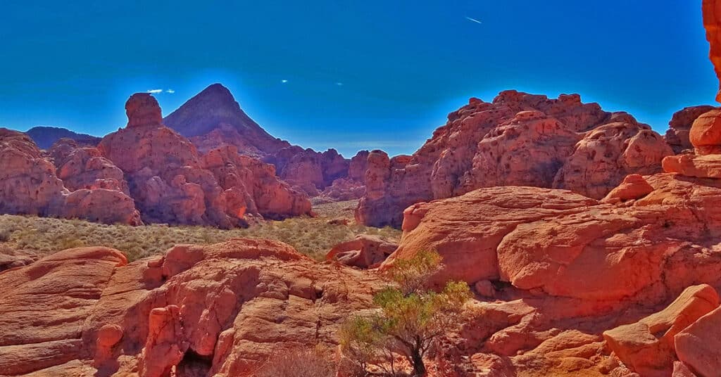
Northern Bowl of Fire | Lake Mead National Recreation Area, Nevada
The Northern Bowl of Fire is a massive Aztec red rock cliff system rivaling any other red rock formation in Nevada. The red rock is composed of frozen sand dunes from the Jurassic era, and the red coloring is caused by iron that leached up through the sand before it solidified into rock. The route I describe here offers spectacular 360 degree views of the Overton Arm of Lake Mead, the Hamblin Mountain area, portions of Lake Mead, the Southern Bowl of Fire, Anniversary Ridge, and the Muddy Mountains. Route details: 8mi RT | 1,887 > 2,568ft; ** Some Trail, Mostly Wilderness** Click image or title above for more…
Black Mesa, Lake Mead National Recreation Area, Nevada
Black Mesa in Lake Mead National Recreation Area has a huge relatively flat summit over a mile in length from North to South. From the Southern Summit one can see one of the best views of Lake Mead to be had from any point in the area (except Fortification Hill). Black Mesa has no real marked and established trailhead. However, the route I took started at a pull-out about mile 10.5 on Northshore Road in Lake Mead National Recreation Area just a few hundred feet before the crossing of the major wash that skirts the West side of Black Mesa. Route details: 4mi | 1,538 > 2,198ft; ** Wilderness, No Trail** Click image or title above for more…