Plan Your Las Vegas Area Wilderness Adventure by Season and Temperature
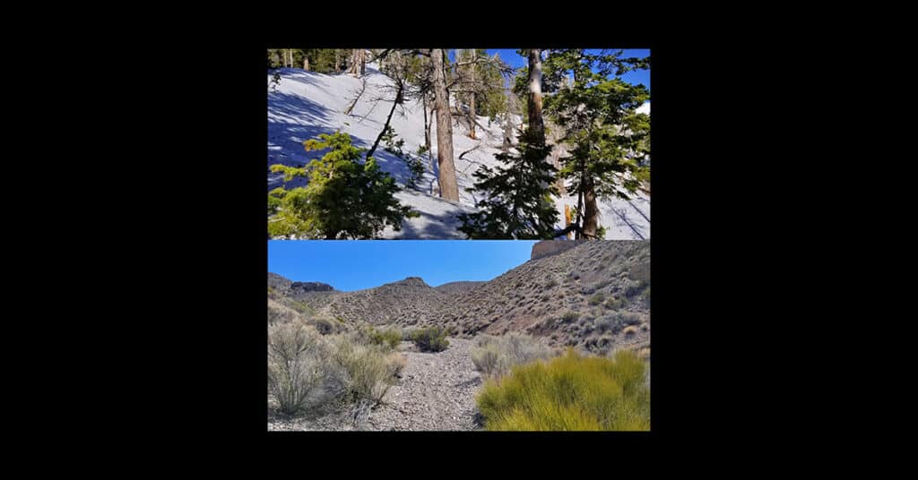
You can generally count on a decrease of about 5 degrees for every 1,000ft elevation rise. Since the elevation of the Las Vegas Strip is about 2000ft and the elevation of Charleston Peak is nearly 12,000ft there is a 10,000ft elevation difference between the two. Doing the math, 10,000ft X 5 degrees per 1,000ft = 50 degrees. Therefore, generally, the temperature at the summit of Charleston Peak is about 50 degrees lower than the temperature on the Las Vegas Strip. Click image or title above for more…
01 Plan Your Las Vegas Area Wilderness Adventure | Overview
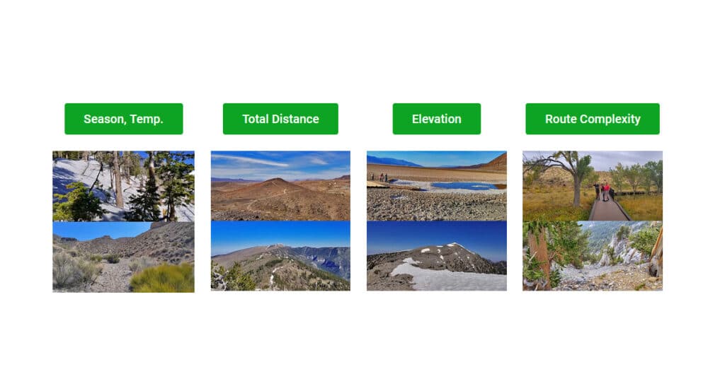
The Las Vegas Area Uniquely Provides Year-Round Wilderness Adventures for All Levels of Conditioning and Varieties of Terrain. For Maximum Enjoyment and Safety, Select the Adventure that Best Fits the Following Criteria. Taking into account a few of the most critical considerations that apply to any Las Vegas Area wilderness adventure will help you to a more enjoyable and safe experience. Click image or title above for more…
Hidden Hills and Jungle Above Kahana in West Maui, Hawaii
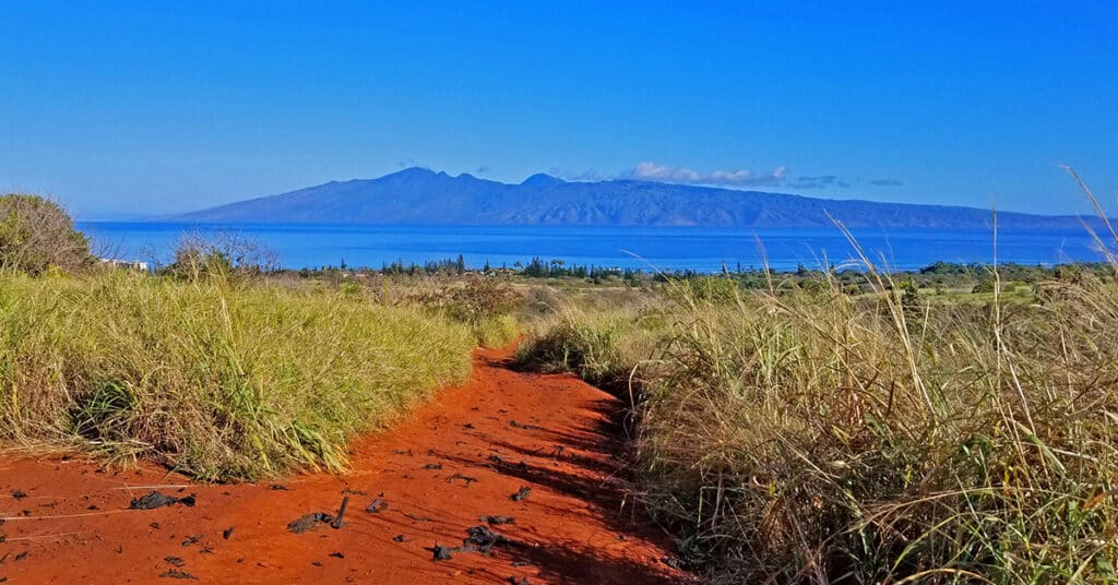
My goal here was to apply the same wilderness exploration strategy I use in the vast wilderness around Las Vegas to an entirely new and unknown area. The goal was to find the best daily trail running conditioning course that could be accessed by foot from the commercial tourist area of Kahana. The only problem was to find access to the interior above Kahana. So I set out to explore potential access points. What I discovered went way beyond expectations including a seemingly endless network of unpaved roads with a perfect surface for running, spectacular views of the ocean West and Northwest of Maui including the islands of Lanai and Moloka’i, total peace entirely devoid of any traffic. Route Details: “”A series of 5-10-mile daily running courses on secluded unpaved roads with spectacular views, including jungle excursions.** Click image or title above for more…
Rhyolite Ghost Town | Death Valley, Nevada
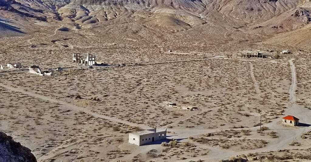
Of all the early 1900’s gold rush ghost towns in the greater Death Valley area, Rhyolite was the most elaborate with the largest population. Rhyolite grew from a 2-tent mining camp in 1904 to a town with a population of 10,000 including the amenities of much larger U.S. cities of the day by 1907. Then, by 1910 with the decline of gold production in its Montgomery Shoshone Mine, Rhyolite was down to a population of 675. By 1920, only 13 years after its heyday, Rhyolite had only 14 residents. Route details: Wander around the town + high view from surrounding hills and mines. Click image or title above for more…
Keane Wonder Mine | Death Valley National Park, California
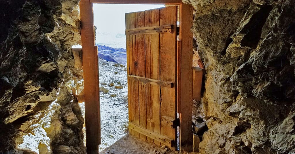
Keane Wonder Mine offers both historical artifacts from the early 1900’s mining boom in the Death Valley Region and a great hike with a spectacular view of Death Valley. See old mine shafts and a aerial tram that transported gold ore down a steep stretch of the Funeral Mountains. A historic timeline is included. Approx. 4 Miles RT; 1,500ft Elevation Gain **Good Trail Almost All the Way** Click image or title above for more…
McCullough Hills | North Sloan Canyon, Nevada
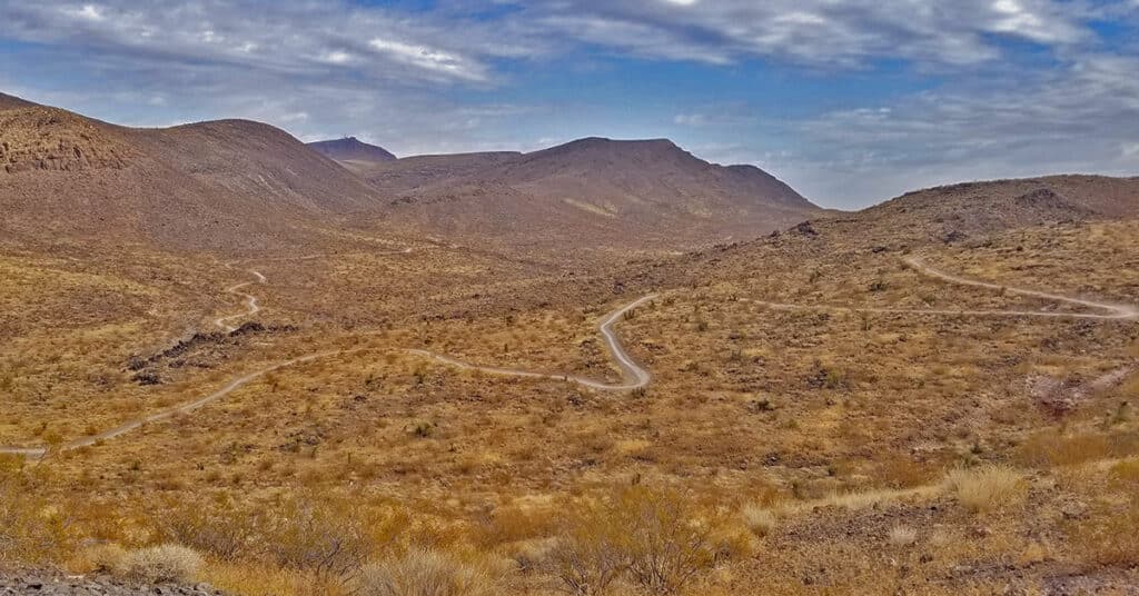
The 14,763 acre North McCullough Wilderness in The Sloan Canyon National Conservation Area contains a network of hiking and biking trails weaving through lava flows, glassy zones and ash falls. The main trail is 8 miles long and begins at the McCullough Hills Trailhead. There are a number of off-shoot trails. If you can see a high point, there is probably a trail leading to it. After a high point at 3,125ft the Las Vegas Valley appears with a backdrop of Mt. Potosi, the Rainbow Mountains on the far side of Red Rock Canyon National Conservation Area, the Mt. Charleston Wilderness and the Las Vegas Strip as you descend the last 3 miles to the city of Anthem. Route details: 25 miles **Paved and Unpaved Roads on Loop** Click image or title above for more…
Petroglyph Canyon | Sloan Canyon National Conservation Area, Nevada
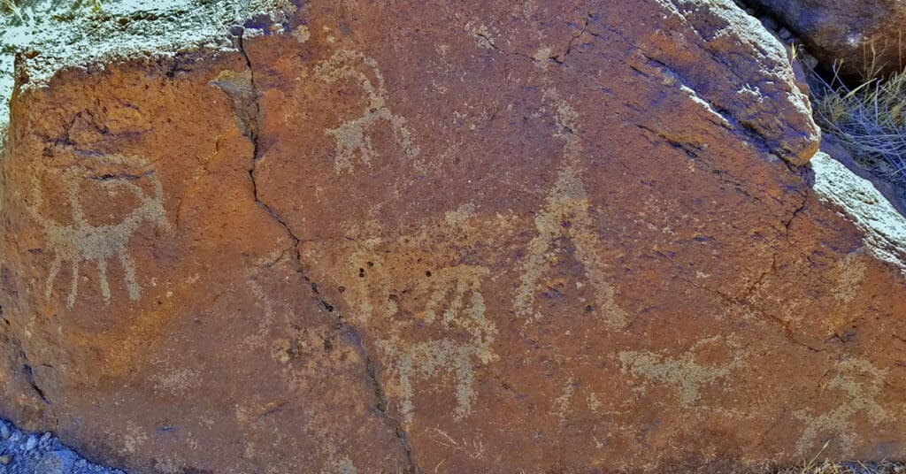
With over 300 rock art panels containing 1,700 design elements, Petroglyph Canyon is the showcase of the Sloan Canyon National Conservation Area. The main area of the Petroglyph Gallery begins after ascending 3 dry waterfalls on the Petroglyph Trail just beyond the lower connection with the Cowboy Trail. Curiously, there is a petroglyph that seems to show the figure of a person who fell. It is a pretty huge dry waterfall there and you could easily fall! 6 mi RT; **Canyon Wash Trail** Click image or title above for more…
Las Vegas Northern Growth Edge 2021
Las Vegas is one of the most rapidly growing population areas in the U.S. as of January, 2021. Clark county was rated as the 2nd of the top 10 U.S. counties in numeric growth (2017-2018) according to Census.gov and our rate of growth has only increased. View this video snapshot in time of the Northern growth edge of Las Vegas in 2021.
Smart Car Bike Rack Test | Sheep Range, Nevada

There’s no way that the tiny Smart Car can handle the 170-mile unpaved 4WD road system of the Desert National Wildlife Refuge in Southern Nevada. However, a mountain bike can. Fortunately there’s a cool compact bike rack system made especially for a Smart Car. The entire bike rack fits in a small one-gallon size nylon bag to store easily in the cargo section of the Smart Car. And it only takes about 5-7 minutes to assemble and dis-assemble the bike rack system including the time taken to mount the bike on the system. Click image or title above for more…
Fossil Ridge North | Sheep Range, Nevada
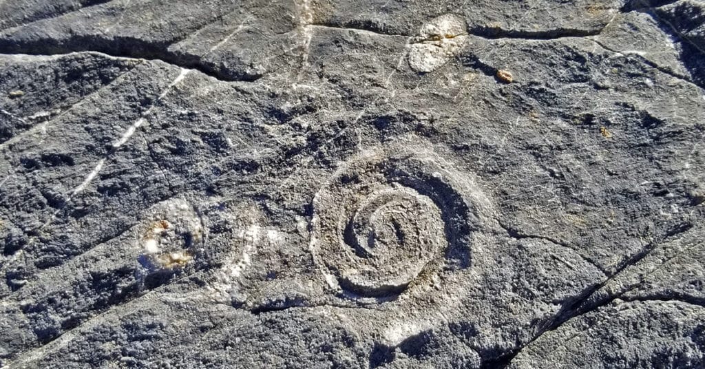
The Northern side of Fossil Ridge is a pretty amazing place. There are fossils embedded in the rocks all along the base of the ridge. These can be seen even without climbing the ridge, especially in the darker rocks beginning in Yucca Gap which skirts the North side of Fossil Ridge. The fossils only get more varied and abundant as you select a spot along Fossil Ridge, ascend and wander around. The scene expands into an upper valley with the largest Joshua Tree forest I’ve ever seen (officially the “Yucca Forest”), extending beyond the Southern tip of the Sheep Range on one side and along the Northern side of Fossil Ridge on the other. Route Details: 12 Miles RT from DNWR HQ **4WD Road** Click image or title above for more…