Grand Staircase | Calico Basin | Red Rock National Conservation Area, Nevada
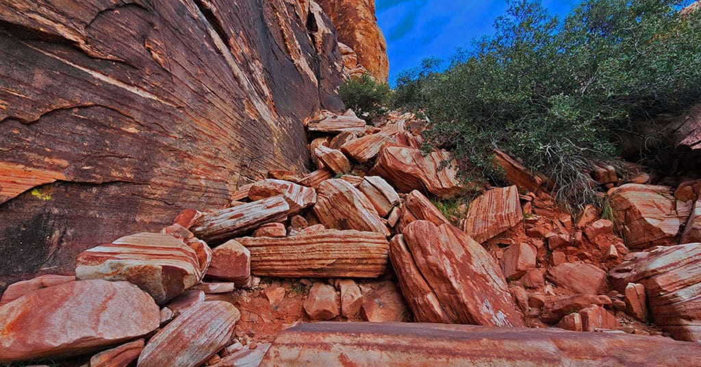
The Calico Hills form a boarder between lower Red Rock Canyon and lower Calico Basin in Nevada. These ancient sand dunes have been frozen into an artistic display of fantastic shapes, colors and designs. The most popular route up the Calico Hills is called The Grand Staircase. As you stand in the parking area in the Red Springs Desert Oasis in the Calico Basin and look closely at the Calico Hills towering above you’ll see a natural diagonal route that begins in the mid section and angles up to the right and to the summit of the hills. This is the Grand Staircase. Route Details: Approx. (2 mi. RT); **Wilderness, Sketchy Path, Class 3 Rock Climbing** Click image or title above for more…
Turtlehead Peak, Red Rock Canyon National Conservation Area, Nevada
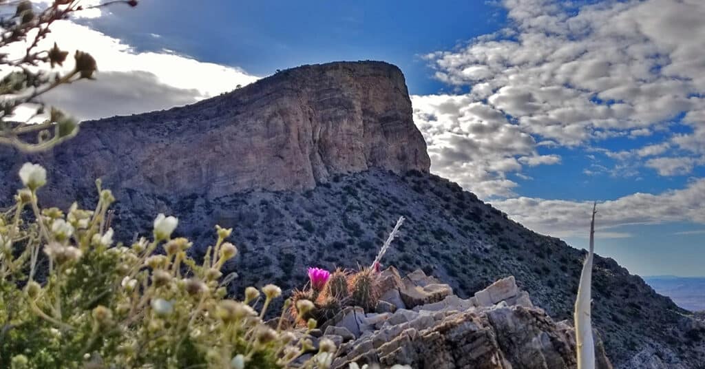
Turtlehead Peak is one of the most popular hikes in Red Rock Canyon. The best time to hike Turtlehead Peak is in the Fall, Winter or Spring, or as early as possible on a Summer morning to avoid high temperatures after 10am. Bring at least 2 quarts of water. The hike takes about 4 hours, allowing for some time to enjoy the summit. In terms of difficulty, it’s a cross between a hike and a climb with some brief boulder sections and a lot of scrambling on loose gravel. Route details: 4.94 mi / 4,306 > 6.285 ft; **Fairly clear trail, but possible to get off track.** Click image or title above for more…
White Rock Mountain Loop Red Rock Canyon National Conservation Area, Nevada
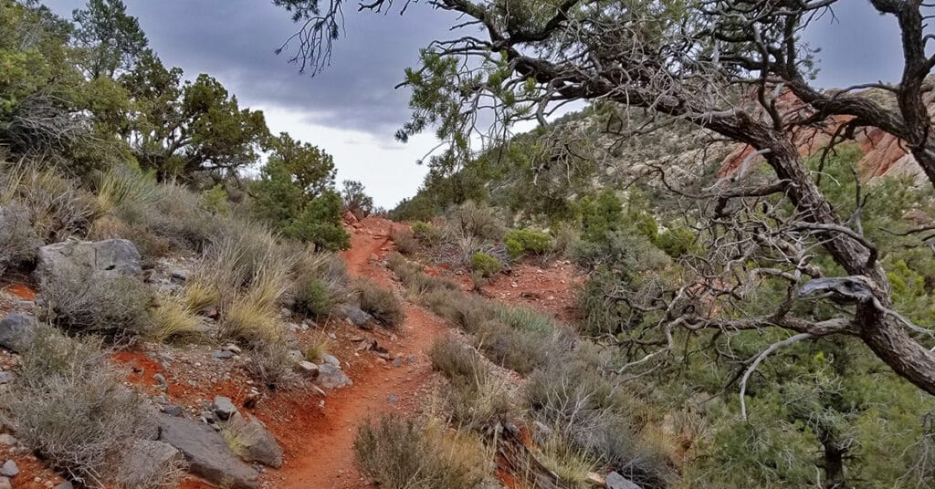
White Rock Mountain Loop Trail in Red Rock Canyon National Conservation Area, Nevada is the ultimate trail for training and for a brief immersion in a rugged desert environment without spending too much time getting there. There are sections with lots of twists and turns which build agility and create the feeling of driving down a curvy road in a fine sports car. And you can easily double the 6.5 mile loop for a 13 mile half marathon, or run it 4 times for a full marathon! Route details: 6.28 mi. / 4,429 > 5,453ft; **Good, well-marked trail.** Click image or title above for more…
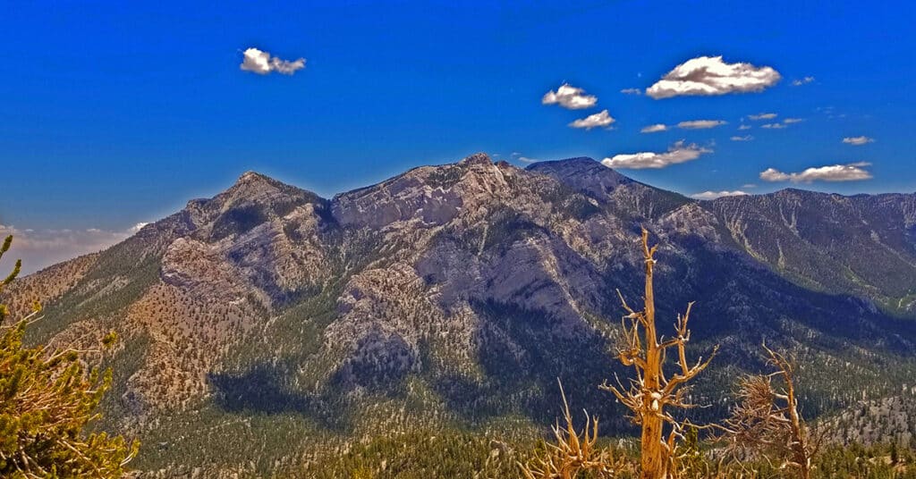
Sisters South to the Sisters North | Mt. Charleston Wilderness | Spring Mountains, Nevada
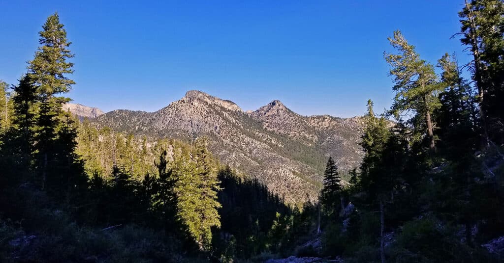
There is a popular circuit route including Sisters South, Sisters North and Black Rock Sister. The route can be taken in either direction and includes about a half day of challenging hiking and climbing (Class 3 at most) in a beautiful pristine wilderness setting. Route details: About 8-9 miles circuit; **Some trail, some wilderness.** Click image or title above for more…
Sisters North | Lee Canyon | Mt Charleston Wilderness | Spring Mountains, Nevada
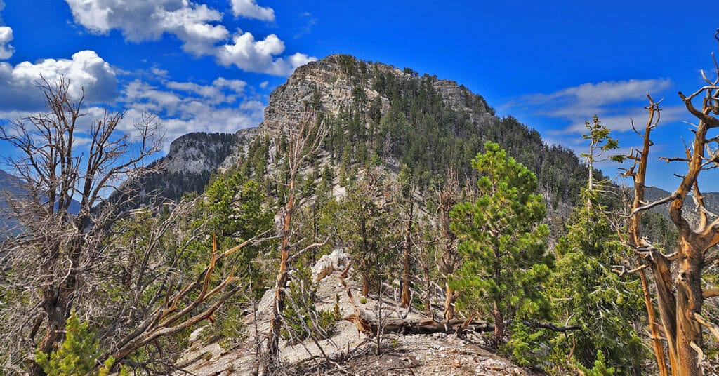
Sisters North, located in Lee Canyon in the Mt. Charleston Wilderness is on a ridge system including Sisters South, Sisters North and Black Rock Sister. The ridge offers incredible 360 degree views with McFarland Peak, Bonanza Peak and Macks Peak to the West, the Sheep Range and Gass Peak to the North, Angel Peak, Mummy Mountain, the North Ridge of Kyle Canyon, Lee Peak and Charleston Peak to the East. There are far more reference points in the distance beyond, but these are the most obvious. A huge rock arch unexpectedly appears near the summit of the approach ridge along with the remarkable rock sculpture of Black Rock Sister. Route details: 8 mi RT/ 8,250 > 10,197ft; **Mostly Wilderness, Some Trails** Click image or title above for more…
Sisters South | Lee Canyon | Mt. Charleston Wilderness | Spring Mountains, Nevada
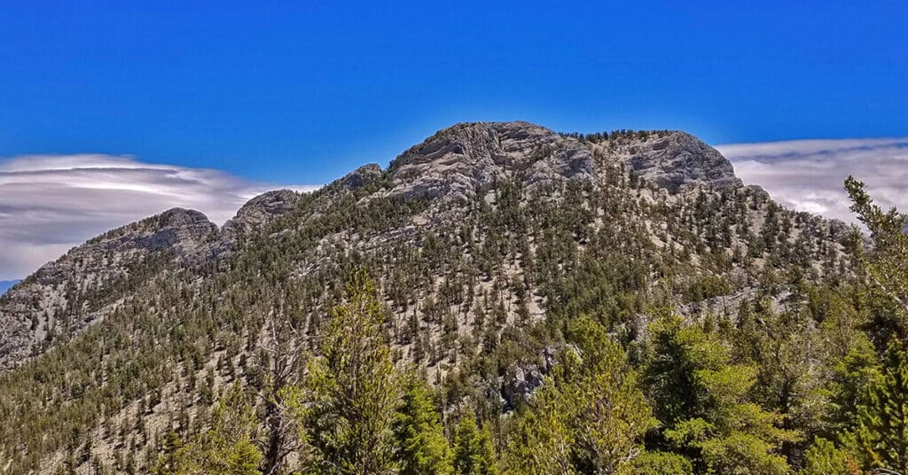
The Sisters South peak in Lee Canyon, Nevada, elevation 10,197 feet has a great trail, spectacular views and is relatively unknown as a destination. As a result, the entire area sparkles with pristine wilderness beauty and you have a good chance of being the only person on the trail, even on a weekend day. On a Saturday in mid-June I saw only 2 people the entire day. Route details: 8 mi RT/ 8,399 > 10,197ft; **Mostly Trail, Some Wilderness** Click image or title above for more…
Black Rock Sister | Mt Charleston Wilderness | Lee Canyon | Spring Mountains, Nevada
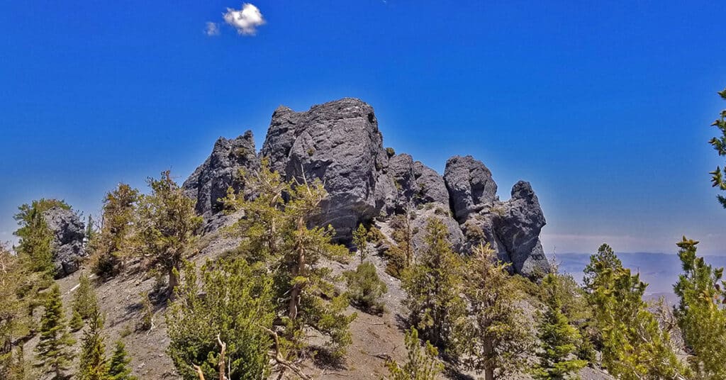
If you’re looking for a summit approach in the Spring Mountains with expanding non-stop spectacular views all the way to the summit after the first brief 1/8th mile, Black Rock Sister is unbeatable. Black Rock Sister, elevation 9,668ft, in the Lee Canyon area of the Spring Mountains in Nevada is the little-known orphan of the more popular and noticeable South and North Sisters. Sitting on a high point in its ridgeline, Black Rock Sister appears to be composed of a single solid mass of rock around 60ft high and 150ft wide. Route details: 8 mi RT/ Approx. 8,300 > 9,668ft; **Wilderness Route** Click image or title above for more…
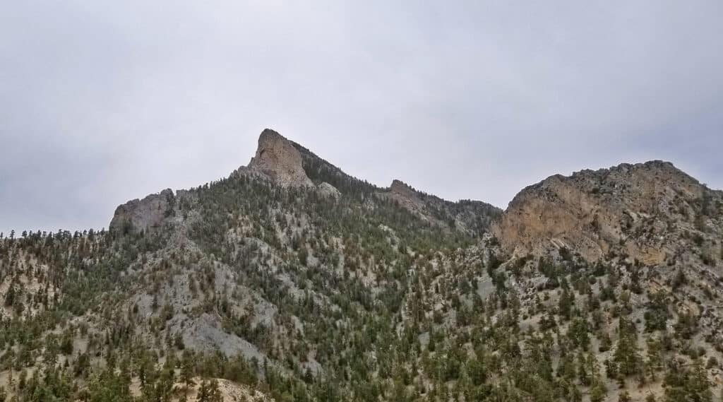
Saw Mill Trailhead to Macks Peak North Base | Mt. Charleston Wilderness | Spring Mountains, Nevada
This adventure began with the intent of doing the Mud Springs Loop trail from the Sawmill Trailhead in Lee Canyon, Spring Mountains, Nevada. Somewhere I went off course and ended up on a 9,235ft bluff near the base of the 10,036ft Macks Peak! Route details: 12 mi RT/ Approx. 7,591 > 9,235ft; **Some Trail, Some Wilderness** Click image or title above for more…
Mud Springs Loop | Lee Canyon | Mt Charleston Wilderness | Spring Mountains, Nevada

Mud Springs Loop is beautiful, though heavily forested. For this reason, the hiker often has no larger point of reference and can get lost in a maze of rabbit trails, and the directional markers are missing when you most need them. All that aside, Mud Springs Loop is a fun wilderness navigational challenge! Click the image or title above for details.
Mummy Mountain Head from Lee Canyon Rd | Additional Approaches | Spring Mountains, Nevada
Once you’ve summited Mummy’s Head from Lee Canyon Road, there are a number of options. You can precede to Mummy’s Nose and Chin, attempt an ascent to Mummy’s Summit or circle around down to the Deer Creek Road or Foxtail area. All these options present challenging climbs. Route details: 10 mi RT/ Approx. 8,000 > 11,535ft; **Some unmarked trails and cairns, mostly wilderness** Click image or title above for more…