Lone Mountain | Las Vegas, Nevada
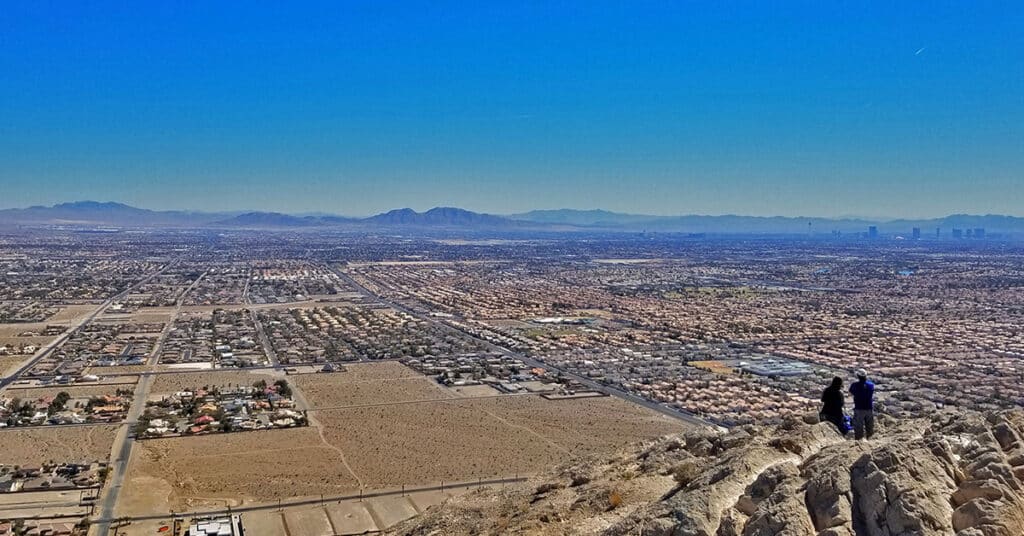
Lone Mountain is pretty awesome with a lot of bang for the buck in this short but spectacular hike. Two trails completely circle Lone Mountain: A wide multi-use trail and above that, a smaller hiking trail. In addition there are multiple routes to the summit that provide the experience of being in a remote wilderness on top of the world even though you’re within the boundaries of Metro Las Vegas in the populated Summerlin area. Route details: 4 mi RT | 7-800ft Elevation Gain/Loss **Unmarked Trailhead, Use Trail at First, Some Wilderness Navigation** Click image or title above for more…
Little La Madre Mt | Little El Padre Mt (aka) Summerlin Peak, Nevada
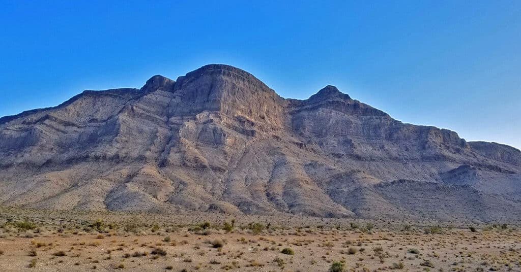
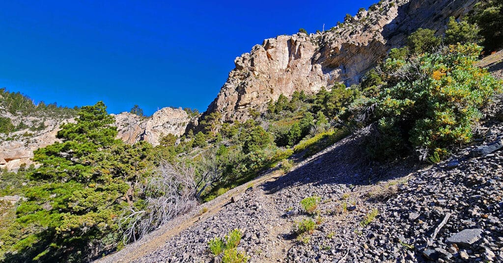
These two features are not in the La Madre Mountains Wilderness. To my knowledge they have no names other than being on a ridge referred to as Summerlin Ridge just beyond the Northwestern growth area of Las Vegas, Nevada. When Little La Madre & El Padre are compared to the actual La Madre and El Padre, they look like miniature versions of the originals (see the first 2 slides of the slide show on this page to compare the two features). Of course, no geological features are exact duplicates, but the similarity here, to me, is pretty striking. On this initial exploration day, my route was to head up the main trail at the base of the Little La Madre, El Padre and Burnt Peak cliffs, circle around the upper end of the canyon, then take the trail leading to the top of the ridge overlook of the Little Red Rock area. Route Details: 8 Miles RT / 3,000-5,00ft; *Half Trails, Half Wilderness* Click image or title above for more…
Lava Butte | Volcanic Cone Between Las Vegas and Lake Mead, Nevada
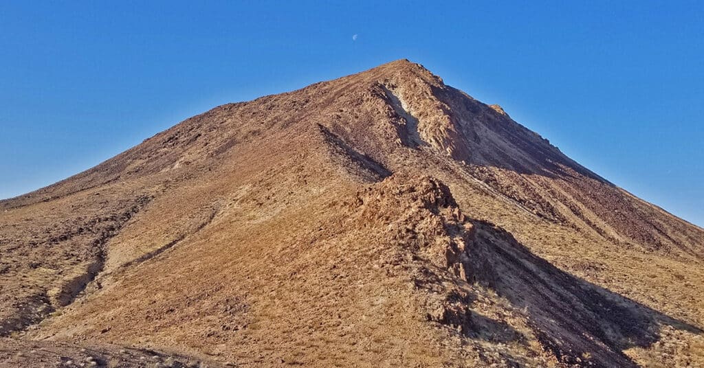
Lava Butte is a distinctive stand-alone volcanic cone below Frenchman Mountain and to the East. It can be seen from many high points in and around the Lake Mead National Recreation Area including Fortification Hill, Mt. Wilson, Frenchman Mountain and others. It’s a fun, challenging climb to go up one side and down the other, weaving around huge volcanic boulders. Route description: 7mi | 1,835 > 2,871ft; ** Service Road / Lava Ridge** Click image or title above for more…
Cheyenne Mountain | Las Vegas, Nevada
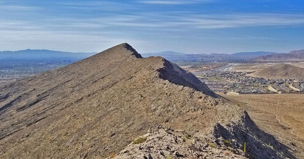
Cheyenne Mountain, elevation 3833ft with an elevation gain of 900ft, is one of the many desert hills surrounding Las Vegas. Located in the Summerlin area, Cheyenne Mountain has a commanding view of Lone Mountain, the Las Vegas Valley and many surrounding high points. When you’re on the Toove Trail circling around the West side of Cheyenne Mountain there’s the feeling of being hundreds of miles from civilization in an isolated wilderness area. There are numerous points along the circuit route where you can ascend to the summit experiencing nearly every level of rock climbing difficulty. Route details: **6 Miles RT, 2,967 – 3,833ft; Elevation ** Click image or title above for more…
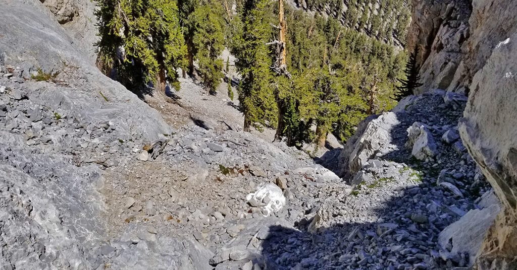
Fletcher Canyon / Fletcher Peak / Cockscomb Ridge Circuit | Mt Charleston Wilderness, Nevada
This circuit adventure begins at the Fletcher Canyon Trailhead, navigates up and above Fletcher Canyon to Fletcher Peak, then descends the Fletcher Peak Trail to the North Loop Trail, finally descends the Eastern wilderness below Cockscomb Ridge to the Stanley B. Springs mine and trail before returning to Fletcher Canyon Trailhead.
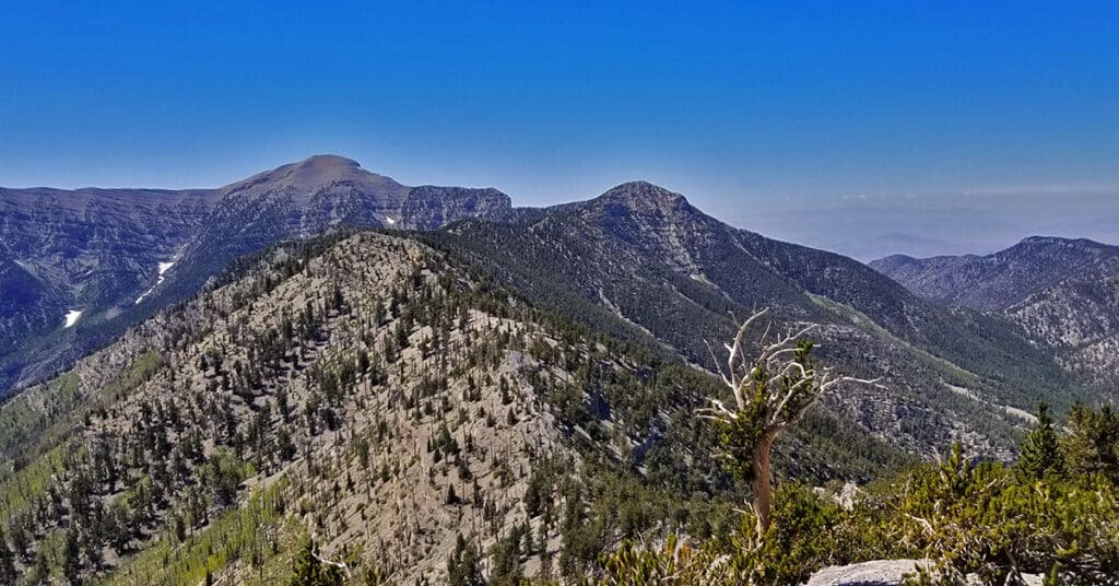
Harris Mountain Griffith Peak Circuit | Mt Charleston Wilderness | Spring Mountains, Nevada
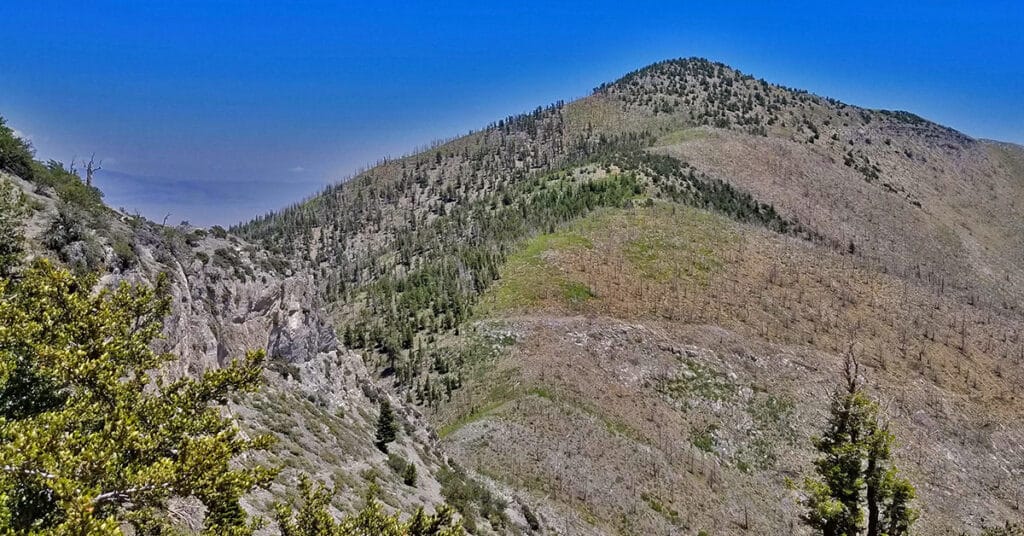
The Harris Mountain Griffith Peak Circuit is largely untouched wilderness with spectacular views of all the peaks in the Mt. Charleston Wilderness: Harris Mountain, Griffith Peak, Charleston Peak, Lee Peak, Mummy Mountain and Fletcher Peak. In addition there are spectacular views up and down the entire length of Kyle Canyon and Lovell Canyon along with views of the La Madre Mountains Wilderness area including La Madre Mountain and El Padre Mountain. You can see the tips of Bridge Mountain, Rainbow Mountain and Mt. Wilson in the Rainbow Mountains Wilderness and even catch a glimpse of the Las Vegas Strip. And to the North, there are views of the Sheep Range and Gass Peak. Route Details: 15 mi / Approx. 7,713 > 11,060ft; **Some Trail, Mostly Wilderness** Click image or title above for more…
Griffith Peak Harris Mountain Circuit | Mt Charleston Wilderness | Spring Mountains, Nevada
The Griffith Peak / Harris Mountain Circuit actually takes over 2 hours longer than the entire Mt. Charleston Loop! I’ve completed the Mt. Charleston loop in about 7.5 hours including the run from the Trail Canyon parking lot to the South Climb parking lot. Adding in Griffith Peak, Lee Peak and Mummy Mountain, the Mt. Charleston 4-Peak Circuit takes me a little under 12 hours. On the other hand, the Griffith Peak / Harris Mountain Circuit took me 9hrs and 50 minutes! Why? Find out in this article. Route details: 15 mi / Approx. 7,713 > 11,060ft; **Some Trail, Mostly Wilderness** Click image or title above for more…
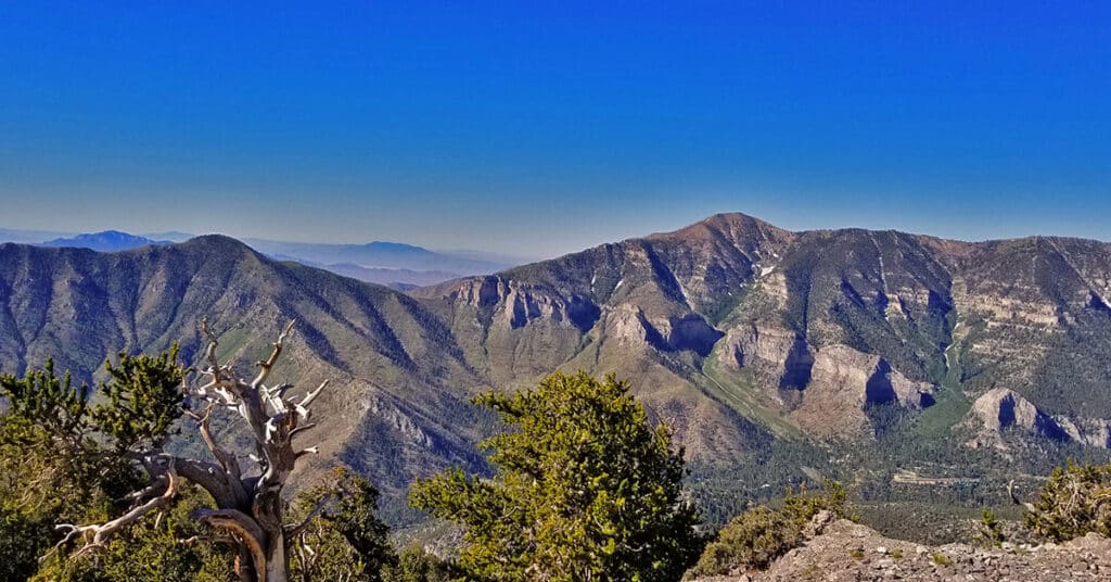
Griffith Peak & Charleston Peak Circuit | Mt Charleston Wilderness | Spring Mountains, Nevada
This out and back adventure involves starting at the Charleston Peak South Climb Trailhead, summiting Griffith Peak, taking the South Rim of Kyle Canyon from Griffith to Charleston Peak, then returning down the South Climb Trail back to that Trailhead. The South Climb Trail out and back is the most direct way to get to Charleston Peak if you’re pressed for time. Adding Griffith Peak to the adventure is a relatively short detour (about 1/2 mile each way off the main route) and well worth the effort. Route Details: 18 mi / Approx. 7,713 > 11,918ft; **Excellent Trails** Click image or title above for more…
Fletcher Peak, Mummy Mountain, Lee Peak Circuit Mt Charleston Wilderness, Nevada
Compare the time it takes to traverse established trails (even with greater elevation gain and loss and longer distance) vs. navigating more direct and level wilderness “shortcuts” to get from Fletcher Peak to Mummy Mountain and Lee Peak. This detailed comparison of 2 routes –wilderness vs. established trails — will show that how the wilderness route takes significantly more time, though may conserve energy. Conclusion: If you want to navigate the wilderness out of interest, enjoy it. However, if you’re looking for a “shortcut”, the established trail will almost always win. Route details: Approx. 18 mi / 7,713 > 11,520ft **Some Trail, Some Wilderness** Click image or title above for more…
Fletcher Peak Mummy Mountain Circuit | Mt Charleston Wilderness | Spring Mountains, Nevada
Ascend Fletcher Peak from Trail Canyon Trailhead, descend to Raintree and Mummy Springs, traverse wilderness to ascend Mummy Mt. Eastern cliffs, return to Trail Canyon Trailhead via traditional Mummy Mt. route. Adding a little more than an hour to the Mummy Mountain Eastern Approach trip includes the beautiful Fletcher Peak, opening up views of the Eastern end of Kyle Canyon including Harris Mountain, Griffith Peak, the entire length of the South ridge of Kyle Canyon all the way to Charleston Peak and a great view of the Eastern approach to Mummy Mountain. Route Details: About 15 miles circuit trip; **Some trail, some wilderness** Click image or title above for more…