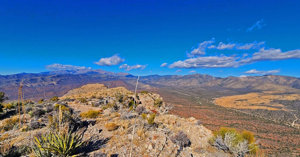
Damsel Peak Loop | Brownstone Basin, Nevada
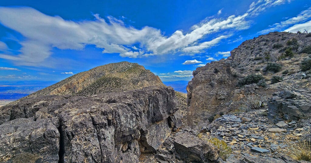
This complete loop of Damsel Peak’s base in the Brownstone Basin, Nevada searches for previously unknown summit routes to the summit.
Upper Calico Hills Loop | Calico Basin & Red Rock Canyon National Conservation Area, Nevada
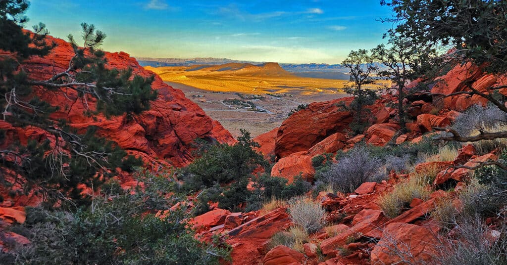
This spectacular 6-mile loop combines 6 or more trails to circle the upper Calico Hills in Red Rock Canyon & Calico Basin, Nevada. The trail passes through two beautiful wild passes in the Calico Hills: Ash Canyon and the mid-Calico Hills Black Corridor Pass. Click the image or title above for all the details.
3 Basin Circuit | Red Rock Canyon, Nevada
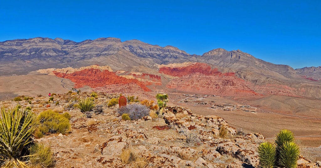
Experience 3 incredible Southern Nevada wilderness areas in one great adventure. This circuit begins in the Calico Basin, rounds the South side of the Calico Hills, heads North to upper Red Rock Canyon, circles over to Brownstone Basin then finally descends to the starting point in Calico Basin. Click the image or title above for more details.
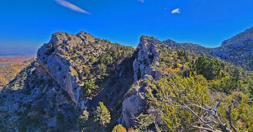
Lovell Canyon Ridgelines | Lovell Canyon, Nevada
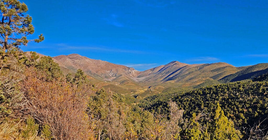
Lovell Canyon’s surrounding ridgelines create both a majestic and an intimate feeling. The ridgelines majestically tower over the canyon while enclosing it in its own unique setting. There’s the Wilson Ridgeline (East Side); Sexton Ridgeline (West Side); Griffith/Harris Saddle (North side); and The Rainbow Mountains Upper Crest Ridgeline (Southeast Region). From 5,000-11,000ft in elevation, the ridgelines offer spectacular views of Lovell Canyon and its surrounding wilderness areas. Click the image or title above to learn more.
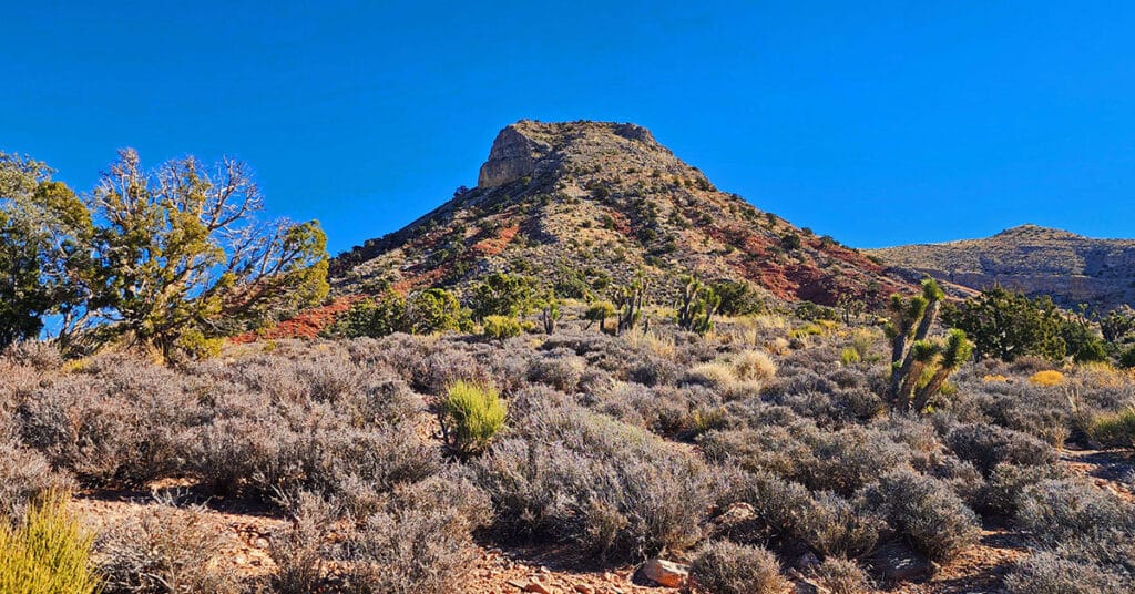
Landmark Bluff Summit | Lovell Canyon, Nevada
Landmark Bluff in Lovell Canyon, Nevada is surrounded by steep loose rock slopes, cliffs and vertical ledges. But there is one little-known narrow canyon gully on this massive 5-mile, 12,00ft bluff that will get you to the summit at an easy class 2 level walk. And the view from the summit of this high, stand-alone bluff is spectacular! Discover the key to summiting Landmark Bluff.
Landmark Bluff Circuit | Lovell Canyon, Nevada
Make a complete 16+ mile loop of Landmark Bluff in Lovell Canyon, Nevada. Along the way, discover a number of potential summit routes to the bluff. The pathless North side of the bluff is beautifully forested with pines and junipers. There are spectacular views of the Mt. Charleston Wilderness and the Wilson Ridge.
Lovell Canyon Camping | Lovell Canyon, Nevada
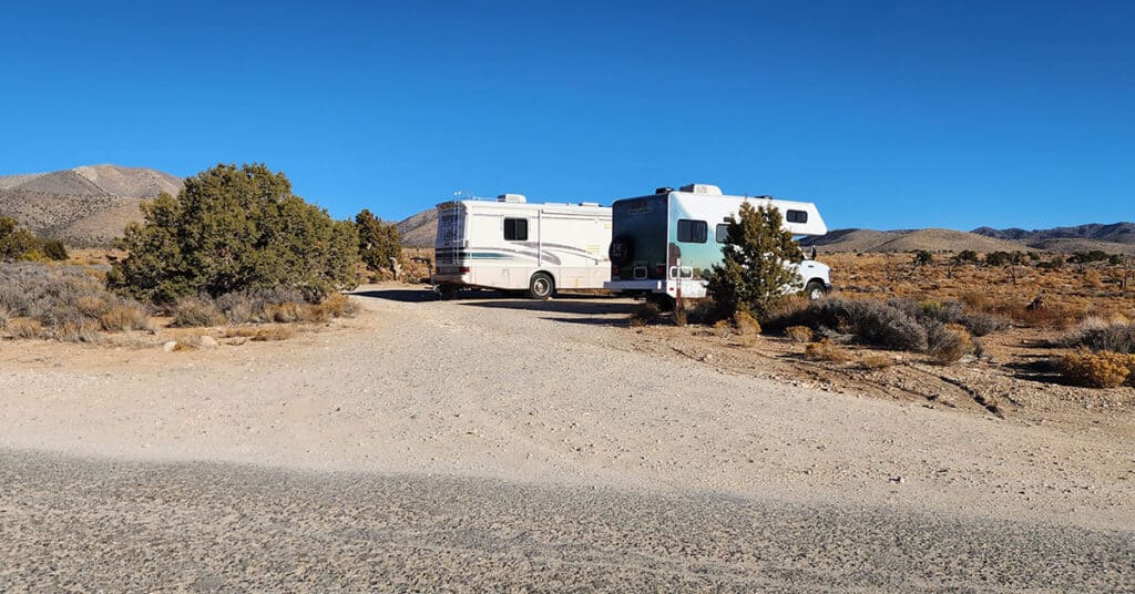
Lovell Canyon, Nevada is paradise for car campers. There are great camping spots lining each of the roads, many with spectacular views! All camping is “dispersed camping”. Campsites are undeveloped so bring everything you need. It’s “first come, first served”. You can stay up to two weeks. Many sites are large enough to accommodate RVs. No reservation is required. In addition to individual camping spots there are group camping areas.
Lovell Canyon Roads | Lovell Canyon, Nevada
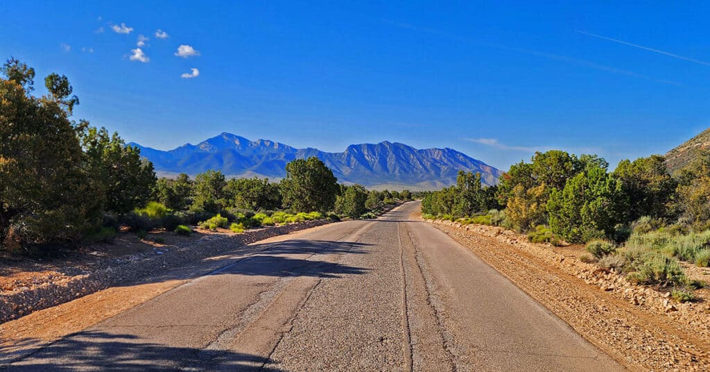
Lovell Canyon in Nevada has a great network of assess roads to camping areas, trails, and wilderness adventures throughout the canyon. Lovell Canyon Road, the main road is paved and 12 miles in length. The tributary roads are unpaved. Many are well graded, but 4WD is recommended and necessary in some cases. There are dispersed camping areas along the length of most roads in the network. Click the image or title above for more details…
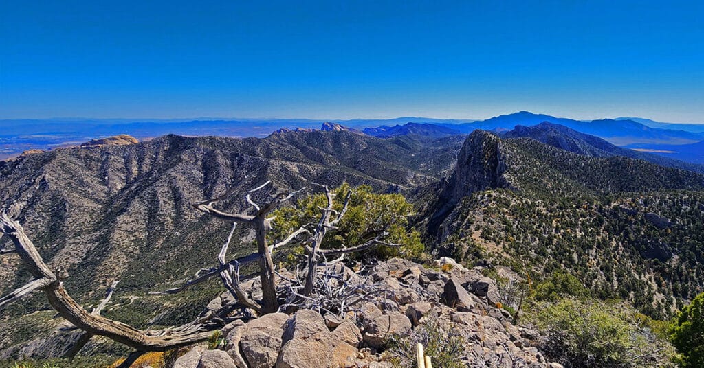
Switchback Spring Pinnacle | Wilson Ridge | Lovell Canyon, Nevada
Switchback Spring Pinnacle is positioned at the summit of Switchback Spring Canyon. This summit on the Wilson Ridge is a low point on the ridge. Ascend an approach ridge from Lovell Canyon & CC Springs Roads to this potential crossover point from Lovell to Red Rock Canyons. The views from the pinnacle are spectacular including Lovell Canyon, The Rainbow Mountain Wilderness, Red Rock Canyon, The La Madre Mountains Wilderness, Mt. Charleston Wilderness, Las Vegas Valley and more! Click the image or title above for more detail.
Mini Matterhorn Pinnacle | Wilson Ridge | Lovell Canyon & Rainbow Mountains, Nevada
This short, but complicated and time-consuming route up a spectacular wild pathless approach ridge takes you to a pinnacle facing a sheer cliff along with dramatic drop-offs to the right and left. The one final approach path to the pinnacle is a narrow rocky spine of a ridgeline. It’s a wonder that one can accomplish this adventure without exceeding class 3 climbing! Best time of year for this adventure is late Fall or early Spring. Click the image or title above for more details.