Catch Pen West | Deer Creek Road | Mt. Charleston Wilderness, Nevada

Explore the region between the West end of Deer Creek Catch Pen Loop and Lee Canyon Road. Experience dramatic changes in climate and flora and fauna similar to changes between Southern Nevada and Canada! Click the image or title above for details.
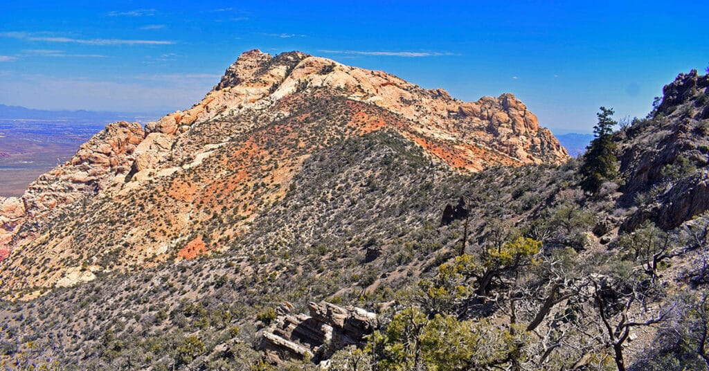
Mummy’s Nose Final Summit Approach from Deer Creek Road, Nevada

Take a beautiful alpine route from Deer Creek Road to the spectacular summit of Mummy’s Nose in the Mt. Charleston Wilderness, Nevada. Mummy’s Nose is a prominent 10,700ft summit with an incredible 360-degree view! This unique route focuses on the final stretch navigating the cliffs to the summit. It’s mostly class 2 with a few brief class 3 rock scrambles below the summit. Click the image or title above for details.
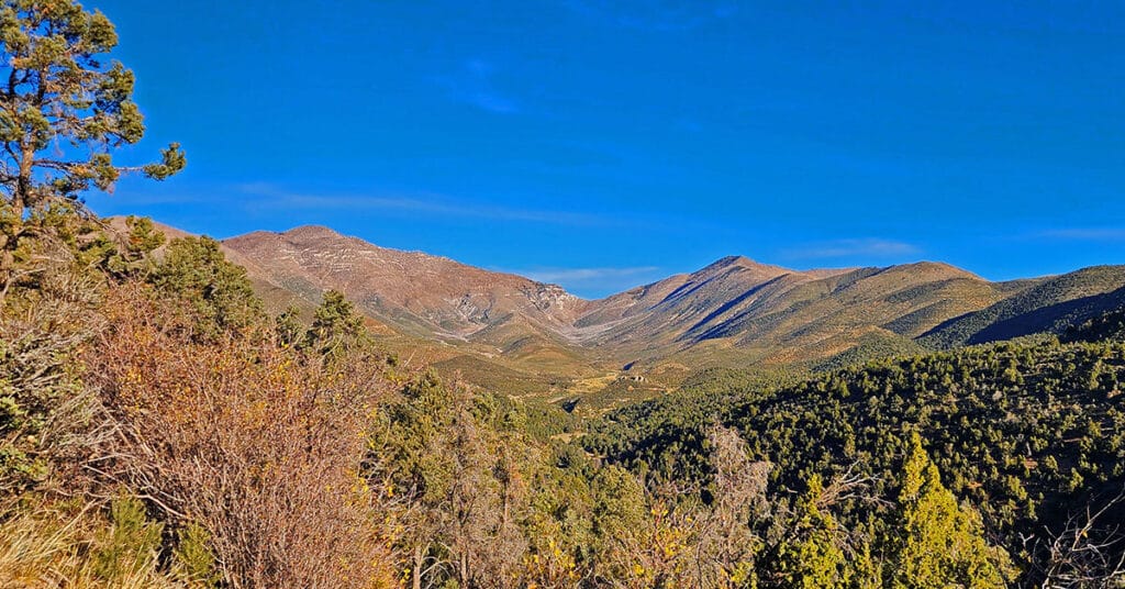
Mummy’s Nose North Alpine Loop | Mt Charleston Wilderness, Nevada

This spectacular 6-7-mile pristine wilderness loop makes a wide circuit between the 8,300ft starting point on Deer Creek Road and the 10,200ft elevation, less than a half-mile below Mummy’s Nose. It’s a great route to practice basic wilderness navigation skills as you always have multiple distinct points of reference and can’t miss intersecting Deer Creek Road during the descent. Click the image or title above for details.
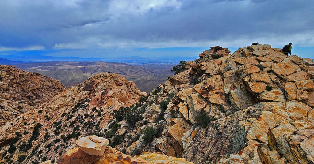
Mummy Mountain’s Nose from Deer Creek Rd | Mt. Charleston Wilderness, Nevada

This is the most direct, streamlined approach to Mummy Mountain’s Nose, a prominent 10,751 ft. elevation with a spectacular 360-degree view. Click the image or title above for details…
Mummy Mountain Nose from Lee Canyon Rd | Mt. Charleston Wilderness | Spring Mountains, Nevada

Traverse the incredibly steep incline (2,846ft in 2.5 miles) from Lee Canyon Road to the summit of Mummy Mountain Nose (elevation 10,751ft) in Nevada. All paths along the way are unmarked. They appear and disappear, but we’ll help you stay on route all the way to the summit! Click the image or title above for details.
South Peak | Rainbow Mountain Wilderness, Nevada

Explore South Peak, the rarely visited Southernmost peak in the colorful Jurassic Era sandstone Rainbow Mountain Wilderness, Nevada. South Peak offers unique and spectacular views of Potosi Mountain to the South and the Rainbow Mountains to the North. This adventure is challenging, though does not exceed the class 3 level of rock climbing. And, it can be accomplished in half a day. Click the image or title above for details.
Black Velvet Peak | Rainbow Mountain Wilderness, Nevada
You might have heard of the highly technical, imposing class 5+ vertical cliff route to Black Velvet Peak summit from below to the East. But here’s a much easier, little-known class 3 route descent to that same peak from the Rainbow Mountains Upper Crest Ridgeline above to the West. Best time of year for this 8-mile round trip is Spring or Fall. Click the image or title above for details.
Mt Wilson Summit Saddle from Lovell Canyon, Nevada
Hike from Lovell Canyon to the Rainbow Mountains Upper Crest Ridgeline above Mt. Wilson. Then, descend from the ridgeline to the saddle between the ridgeline and Mt. Wilson. Here we explore that steep slope between the Rainbow Mts. Upper Crest Ridgeline and the Mt. Wilson Summit Saddle. Best time of year for this adventure is mid-Spring through Fall. Late June through early August may bring uncomfortably high heat. Click the image or title above for details.
Lovell Canyon Ridgelines | Lovell Canyon, Nevada
Lovell Canyon’s surrounding ridgelines create both a majestic and an intimate feeling. The ridgelines majestically tower over the canyon while enclosing it in its own unique setting. There’s the Wilson Ridgeline (East Side); Sexton Ridgeline (West Side); Griffith/Harris Saddle (North side); and The Rainbow Mountains Upper Crest Ridgeline (Southeast Region). From 5,000-11,000ft in elevation, the ridgelines offer spectacular views of Lovell Canyon and its surrounding wilderness areas. Click the image or title above to learn more.
Fletcher View Ridge | Mt Charleston Wilderness, Nevada
Fletcher View Ridge ascends between The Fletcher View Campground and the final summit approach to Harris Mountain. The ridge originates in The Fletcher Canyon area on Kyle Canyon Road in The Mt. Charleston Wilderness, Nevada. Expect non-stop spectacular views of the highest peaks on The Mt. Charleston Loop along with a good aerial view of Fletcher Canyon and potential route to Fletcher Peak summit. Elevation: 7,000-9,000ft. wilderness route, no trails or trail signs. Best time of year for this adventure: July through September. Click the image or title above for details.