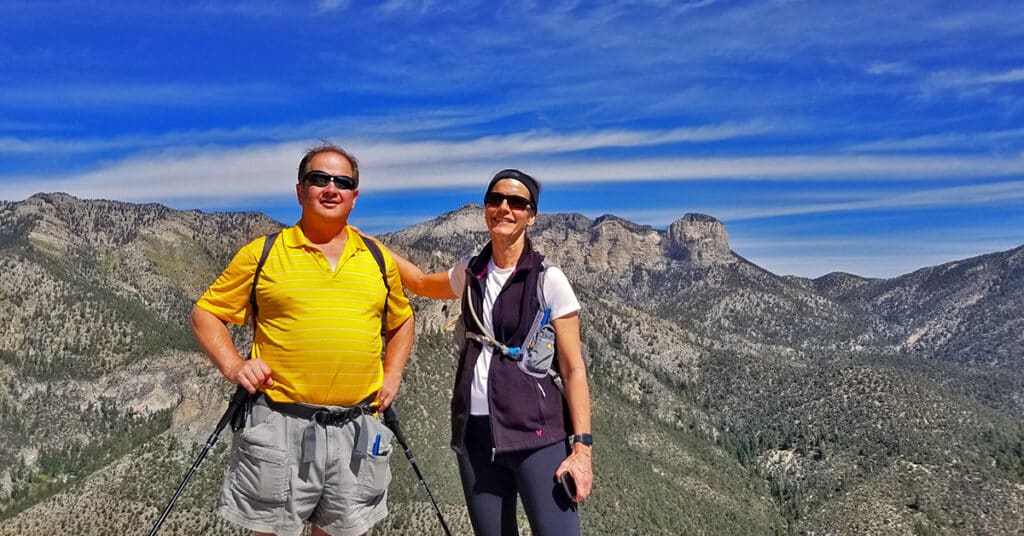
Eagles Nest Loop | Mt Charleston Wilderness | Spring Mountains, Nevada
Mt. Charleston Wilderness BLM Fact Sheet Eagles Nest Loop | Mt. Charleston Wilderness | Spring Mountains, Nevada Spring Mountains NRA Brochure Overview – Eagles Nest Loop | Mt Charleston Wilderness | Spring Mountains, Nevada Adventure Slideshow will appear on the week of May 14, 2023 The Unique World of Eagle’s Nest Loop Eagle’s Nest Loop […]
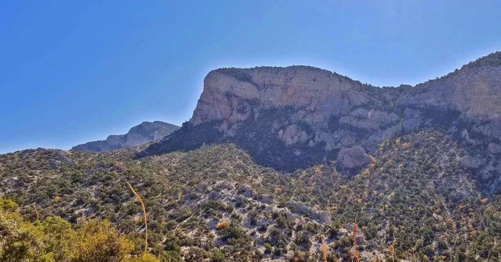
Fletcher Canyon Trail | Mt Charleston Wilderness, Nevada
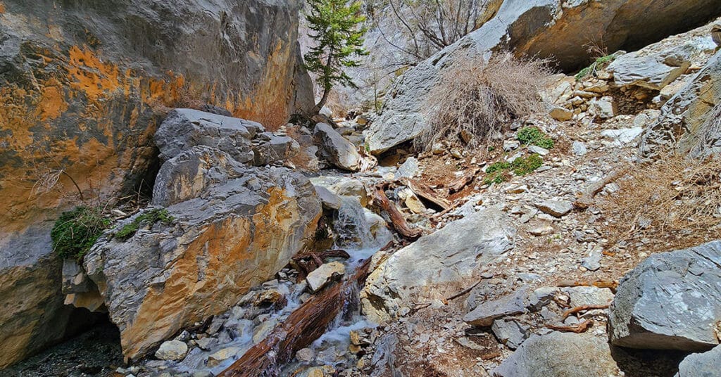
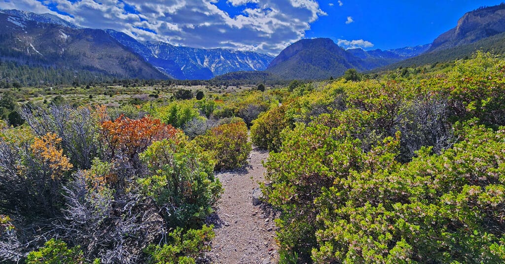
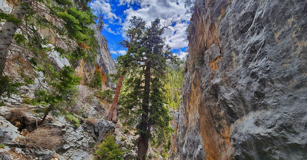
Fletcher Canyon Trail in The Mt. Charleston Wilderness, Spring Mountains, Nevada is an easy 4.2-mile round trip hike along a creek in a beautiful forested area with spectacular mountain views. It’s a great trail for altitude conditioning. Beyond the trail’s end may be a possible extreme adventure to Fletcher Peak summit.
Fletcher Canyon Trails Overview | Mt Charleston Wilderness, Nevada
Trails Accessed from The Fletcher Canyon Trailhead in The Mt. Charleston Wilderness, Nevada include Fletcher Canyon Trail; Eagle’s Nest Loop; Acastus Trail and Escarpment Trail. These are great introductory trails to the Mt. Charleston Wilderness and excellent initial altitude conditioning trails.
Mary Jane Falls | Mt Charleston Wilderness, Nevada
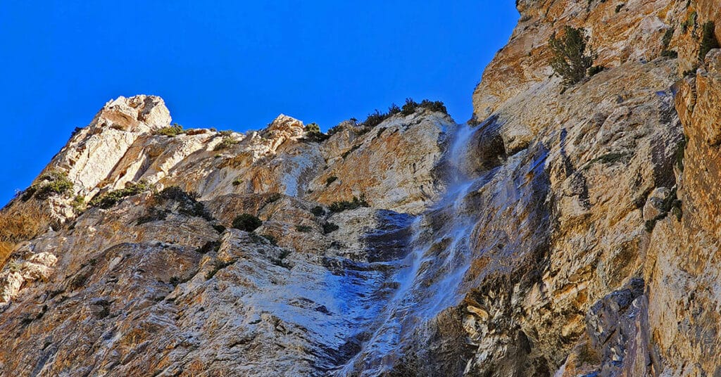
Mary Jane Falls is a moderate 3.2-mile round trip hike in Nevada’s Mt. Charleston Wilderness from a convenient trailhead just beyond Charleston Village. To see the falls at their best, visit them in mid-to-late Spring. Experience spectacular views of Kyle Canyon along the way, and don’t miss visiting the secret cave just beyond the falls.
Hiking with Dogs | Mt Charleston Wilderness | Spring Mountains, Nevada
Two dog experts, Pug Society rescue owners and avid hikers give their best wisdom and tips for hiking with dogs. Click image or title above for more…
Spring Mountains Hiking Strategy | Trail Running and Hiking Tips
If you’re looking to summit 11,918ft Charleston Peak but are starting at ground zero in terms of your conditioning, here is a strategy to develop the conditioning you will need to reach your goal. This graded hiking strategy takes into account developing the necessary endurance, altitude conditioning and strength, while having fun throughout. Click image or title above for more…
Potosi Mountain Southern Approach | Spring Mountains Wilderness | Nevada
The Southern approach to Potosi Mountain is nothing less than a huge endurance test. Though it’s only 14 miles out and back from my starting point at the “warning rock” parking area, and you’re on a pretty good road all the way to the summit, the angle of incline is the challenge. Think streets of San Francisco, only instead of a one block steep incline you’re looking at half-mile sections of incredibly steep incline. The incline is so steep in places that you’re gaining nearly one foot elevation gain per stride! One note: your total ascent is between 3,500 and 4,000ft. Route details: 14 mi RT/ 4,700ft > 8,500ft; **Paved and Unpaved Maintenance Roads** Click image or title above for more…
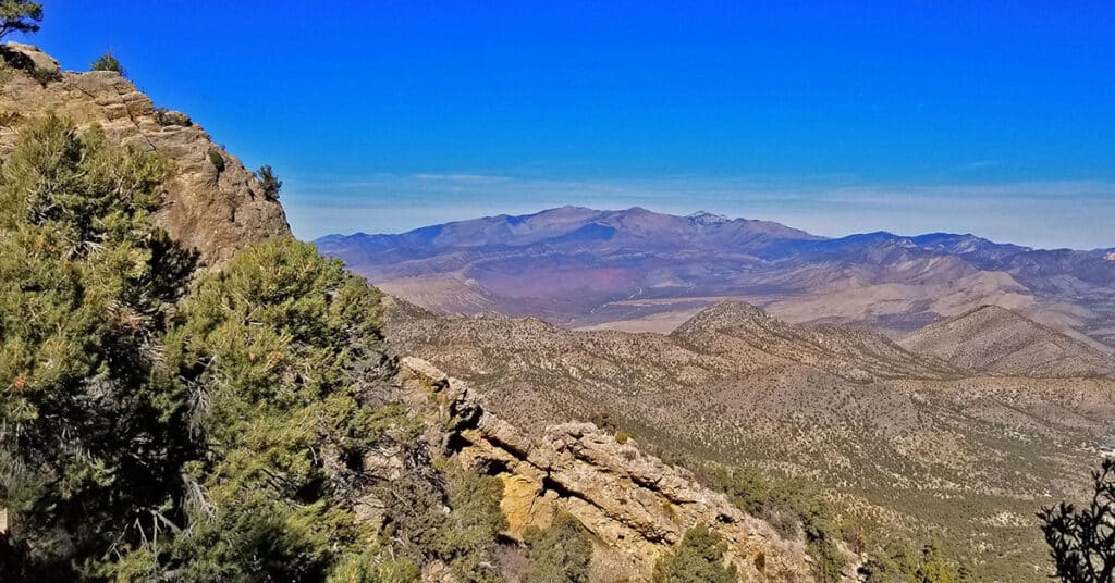
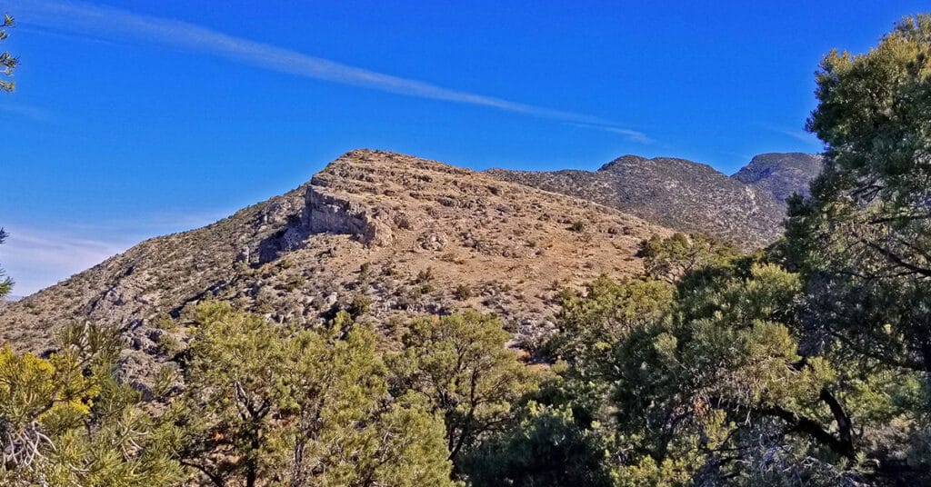
Potosi Mountain | Northern Hills Exploration | Spring Mountains, Nevada
During this adventure, though I do not ascend to the summit, I scope out the Northwestern area of Potosi Mountain and discover a few alternate summit approaches. Potosi Mountain, Elevation 8,517ft, is the last high point along the horizon in the Spring Mountains as you’re viewing the skyline from Las Vegas. From Potosi Mountain’s 8,517ft summit, populated with a number of communications towers, you can look across the entire stretch of the Rainbow Mountains. Route details: 16 mi RT from Hwy 160/ 5,500ft > 7,200ft; **Unpaved Road then Wilderness (no trails)** Click image or title above for more…
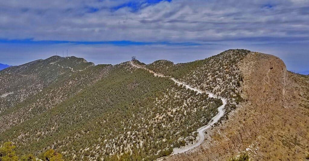
Potosi Mountain Northern Cliffs Trail | Spring Mountains, Nevada
The Potosi North Trail is very well constructed and the views are spectacular — both along the trail and off in the distance. Along the trail there are elaborate rock formations including pinnacles and a few small natural bridges branching out from the spectacular limestone cliff face. The plant life is rich, a mountain pine forest. Then, there is the distant back-drop including Lovell Canyon bordered by Griffith Peak and Harris Mountain with Mummy Mountain dead center. Route details: 16 mi RT from Hwy 160/ 5,500ft > 7,500ft; **Unpaved Road then Wilderness (no trails)** Click image or title above for more…
Potosi Mt Summit via Western Cliffs Ridge | Spring Mountains, Nevada
The Potosi Mt Western Cliffs Ridge is not only a spectacular route with views that do not end, but it is also a historical site, the location of Potosi Mine. This route discovers a nice trail beginning at the end of Potosi Springs Road and heading upward to the old route from the aerial tram site to the Potosi Mine. I believe wide, well constructed route between the high point of the tram and the mine was the route of the baby gauge railroad. Upon meeting the Potosi Mine route another very faint use trail continues up and along the Western Cliffs Ridge. That faint trail appears and disappears, but the ridge eventually leads to Potosi Mountain summit. Route details: 20+ mi RT from Hwy 160/ 5,500ft > 8,500ft; **Unpaved Road, Some Trails, Some Wilderness** Click image or title above for more…