Mummy Mountain Nose from Lee Canyon Rd | Mt. Charleston Wilderness | Spring Mountains, Nevada

Traverse the incredibly steep incline (2,846ft in 2.5 miles) from Lee Canyon Road to the summit of Mummy Mountain Nose (elevation 10,751ft) in Nevada. All paths along the way are unmarked. They appear and disappear, but we’ll help you stay on route all the way to the summit! Click the image or title above for details.
Sisters South to the Sisters North | Mt. Charleston Wilderness | Spring Mountains, Nevada
There is a popular circuit route including Sisters South, Sisters North and Black Rock Sister. The route can be taken in either direction and includes about a half day of challenging hiking and climbing (Class 3 at most) in a beautiful pristine wilderness setting. Route details: About 8-9 miles circuit; **Some trail, some wilderness.** Click image or title above for more…
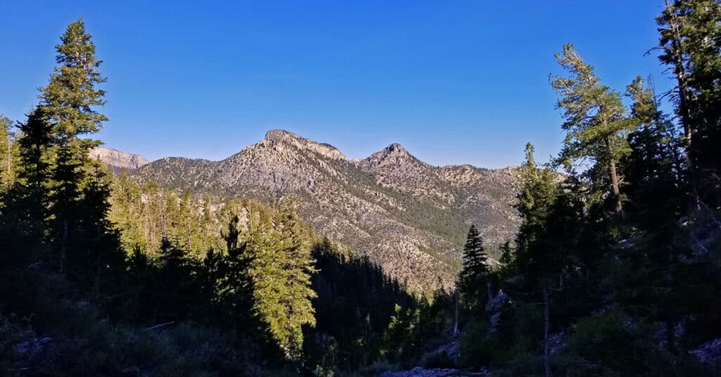
Sisters North | Lee Canyon | Mt Charleston Wilderness | Spring Mountains, Nevada

Sisters North, located in Lee Canyon in the Mt. Charleston Wilderness is on a ridge system including Sisters South, Sisters North and Black Rock Sister. The ridge offers incredible 360 degree views with McFarland Peak, Bonanza Peak and Macks Peak to the West, the Sheep Range and Gass Peak to the North, Angel Peak, Mummy Mountain, the North Ridge of Kyle Canyon, Lee Peak and Charleston Peak to the East. There are far more reference points in the distance beyond, but these are the most obvious. A huge rock arch unexpectedly appears near the summit of the approach ridge along with the remarkable rock sculpture of Black Rock Sister. Route details: 8 mi RT/ 8,250 > 10,197ft; **Mostly Wilderness, Some Trails** Click image or title above for more…
Sisters South | Lee Canyon | Mt. Charleston Wilderness | Spring Mountains, Nevada

The Sisters South peak in Lee Canyon, Nevada, elevation 10,197 feet has a great trail, spectacular views and is relatively unknown as a destination. As a result, the entire area sparkles with pristine wilderness beauty and you have a good chance of being the only person on the trail, even on a weekend day. On a Saturday in mid-June I saw only 2 people the entire day. Route details: 8 mi RT/ 8,399 > 10,197ft; **Mostly Trail, Some Wilderness** Click image or title above for more…
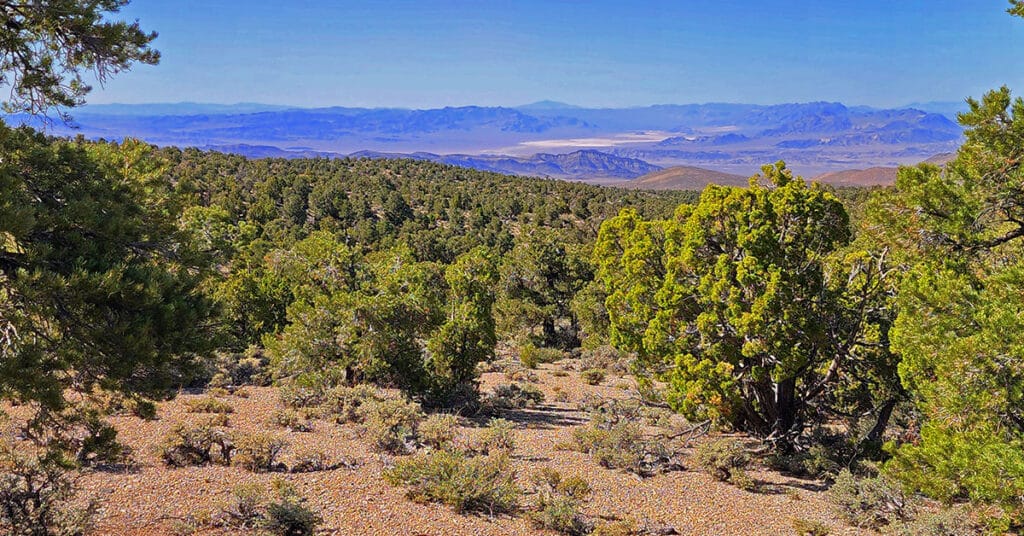
Black Rock Sister | Mt Charleston Wilderness | Lee Canyon | Spring Mountains, Nevada

If you’re looking for a summit approach in the Spring Mountains with expanding non-stop spectacular views all the way to the summit after the first brief 1/8th mile, Black Rock Sister is unbeatable. Black Rock Sister, elevation 9,668ft, in the Lee Canyon area of the Spring Mountains in Nevada is the little-known orphan of the more popular and noticeable South and North Sisters. Sitting on a high point in its ridgeline, Black Rock Sister appears to be composed of a single solid mass of rock around 60ft high and 150ft wide. Route details: 8 mi RT/ Approx. 8,300 > 9,668ft; **Wilderness Route** Click image or title above for more…
Saw Mill Trailhead to Macks Peak North Base | Mt. Charleston Wilderness | Spring Mountains, Nevada

This adventure began with the intent of doing the Mud Springs Loop trail from the Sawmill Trailhead in Lee Canyon, Spring Mountains, Nevada. Somewhere I went off course and ended up on a 9,235ft bluff near the base of the 10,036ft Macks Peak! Route details: 12 mi RT/ Approx. 7,591 > 9,235ft; **Some Trail, Some Wilderness** Click image or title above for more…
Pinyon Pine Loop Trail | Lee Canyon | Mt. Charleston Wilderness | Spring Mountains, Nevada
This adventure mainly covers the Pinyon Pine Loop Trail accessed from the upper parking area of the Sawmill Trailhead in Lee Canyon. The Pinyon Pine Loop Trail is a peaceful, serene emersion in nature including juniper and pine forested areas and high ridges with spectacular views of Mummy’s Head, Macks Peak, McFarland Peak, Bonanza Peak, the Sheep Range, Gass Peak and points North of the Sheep Range. Route details: 8.5 mi RT/ Approx. 6,496 > 7,688ft; **Excellent Trails But Easy to Go Off-Track** Click image or title above for more…
Mud Springs Loop | Lee Canyon | Mt Charleston Wilderness | Spring Mountains, Nevada

Mud Springs Loop is beautiful, though heavily forested. For this reason, the hiker often has no larger point of reference and can get lost in a maze of rabbit trails, and the directional markers are missing when you most need them. All that aside, Mud Springs Loop is a fun wilderness navigational challenge! Click the image or title above for details.
Mummy Mountain Head from Lee Canyon Rd | Additional Approaches | Spring Mountains, Nevada

Once you’ve summited Mummy’s Head from Lee Canyon Road, there are a number of options. You can precede to Mummy’s Nose and Chin, attempt an ascent to Mummy’s Summit or circle around down to the Deer Creek Road or Foxtail area. All these options present challenging climbs. Route details: 10 mi RT/ Approx. 8,000 > 11,535ft; **Some unmarked trails and cairns, mostly wilderness** Click image or title above for more…
Mummy Mountain Summit from Lee Canyon | Mt Charleston Wilderness | Spring Mountains, Nevada

This adventure takes you up a canyon wash on the far Northwestern edge of Mummy Mountain. Though the wash is filled with boulders, branches and tree trunks, one can find a pretty easy class 2 stairway dramatically ascending upward through unique climate and plant life zones from the beginning of the adventure at 8,000ft on Lee Canyon Road to the 11,532ft summit of Mummy Mountain. Of course, expect a few of Mummy Mountain’s signature avalanche slopes. There are spectacular views all the way up… Route details: 10 mi RT/ Approx. 8,000 > 11,535ft; **Mostly Wilderness** Click image or title above for more…