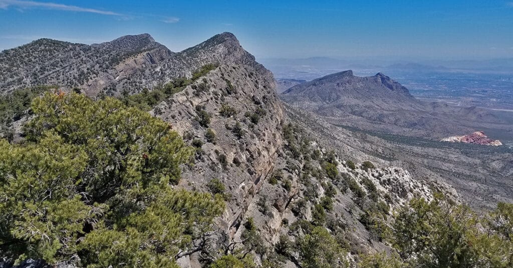
Mt. Wilson, Rainbow Mountain Wilderness, Nevada
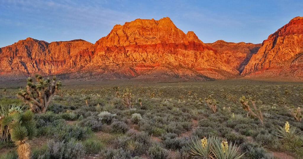
Mt. Wilson, Nevada, at 7070ft elevation is the highest mountain in the Rainbow Mountain Wilderness to the West. It’s one of the more challenging Rainbow Mountains to climb due to thick brush at its base and the cliffs above. I’ve seen countless hikers staring at their smart phones trying to follow granular directions (turn this way at this rock or tree…etc.) and totally lost in an elaborate maze of rabbit trails. I myself did this in the beginning, until I finally put my smart phone down and focused on the big picture. Route details: 12 mi/ 3,757 > 7070ft; Some Trails, Mostly Wilderness. Click image or title above for more…
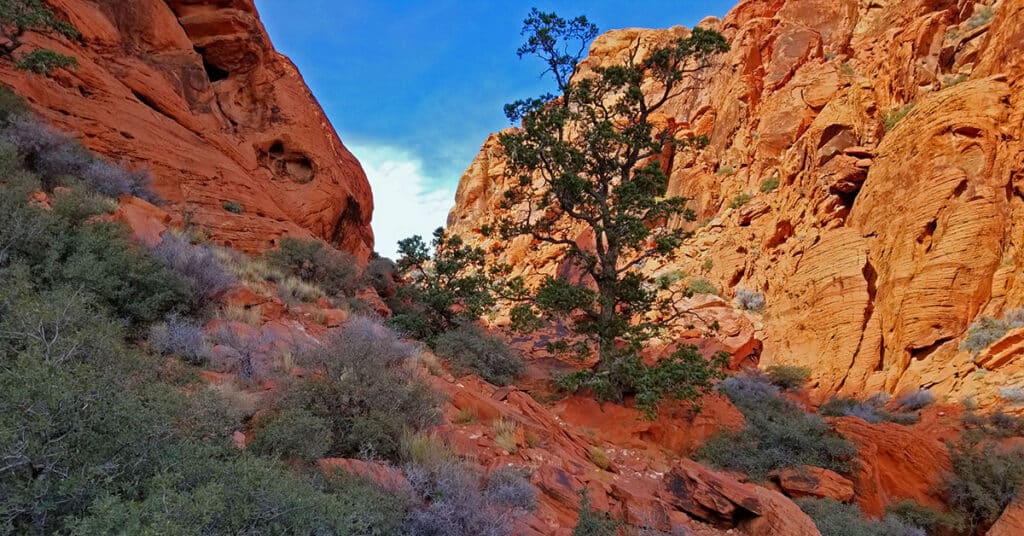
Pine Creek Canyon, Rainbow Mountain Wilderness, Nevada
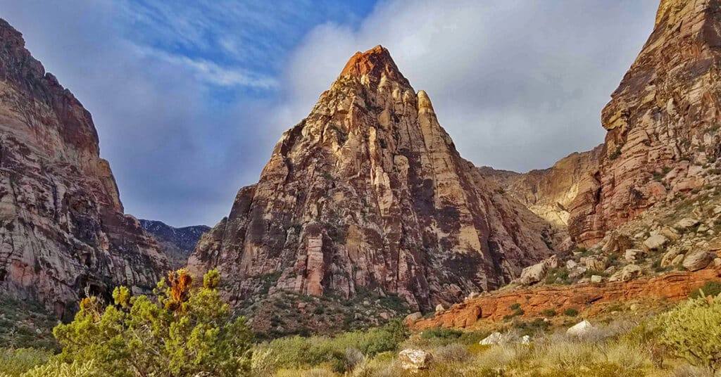
Pine Creek Canyon is definitely worth a day or two. It is more wild, untouched and the plant life more varied and abundant than in many other areas around Red Rock Park. It’s the second to the last trailhead parking area on the Red Rock Park Scenic Loop Drive. This entire side of Red Rock Park is often overlooked by those who spent their time at the more popular Red Rock Park Visitor Center, the Calico Hills, Turtlehead Peak, upper viewpoint, Willow Springs and Ice Box Canyon. But be prepared for a maze of trails! Route details: 3 mi/ 4000 > 4,500ft; **Some Trails, Some Wilderness** Click image or title above for more…
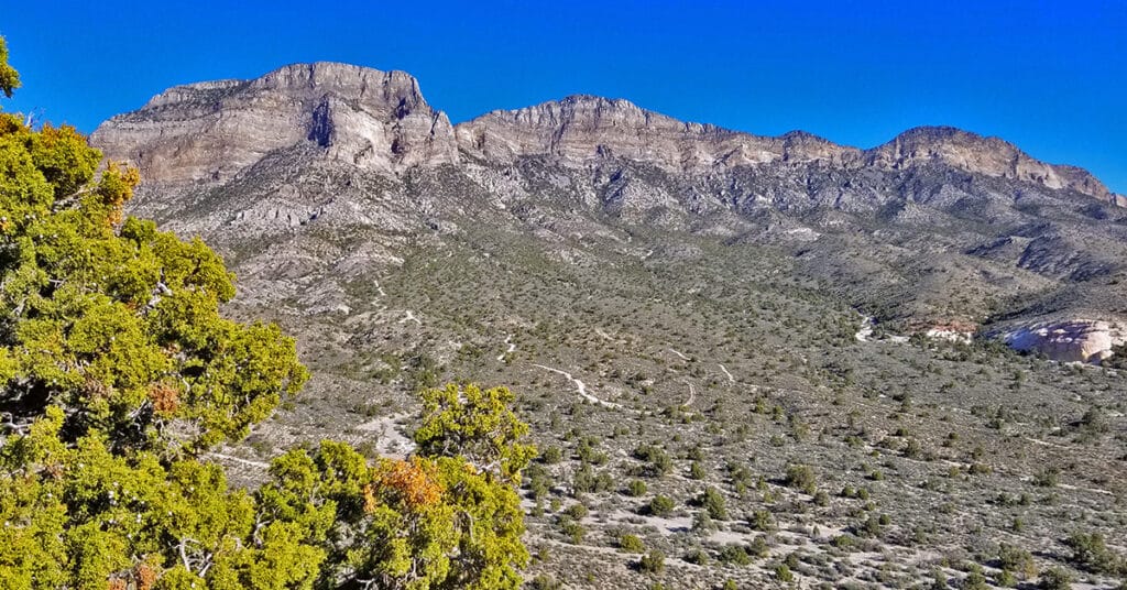
Rainbow Mountain, Rainbow Mountain Wilderness, Nevada
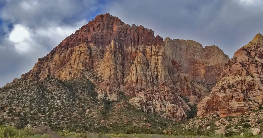
Rainbow Mountain is one of the most difficult mountains to summit in the Rainbow Mountain Wilderness. Its beauty is in part due to the distinct Rainbow effect of reds and browns along with the massive vertical conical shaped cliff feature to the right: Rainbow Wall. Click image or title above for more…
Bonnie Springs Ranch | Red Rock Canyon
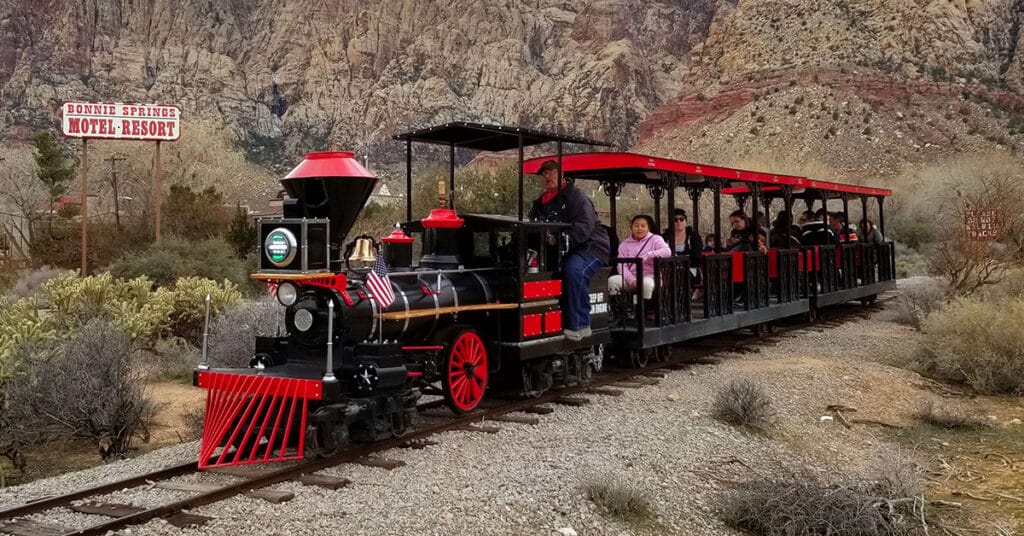
In mid-March of 2019, after about 45 years of operation, Bonnie Springs Ranch and it’s Old Nevada replica mining town, just West of Red Rock National Park, closed down. We feature Bonnie Springs Ranch here not because it is a hiking destination, but rather a long-time fixture in Red Rock Canyon. Click image or title above for more…
La Madre Mountain Western Approach from Red Rock Canyon NCA | La Madre Mountains Wilderness, Nevada
This is my favorite approach to La Madre Mountain due to the beauty of the terrain and the scenery. You begin in the scenic Willow Springs area (ample parking available), circle around between the Keystone Thrust Cliffs and White Mountain. Head up through the La Madre Springs area, pass an old Miner’s Cabin, then ascend to the top of the Keystone Thrust (the cliff system at the back of Red Rock Park). At the top take a right and travel along the very top of the Keystone Thrust ridge to La Madre Mountain. Route Details: 28 mi / 4306-8000ft; *Wilderness, No Trail* Click image or title above for more…
La Madre Mountain Southern Approach from Red Rock Canyon | La Madre Mountains Wilderness, Nevada
La Madre Mountain is 8,154ft in elevation. It is the highest central feature of the Keystone Thrust, the cliff system that spans the rear area of Red Rock Park in Nevada. The La Madre Mountain Southern approach, from a distance, looks impossible as you’re facing a sheer cliff wall between 1000 and 2000 feet high. However, as you approach the base of the cliff from Calico Basin it’s evident that there is a passage between the two peaks. The summit view is amazing featuring Las Vegas Valley with Lake Mead across and to the East, Gass Peak and the Sheep Range to the North, spectacular views of Mt. Charleston Wilderness to the East and the awesome total expanse of Red Rock Canyon National Conservation Area and Calico Basin to the Southwest. Route details: 22 mi / 4306-8000ft; *Wilderness, No Trail* Click image or title above for more…
Damsel Peak Northern Approach | Red Rock Canyon National Conservation Area, Nevada
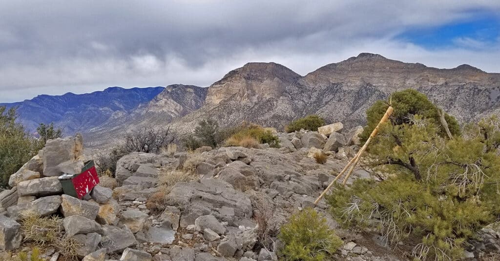
From the top of Damsel Peak outside of Las Vegas, Nevada one can see almost all of the Las Vegas Valley in the same way that Damsel Peak is visible from just about anywhere in Las Vegas Valley. In addition, there is an awesome view of the entire Calico Basin, Turtlehead Peak, the Calico Hills, Mt. Wilson, Rainbow Mountain, Juniper Peak, North Peak and Bridge Mountain and finally the huge expanse of the Keystone Thrust cliffs with La Madre Mountain as the high point. To the North one can see Gass Peak, the Sheep Range and Fossil Ridge. Route details: 16 mi Start Sandstone Quarry Red Rock | 4370 > 6977ft; **Wilderness, No Trail** Click image or title above for more…
02 Red Rock Canyon Scenic Drive | Red Rock Canyon NCA, Nevada
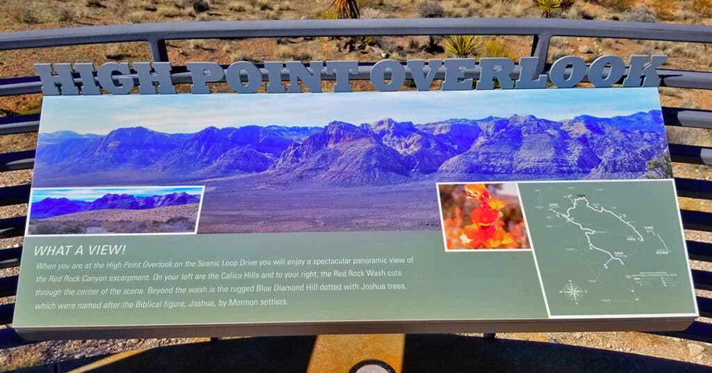
General information for Red Rock Canyon NCA including how to work the reservation system is on this page. In addition, the 10 points of interest along the Red Rock Canyon Scenic Drive are described. I’ll mention the trailheads from these points as jumping off points for wilderness adventures, but realize that the scenic drive is in itself a totally rewarding experience even if you don’t get out of your car! 13-mile scenic loop drive. Click image or title above for more…
Grand Circle | Calico Basin | Red Rock Canyon National Conservation Area, Nevada
The Calico Hills form a boarder between lower Red Rock Canyon and lower Calico Basin in Nevada. The Calico Hills form a boarder between lower Red Rock Canyon and lower Calico Basin in Nevada. The Lower Calico Hills Loop follows a 5-mile series of 4 trails around the circumference of the Calico Hills. The Calico Hills are composed of ancient Jurassic Era sand dunes that have been frozen into an artistic display of fantastic shapes, colors and designs. From a distance the Calico Hills are dwarfed by the larger surrounding formations. However looks are very deceiving as the closer you get these formations become huge with 30-40ft sheer drop-offs. Route description: 5mi Loop Circles Calico Hills; *Fairly Good Trail, Sketchy in Places – Some Steep Rocky Stretches* Click image or title above for more…
Grand Staircase | Calico Basin | Red Rock National Conservation Area, Nevada
The Calico Hills form a boarder between lower Red Rock Canyon and lower Calico Basin in Nevada. These ancient sand dunes have been frozen into an artistic display of fantastic shapes, colors and designs. The most popular route up the Calico Hills is called The Grand Staircase. As you stand in the parking area in the Red Springs Desert Oasis in the Calico Basin and look closely at the Calico Hills towering above you’ll see a natural diagonal route that begins in the mid section and angles up to the right and to the summit of the hills. This is the Grand Staircase. Route Details: Approx. (2 mi. RT); **Wilderness, Sketchy Path, Class 3 Rock Climbing** Click image or title above for more…