01 Hoover Dam Area, Nevada | Overview

Explore the heights surrounding the world famous Hoover Dam South of Las Vegas, Nevada. Enjoy spectacular views of Hoover Dam from the water’s entrance into the dam from Lake Mead above to where the Colorado River spills out to coutinue its course below the dam. Click any of the images or titles on this page for details on various adventures in the Hoover Dam area!
01 Eldorado Wilderness, Nevada | Overview

Nevada’s El Dorado Wilderness is located along the Colorado River South of Las Vegas. It’s a stark, volcanic terrain of rocks, boulders, hills peaks and canyons.
Lonesome Peak Eldorado Wilderness, Nevada

Hike to Lonesome Peak, the high point in the Eldorado Wilderness, Nevada, for an unrivaled view of this hidden landscape. The best time of year for this adventure is October through March in order to avoid dangerously high temperatures. Click the image or title above for details.
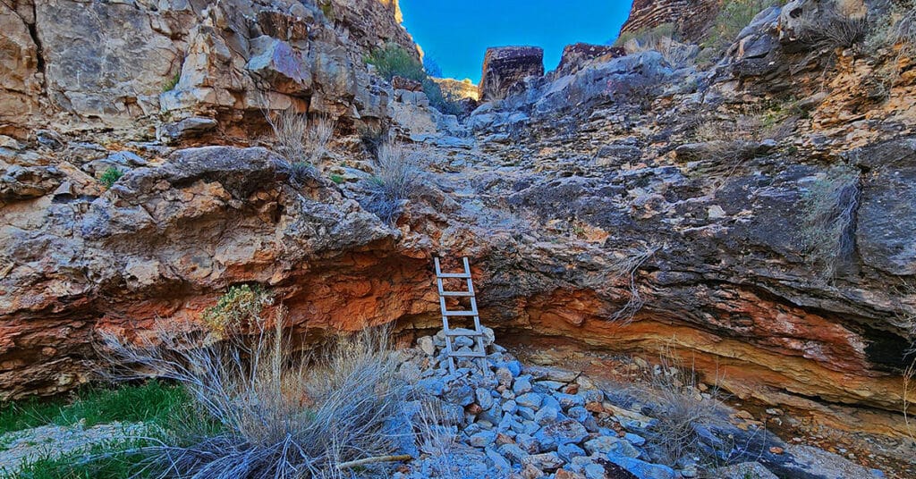
North Lonesome Peak | Eldorado Wilderness, Nevada
North Lonesome Peak is a great introductory adventure that will give you a good sampling of the Eldorado Wilderness. This peak, actually unnamed, is the Northern sister of the 400ft-higher, larger Lonesome Peak, separated by a high saddle with a spectacular view toward the Colorado River Basin and points far beyond. You could, instead, just top the closer Lonesome Peak, but North Lonesome Peak will give you a more extensive education in navigating the Eldorado Wilderness. Click the image or title above for details.
Mummy’s Forehead Summit Approach Gully | Mt Charleston Wilderness, Nevada

This is a streamlined approach from Deer Creek Rd. Catch Pen Loop trailhead parking area to connect with Mummy’s Forehead Summit Approach Gully midway to the summit. On the return trip we explore the large area of ridges and gullies between Camp Stimpson and the Catch Pen Loop trailhead. Click the image or title above for details.
Gateway Canyon & Gray Cap Ridge NW | Calico Basin, Nevada
Wander through a unique, hidden world in the Northwest area of Gray Cap Ridge. Gateway Canyon will whirl you around and by the time you emerge into the Northwest area of Gray Cap Ridge you may wonder if you’d landed in another dimension! Finding a non-vertical way down into the Brownstone Basin can be a real puzzle, but great fun. Click the image or title above for details.
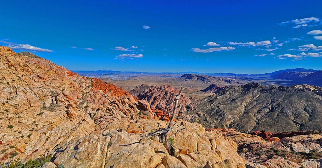
The Blue Diamond Hill Southern Triangle | Red Rock Canyon National Conservation Area, Nevada
The Blue Diamond Hill Southern Triangle is a formation of two deep majestic canyons just South of the Gypsum Mine Road off of Highway 159. Navigate a few challenges, discover some limestone caves, experience spectacular views! The best time of year for this adventure is Fall through Spring. Click the image or title above for more details.
Blue Diamond Hill Southern Canyons, Nevada
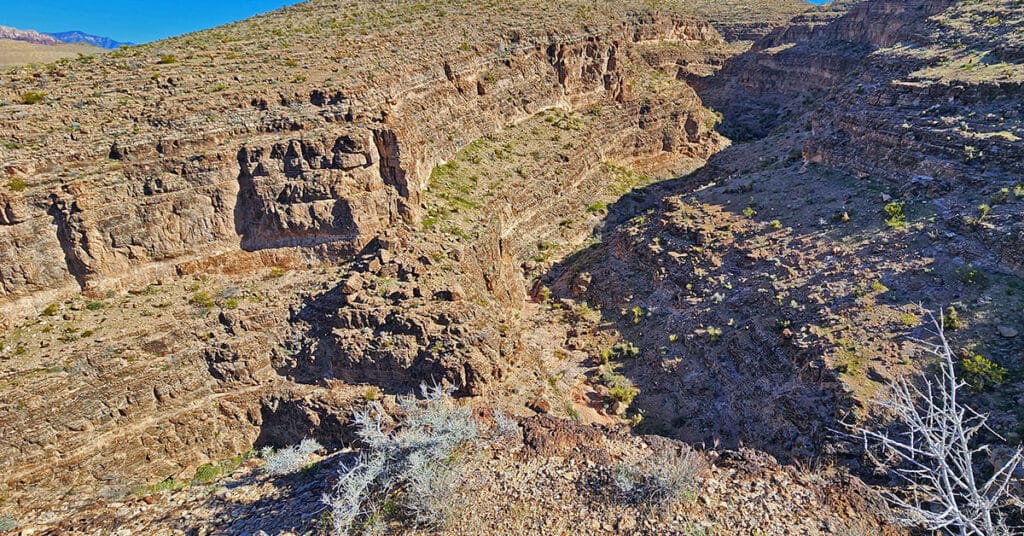
Explore a few of the 7 little-known deep, majestic canyons in the southern area of Blue Diamond Hill in Nevada. Starting at Wheeler Camp Spring trailhead parking on Hwy 159, begin exploring canyons South of the Blue Diamond Hill Gypsum Mining Road. The best time of year for this adventure is Fall through Spring. Click the image or title above for more details.
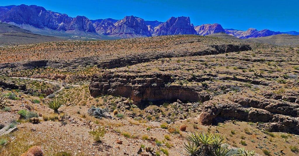
Blue Diamond Hill Southern Ridgelines, Nevada
Enjoy non-stop eagle-eye views of the entire Rainbow Mountain range from a Southern perspective while simultaneously surrounded by majestic canyons! This little-known Southern wilderness area on Blue Diamond Hill is across highway 159 from the town of Blue Diamond. Click the image or title above for more details.
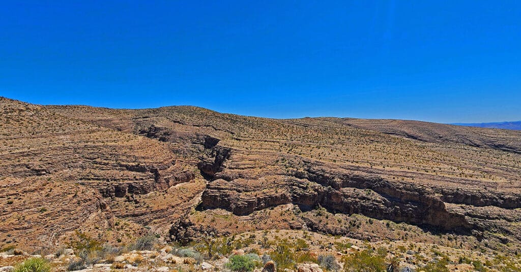
Fossil Canyon | Cowboy Canyon | Blue Diamond Hill, Nevada
Experience two huge, wild canyons in Blue Diamond Hill just outside of Las Vegas, Nevada. Navigate the full length of these canyons through trails and stretches of pathless wilderness. Discover ancient fossils and enjoy spectacular views of Red Rock Canyon and the Rainbow Mountains framed by towering cliff walls. Best time of year for this adventure: Fall through Spring. Click the image or title above for more details.