La Madre Mt, El Padre Mt, Burnt Peak | La Madre Mountains Wilderness, Nevada
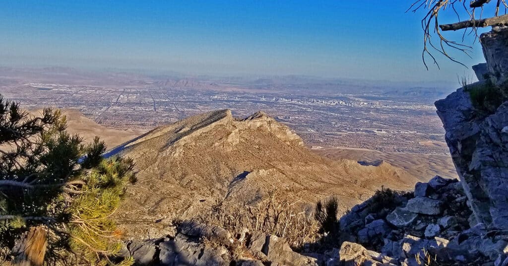
This adventure summits three of the highest peaks in the La Madre Mountains Wilderness to the West of Las Vegas, Nevada: La Madre Mountain, El Padre Mountain and Burnt Peak from the intersection of Kyle Canyon and lower Harris Springs Roads. The entire adventure took about 17 hours (including getting bogged down in a lower wash) compared to my recent completion of the Mt. Charleston Loop in 7 and a half hours! The La Madre Mountain, El Padre Mountain and Burnt Peak circuit offers incredible views all along the way including the Mt. Charleston Wilderness with Griffith Peak, Charleston Peak, Lee Peak, Mummy Mountain, Fletcher Peak and Angel Peak to the West. Then there is the Sheep Range, Fossil Ridge and Gass Peak to the Northeast. Add spectacular aerial views of Las Vegas Valley and the Las Vegas Strip with Frenchman Mountain and Lake Mead in the background to the East. Then add Calico Basin, Calico Hills, Damsel Peak, Red Rock Park, Turtlehead Peak, White Rock Mountain and the Rainbow Mountains all the way to Potosi Mountain to the Southwest including Bridge Mountain, North Peak, Rainbow Mountain, Juniper Peak, Mt. Wilson, Indecision Peak and Windy Mountain. Route details: 25+ Miles RT / 4500-8,500ft; *Some Road, Mostly Wilderness* Click image or title above for more…
Harris Springs Canyon, Nevada | Mountain Biking from Centennial Hills in Las Vegas
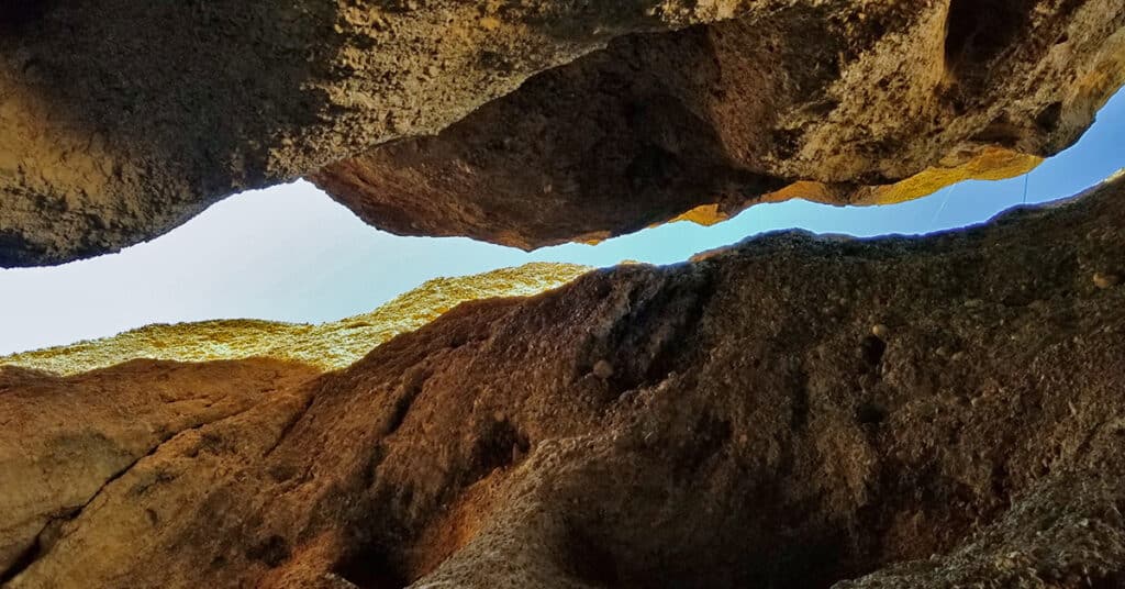
Harris Springs Canyon parallels upper Kyle Canyon Road around 5-8 miles below the Charleston Village area. The most notable feature of the canyon is the incredible slot canyon at its lower opening near the intersection of upper Harris Springs Road and Kyle Canyon Road. Though the canyon parallels Kyle Canyon Road it seems as though it is in an entirely untouched wilderness area as there are no sounds of the vehicles just over the ridge on Kyle Canyon Road. Very often as you round a bend there is a direct view of Charleston Peak. Route Details: About 20 miles to the intersection of Kyle Canyon and upper Harris Springs Roads, then 2-4mi RT in the canyon / Approx. 8,439 > 10,255ft; **Good Route from Upper Harris Sprs. Rd.** Click image or title above for more…