Mud Springs Loop Clockwise | Lee Canyon | Mt. Charleston Wilderness | Spring Mountains, Nevada

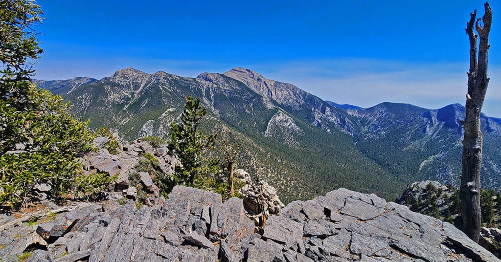
This is the complete 15-mile outer loop in a clockwise direction from the Sawmill Trailhead including a traverse of Macks Peak Eastern Base. Click the image or title above for details.
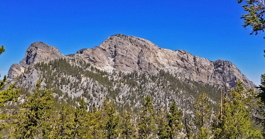
Amargosa Overlook | Mt. Charleston Wilderness | Spring Mountains, Nevada
Enjoy a spectacular view overlooking Charleston Peak and the Amargosa Valley from a 10,154ft high point above Lee Canyon, Nevada. Click the image or title above for details.
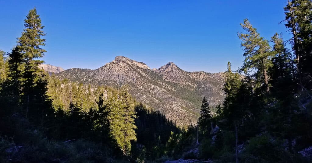
Sawmill Loop | Sawmill Trailhead | Lee Canyon, Nevada

The 1.5-mile Sawmill Loop Trail is the hub for all six trails branching off from the Sawmill Trailhead area in Lee Canyon Nevada. Understanding this trail and its connections is the key to navigating the Sawmill area. Click the image or title above for details.
Rocky Gorge Loop Trail | Sawmill Trailhead Area | Lee Canyon, Nevada

This intimate little gorge is like a desert bonsai garden! Though the loop trail is hidden away in Lee Canyon with no visible trailheads, it’s well worth the search! | Click the Image or Title Above for Details
Sisters South to the Sisters North | Mt. Charleston Wilderness | Spring Mountains, Nevada
There is a popular circuit route including Sisters South, Sisters North and Black Rock Sister. The route can be taken in either direction and includes about a half day of challenging hiking and climbing (Class 3 at most) in a beautiful pristine wilderness setting. Route details: About 8-9 miles circuit; **Some trail, some wilderness.** Click image or title above for more…
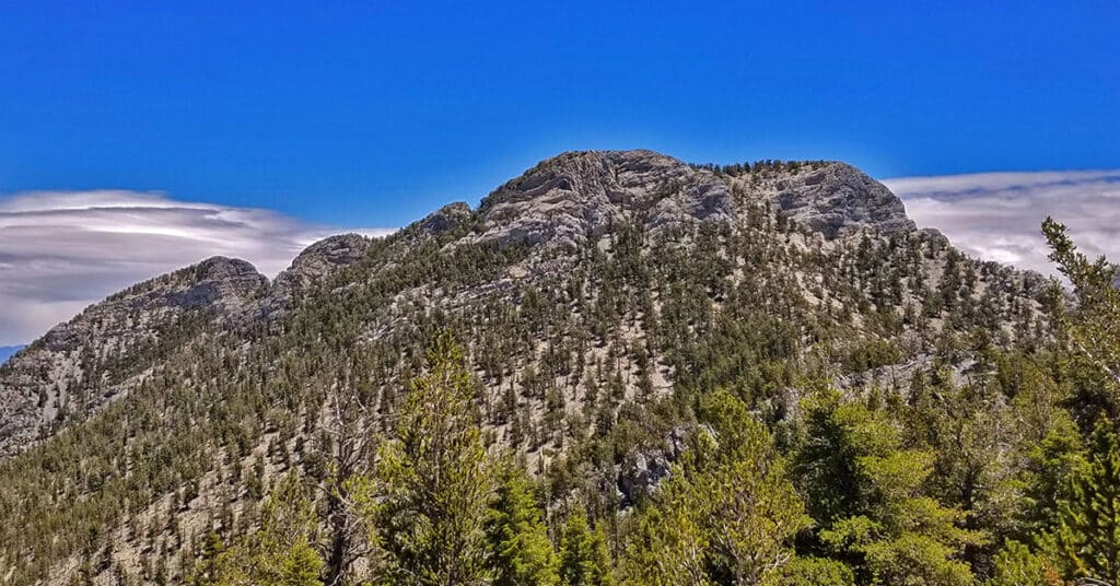
Sisters North | Lee Canyon | Mt Charleston Wilderness | Spring Mountains, Nevada
Sisters North, located in Lee Canyon in the Mt. Charleston Wilderness is on a ridge system including Sisters South, Sisters North and Black Rock Sister. The ridge offers incredible 360 degree views with McFarland Peak, Bonanza Peak and Macks Peak to the West, the Sheep Range and Gass Peak to the North, Angel Peak, Mummy Mountain, the North Ridge of Kyle Canyon, Lee Peak and Charleston Peak to the East. There are far more reference points in the distance beyond, but these are the most obvious. A huge rock arch unexpectedly appears near the summit of the approach ridge along with the remarkable rock sculpture of Black Rock Sister. Route details: 8 mi RT/ 8,250 > 10,197ft; **Mostly Wilderness, Some Trails** Click image or title above for more…
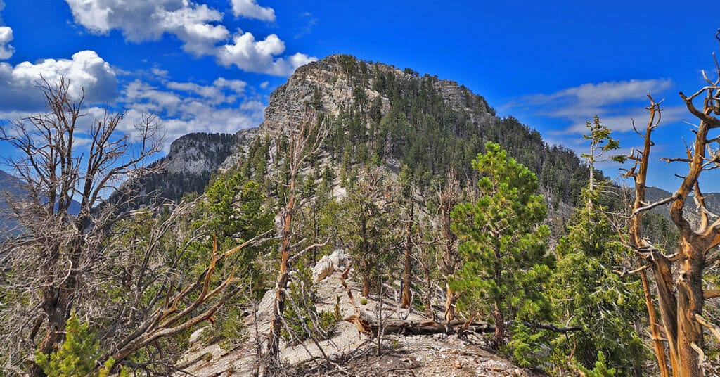
Sisters South | Lee Canyon | Mt. Charleston Wilderness | Spring Mountains, Nevada
The Sisters South peak in Lee Canyon, Nevada, elevation 10,197 feet has a great trail, spectacular views and is relatively unknown as a destination. As a result, the entire area sparkles with pristine wilderness beauty and you have a good chance of being the only person on the trail, even on a weekend day. On a Saturday in mid-June I saw only 2 people the entire day. Route details: 8 mi RT/ 8,399 > 10,197ft; **Mostly Trail, Some Wilderness** Click image or title above for more…
Pinyon Pine Loop Trail | Lee Canyon | Mt. Charleston Wilderness | Spring Mountains, Nevada

This adventure mainly covers the Pinyon Pine Loop Trail accessed from the upper parking area of the Sawmill Trailhead in Lee Canyon. The Pinyon Pine Loop Trail is a peaceful, serene emersion in nature including juniper and pine forested areas and high ridges with spectacular views of Mummy’s Head, Macks Peak, McFarland Peak, Bonanza Peak, the Sheep Range, Gass Peak and points North of the Sheep Range. Route details: 8.5 mi RT/ Approx. 6,496 > 7,688ft; **Excellent Trails But Easy to Go Off-Track** Click image or title above for more…
Mud Springs Loop | Lee Canyon | Mt Charleston Wilderness | Spring Mountains, Nevada

Mud Springs Loop is beautiful, though heavily forested. For this reason, the hiker often has no larger point of reference and can get lost in a maze of rabbit trails, and the directional markers are missing when you most need them. All that aside, Mud Springs Loop is a fun wilderness navigational challenge! Click the image or title above for details.
McFarland Peak from Bristlecone Pine Trailhead | Lee Canyon, Spring Mountains, Nevada
The route to the base of McFarland Peak via the Bristlecone Pine and Bonanza Trails is a true show stopper! Most of the route winds through an ancient pristine Bristlecone Pine forest. As if that were not enough, all along the way there are spectacular views including Mummy Mountain, the North Ridge of Kyle Canyon from Mummy Mountain to Lee Peak and then on to the summit of Charleston Peak, the Sisters Peaks bordering Lee Canyon, Pahrump Valley and Telescope Peak in the Panamint Range on the far side of Death Valley as a faint high point in the background and of course the full spectacular Western side of McFarland Peak with its sheer majestic cliffs. Route Details: 15 mi RT/ Approx. 8,690 > 9,600ft; **Excellent Trail** Click image or title above for more…